Sperrin Sedgewater Landscape30375 BCE
30,375 BCE is a modern label rather than a precisely datable Irish event. Derryvree, County Fermanagh, preserves freshwater sediments between glacial tills, calibrated broadly to 36,900–31,700 cal BP, indicating treeless tundra, wetlands and severe periglacial conditions before renewed ice advance. Castlepook Cave, County Cork, contains MIS 3 remains of cold-adapted, open-country fauna, though its mixed deposits require caution. A possibly cut-marked reindeer bone may indicate brief human activity, but proves neither settlement nor society. No evidence supports agriculture, trade, communities or political life. Later glaciation obscured much evidence; Ireland’s record chiefly reveals changing ice, water, vegetation and animals over time.
Dateline
“30,375 BCE” is a modern calendar label, not a date at which an Irish event can be placed. No calendar, inscription, settlement sequence or annual record survives from this depth of time. In archaeological terms it denotes a point roughly 32,300 years before 1950, within the Late Pleistocene and Marine Isotope Stage 3. The responsible view is therefore regional and probabilistic: evidence can illuminate environmental conditions across broad intervals, but not tell us what happened in Ireland in a particular year.
A Date Range, Not a Day
The most informative Irish evidence close to this horizon comes from Derryvree near Maguiresbridge, County Fermanagh. Roadworks in 1969 cut through a drumlin and exposed organic freshwater silts and fine sands trapped between two thick sheets of till. The lower till shows that glacier ice had earlier overridden the locality; the upper till shows that ice returned later. In between lay deposits formed while this part of Fermanagh was ice-free, or at least beyond a local ice margin. The original radiocarbon determination, BIRM-166, was 30,500 radiocarbon years BP, with a stated uncertainty of roughly a millennium.
Radiocarbon years are not calendar years. Atmospheric carbon-14 has varied through time, so determinations must be calibrated against independently dated records. Modern reassessments place the Derryvree result within a broad calibrated interval of approximately 36,900–31,700 cal BP. The label 30,375 BCE falls near the younger part of that wide window, but neither the deposit nor its fossils can be assigned precisely to that numbered year. It is safer to say that Derryvree offers an unusually valuable picture of an Irish cold-stage landscape broadly relevant to the thirty-first millennium BCE.
Freshwater Beneath a Future Drumlin
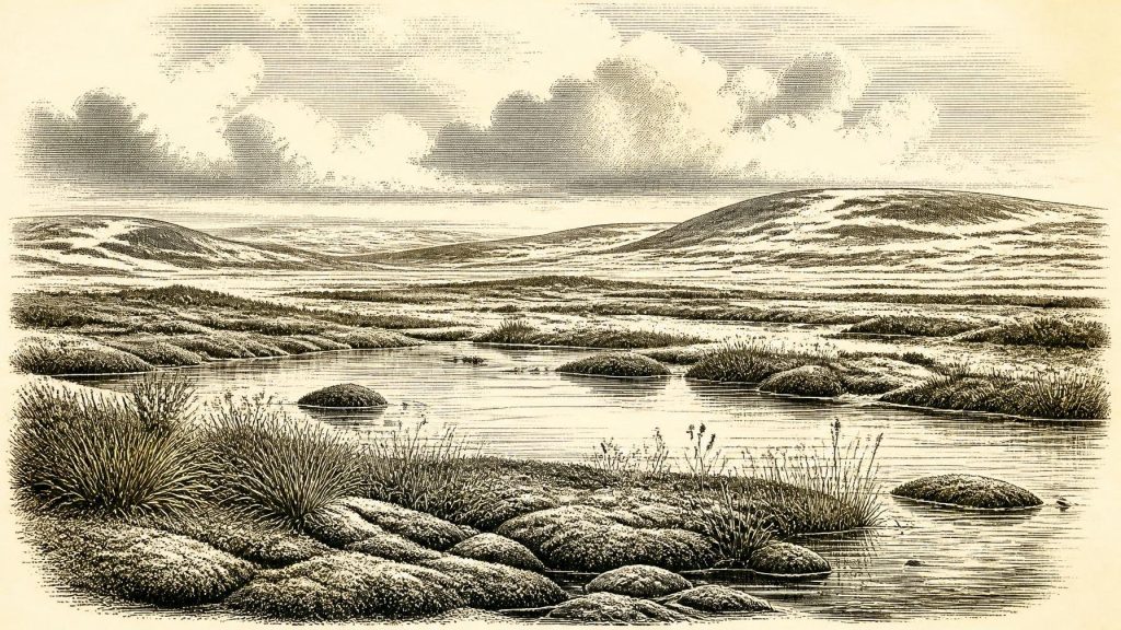
Derryvree is important because it preserves life rather than merely ice. The sediment held poorly preserved pollen, plant macrofossils, mosses and insect remains. Together they indicate open tundra vegetation and a periglacial regime: ground subject to intense seasonal frost, with a short growing season and no established woodland. This was not a white, featureless ice desert. It included wet, plant-rich hollows, shallow pools and mossy margins within a larger treeless landscape. Grasses, sedges and cold-adapted herbs could exploit the brief summer; low shrubs occurred locally. The evidence supports ecological variety on a small scale, even in an overall severe climate.
The title “freshwater series” matters. The deposit records standing or slow-moving water accumulating fine sediment and organic material, rather than a dry plain frozen solid throughout the year. Such wet ground would have been seasonally productive for insects, birds and grazing mammals. Yet this was not a modern Fermanagh lakeland. Trees were absent, soils were immature and the land was shaped by frost, thaw, wind and the proximity of ice. The drumlin visible today was subsequently remodelled or sealed by glacial deposition, making the exposed road-cut a rare glimpse of a landscape otherwise hidden beneath later deposits.
Ice Was Advancing, But Unevenly
At this time Ireland stood within the long Midlandian, or last glacial, cold stage. It would be misleading to imagine the entire island either wholly ice-covered or wholly open. Ice sheets waxed and waned, with margins responding differently in separate basins and uplands. Derryvree proves that one northern locality supported freshwater tundra during the interval represented by its silts; it does not map conditions across every county. Other Irish inter-till deposits, including those at Hollymount, Greenagho and Aghnadarragh, likewise preserve evidence for cold, non-glacial episodes, but their chronologies and local histories cannot simply be compressed into one national weather report.
What is clear is the direction of the longer story. The British–Irish Ice Sheet later expanded dramatically, reaching its maximum extent around 27,000–23,000 cal BP and covering Ireland and much of its surrounding shelf. Thus the Derryvree wetland belongs before the full Last Glacial Maximum, in a landscape whose habitable patches were vulnerable to renewed ice advance. Future glaciers would scour, bury and rearrange older land surfaces, one reason why evidence from this period is so fragmentary.
Animals in the Open Country
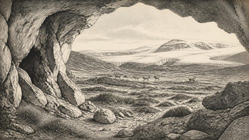
Southern Ireland supplies a different kind of evidence. Castlepook Cave, near Doneraile in north County Cork, produced a remarkable but complicated accumulation of Late Pleistocene animal bones. Earlier and more recent dating work places elements of its fauna in Marine Isotope Stage 3. Reindeer, woolly mammoth, spotted hyaena, brown bear, wolf, arctic fox and giant deer are among the animals represented in the wider Castlepook collections. These species should not be treated as a single herd seen on one day: cave deposits can combine remains accumulated over long periods by carnivores, water movement, collapse and earlier excavation. But the assemblage strongly supports the presence, in parts of Ireland during this broad phase, of open-country and cold-adapted animal communities.
New radiocarbon work has also changed the chronology. Improved pretreatment showed that some 1990s dates from Castlepook were substantially too young, moving several faunal remains further back into MIS 3. This is a useful warning against overconfident narratives. The cave is a major archive, but it is not a neatly layered campsite, and every bone has its own taphonomic history. A mammoth or reindeer bone establishes that an animal died or was deposited; it does not by itself reveal how many people, if any, lived nearby.
The Human Question
A reindeer femur from Castlepook has been publicly interpreted by zooarchaeologist Ruth Carden as bearing a deep mark made by a sharp stone implement during butchery. County Cork’s heritage publication dates the object broadly to about 31,000 BCE and presents it as potential evidence for Upper Palaeolithic hunters in Ireland. If the mark is correctly identified as human-made and contemporary with the animal’s death, it would be exceptionally significant: it would show people handling a reindeer carcass in Ireland within the wider period considered here.
Its limits are equally significant. The bone derives from an old cave collection, not a modern sealed excavation containing a hearth, stone-tool scatter, dwelling floor or repeated sequence of butchered animals. No securely associated lithic assemblage, human skeleton, art object or settlement of this age has been published from Ireland. The mark therefore cannot demonstrate permanent occupation, a population size, a named culture or a route of arrival. It supports a carefully phrased possibility of a human visit or brief activity, not a settled Irish society. Recent work at Castlepook has sought undisturbed deposits and further evidence, precisely because the question demands better context.
Society Beyond Recovery
For this reason, political affairs, warfare, diplomacy, religion, language and formal learning cannot responsibly be reconstructed for Ireland around 30,375 BCE. There were no states, kingdoms, written agreements or institutions available to the record, and there is no evidence for a local population on which to build such claims. Nor can archaeology identify an Irish identity, tribe or lineage at this date. The familiar historical categories belong to vastly later worlds.
If people did reach Ireland during an ice-free interval, comparison with Upper Palaeolithic groups elsewhere in north-west Europe suggests that mobility, detailed environmental knowledge and co-operation in obtaining food would have been essential. But that is comparative interpretation, not direct Irish evidence. Castlepook does not establish the use of a particular weapon, the organisation of a hunt, clothing, belief or seasonal camp life. It does, at most, make animal processing a plausible part of a fleeting human presence.
No Proven Trade or Settlement Network
There is likewise no evidence for farming, herding, cultivation, pottery, metalworking, exchange networks or built villages. An economy, if humans were present, would have depended on wild resources: especially the movements of large mammals, smaller game and the seasonal opportunities offered by wetlands. This is inference from ecology and from the possible cut-marked bone, not proof of an Irish subsistence system. No contemporary harbour, boat, trackway or imported material is known from which trade or regular contact can be demonstrated.
Lower global sea levels changed the geography around Ireland, exposing areas now submerged, but ice loading, local sea level and the Irish Sea’s complex bathymetry make simple claims about a continuous dry land bridge unsafe. Whether people or animals could have moved through changing coastal, island, ice-margin or sea-crossing routes remains a research problem rather than a settled fact. The key historical reality is uncertainty: access to Ireland was environmentally difficult, and later glaciation destroyed or submerged much of the evidence needed to resolve it.
A Landscape, Not an Annal
The strongest account of Ireland at this remote chronological label is therefore not an annal of rulers and battles, but a reconstruction of a fragile landscape. In Fermanagh, freshwater sediments accumulated among tundra plants before later ice sealed them below till. In Cork, caves retained bones from a cold-stage animal world and perhaps one trace of human butchery. Together they show that parts of Ireland could support life during unstable intervals before the Last Glacial Maximum. They do not tell us that a particular community occupied the island in 30,375 BCE.
That restraint is not a weakness. The Derryvree silts, Castlepook fauna and later scientific re-dating demonstrate how Irish prehistory advances: by recovering overlooked deposits, testing old collections with improved methods, calibrating dates and separating what a specimen proves from what it merely suggests. Around this point in deep time, Ireland’s best-documented history is the history of ice, water, plants, animals and the very faint possibility of people at the edge of a changing world.
Primary Sources
- Middle Midlandian Freshwater Series at Derryvree, Maguiresbridge, County Fermanagh, Northern Ireland
- Middle Midlandian Freshwater Series at Derryvree, Maguiresbridge, County Fermanagh, Northern Ireland
- Figure 6.— The Subdivision of the Quaternary Period in Ireland
- Palaeoecology
- Deglacial Rates and Controls for the British-Irish Ice Sheet Western Margin
- Pleistocene Glaciations in Ireland
- Exploring the Marine–Terrestrial Transition: A Geochronological Framework for the Last Glacial–Interglacial Cycle in Ireland
- The Timing and Magnitude of the British–Irish Ice Sheet Between Marine Isotope Stages 5d and 2
- Pattern and Timing of Retreat of the Last British-Irish Ice Sheet
- New Age Constraints for the Maximum Extent of the Last British-Irish Ice Sheet (NW Sector)
- Ireland: Submerged Prehistoric Sites and Landscapes
- A Reconsideration of the Radiocarbon Dating of the Marine Isotope Stage 3 Fauna from Southern Ireland
- The Irish Quaternary Fauna Project
- New Insights on the Fauna of Ireland's Younger Dryas and Early Holocene from Alice & Gwendoline Cave
- Heritage Artefacts of County Cork
- Archaeological Heritage of County Cork
- 32564: Castlepook Cave, Castlepook South, Cork
- The Problem of a Late Quaternary Landbridge Between Britain and Ireland
- Deglaciation, Earth Crustal Behaviour and Sea-Level Changes in the Determination of Insularity: A Perspective from Ireland
- Relative Sea-Level Change and Glacial Rebound Modelling in Ireland
- The IntCal20 Approach to Radiocarbon Calibration Curve Construction: A New Methodology Using Bayesian Splines and Errors-in-Variables