Derryvree’s Glacially Sealed Wetland30411 BCE
Derryvree, County Fermanagh, preserves freshwater silts and organic remains sealed between glacial tills, documenting an ice-free wetland interval during Marine Isotope Stage 3, broadly 34,950–29,750 BCE. Its plants indicate a cold, treeless mosaic of pools, sedges and Arctic-alpine vegetation, while demonstrating local rather than island-wide conditions. Dynamic ice margins and lower sea levels shaped an uncertain regional landscape. Castlepook Cave’s time-averaged fauna shows that mammoth, reindeer, deer, bears and predators occurred in Pleistocene Ireland. A possibly tool-marked reindeer bone suggests fleeting human presence, but no secure settlement evidence exists. These rare deposits reveal an intermittently habitable, environmentally unstable glacial Ireland.

Dateline
Modern calendar-year precision is not available for Ireland in 30,411 BCE. The label is a useful point on a modern backward-counting scale, roughly 32,360 years before the conventional radiocarbon ‘present’ of AD 1950, but no Irish find can be assigned to that individual year, season or generation. The responsible subject is therefore an interval in the later part of the Pleistocene: Marine Isotope Stage 3 (MIS 3), within the Irish sequence often called the Middle Midlandian. Its evidence consists not of chronicles, settlements or named people, but of buried sediments, plant remains, animal bones and the changing imprint of ice.
The date falls within the broad calibrated age range associated with a remarkable deposit at Derryvree, near Maguiresbridge in County Fermanagh. A radiocarbon measurement from the deposit, BIRM-166, was reported as 30,500 ± 1,100 radiocarbon years before present. Radiocarbon years are not identical to calendar years: atmospheric carbon-14 varied through time, and calibration produces broad probability ranges rather than a single secure date. Commonly cited calibrations place the Derryvree organic sediments at approximately 36,900–31,700 calibrated years before present, or about 34,950–29,750 BCE. Thus 30,411 BCE lies within the range relevant to the deposit, but it cannot be claimed as the date on which its wetland existed in precisely the observed form.
Fresh Water Between Glaciers
Derryvree is important because of its sequence. Road excavations in 1969 cut through a drumlin, one of the streamlined hills made by glacial action, and exposed freshwater silts and fine sands enclosed between two thick sheets of till. Till is the unsorted mixture of clay, stones and other debris deposited by ice. The order of the layers establishes three major developments: glacier ice had earlier occupied the locality; an interval followed in which fresh water, sediment and vegetation accumulated; then ice or ice-proximal processes returned and sealed the deposit beneath another till sheet.
That stratigraphy is direct evidence for local environmental change, not a complete map of the island. It demonstrates that the Derryvree hollow was not overridden by ice throughout this part of the cold stage and that a freshwater habitat developed there. It does not prove that all Ireland was ice-free, nor that the same landscape extended unbroken from Fermanagh to Cork, Kerry or the coast. The contrast between the lower and upper tills instead warns that the island’s ice cover could advance, retreat and reorganise markedly over long periods. Derryvree survives precisely because a later glacial deposit buried its fragile organic record.
A Treeless Wetland Landscape
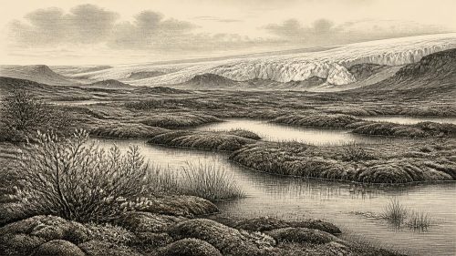
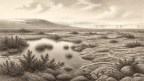
The plant evidence points to a cold, open environment. Mosses, sedges, grasses and hardy Arctic-alpine or northern plants occurred around shallow water and wet ground; records include bogbean, dwarf willow, mountain avens and water-milfoil. These are not signs of a forested Ireland. They indicate a low-growing mosaic in which pools, sedgy margins, damp mineral soils and exposed ground could sit beside more barren, frost-affected terrain. Short summers could support vigorous local growth, while winters were severe and the yearly growing season limited.
It is tempting to picture a single, uniform tundra stretching over the whole island, but the evidence supports something less simple. Topography, drainage, exposure and the proximity of ice would have created local differences. A sheltered basin with standing or slow-moving water could sustain aquatic plants even as nearby slopes were cold, wind-swept and sparsely vegetated. The Derryvree fossils are therefore best understood as a detailed local ecological archive and a window onto the kinds of habitat available in parts of Ireland, rather than a photograph of the entire country in one year.
Ice, Sea and Regional Change
At this time Ireland was moving through a volatile phase of the last glacial cycle, well before the fullest expansion traditionally associated with the Last Glacial Maximum. Research on the British–Irish Ice Sheet increasingly emphasises that its pre-maximum history was dynamic and remains difficult to reconstruct. Evidence suggests ice growth before MIS 2 and retreat–advance behaviour during MIS 3, but the exact extent, thickness and timing of ice in every Irish region are not securely known. What Derryvree adds is a firm local indication of an ice-free freshwater interval amid that broader instability.
Sea level was substantially lower than it is today because immense volumes of water were locked in northern ice sheets. Coastlines and sea passages around Ireland consequently differed from the modern map. Yet lower sea level should not be converted automatically into a claim of an easy dry-land route from Britain or continental Europe. The Irish Sea basin, changing ice margins, rivers, estuaries and local marine channels made access variable and uncertain. For animals or people, the practical landscape was defined not only by distance but by weather, ice, water crossings and the availability of food and shelter.
Animals in the Irish Record
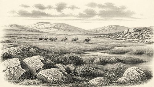
Castlepook Cave, near Doneraile in County Cork, provides the strongest faunal counterpart to Derryvree. It is Ireland’s richest known cave archive for vertebrates before the Last Glacial Maximum. Its deposits accumulated over a long span and contain remains of woolly mammoth, giant Irish deer, reindeer, brown bear and spotted hyaena, alongside later cold-climate animals including lemmings, Arctic fox and wolf. These remains demonstrate that Ireland could support, or be reached by, a varied Ice Age fauna during different portions of the late Pleistocene.
They must not, however, be assembled into a single herd wandering past Derryvree in 30,411 BCE. Cave deposits are time-averaged archives. Bones may have been brought in by carnivores, moved by water, excavated under early twentieth-century recording standards, or separated by thousands of years. Spotted hyaenas, in particular, may have used the cave and contributed to its bone assemblage. Castlepook therefore illuminates the wider ecological possibilities of MIS 3 Ireland, while its stratigraphic complications limit detailed claims about a particular year or local food chain.
The Human Question
The most provocative Irish evidence close to this broad period is a reindeer femur from Castlepook. Re-examination identified a deep mark interpreted as consistent with cutting or chopping by a stone tool, and radiocarbon work placed the bone at around 33,000 years ago. If the modification is confirmed as human-made, it would show brief Upper Palaeolithic human activity in Ireland far earlier than the island’s first well-attested, sustained Mesolithic settlement. It would suggest that people reached the island, encountered or processed reindeer, and then left little surviving archaeological trace.
That conclusion remains appropriately cautious. A single modified bone is not a camp, a hearth, a stone-tool assemblage or a burial. No securely dated dwelling, settlement surface, routeway, art, grave or tool industry is known from Ireland at this date. Natural damage can sometimes resemble human modification, and the cave’s deposits have been disturbed. Recent excavations have sought undisturbed Pleistocene-bearing sediments and clearer associations between fauna, tools and dated layers; this work is essential because the difference between a possible visit and a demonstrated occupation is substantial.
What Cannot Be Written
For this reason, there is no responsible political history for Ireland in 30,411 BCE. There were no recorded rulers, polities, diplomatic agreements, battles, territories, ethnic names or institutions. Nor is there evidence for farming, animal husbandry, long-distance trade networks, permanent villages, formal religion or learned traditions on the island. Terms such as ‘Irish’, ‘tribe’, ‘Celtic’ or ‘kingdom’ would impose far later identities upon a world that predates them by many millennia.
Everyday human life can likewise be described only conditionally. If people did reach Ireland during this interval, they were almost certainly mobile foragers relying on skills, equipment and social ties that leave little durable evidence in this landscape. They would have had to respond to cold, seasonal scarcity and a changing geography of ice and water. This is an inference from the environmental setting and contemporary Upper Palaeolithic societies elsewhere in north-west Europe, not a direct description of a known Irish community. The evidence does not establish whether any visitors stayed for days, seasons or generations.
Derryvree’s enduring importance lies in that restraint. Its buried silts do not supply an event for a calendar year; they preserve a sequence of ice, water, plants and renewed ice. Alongside the cave fauna of southern Ireland, they show that this was neither a blank nor a settled historical landscape. It was a changing cold-stage world, intermittently habitable for specialised plants and animals, perhaps occasionally visited by people, and later transformed so thoroughly by glaciation that only rare sealed deposits still speak for it.
Primary Sources
- Middle Midlandian Freshwater Series at Derryvree, Maguiresbridge, County Fermanagh, Northern Ireland
- A Reconsideration of the Radiocarbon Dating of the Marine Isotope Stage 3 Fauna from Southern Ireland
- The Timing and Magnitude of the British–Irish Ice Sheet Between Marine Isotope Stages 5d and 2
- Growth and Retreat of the Last British–Irish Ice Sheet, 31,000 to 15,000 Years Ago: the BRITICE-CHRONO Reconstruction
- Exploring Controls on the Last Irish Sea Ice Stream Using the BRITICE-CHRONO Database
- Pleistocene Glaciations in Ireland
- Quaternary Deposits and Glacial Stratigraphy in Ireland
- The Irish Quaternary Fauna Project
- Castlepook Cave: Cork County Geological Site Report
- 2022:564 – Castlepook Cave, Castlepook South, Cork
- New Insights on the Fauna of Ireland’s Younger Dryas and Early Holocene from Alice & Gwendoline Cave
- Our Ancient Landscapes: Hunter-Gatherers in Ireland
- The IntCal20 Northern Hemisphere Radiocarbon Age Calibration Curve (0–55 cal kBP)
- Pattern and Timing of Retreat of the Last British-Irish Ice Sheet
- Trimlines, Blockfields and the Vertical Extent of the Last Ice Sheet in Southern Ireland
- Cenozoic: Tertiary and Quaternary
- Figure 6: The Subdivision of the Quaternary Period in Ireland
- Soils of County Waterford
- Archaeological Heritage of County Cork
- The Exploration of Castlepook Cave, Co. Cork
- Ireland’s Palaeolithic Archaeology – Fleeting Footprints in a Frozen Land