
Derryvree Stratified Tills30382 BCE
Thirty thousand years BCE cannot identify a precise Irish historical year; evidence instead supports broad calibrated ranges. At Derryvree, County Fermanagh, stratified tills enclose freshwater organic sediments, proving an ice-free wetland interval between glacial episodes during Marine Isotope Stage 3. Radiocarbon dating places the deposit broadly around 33,500 calibrated years BP, not a single date. Plants, insects and sediments indicate treeless tundra, shallow water and severe periglacial conditions. Southern cave fauna demonstrates diverse cold-stage animals, while a possible cut-marked reindeer bone offers tentative evidence of human presence. Later ice and sea-level change destroyed evidence, precluding claims of permanent settlement, society.
Dateline
30,382 BCE is a useful modern label, but it cannot denote an identifiable Irish “year” in the historical sense. No calendar used in Ireland then can be aligned with ours; there are no texts, named people, settlements, graves or events that archaeology can date to this single point. In radiocarbon work, “before present” means before AD 1950, so the nominal year falls roughly 32,331 years before that reference date. The responsible history of Ireland at this depth of time must therefore use broad, calibrated ranges, stratigraphic sequences and environmental proxies rather than a year-by-year narrative.
The closest major Irish archive is at Derryvree, near Maguiresbridge in County Fermanagh. Roadworks in 1969 cut through a drumlin and revealed a remarkable layer-cake: a thick lower till, then fine freshwater sands and organic silts, and above them a second, distinct till. Till is debris deposited directly by glacier ice. The sequence demonstrates a local order of events with unusual clarity: ice had occupied this ground; an interval followed in which water, sediments, plants and small animals accumulated; and later ice or ice-related deposits buried the wetland beneath fresh glacial material.
A Range, Not a Date
Organic material from the Derryvree deposit produced the conventional radiocarbon determination BIRM-166: 30,500 radiocarbon years BP, with a large uncertainty of +1,170 and −1,030 years. That is not a calendar age. Atmospheric radiocarbon levels have varied substantially through time, so an old measurement must be calibrated, and its uncertainty remains broad. The original deposit is usually treated as belonging to the later part of Marine Isotope Stage 3, the long, climatically unstable middle phase of the last Ice Age. Modern modelling has used the Derryvree result cautiously as a legacy date, placing its central calendar estimate around 33,500 calibrated years BP, with uncertainty extending over more than a millennium.
Accordingly, 30,382 BCE lies near the younger side of a wide chronological window relevant to Derryvree, rather than at a securely identified moment within it. The freshwater bed does not prove that its plants grew in that exact calendar year, and it cannot establish the weather, season or ice margin of Ireland at that instant. What it does securely preserve is an environmental interval before the main late advance of the British–Irish Ice Sheet sealed the locality. That is stronger evidence than any attempt to assign a particular episode of Irish prehistory to a modern date.
Wet Ground Between Glaciers
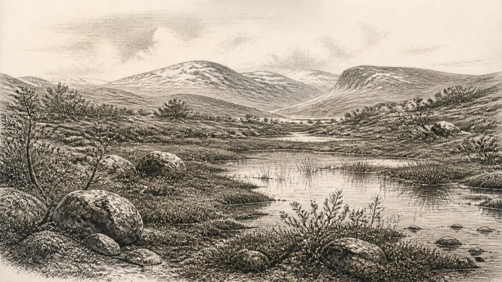
The Derryvree flora and fauna point to open tundra and a periglacial climate: ground subject to intense cold, frost action and short growing seasons, but not permanently overwhelmed by ice at that location during the formation of the freshwater sediments. Moss-rich mud, sedges and aquatic or waterside plants show that this was not an unbroken desert of snow or bare rock. There was standing or slow-moving fresh water, wet margins and vegetation able to exploit the brief summer season. Dwarf willow, mountain avens, bogbean and water-milfoil, among the kinds of remains discussed from the deposit, indicate a patchwork of shallow pools, marshy edges, low herbaceous cover and sparse shrub growth.
This was a landscape of contrasts. Summer light could support productive wetland vegetation, while winters were severe and the annual thaw limited. The absence of forest matters: it points away from a wooded Ireland and towards a largely treeless terrain. Yet a treeless environment need not have been lifeless. Insects, small animals and plants occupied niches around water and exposed ground. The sediments record local conditions rather than the entire island, so they should not be turned into a universal map of Ireland. Still, their very preservation beneath a drumlin makes them one of the best windows onto an otherwise damaged pre-maximum-glaciation landscape.
Ice Sheets in Formation
Ireland was part of a wider north-west European system in which the British–Irish Ice Sheet repeatedly grew, shifted and discharged ice towards the surrounding seas. The broad direction of change is clear: the great expansion associated with the Last Glacial Maximum came later, while the decades and millennia around this nominal date belonged to an earlier, highly variable phase. The precise geometry of Irish ice at any given time remains debated, and regional histories were not identical. Ice could advance in one sector while exposed or waterlogged ground persisted elsewhere.
The Derryvree sequence is important precisely because it disproves a simple picture in which all of Ireland was continuously ice-covered throughout the last Ice Age. It records an ice-free interval in Fermanagh between glacial episodes. Conversely, the upper till records the vulnerability of such terrain: the wetland was not a stable refuge lasting indefinitely, but a landscape later overridden or sealed by renewed glacial activity. Changes in sea level, ice extent and land surface were remaking routes and habitats across the Irish region. However, no surviving evidence can reconstruct a coastline, a crossing or an individual journey for 30,382 BCE itself.
Animals and the Human Question
Southern Irish caves provide a different, though equally fragmentary, line of evidence. Castlepook Cave near Doneraile in County Cork has yielded a rich Pleistocene faunal collection assembled mainly through early excavations. Its mammal remains include reindeer, woolly mammoth, spotted hyaena, wolf, foxes, bears, hares, lemmings and giant deer. Together, direct dates and reassessments show that Ireland supported a more varied cold-stage fauna during Marine Isotope Stage 3 than the modern island does. Such animal evidence supports the inference that open, seasonally productive habitats existed in some regions before the Last Glacial Maximum.
But cave collections demand restraint. Bones from Castlepook were recovered from deposits disturbed by natural processes and by antiquarian excavation; specimens need not all belong to one moment, one ecological community or one episode of deposition. A bone in a cave establishes that an animal, or a part of it, entered the cave system. It does not automatically identify the surrounding hunting ground, the season of death, or a population living nearby. The same cave may contain material spanning many thousands of years.
A reindeer femur from Castlepook has drawn particular attention because Ruth Carden interpreted a mark on it as a possible fresh-bone cut made with a sharp stone tool. Public reports have linked the dated bone to human activity around 33,000 years ago. If further study confirms both the modification and its context, it would be important evidence for a brief Upper Palaeolithic human encounter with a carcass in Ireland during the wider pre-maximum-glaciation period. It would not establish a permanent settlement, a named group, a migration route or a continuing population. No excavated house, hearth, lithic workshop, burial or stratified camp securely documents a human community in Ireland around the nominal date considered here.
No Polities, No Trade Networks
For this reason, political affairs, warfare, diplomacy and institutions are not recoverable subjects for Ireland at this time. There is no evidence for chiefs, tribes, territories, alliances or organised conflict, and it would be misleading to supply them from analogy with later peoples. Nor is there evidence for farming, herding, fields, pottery, metalworking, monuments, formal religion, long-distance trade or systems of learning. The material record does not support claims about language, ethnicity, kinship or belief.
Even everyday human life remains unknown. The cautious possibility is not of a settled Ice-Age society, but of occasional visitors—if the Castlepook interpretation is sustained—using animal resources in a difficult, changing environment. The evidence is far stronger for the conditions that would have framed any such visit: cold open country, wetlands and freshwater, mobile animal populations, and an ice sheet whose later advance would erase or bury many traces.
A Landscape Before Erasure
The chief historical development appropriate to 30,382 BCE is therefore environmental rather than political. At Derryvree, water and vegetation briefly occupied a hollow between episodes of glaciation. Across Ireland, the precise regional pattern remains uncertain, but the island was entering the increasingly severe world that led towards the Last Glacial Maximum. Later ice scoured landscapes, reworked sediments and removed many possible archaeological sites; later sea-level rise submerged other coastal evidence. Absence of evidence is not proof that no person ever entered Ireland, but it is decisive against confident stories of occupation.
What survives is more modest and more revealing: organic silt under glacial debris, seeds and mosses from a cold wetland, and cave bones from a changing animal world. They show that Ireland was neither outside Ice-Age history nor a blank white space. It was a regional landscape of tundra, pools, animals and advancing ice—knowable in calibrated spans and sedimentary layers, but not in the false precision of a single calendar year.
Primary Sources
- Middle Midlandian Freshwater Series at Derryvree, Maguiresbridge, County Fermanagh, Northern Ireland
- A Reconsideration of the Radiocarbon Dating of the Marine Isotope Stage 3 Fauna from Southern Ireland
- The Irish Quaternary Fauna Project
- Phylogeographic, Ancient DNA, Fossil and Morphometric Analyses Reveal Ancient and Modern Introductions of a Large Mammal: The Complex Case of Red Deer (Cervus elaphus) in Ireland
- First Evidence of a Late Upper Palaeolithic Human Presence in Ireland
- New Insights on the Fauna of Ireland’s Younger Dryas and Early Holocene from Alice & Gwendoline Cave
- The Colonization of Ireland: A Human Ecology Perspective
- Growth and Retreat of the Last British–Irish Ice Sheet, 31,000 to 15,000 Years Ago: the BRITICE-CHRONO Reconstruction
- Exploring Controls of the Early and Stepped Deglaciation on the Western Margin of the British Irish Ice Sheet
- Pattern, Style and Timing of British–Irish Ice Sheet Advance and Retreat Over the Last 45,000 Years: Evidence from NW Scotland and the Adjacent Continental Shelf
- The Timing and Magnitude of the British–Irish Ice Sheet Between Marine Isotope Stages 5d and 2: Implications for Glacio-Isostatic Adjustment, High Relative Sea Levels and ‘Giant Erratic’ Emplacement
- Maximum Extent and Readvance Dynamics of the Irish Sea Ice Stream and Irish Sea Glacier Since the Last Glacial Maximum
- Character of Advance and Retreat of the Southwest Sector of the British-Irish Ice Sheet During the Last Glaciation
- Radiocarbon Constraints on the Age of the Maximum Advance of the British–Irish Ice Sheet in the Celtic Sea
- The Deglaciation of the Western Sector of the Irish Ice Sheet from the Inner Continental Shelf to Its Terrestrial Margin
- IntCal20 Northern Hemisphere Radiocarbon Age Calibration Curve (0–55 cal kBP)
- A Stratigraphy Framework for Abrupt Climatic Changes During the Last Glacial Period Based on Three Synchronized Greenland Ice-Core Records
- Figure 6—The Subdivision of the Quaternary Period in Ireland
- Archaeological Heritage of County Cork
- The Mesolithic in Ireland: When Was It?
