Frostwater at Derryvree31767 BCE
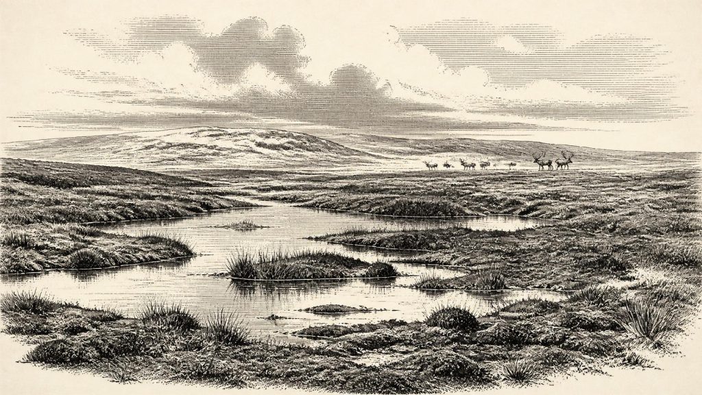
Around 31,767 BCE, Ireland lay within the climatically unstable Marine Isotope Stage 3, not a historically identifiable year. Derryvree, County Fermanagh, preserves freshwater sediments dating broadly to 31,700–36,900 cal BP, indicating locally ice-free, treeless wet tundra with pools, sedges, mosses and insects. Castlepook Cave, County Cork, contains faunal remains from a wider period, including reindeer, mammoth, giant deer, bears, wolves and hyaenas, demonstrating biologically active cold-stage environments. A possibly cut-marked reindeer bone may indicate brief human activity, but no settlement is known. Later glaciation destroyed much evidence, leaving an incomplete record of shifting habitats, animal movements and uncertain human presence.
Dateline
The label 31,767 BCE cannot denote an event in an Irish calendar. No written record, annually layered archive or excavated settlement allows historians to identify what happened in this particular year. It is a modern chronological convenience, equivalent to about 33,700 calendar years before present (cal BP, with “present” conventionally fixed at 1950). The responsible frame is therefore a calibrated range, not a date-like anniversary. This point falls within Marine Isotope Stage 3 (MIS 3), a long and climatically unstable part of the Late Pleistocene, before the Last Glacial Maximum. Ireland’s evidence consists chiefly of buried freshwater deposits, cave fauna, radiocarbon measurements and reconstructions of advancing ice—not a human narrative.
Dating a Deep Past
At this depth of time, radiocarbon ages are not calendar ages. They measure residual carbon-14 in once-living material and must be converted through calibration curves that account for past changes in atmospheric carbon. The conversion produces probability ranges, often broad ones, rather than an exact year. The useful local range is supplied by the organic sediments at Derryvree, near Maguiresbridge in County Fermanagh: material from the deposit has been reported within approximately 31,700–36,900 cal BP. The nominal year in this article lies inside that span, but it cannot be tied to a particular layer, season, animal or human action.
The same caution applies to the term “Ireland”. The modern island is a familiar geographical unit, but its coastlines, sea levels, ice margins and habitats were radically different. Lower global sea levels altered the extent of the continental shelf, while ice and water shaped the routes by which animals—and conceivably people—could move across north-west Europe. That does not demonstrate a simple, permanent land bridge, still less a known route into Ireland at this moment. Connectivity changed over time, and the precise geography of any crossing around 33,700 cal BP remains uncertain.
An Unsettled Cold Landscape
MIS 3 was neither one uninterrupted freeze nor a mild interval before winter. It contained abrupt shifts between colder stadials and comparatively warmer interstadials. Ireland lay close to the changing western margin of the British–Irish Ice Sheet system. Some ground could be ice-free during parts of this period, only to be overridden, eroded or buried during later advances. The great expansion associated with the Last Glacial Maximum lay ahead: major evidence indicates that the ice sheet’s maximum volume came much later, around 23,000 years ago, although advance and retreat varied markedly between regions.
That later glaciation explains why the record is so patchy. Ice can scour bedrock, remobilise older sediment and remove open-air traces of occupation. Acid soils further reduce the survival of bone and organic material. Caves and exceptional deposits beneath glacial sediments are consequently disproportionally important. They are not complete landscapes in miniature; rather, they are rare survivals from a world otherwise heavily edited by ice.
Derryvree’s Cold Water
Derryvree is one of the clearest Irish environmental windows onto this broad interval. In a road cutting through a drumlin, researchers found organic silts and fine sands trapped between two thick glacial deposits. The lower and upper tills show that the freshwater accumulation belongs between episodes of ice activity. The organic layer records an ice-free phase locally, not an assurance that all Ireland was free of ice at once.
Pollen, plant remains, mosses and insects indicate treeless, open country with wet ground, pools and abundant plant matter: a cold muskeg or tundra-like wetland rather than forest. Sedges and mosses could flourish around shallow water even in a harsh climate. Insect evidence is especially valuable because many beetles have narrow environmental tolerances. Together, these proxies support an interpretation of severe winters, short productive summers and a mosaic of waterlogged hollows and open vegetation. They do not yield temperatures for 31,767 BCE itself, nor do they map every Irish region. The safest conclusion is local and powerful: north-eastern Ireland preserved freshwater habitats during part of MIS 3 before later ice sealed them beneath till.
Castlepook’s Animal Archive
In north County Cork, Castlepook Cave near Doneraile provides the principal faunal archive for pre-Last Glacial Maximum Ireland. Excavations conducted mainly in the late nineteenth and early twentieth centuries recovered remains attributed to such animals as reindeer, woolly mammoth, giant deer, brown bear, wolf, fox, hare, lemmings and spotted hyaena. This striking combination places Ireland within the wider cold-stage fauna of north-west Europe. Large herbivores imply enough seasonal food and accessible ground to sustain them; predators and scavengers reveal a more complex food web than a bare, lifeless ice margin.
But Castlepook must not be turned into a single scene in which every listed species shares one hillside. The cave accumulated material over a long period. Carnivores could drag in carcass parts; water, trampling and sediment movement could rearrange bones; and early excavation methods did not preserve the contextual detail expected today. Modern redating has also altered the chronology. Improved collagen pretreatment showed that several old Irish cave determinations were too young, with some Castlepook specimens returning dates thousands of radiocarbon years older than earlier results. The reassessment suggests that giant deer and spotted hyaena may have disappeared from Ireland before about 40,000 cal BP. Thus the cave demonstrates repeated animal presence across a broad period, not a census for the nominal year.
The hyaena remains are particularly instructive. Spotted hyaenas were then part of European Pleistocene faunas, although their present range is in Africa. At Castlepook, gnawed bones and the uneven survival of skeletal parts are compatible with carnivore use of the cave. This is evidence of animal behaviour as well as animal distribution. It also imposes an archaeological discipline: bone damage must be distinguished carefully between tooth marks, natural fracture, sediment abrasion, excavation damage and cuts made by stone tools.
A Possible Human Episode
The question of people rests chiefly on a reindeer femur from Castlepook reported to carry a chop or cut mark consistent with a sharp stone implement. If the identification and association are accepted, it offers a remarkable possibility: human processing of an animal in Ireland during the wider MIS 3 period, far earlier than the formerly accepted post-glacial evidence. It would be evidence for an episode, however, not proof of a resident population.
No securely associated hearth, stone-tool assemblage, built shelter, burial, artwork or repeatedly occupied camp of this age has yet been established in Ireland. The marked bone came from an old cave collection, not from a newly excavated sealed living floor. It cannot disclose the language, identity, kinship system or numbers of any visitors. Nor can it tell whether they crossed the wider landscape on a single foray, returned seasonally, or merely passed through. Archaeology can responsibly preserve the possibility of a brief human presence; it cannot responsibly populate Ireland with a settled Palaeolithic community.
What Society Cannot Yet Tell Us
Accordingly, there is no evidence for political institutions, rulers, diplomacy, territorial boundaries, organised warfare, formal religion, trade networks, farming, metalworking, monuments or literacy in Ireland at this date. Such subjects are not missing chapters waiting to be filled with plausible imagination; they are beyond the resolution of the surviving evidence. If humans visited, their likely technologies and social practices would have belonged to wider Late Palaeolithic hunter-gatherer worlds known elsewhere in Europe, but applying those comparisons to Ireland is interpretation, not direct observation.
Economy, in the narrow sense supported here, was ecological. Herbivores converted sparse seasonal vegetation into meat, hides, bone and antler; carnivores competed for or scavenged carcasses; wetlands sustained plants and insects. A human group able to reach Ireland would have depended on mobility, careful knowledge of weather and animal movement, and portable equipment. Yet none of those reasonable inferences can establish hunting strategy or exchange in Ireland itself. The direct evidence is of landscape and fauna, with one possible trace of carcass processing.
Before the Ice Advance
The most important development around 31,767 BCE was therefore environmental rather than political: parts of Ireland formed a cold but biologically active fringe of Pleistocene Europe before the later ice-sheet maximum transformed the island. Derryvree’s freshwater silts show that wet tundra habitats existed during an ice-free interval; Castlepook’s bones show that substantial mammals and carnivores reached southern Ireland over the wider period. Their records are separated in place, formed over long spans and affected by later processes. Taken together, they replace the old image of a wholly blank, frozen Ireland with a more demanding reality—changing habitats, mobile animals, uncertain connections and, perhaps, fleeting human footsteps that remain just beyond clear historical view.
Primary Sources
- A reconsideration of the radiocarbon dating of the Marine Isotope Stage 3 fauna from southern Ireland
- The Irish Quaternary Fauna Project
- A Middle Midlandian Freshwater Series at Derryvree, Maguiresbridge, County Fermanagh, Northern Ireland
- The Exploration of Castlepook Cave, County Cork, Being the Third Report from the Committee Appointed to Explore Irish Caves
- 2022:564 – Castlepook Cave, Castlepook South, Cork
- Growth and retreat of the last British–Irish Ice Sheet, 31,000 to 15,000 years ago: the BRITICE-CHRONO reconstruction
- Maximum extent and dynamic behaviour of the last British–Irish Ice Sheet west of Ireland
- Pattern and timing of retreat of the last British-Irish Ice Sheet
- New data for the Last Glacial Maximum in Great Britain and Ireland
- The IntCal20 Northern Hemisphere Radiocarbon Age Calibration Curve (0–55 cal kBP)
- IntCal Publications
- Figure 6.— The subdivision of the Quaternary Period in Ireland
- Quaternary Site Descriptions
- Occurrence of mammalia relicts at site Castlepook Cave
- Heritage Artefacts of County Cork
- New Insights on the Fauna of Ireland’s Younger Dryas and Early Holocene Caves
- “Big Game” Extinction Caused by Late Pleistocene Climatic Change: Irish Elk (Megaloceros giganteus) in Ireland
- European vegetation during Marine Oxygen Isotope Stage-3
- Ireland's Palaeolithic Archaeology – Fleeting Footprints in a Frozen Land
- Mammoth Cave / Castlepook Cave
