

Derryvree’s Frozen Sedge Basin31768 BCE
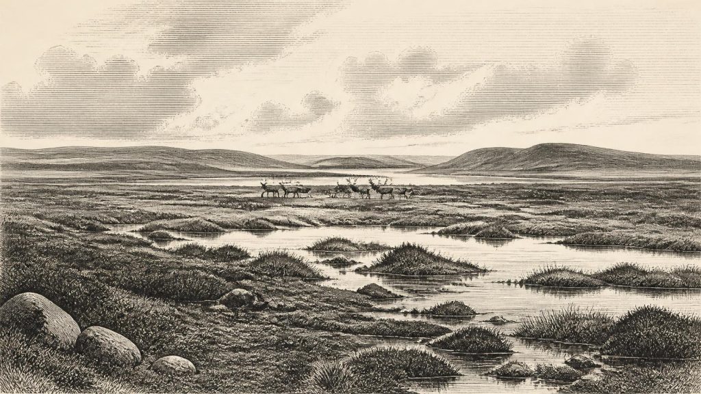
31,768 BCE is a nominal modern date, not an identifiable Irish event, and belongs broadly to Late Pleistocene MIS 3. Derryvree, County Fermanagh, preserves freshwater organic sediments between glacial tills, dated broadly to 36,900–31,700 calibrated years BP. They reveal a cold, locally ice-free, treeless periglacial wetland of sedges, mosses, pools and short growing seasons, later overridden by ice. Northern sites corroborate open conditions. Castlepook Cave, County Cork, records cold-adapted fauna including mammoth, reindeer and hyaena, though not necessarily contemporaneously. A marked reindeer bone may indicate early human butchery, but lacks secure supporting context. No evidence establishes permanent settlement or institutions.
Dateline
31,768 BCE is a modern chronological label, not a year that can be recovered from the Irish archaeological record. No written calendar, settlement sequence or historical narrative permits us to identify an event in Ireland in that precise year. The most responsible approach is to place it within the later part of the Late Pleistocene, broadly Marine Isotope Stage 3 (MIS 3), before the Last Glacial Maximum. Radiocarbon ages from this remote period must be calibrated and are expressed as ranges, not as exact anniversaries. A useful Irish environmental record, at Derryvree near Maguiresbridge in County Fermanagh, has a conventional radiocarbon age of 30,500 +1,170/−1,030 radiocarbon years BP. In modern calibration, it belongs broadly within a span of roughly 36,900–31,700 calibrated years BP. The nominal date 31,768 BCE falls within that wide window, but it cannot be tied to a particular layer, season or occurrence.
That limitation is important. Ireland at this point was not the settled, wooded island familiar from later prehistory. There are no securely dated houses, hearths, tool scatters, graves, monuments or fields from 31,768 BCE. Consequently, there can be no evidence-based account of named peoples, rulers, political affairs, warfare, diplomacy, formal religion, trade institutions or learning. What survives instead is a demanding but revealing record in sediments, pollen, plant remains, insects, animal bones, cave deposits and the traces left by moving ice. It tells a story not of a nation in formation, but of a changing northern Atlantic landscape in which animal communities, water, frost and ice were the principal historical forces.
A Freshwater Record Beneath Ice
Derryvree is central because road excavations in 1969 cut through a drumlin and exposed an unusual sequence. Beneath the landform lay one thick sheet of glacial till, then freshwater silts and fine sands rich in organic material, followed by another thick till sheet. Till is debris laid down directly by glacier ice. The order of deposits therefore demonstrates a major environmental reversal: ice had covered the area; a non-glacial freshwater landscape subsequently developed; and later ice overran and sealed it. Much of Ireland’s older Pleistocene evidence was eroded, redistributed or buried by later glaciation. The Derryvree sediments survived precisely because they were protected between those tills.
The deposit is evidence, first, for a cold but locally ice-free interval in this part of Fermanagh. Its flora and fauna were described by the original investigators as being of ‘full glacial aspect’; later syntheses interpret the setting as open tundra or muskeg. The latter term conveys waterlogged, mossy ground with shallow pools and sedge-rich margins, rather than a continuous frozen desert. Fine sediment settled in standing or slow-moving fresh water. Plant macrofossils, including a seed of bogbean, alongside mosses, sedges and insect remains, point to wetland habitats capable of persisting under short growing seasons and severe winter conditions. This was not a snapshot of every part of Ireland. It was a local archive, but one of exceptional value for reconstructing the island’s broader climatic possibilities.
Open Ground, Pools and Frost
The most defensible picture of the Derryvree district is therefore a largely treeless, exposed terrain. Sedges, grasses, herbs, mosses and low shrubs would have occupied wet hollows and better-drained ground. Periglacial conditions mean a climate shaped by frost, seasonal thaw and ground instability at the edge of or beyond permanent glacier ice. Water would have collected in basins during thaw periods, while frozen ground, snow cover and hard winds restricted plant growth for much of the year. There is no basis for imagining the oak, elm and hazel woods of the much later Holocene, nor the hedged farms, bogs and lakes of the recent Irish countryside.
The wider North Atlantic climate was highly unstable during MIS 3. Greenland ice cores register repeated shifts between relatively milder interstadials and colder stadials over millennial rather than annual scales. Irish deposits should not be mechanically assigned to one Greenland event, but this background explains why a single region might move between glacial cover and open, wet periglacial ground. The Derryvree sequence records precisely such volatility. Conditions suitable for freshwater sedimentation did not signal a permanently benign climate; they occupied an interval between advances of ice.
At Hollymount, also near Maguiresbridge, and at Greenagho near Belcoo, organic deposits provide supporting, though differently dated and sometimes less secure, evidence for cold, open, non-forested conditions in northern Ireland. Their value lies in corroboration: Derryvree was not simply an inexplicable isolated pond. Yet the gaps between sites matter. Dating uncertainties, erosion and the patchy survival of deposits mean that archaeologists cannot draw a detailed island-wide weather map for 31,768 BCE. Regional variation in altitude, exposure, drainage and proximity to ice would have been substantial.
Castlepook’s Animal World
Animal remains from Castlepook Cave, near Doneraile in the Awbeg Valley of north County Cork, add a striking southern Irish dimension. The cave, historically called Mammoth Cave, is Ireland’s richest known Late Pleistocene vertebrate site. Its assemblage includes woolly mammoth, reindeer, giant deer, brown bear and spotted hyaena, with wolf, Arctic fox, lemmings and mountain hare among other cold-stage animals recorded in the cave deposits. These are not all demonstrably contemporaneous: the cave accumulated material over a long span, its deposits have been disturbed by water and animals, and early excavations did not meet modern recording standards. It is consequently wrong to picture every listed species standing together outside the entrance in 31,768 BCE.
Nevertheless, the assemblage firmly establishes that, during parts of the pre-maximum Ice Age, Ireland lay within the range of a distinctive cold-climate mammal community. Reindeer and mammoth indicate open habitats with substantial forage; lemmings and Arctic fox reinforce the northern character of parts of that environment. Spotted hyaenas and wolves were predators and scavengers, while caves could serve as dens, shelters or traps in which bones accumulated. Castlepook’s bones document animal movement and ecological connectivity with Britain and continental north-west Europe. They do not demonstrate a simple, permanent dry land bridge. Sea level, local ice loading, coastlines and routes across the Irish Sea region changed through time, and the exact pathways used by animals remain uncertain.
The Question of People
A reindeer femur from Castlepook has made this period especially important for Irish archaeology. The bone has been reported as dating to about 33,000 years ago and bears a deep linear mark which zooarchaeologist Ruth Carden has interpreted as damage made by a sharp stone tool during carcass processing. If that interpretation is confirmed, it would indicate that Upper Palaeolithic people reached Ireland far earlier than the better-established terminal-Pleistocene evidence. It would be a profound finding: a human encounter with an animal in an Ice-Age Irish landscape, perhaps during a brief hunting or scavenging visit.
But the distinction between evidence and interpretation must remain clear. The reindeer bone itself is evidence; its date applies to the animal, not automatically to the instant of modification. The mark is an interpretation of human agency that must be weighed against natural breakage, carnivore action, sediment movement and the compromised context of antiquarian cave excavation. No securely associated stone tools, butchered assemblage, hearth, camp floor or dwelling has yet been identified at Castlepook for this early period. It would therefore be premature to write of a settled population, a named hunting band or a continuous Irish occupation in 31,768 BCE. The bone makes human presence plausible and potentially momentous; it does not provide a full social history.
What Cannot Yet Be Claimed
Accordingly, the political and cultural history of Ireland at this date is mostly a history of absence in the record. There is no evidence for chiefs or states, territorial boundaries, organised conflict, diplomacy, exchange networks, farming, domesticated animals, monuments, ritual sites, art or formal systems of knowledge. Even if small groups of people occasionally arrived, the evidence does not reveal their language, kinship arrangements, beliefs, seasonal rounds or relations with one another. A possible act of reindeer processing is not proof of permanent settlement. Nor should familiar later categories such as ‘Irish society’ be projected backwards onto a landscape that was periodically rendered uninhabitable by expanding ice.
Economy, in the narrow sense, cannot be documented. In the broad ecological sense, however, the landscape supported food webs based on tundra and wetland vegetation, herbivores and predators. If people were present, they would have depended on mobile hunting and gathering rather than cultivation. That is a reasonable inference from the environmental and faunal evidence, not a directly observed Irish camp economy. The contrast matters: archaeology can identify what a reindeer femur may imply, but it cannot safely supply the missing settlement, technology or social organisation.
Before the Ice Peak
31,768 BCE also belongs to a longer transition towards much more extensive glaciation. The Last Glacial Maximum, when the British–Irish Ice Sheet covered Ireland and extended over much of its continental shelf, came later, broadly around 27,000–23,000 calibrated years BP, though timing and ice thickness varied regionally. Derryvree’s upper till is material testimony to the return of ice after the freshwater interval. The island’s future physical geography would be profoundly altered by that advance: bedrock was scoured, sediments shifted, drainage reorganised and innumerable older surface traces destroyed.
The principal development around this nominal year was thus neither a battle nor a dynasty, but environmental precariousness. In Fermanagh, a cold freshwater basin preserved sedges, mosses, insects and fine mud beneath a drumlin. In Cork, caves retained bones from a complex Ice-Age fauna and perhaps a tantalising indication of human butchery. Together they show that Ireland was not simply a blank beneath ice. It contained intermittent, regionally varied habitats before the glacial maximum, but its record is fragmentary. The honest historical conclusion is both vivid and restrained: around 31,768 BCE, Ireland was an open, cold and changing Pleistocene landscape whose most securely known inhabitants were plants and animals, while the earliest human presence remains an important question still being tested.
Primary Sources
- Middle Midlandian Freshwater Series at Derryvree, Maguiresbridge, County Fermanagh, Northern Ireland
- Middle Midlandian Freshwater Series at Derryvree, Maguiresbridge, County Fermanagh, Northern Ireland
- Early Midlandian–Middle Midlandian, Pleistocene, Northern Ireland
- Figure 6.— The Subdivision of the Quaternary Period in Ireland
- Section 1: Introduction
- Castlepook Cave, County Geological Site Report CK032
- Spotted Hyena Skull
- The Irish Quaternary Fauna Project
- Pleistocene Vertebrates in the British Isles
- Heritage Artefacts of County Cork
- Archaeological Heritage of County Cork
- Archaeology Research Excavation Grant 2022: Castlepook Cave
- New Insights on the Fauna of Ireland’s Younger Dryas: Evidence from Alice and Gwendoline Cave, County Clare
- Sedimentary Ancient DNA Reveals Late Pleistocene Faunal Connectivity Between Ireland and Eurasia
- Maximum Extent and Dynamic Behaviour of the Last British–Irish Ice Sheet West of Ireland
- Trimlines, Blockfields and the Vertical Extent of the Last Ice Sheet in Southern Ireland
- Timing and Pace of Ice-Sheet Withdrawal Across the Marine–Terrestrial Transition West of Ireland During the Last Glaciation
- Growth and Retreat of the Last British–Irish Ice Sheet, 31,000 to 15,000 Years Ago: the BRITICE-CHRONO Reconstruction
- Ireland: Submerged Prehistoric Sites and Landscapes
- The IntCal20 Northern Hemisphere Radiocarbon Age Calibration Curve (0–55 cal kBP)
- IntCal Publications
- Mechanisms of Abrupt Climate Change of the Last Glacial Period