
Derryvree’s Organic Silts31615 BCE
About 31,615 BCE is best treated as a broad interval within Marine Isotope Stage 3, not a precise historical year. At Derryvree, County Fermanagh, organic silts between glacial tills indicate a locally ice-free freshwater wetland sometime around 34,950–29,750 BCE, amid fluctuating cold conditions and advancing ice. Fossils suggest open, tundra-like habitats, while cave deposits document varied fauna including reindeer, mammoth and predators. Ireland’s changing ice, sea levels and routes constrained movement. A marked Castlepook reindeer bone may indicate early human activity, but lacks secure context. No evidence establishes permanent settlement, society or cultural continuity; palaeoenvironmental records remain the principal evidence.
Dateline
A modern calendar label such as 31,615 BCE gives a false impression of precision for Ice Age Ireland. No written calendar existed, and neither archaeology nor geological dating can identify an event in that individual year. The responsible frame is a broad, calibrated interval. This notional date falls within the later part of Marine Isotope Stage 3, a long, unstable phase of the last glacial cycle. The best directly relevant Irish evidence is not a settlement or a historical person, but a buried freshwater deposit exposed at Derryvree near Maguiresbridge, County Fermanagh.
Organic silts and fine sands at Derryvree lay between two thick sheets of glacial till within a drumlin. Their radiocarbon determination, 30,500 radiocarbon years before present, has been calibrated broadly to about 36,900–31,700 calendar years before present: approximately 34,950–29,750 BCE. The range, rather than any single point within it, is the meaningful result. It establishes that, sometime within that span, an ice-free or at least locally ice-free freshwater environment existed in north-central Ireland after an earlier glaciation and before a later advance. Around the date used here, Derryvree therefore provides a rare window onto a cold Irish landscape in motion.
A Landscape Between Ice Advances
The silts do not show a stable, temperate Ireland. They record an interval bounded by glacial action. Beneath them was older till, deposited by ice; above them was another till, evidence that ice later returned across the ground. Such a sequence is a reminder that the landscape was repeatedly reorganised by ice sheets, meltwater, frost and sediment. Many of the landforms now familiar in Ireland—drumlins, streamlined ridges, scoured rock and spreads of glacial debris—derive from these long episodes, though the surfaces visible today often reflect later phases rather than this particular interval.
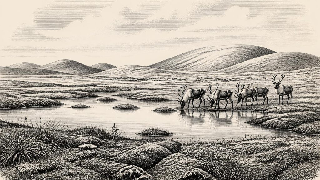
The Derryvree deposit is conventionally associated with a cold phase and with open tundra-like conditions. Fossil plants, insects and other small remains point to wet ground with open pools, abundant plant material and mossy margins rather than woodland. This has sometimes been described as a muskeg environment: waterlogged, peaty or silty ground, interrupted by shallow water and exposed vegetation. It was a setting in which seasonality mattered intensely. Summers could permit plant growth and flowing water; winters were harsh enough for frozen ground and periglacial processes. The evidence supports a cold, largely treeless mosaic, not an unbroken white wilderness.
That distinction matters. “Ice Age” is not a uniform climate, and Ireland was not necessarily buried beneath ice everywhere at every moment before the Last Glacial Maximum. Millennial-scale shifts in North Atlantic climate produced alternations between colder stadials and relatively milder interstadials. Calcite growth in Crag Cave, County Kerry, has been dated across parts of this wider period. Because cave calcite requires liquid water moving through soil and rock, episodes of its formation provide independent evidence that conditions could ameliorate substantially, albeit temporarily. The Irish record is fragmentary, but it confirms that cold-stage environments changed repeatedly rather than simply worsening in a straight line.
The Reach of the Last Ice Sheet
At 31,615 BCE, the great expansion that culminated in the Last Glacial Maximum still lay ahead. The maximum extent of the British–Irish Ice Sheet is generally placed much later, roughly 26,500–19,000 years ago, although its growth and the timing of advances varied by region. Research on mountain trimlines, erratic boulders, offshore landforms and dated sediments suggests that a large part of Ireland was ice-free before about 34,000 years ago, followed by a prolonged build-up and expansion of the Irish Ice Sheet. This broad reconstruction makes Derryvree particularly valuable: its buried wetland belongs near the beginning of that transition, not at the point when the island was most extensively glaciated.
There are limits to that reconstruction. Individual ages have uncertainties, old samples can be contaminated or redeposited, and sediments may be reworked long after an organism died. Debate over deposits at Glenulra in County Mayo illustrates the problem. Marine shells and microfauna once seemed to support very old open-water conditions, but subsequent work has argued that some of this material may have been reworked and therefore supplies only a maximum age for the sediment containing it. This is not a weakness peculiar to Irish research; it is how Quaternary science proceeds. Competing explanations are tested against sedimentary context, new dating methods and the physical traces of former ice flow.
What can safely be said is that the island’s geography was very different from the modern Republic of Ireland and Northern Ireland. Sea level was globally lower than today because immense volumes of water were held in continental ice sheets, but lower sea level did not automatically create a simple, permanent walking route to Britain or mainland Europe. Ice margins, exposed shelves, rivers and marine channels altered through time. Any route into Ireland, whether for animals or people, must be considered in relation to this changing geography rather than imagined as a fixed land bridge.
Animals in an Open Country
Irish cave collections, especially from southern sites such as Castlepook Cave near Doneraile in County Cork, show that Ireland supported or received a striking Late Pleistocene fauna during parts of Marine Isotope Stage 3. The assemblages include reindeer, mammoth, giant deer, wolf, fox, arctic fox, bear and spotted hyaena, as well as lemmings. Their precise contemporaneity cannot always be assumed: early excavations often removed deposits in ways that make it difficult to reconstruct every layer, and bones may have been moved by water or carnivores. Even so, improved dating of selected bones has shown that some southern Irish fauna is substantially older than previously thought.
These animals illuminate ecology rather than a complete food web for one year. Reindeer and lemmings are consistent with cold, open habitats. Mammoth and giant deer indicate that, at least during suitable intervals, the wider landscape could sustain large herbivores. Wolves and hyaenas show the presence of predators and scavengers. Caves were not neutral sample boxes: hyaenas and other carnivores could drag carcass parts inside, while bone gnawing, water movement and later digging mixed the evidence. A bone in a cave may therefore represent an animal killed nearby, carried there by a predator, or transported after death.
The Derryvree wetland and the cave faunas should not be fused into a single map of every animal living together. They come from different places and dating ranges. Taken cautiously, however, they suggest Ireland contained patches of usable habitat within a severe North Atlantic climate: wet basins, open ground, river corridors, sheltered limestone country and changing coastal or lowland routes. In such a world, animal populations may have expanded, contracted or disappeared locally as ice advanced and habitats shifted.
The Castlepook Human Question
There is no securely excavated camp, hearth, stone-tool assemblage, house, burial or artistic site that can be assigned to Ireland around 31,615 BCE. Political institutions, named communities, warfare, diplomacy, organised trade, farming and formal religious practice are consequently beyond the evidence. There is no basis for treating this date as the origin of a continuous Irish population, much less of later Irish languages, identities or traditions.
One find nonetheless makes this horizon unusually important. A reindeer femur from the old Castlepook Cave collection has been reported as carrying a mark interpreted as a cut made by a sharp stone tool, and the bone has been presented as dating to about 31,000 BCE. If the interpretation is sustained, it would indicate that one or more Upper Palaeolithic people processed reindeer in Ireland far earlier than the previously accepted evidence for human presence. It is an important possibility, not proof of a settled community. The bone derives from an antiquarian cave collection rather than a modern, sealed occupation surface, and no associated tool kit or hearth has been recovered.
The alternative explanations must remain visible. Carnivore damage, breakage, excavation history and surface alteration can complicate the reading of bone marks. Moreover, the date of an animal bone does not by itself date the moment of any incision, establish that hunters killed the animal, or show how long people stayed. A renewed excavation at Castlepook in 2022 demonstrated the continuing value of re-examining such sites, but also the difficulty of recovering intact Pleistocene deposits after earlier work. The appropriate description is possible early human activity, not established permanent occupation.
Society Beyond the Record
If people did reach Ireland in this period, they would have belonged to the wider Upper Palaeolithic human world of north-west Europe. Elsewhere, groups used sophisticated stone technologies, fire, hides, animal materials and extensive social connections. But none of those practices can be transferred automatically across the Irish Sea. Ireland has yielded no demonstrable Gravettian or other contemporaneous tool tradition for this date. Nor can archaeology identify a language, a people’s name, a religion or a political order from a single potentially modified bone.
The absence of evidence is itself historically significant. Ireland at this depth of time is better understood through palaeoenvironmental archives than through conventional history. Derryvree’s organic silts preserve the trace of a cold freshwater landscape between ice advances. Southern caves preserve a partial record of animals moving through, living in or being taken into Irish habitats. Together they reveal an island—or a changing north-western extension of the European margin—where climate and ice determined the possibilities of life. Whether people briefly entered that landscape remains a promising but unresolved question, and its answer must rest on new discoveries rather than on a falsely precise calendar year.
Primary Sources
- A Middle Midlandian Freshwater Series at Derryvree, Maguiresbridge, County Fermanagh, Northern Ireland
- A Reconsideration of the Radiocarbon Dating of the Marine Isotope Stage 3 Fauna from Southern Ireland
- Trimlines, Blockfields and the Vertical Extent of the Last Ice Sheet in Southern Ireland
- Episodic Speleothem Deposition Tracks the Terrestrial Impact of Millennial-Scale Last Glacial Climate Variability in SW Ireland
- A Stratigraphic Framework for Abrupt Climatic Changes During the Last Glacial Period Based on Three Synchronized Greenland Ice-Core Records
- Exploring Controls of the Early and Stepped Deglaciation on the Western Margin of the British Irish Ice Sheet
- Early Deglaciation of the British-Irish Ice Sheet on the Atlantic Shelf Northwest of Ireland Driven by Glacioisostatic Depression and High Relative Sea Level
- New Data for the Last Glacial Maximum in Great Britain and Ireland
- The Irish Quaternary Fauna Project
- Pleistocene Vertebrates in the British Isles
- Occurrence of Mammalia Relicts at Site Castlepook Cave
- New Insights on the Fauna of Ireland's Younger Dryas and Early Holocene from Alice & Gwendoline Cave
- First Evidence of a Late Upper Palaeolithic Human Presence in Ireland
- Prehistoric Details
- 32564: Castlepook Cave, Co. Cork
- Heritage Artefacts of County Cork
- Quaternary Geomorphology 1:50,000 Ireland (ROI) ITM
- Tipperary County Geological Site Report: Ardfinnan
- The IntCal20 Northern Hemisphere Radiocarbon Age Calibration Curve (0–55 cal kBP)
- IntCal Publications
- Could Brown Bears Have Survived in Ireland During the Last Glacial Maximum?
- Phylogeographic, Ancient DNA, Fossil and Morphometric Analyses Reveal Ancient and Modern Introductions of a Large Mammal: The Complex Case of Red Deer in Ireland
