
Derryvree’s Freshwater Witnesses31569 BCE
At 31,569 BCE, Ireland’s evidence belongs to a broad, climatically unstable Late Pleistocene interval, not a single year. Derryvree, County Fermanagh, preserves freshwater sediments between glacial tills, indicating an ice-free tundra-like wetland during later MIS 3. Castlepook Cave, County Cork, contains mammoth, reindeer, giant deer, bear and hyena remains, showing a diverse open-country fauna. A cut-like mark on a reindeer bone may indicate early human activity, but cannot demonstrate settlement. Approaching glacial maximum conditions, lower sea levels and uncertain routes shaped a changing landscape. Surviving sediments, bones and landforms reveal ecology and climate, but no political, cultural or social history.
Dateline
Modern calendar-year precision cannot be imposed on Ireland in 31,569 BCE. There is no written record, no dated settlement, no named community and no event that can responsibly be assigned to this particular year. The label is best treated as a point within the Late Pleistocene, during Marine Isotope Stage 3, a long and climatically unstable part of the last Ice Age. In simple calendar arithmetic it lies about 33,500 years before AD 1950, but archaeological and environmental evidence is dated in radiocarbon years, calibrated calendar ranges, stratigraphic sequences and relative climatic phases. Those methods illuminate intervals, not individual years.
The strongest Irish evidence relevant to this broad horizon comes not from a habitation site but from buried wetland sediments and cave-bone collections. They show that parts of Ireland could support cold-adapted plants and large mammals before the Last Glacial Maximum. They do not permit a narrative of Irish tribes, chiefs, wars or ceremonial centres. Indeed, the most important historical fact about this period is the narrowness of the surviving record, and the care required not to turn a few traces into a crowded prehistoric world.
A Wetland Beneath a Drumlin
At Derryvree near Maguiresbridge, County Fermanagh, roadworks in 1969 cut through a drumlin and exposed an exceptional sequence. Freshwater silts and fine sands, including organic material, lay between two tills: unsorted deposits left by separate episodes of glacier ice. The sequence establishes a clear local order. Ice had occupied the ground; an interval followed in which freshwater sediment, plants and small animals accumulated; later ice crossed the area again and sealed the deposit beneath a further layer of till.
The original radiocarbon determination from the organic horizon was 30,500 radiocarbon years BP, with a large uncertainty of +1,170 and −1,030 years. Radiocarbon years cannot simply be converted into calendar years because atmospheric carbon-14 varied considerably in the distant past. Modern calibration therefore places the Derryvree evidence broadly in later MIS 3, approximately 37,000–32,000 calibrated years BP, or about 35,050–30,050 BCE. The notional year considered here falls within that wide span, but cannot be fixed to a particular season, pool, animal or layer at Derryvree.
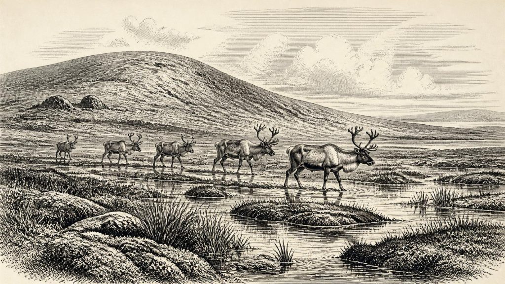
The organic beds offer a rare view of an ice-free locality in northern Ireland. Pollen was poorly preserved, yet much of it derived from herbaceous plants associated with tundra. Plant macrofossils and mosses reinforce the picture of open, cold ground with wet hollows and freshwater margins. The evidence is often described as tundra or muskeg: a waterlogged, largely treeless landscape in which sedges, mosses and low herbs could survive around pools, while exposed terrain was probably sparsely vegetated. This was not the later green, wooded Ireland familiar from Mesolithic and Neolithic archaeology.
Such evidence must be scaled correctly. Derryvree demonstrates a local environment, not a uniform island-wide climate. Conditions in a Fermanagh basin cannot straightforwardly be transferred to limestone lowlands in Cork, Atlantic headlands or upland Ireland. Nevertheless, the deposit is decisive in showing that glacial history was neither a single uninterrupted freeze nor a simple advance from ice-free land to maximum ice cover. Local landscapes changed repeatedly as ice margins, meltwater, permafrost and vegetation responded to abrupt climatic shifts.
The Approach of Major Ice
Ireland was moving towards a more severe glacial world. The British–Irish Ice Sheet did not attain its overall maximum at one identical moment everywhere: modern reconstructions show substantial regional variation in advance and retreat. Much of its maximum expansion belongs broadly to the period after this article’s notional date, especially roughly 30,000–22,000 years ago, with a major maximum around 23,000 years ago in some reconstructions. At 31,569 BCE, therefore, it is safer to speak of a changing pre-maximum landscape than of an island already buried beneath a single continuous ice sheet.
Sea level was lower than today because vast quantities of water were held in global ice sheets. The Irish Sea basin and the lands now submerged around Ireland consequently had a different shape. Yet a lowered sea is not proof of an easy, permanent land bridge from Ireland to Britain. The form, timing and continuity of possible connections remain matters for palaeogeographical reconstruction; ice, channels, tidal waters and broken terrain mattered as much as sea level. Mammals evidently reached Ireland during parts of the Late Pleistocene, but the routes, duration and openness of their movements varied.
For people, if any entered Ireland during this broad interval, these shifting geographical conditions would have mattered profoundly. Crossings could not be assumed to be simple walks across a fixed plain. Nor should the existence of large mammals be converted automatically into evidence of regularly occupied hunting territory. A landscape capable of supporting mobile herds could still have been visited only sporadically by humans, or not at all.
Castlepook’s Mixed Fauna
Castlepook Cave, also known as Mammoth Cave, near Doneraile in north County Cork, is Ireland’s richest cave assemblage for mammals of the period leading towards the Last Glacial Maximum. Excavations in the early twentieth century recovered bones from a cave system with galleries later given evocative names such as Hyenahall and Elephant Hall. The National Museum of Ireland and Geological Survey Ireland identify woolly mammoth, giant deer, reindeer, brown bear and spotted hyena among the Ice Age fauna; later cold-stage material includes Arctic fox, wolf and lemmings.
This is compelling evidence that an Irish Late Pleistocene fauna was far more varied than the island’s modern mammal community. Reindeer and mammoth imply extensive open country with adequate grazing; predators and scavengers point to a functioning food web rather than isolated animal arrivals. Spotted hyena is especially important. Castlepook is its only securely known Irish site, and the cave’s bones bear the effects of carnivore activity, including gnawing and accumulation. Caves were not neutral storehouses. A bone found in one may represent an animal that died outside, a carcass dragged in by a scavenger, water movement, excavation disturbance, or more than one such process.
That warning is essential because Castlepook also contains the much-publicised reindeer femur with a cut-like mark. Analysis announced in 2021 proposed that the incision was made by a stone tool while a reindeer carcass was being processed, potentially indicating human activity in Ireland around 33,000 years ago. The possibility is important, but the specimen does not provide a securely excavated camp, a tool assemblage, hearth, dwelling, human skeleton or a date for 31,569 BCE. Its broader cave context is disturbed and the collection includes material accumulated over a long timespan. The responsible conclusion is that it raises the prospect of a very early human visit; it does not establish permanent settlement or an annual episode of reindeer hunting.
People at the Edge of Evidence
No political affairs can be recovered for Ireland at this date. There are no states, kingdoms, chiefs, alliances, diplomatic contacts or conflicts visible in the evidence. There is likewise no direct Irish evidence for language, personal names, kinship rules, religious rites, art, formal learning or trade. To fill these absences with images borrowed from better-known Upper Palaeolithic societies in continental Europe would be tempting but misleading.
Comparison does, however, define what a human presence would have required. Upper Palaeolithic groups elsewhere in north-west Europe were mobile hunter-gatherers who used stone, bone, hide, wood and fire, and whose social knowledge enabled them to navigate seasonal resources and long distances. If the Castlepook mark is genuinely anthropogenic, it may record one such practical act: cutting meat or disarticulating a reindeer limb with a sharp stone edge. It cannot reveal how many people were involved, whether they were resident in Ireland, or what they believed.
Economy, in the strict archaeological sense, is therefore visible chiefly as ecology. Animals obtained grass, herbs and browse from open terrain; carnivores and scavengers exploited carcasses; water, vegetation and sediment built up in sheltered basins. Human procurement of animal food remains possible at Castlepook, not demonstrated as a sustained economic system. There is no evidence for farming, domesticated animals, fields, pottery, metalworking, monuments or maritime trade. Those transformations belong tens of millennia later.
An Ireland of Intervals
The most defensible portrait of Ireland around 31,569 BCE is one of changing habitats rather than a settled human country. In Fermanagh, Derryvree’s freshwater deposits preserve an interval of cold, open wetland between glacial advances. In Cork, Castlepook preserves a time-averaged faunal archive showing that mammoth, reindeer, giant deer, bears and hyenas formed part of an intermittently connected Late Pleistocene world. Around and after this broad period, advancing ice would erase, bury and reshape many of the surfaces on which people or animals might once have left clearer traces.
That erasure helps explain why the evidence is so uneven. Ireland’s Ice Age history is reconstructed from cave collections, fragments of bone, plant remains, insects, sediments, landforms and increasingly refined dating methods. Each archive answers a different question. Derryvree can speak powerfully about a local wetland and climate; Castlepook can speak powerfully about fauna and cave formation; neither can supply the missing political or cultural history. The apparent silence is not proof that nothing happened. It is a measure of what has survived, and of the discipline needed to distinguish a prehistoric possibility from a demonstrated past.
Primary Sources
- Spotted Hyena Skull
- Cork County Geological Site Report: Castlepook Cave
- Palaeoecology
- A Middle Midlandian Freshwater Series at Derryvree, Maguiresbridge, County Fermanagh, Northern Ireland
- Irish Pleistocene Biostratigraphy
- The Irish Quaternary Fauna Project
- The Irish Quaternary Fauna Project
- Quaternary Site Descriptions
- Growth and Retreat of the Last British–Irish Ice Sheet, 31,000 to 15,000 Years Ago: the BRITICE-CHRONO Reconstruction
- Trimlines, Blockfields and the Vertical Extent of the Last Ice Sheet in Southern Ireland
- Maximum Extent and Dynamic Behaviour of the Last British–Irish Ice Sheet West of Ireland
- Stratigraphic and Palaeo-Geomorphological Evidence for the Glacial-Deglacial History of the Last British-Irish Ice Sheet in the North-Western Irish Sea
- The Problem of a Late Quaternary Landbridge Between Britain and Ireland
- The Island of Ireland: Drowning the Myth of an Irish Land-Bridge?
- New Data for the Last Glacial Maximum in Great Britain and Ireland
- The IntCal20 Northern Hemisphere Radiocarbon Age Calibration Curve (0–55 cal kBP)
- The Greenland Ice Core Chronology 2005, 15–42 ka. Part 1: Constructing the Time Scale
- Rapid Global Ocean-Atmosphere Response to Southern Ocean Freshening During the Last Glacial
- New Insights on the Fauna of Ireland’s Younger Dryas and Early Holocene from Alice & Gwendoline Cave
- 2022:564 – Castlepook Cave, Castlepook South, Cork
- Castlepook Caves
- Mammoth Cave
- The Late Quaternary History of East-Central Ireland
