
Fermanagh’s Intertill Reedbed31440 BCE
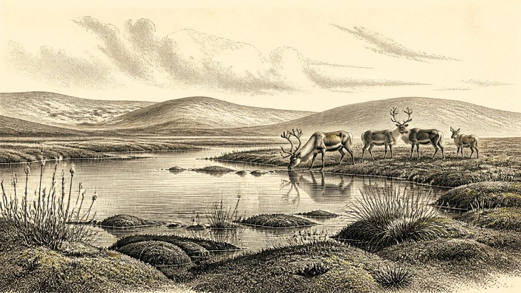
Around 31,440 BCE, Ireland lay within the climatically unstable later Marine Isotope Stage 3, although no evidence can identify events in that exact year. At Derryvree, County Fermanagh, freshwater silts sealed between glacial tills preserve a cold, treeless tundra wetland of sedges, mosses and shallow water. Castlepook Cave, County Cork, contains remains of mammoth, reindeer, giant deer, bear and hyena, indicating changing animal movements rather than a permanent fauna. A cut-marked reindeer bone may indicate human butchery about 33,000 years ago, but cannot prove settlement. Later glaciation obscured evidence; no politics, monuments, farming or permanent communities are firmly known anywhere.
Dateline
The label 31,440 BCE gives a useful position in a modern chronological sequence, but it cannot identify an Irish event, person or calendar date. No community in Ireland recorded years at this depth of time, and archaeology cannot recover activity with annual precision nearly 33,500 years ago. In radiocarbon convention, the label lies at roughly 33,390 calibrated years before present, where “present” means AD 1950. That is an approximate conversion, not a date for a particular layer, animal death or human visit.
The responsible subject is therefore Ireland during the later part of Marine Isotope Stage 3, an unstable interval of the last Ice Age before the Last Glacial Maximum. The richest evidence close to this notional date does not come from houses, graves, tools or monuments. It comes from sediments, fossils and landforms: especially an extraordinary buried freshwater deposit at Derryvree, near Maguiresbridge in County Fermanagh, and cave-bone assemblages in north Cork. They provide a fragmentary but valuable picture of environments and animals. They do not provide a year-by-year history of a settled society.
A Date Within a Wide Interval
The key chronological warning concerns scale. Organic material from the Derryvree freshwater deposits produced a conventional radiocarbon determination of 30,500 ± 1,170 radiocarbon years BP. When considered through modern calibration, this represents a broad calendar range, approximately 36,900–31,700 calibrated years BP, or about 34,950–29,750 BCE. The notional year 31,440 BCE falls within that wide span, but the deposit cannot tell us what happened in that particular year. Calibration is essential because atmospheric radiocarbon levels changed through time; at these great ages, results are necessarily broader than familiar historical dates.
The period was not the Last Glacial Maximum itself. The British–Irish Ice Sheet later expanded dramatically, with its greatest overall volume around 23,000 years ago and extensive Irish ice reaching the Atlantic shelf edge and Celtic Sea shelf edge at different times. Around 31,440 BCE, however, ice growth, local glaciation, changing sea levels and climatic oscillation were already reshaping the western edge of Europe. Ireland was neither a stable green island nor a single uniform ice sheet. Conditions varied by region, altitude, season and the shifting positions of ice margins.
Freshwater Beneath a Drumlin
Derryvree is important precisely because later glaciation preserved evidence that it might otherwise have destroyed. Roadworks in 1969 cut through a drumlin about two kilometres north-east of Maguiresbridge. Beneath the familiar smooth hill lay a sequence with a clear order: an older sheet of glacial till, then freshwater silts and fine sands containing organic remains, then another thick till sheet deposited by later ice. The middle deposit records an interval in which open water and wet ground existed after one glacial episode and before another.
Its fossil plants and invertebrates indicate a cold, treeless, wet landscape rather than woodland. The original investigators described a full-glacial flora and fauna; later syntheses characterise the setting as a tundra or muskeg environment. Sedges, moss-rich ground and shallow freshwater habitats are central to the reconstruction. Plants associated with cold northern and alpine conditions, alongside aquatic and waterside species, show that water persisted locally even in a severe climate. Such evidence is stronger for the existence of that particular wetland than for conditions across every part of Ireland.
Nevertheless, Derryvree helps make the broader landscape imaginable. On low, waterlogged ground there may have been sedge fens, pools, muddy margins and seasonally frozen surfaces. Exposed mineral soils and sparse vegetation would have extended beyond them. Wind, frost action and short growing seasons constrained plant cover, while valleys and sheltered hollows could preserve water and organic sediment. The drumlin visible today is not a feature of a single year: it is the result of glacial erosion and deposition across changing episodes. Yet the sealed freshwater bed reveals that the land beneath later ice was not always lifeless or uniformly frozen.
Animals on a Changing Western Margin
Animal remains from Irish caves complement this wetland record. Castlepook Cave, also known as Mammoth Cave, near Doneraile in County Cork, is Ireland’s most important site for mammals from the last cold stage. Its collections include remains attributed to woolly mammoth, reindeer, giant deer, brown bear and spotted hyena, among other animals. The presence of spotted hyena is especially striking: the National Museum of Ireland places the species’ Irish migration, with other mammals, broadly between about 45,000 and 30,000 years ago.
These finds establish that Ireland could form part of wider animal movements during parts of MIS 3. They do not demonstrate that every named species lived together at Castlepook on one day, or that the whole island supported a continuous ‘mammoth-steppe’. Cave assemblages commonly mix material accumulated over long periods. Animals may die naturally, be carried in by carnivores, be scavenged, or be moved by water and sediment. Improved radiocarbon methods have also led specialists to reassess several older Irish cave dates. The appropriate conclusion is one of changing faunal geography, not a fixed Ice Age menagerie.
Reindeer fit the cold, open environments suggested at Derryvree; large herbivores would have used patches of forage distributed across a difficult terrain. Carnivores followed opportunities rather than political boundaries. Hyenas may have used caves as dens or feeding places, leaving bones altered by teeth and transport. The fossil record therefore describes ecological relationships—grazing, scavenging, predation and seasonal movement—far more securely than it describes human activity.
The Human Question at Castlepook
One object makes this period important to the human history of Ireland: a reindeer femur from Castlepook Cave that bears a deep mark interpreted by zooarchaeologist Ruth Carden as having been made by a sharp stone tool during butchery. If that interpretation and its broad age association are upheld, it suggests that people reached Ireland roughly 33,000 years ago—far earlier than the substantial evidence for Mesolithic settlement after about 8000 BCE.
This is a significant possibility, but it must be expressed narrowly. The bone is not a settlement site. No securely dated hearth, dwelling, burial, stone-tool assemblage, boat, artwork or repeated occupation surface is presently known from Ireland around 31,440 BCE. Nor does one cut-marked bone establish a resident population, a named cultural group or a direct relationship with the Upper Palaeolithic communities known on the European mainland and in Britain. The mark may be evidence for carcass processing by a visitor or a small party; it cannot reveal their language, kinship system, route, length of stay or fate.
The cave’s older collections also illustrate a general archaeological difficulty. Material excavated long ago may lack the precise stratigraphic documentation expected today. A bone’s radiocarbon result dates the animal, not automatically the human modification or the episode when it entered the cave. Claims about the earliest people in Ireland are therefore being tested through renewed examination, better sampling and new excavation. Caution is not a dismissal of the evidence; it is what allows a potentially important discovery to retain its proper weight.
No Politics, but Powerful Constraints
There is no evidence from which to describe rulers, territories, diplomacy, warfare or formal religion in Ireland at this date. There are likewise no grounds for claiming farming, trade networks, permanent villages, literacy, ritual monuments or an Irish political community. Agriculture lay tens of millennia in the future. The stone circles, passage tombs and rock art often associated with prehistoric Ireland belong to much later worlds and should not be projected back into this one.
If people did cross into Ireland during this interval, their everyday lives would have been organised around survival in an exposed, climatically volatile landscape: shelter, fire, clothing, tools, food-sharing and knowledge of animals and terrain. Such statements are reasonable inferences from Upper Palaeolithic lifeways elsewhere, not direct observations of Irish households. Nor should low sea level be simplified into a guaranteed land bridge. Ice-sheet growth, relative sea level, isostatic change and the geography of the Irish Sea created complicated, shifting conditions. Routes from Britain or the continental margin remain uncertain.
Environmental change was the dominant force. It influenced where water lay open, where herbivores could feed, whether carnivores found prey, and whether a human journey was feasible. A later, more extensive glaciation would scour and bury much of the landscape, helping explain why evidence is so scarce. The absence of a rich archaeological record is thus partly a result of preservation, discovery and sampling, not proof that every part of Ireland was always unvisited.
What Can Be Said Responsibly
Around the broad interval represented by 31,440 BCE, parts of Ireland preserved cold-climate wetlands and supported changing communities of Ice Age animals. At Derryvree in Fermanagh, a freshwater tundra environment accumulated between two glacial episodes. At Castlepook in Cork, caves retained evidence of large mammals and carnivores moving through an intermittently habitable landscape. A marked reindeer bone raises the serious possibility of very early human butchery, while falling well short of proving permanent occupation.
This is not a lost year of kings, battles or monuments. It is a deep-time Irish history written in silt, pollen, seeds, insects, bones, cave deposits and glacial sediments. Its chief lesson is one of precision about uncertainty: the evidence can illuminate an Ice Age landscape and its possibilities, but not an exact day—or even an exact year—in the lives of the people and animals who may have passed through it.
Primary Sources
- A Middle Midlandian Freshwater Series at Derryvree, Maguiresbridge, County Fermanagh, Northern Ireland
- Palaeoecology
- The Subdivision of the Quaternary Period in Ireland
- A Reconsideration of the Radiocarbon Dating of the Marine Isotope Stage 3 Fauna from Southern Ireland
- The Irish Quaternary Fauna Project
- Growth and Retreat of the Last British–Irish Ice Sheet, 31,000 to 15,000 Years Ago: the BRITICE-CHRONO Reconstruction
- Growth and Retreat of the Last British–Irish Ice Sheet, 31,000 to 15,000 Years Ago: the BRITICE-CHRONO Reconstruction
- Timing, Pace and Controls on Ice Sheet Retreat: an Introduction to the BRITICE-CHRONO Transect Reconstructions of the British–Irish Ice Sheet
- Trimlines, Blockfields and the Vertical Extent of the Last Ice Sheet in Southern Ireland
- New Insights on the Fauna of Ireland's Younger Dryas and Early Holocene from Alice & Gwendoline Cave
- The IntCal20 Northern Hemisphere Radiocarbon Age Calibration Curve (0–55 cal kBP)
- IntCal Publications
- The Problem of a Late Quaternary Landbridge Between Britain and Ireland
- Deglaciation, Earth Crustal Behaviour and Sea-Level Changes in the Determination of Insularity: A Perspective from Ireland
- The Island of Ireland: Drowning the Myth of an Irish Land-Bridge?
- Ireland: Submerged Prehistoric Sites and Landscapes
- Spotted Hyena Skull
- Heritage Artefacts of County Cork 2021
- The Mesolithic in Ireland: When Was It?
- Reindeer Bone Found in Cork Cave Shows Human Activity in Ireland 33,000 Years Ago
- Phylogeographic, Ancient DNA, Fossil and Morphometric Analyses Reveal Ancient and Modern Introductions of a Large Mammal: the Complex Case of Red Deer (Cervus elaphus) in Ireland
- BRITICE-CHRONO: Introduction
