Derryvree’s Mountain-Avens Bed31137 BCE
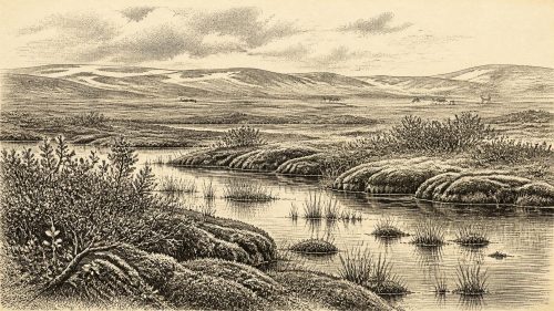
At roughly 31,137 BCE, Ireland lay within the volatile Late Pleistocene, approaching but preceding the Last Glacial Maximum. Sediments beneath glacial tills at Derryvree, County Fermanagh, preserve evidence of a cold, locally ice-free freshwater wetland, dated broadly to 36,900–31,700 calibrated years BP. Mosses, sedges, mountain avens, dwarf willow, juniper, bogbean and insects indicate open, treeless, waterlogged tundra-like terrain. Elsewhere, Castlepook Cave fauna demonstrate intermittent connections with north-west Europe, including cold-adapted mammals and predators. A possibly butchered reindeer bone suggests, but cannot prove, occasional human visits. The evidence reveals changing ice, sea levels and habitats, not dated events, societies or settlements.
Dateline
The numbered year 31,137 BCE cannot be treated as a date in the ordinary historical sense. No written record, annual sequence, named community or securely year-specific event exists for Ireland at this depth of time. Archaeologists instead work with long spans, stratigraphic relationships and calibrated ranges. In archaeological convention this point is roughly 33,086 years before AD 1950, or about 33.1 thousand calibrated years before present. It belongs to the Late Pleistocene, within the climatically volatile Marine Isotope Stage 3, before the height of the Last Glacial Maximum.
The most revealing Irish evidence for this broad interval comes not from a settlement but from sediments beneath a drumlin at Derryvree, near Maguiresbridge in County Fermanagh. Road works in 1969 exposed freshwater silts and fine sands trapped between two substantial sheets of glacial till. The sequence establishes a basic local history: ice had earlier covered the ground; afterwards, a cold freshwater environment developed long enough to accumulate mud, plant remains and insect fossils; then a later advance of glacier ice sealed the deposits below another till. It is one of the rare places where a living Irish landscape can be glimpsed between episodes of glaciation.
A Date Within a Range
Organic material from the Derryvree bed returned a conventional radiocarbon determination of 30,500 years BP, with a large uncertainty of approximately a millennium. Such measurements are not calendar dates. Radiocarbon ages must be calibrated because atmospheric carbon levels have varied over time, and the calibration curve is particularly difficult in this part of the Late Pleistocene. Published assessments place the deposit broadly within a range extending from about 36,900 to 31,700 calibrated years BP. Thus 31,137 BCE falls within the broad chronological window relevant to the deposit, but it does not identify a particular season, generation or episode at Derryvree.
This distinction matters. The organic bed is evidence for a cold, locally ice-free interval in south Fermanagh, not a weather report for every part of the island. Nor does its radiocarbon result mean that all fossils within it accumulated on the day represented by the modern calendar label. Sediments can form over centuries or longer, while pollen, seeds, mosses and insects each record particular ecological settings. The proper historical picture is therefore regional and probabilistic: around this point in time, at least part of Ireland supported open periglacial wetland rather than being continuously buried beneath moving ice.
Water Between the Tills
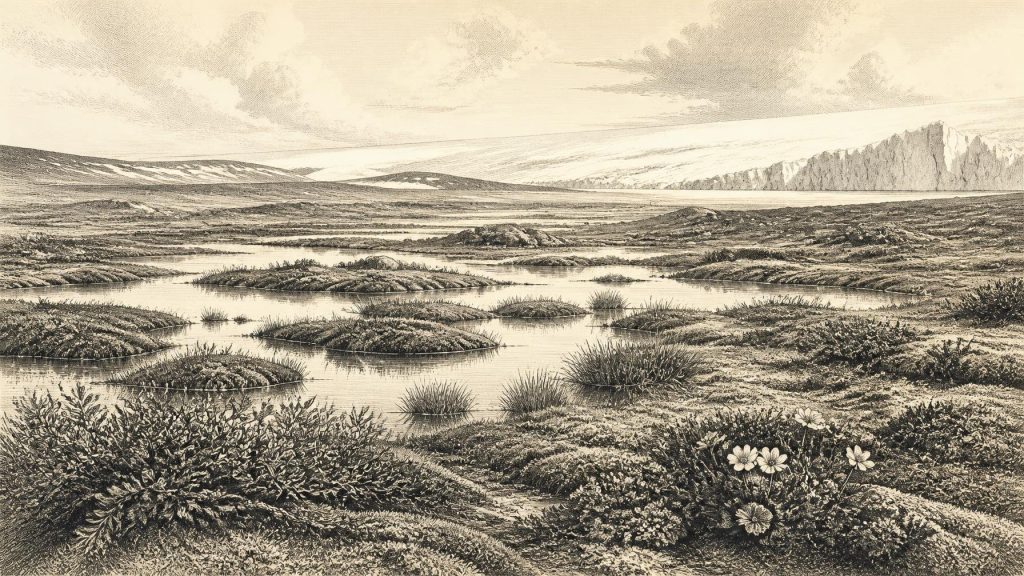
Derryvree’s plant evidence gives the clearest impression of that environment. The assemblage included mosses, sedges and herbaceous pollen, alongside remains of plants associated with cold, wet ground. Fossil records of mountain avens, dwarf willow, juniper and bogbean are especially significant. They do not reconstruct a dense forest. Instead, they point towards an open, treeless mosaic in which saturated ground, shallow pools, mossy margins and sparse dry patches lay within a generally cold landscape. The term ‘muskeg’, used by the original investigators, conveys a waterlogged tundra-like terrain rich in mosses and organic matter.
Mountain avens is now familiar from limestone uplands such as the Burren, but in the Derryvree evidence it helps to identify a much colder Pleistocene vegetation community. Bogbean, a plant of freshwater margins, is equally informative: its fossil seed shows that standing or slow-moving water and vegetated wet ground were present. Insect remains reinforce the picture of open pools and decaying plant material. These are modest traces, yet they provide firmer evidence for everyday ecological conditions than any imagined Ice Age panorama. A small wetland could sustain invertebrates, birds and grazing animals even where the wider climate imposed hard winters and a short growing season.
The landscape should not, however, be pictured as a uniform white desert. Periglacial means shaped by severe frost and seasonal thaw, not necessarily permanent ice cover. Local relief, drainage, snow cover and the proximity of ice margins would have created sharply varied habitats. Water could be available in summer; vegetation could take hold in sheltered or saturated places; exposed ridges could remain sparsely colonised. Derryvree’s freshwater deposits exist precisely because liquid water, sediment and plant matter were able to accumulate there.
An Island at the Edge of Ice
Across Ireland, the larger glacial setting was changing. The British–Irish Ice Sheet had not yet reached its later maximum configuration everywhere, but ice masses were growing and repeatedly reorganising. Modern reconstructions generally place the local maximum extent of the British–Irish Ice Sheet at about 27,000 years ago in some offshore sectors, while the global Last Glacial Maximum is conventionally dated to about 26,500–19,000 years ago. In 31,137 BCE Ireland was therefore approaching, rather than living at, the maximum cold and ice extent of the last glaciation.
This chronology is not identical in every region. Offshore landforms and marine cores show ice later reaching the Atlantic shelf edge west and north-west of Ireland; work in Donegal, Connemara and south-west Ireland demonstrates that the timing, thickness and flow of ice varied by sector. Some mountain summits may have stood above erosive warm-based ice or lain beneath thin, cold-based ice that did little to scour the rock. Such debates underline the limits of precision. What is secure is that glaciers repeatedly reshaped Ireland’s surface, eroding earlier deposits in some places and preserving exceptional archives, such as Derryvree, where later till covered them.
Sea level was substantially lower than today because so much water was locked in continental ice. Ireland’s present shoreline did not exist. Wider coastal plains and exposed shelf areas altered routes for animals and possibly people, although water channels and changing ice barriers still mattered. It is unsafe to speak of a simple, permanent land bridge from Ireland to Britain or continental Europe at this date. Connectivity was episodic and geographically complex, governed by sea level, glacier margins and the suitability of the terrain.
Animals and the Human Question
Caves in southern Ireland supply another, different class of evidence. Castlepook Cave near Doneraile, County Cork, has produced remains of woolly mammoth, reindeer, giant deer, brown bear, wolf, Arctic fox, lemmings and spotted hyaena. Improved radiocarbon methods have shown that parts of the cave fauna belong to Marine Isotope Stage 3, though individual bones and cave deposits need not be contemporary. The assemblage demonstrates that Ireland was intermittently connected to a wider north-west European world of cold-adapted and open-country animals.
These animals should not be transferred uncritically to Derryvree or to this exact year. A mammoth bone in a Cork cave is evidence of the species’ Irish presence during a broad period, not proof that mammoths were beside a Fermanagh pool in 31,137 BCE. Likewise, predator bones and hyaena coprolites reveal ecological opportunity and scavenging or denning behaviour at Castlepook, but do not yield a continuous food web for the whole island. Still, the contrast is valuable: Derryvree preserves the small-scale wetland setting, while Castlepook reveals that large mammals and carnivores could enter or inhabit parts of Ireland before the subsequent maximum glaciation.
A reindeer femur from Castlepook has attracted particular attention because a mark on it has been interpreted as damage made by a stone tool during butchery. Public reporting has presented the bone as evidence of human activity in Ireland around 33,000 years ago. It is an important possibility, but it cannot responsibly support a detailed narrative of a resident population in 31,137 BCE. The find is isolated, there is no securely associated tool-kit or habitation floor, and a claimed modification on one bone cannot reveal numbers, language, kinship, ritual or political organisation. It does, however, make it reasonable to keep open the possibility that people entered Ireland intermittently during favourable windows.
No Kingdoms, No Recorded Diplomacy
There is no evidence for political institutions, chiefs, diplomacy, warfare or territorial states in Ireland at this date. Nor can religion be recovered directly from the Derryvree wetland or the scattered cave fauna. It would be misleading to supply invented hunter groups with rituals, leaders or conflicts simply because Upper Palaeolithic communities elsewhere in Europe made art, ornaments and sophisticated stone tools. Similar age does not establish similar activity in Ireland.
If people did visit, their economy would have depended on immediate landscapes: movement through open ground, knowledge of weather and animal behaviour, and access to stone, fuel, water and shelter. That is an inference from hunter-gatherer lifeways and from the resource patterns of the wider European Palaeolithic, not direct Irish evidence. No demonstrable trade network, craft tradition, school of learning or settlement system can be assigned to Ireland around 31,137 BCE. The most defensible ‘society’ visible here is ecological: plants, insects, herbivores and predators occupying a precarious terrain near advancing ice.
A Fragile Archive
Derryvree’s importance lies partly in what later glaciation did not destroy. The two tills bracket an organic interval and turn a roadside exposure into an archive of environmental change. Its evidence tells of freshwater, tundra plants and insects in a landscape without woodland; it also proves that Ireland’s Pleistocene history was not a single uninterrupted blanket of ice. Castlepook’s bones add a broader faunal dimension, but their cave context and varying ages demand caution.
For 31,137 BCE, then, Ireland is best understood through this combination of evidence and restraint. There is no annual chronicle, no named individual and no event to commemorate. There is, instead, a mountain-avens and bogbean wetland in Fermanagh, preserved beneath later glacial deposits; an island whose shores and ice margins were changing; and rare cave fossils that show connections with the cold-steppe world beyond it. These fragments are limited, but they are enough to recover a real, dynamic Irish landscape from deep time.
Primary Sources
- A Middle Midlandian Freshwater Series at Derryvree, Maguiresbridge, County Fermanagh, Northern Ireland
- Palaeoecology
- The Subdivision of the Quaternary Period in Ireland
- A reconsideration of the radiocarbon dating of the Marine Isotope Stage 3 fauna from southern Ireland
- New insights on the fauna of Ireland’s Younger Dryas and Early Holocene from Alice & Gwendoline Cave
- Timing and pace of ice-sheet withdrawal across the marine–terrestrial transition west of Ireland during the last glaciation
- Deglaciation chronology of the Donegal Ice Centre, north-west Ireland
- Extent and deglacial chronology of the last British–Irish Ice Sheet: implications of exposure dating using cosmogenic isotopes
- Dimensions and chronology of the last ice sheet in Western Ireland
- Exploring controls of the early and stepped deglaciation on the western margin of the British Irish Ice Sheet
- Late Pleistocene chronostratigraphy and ice sheet limits, southern Ireland
- Last Glacial Maximum cirque glaciation in Ireland and implications for reconstructions of the Irish Ice Sheet
- Glacial geomorphology in the Wicklow Mountains, Ireland
- Quaternary Geology
- Freshwater organic deposits and stratified sediments between early and late Midlandian (Devensian) till sheets, at Aghnadarragh, County Antrim, Northern Ireland
- BSBI: Menyanthes trifoliata
- BSBI: Dryas octopetala
- The Irish Quaternary Fauna Project
- NMI Burial Excavation Records: Castlepook Cave, Co. Cork
- Archaeology Research Excavation Grant 2022: Final Report
- Heritage Artefacts of County Cork