Derryvree’s Bogbean Macrofossils30707 BCE
At the modern filing date 30,707 BCE, Ireland’s Late Pleistocene history is reconstructed from uncertain environmental evidence, not records of events or societies. Derryvree, County Fermanagh, preserves freshwater sediments between glacial tills, indicating a locally ice-free MIS 3 interval with tundra vegetation, wetlands and permafrost-influenced conditions. Its radiocarbon dates provide broad calibrated ranges rather than annual precision. Castlepook Cave, County Cork, contains diverse cold-stage fauna, demonstrating periodically viable open habitats and food webs, although its bones accumulated over time. A possibly cut-marked reindeer femur offers disputed evidence of human activity, not settlement. Later ice expansion destroyed or buried early evidence.
Dateline
The label 30,707 BCE is a modern filing point, not a date that anyone in Ice Age Ireland could have named or recorded. It corresponds roughly to 32,656 years before AD 1950, but that arithmetic conversion must not be mistaken for archaeological precision. Around this point in the Late Pleistocene, during Marine Isotope Stage 3 (MIS 3), Irish evidence comes in broad calibrated ranges, not calendar years. The most relevant environmental sequence, at Derryvree near Maguiresbridge in County Fermanagh, is generally placed within about 36,900–31,700 calibrated years before present. That range encompasses the nominal date, but cannot identify what occurred in any particular season, year or generation.
Accordingly, this was not a year of kings, treaties, battles or recorded migrations. There are no written sources, built settlements, human burials, securely dated hearths or known tool assemblages from Ireland that allow such a history. What can responsibly be described is a changing northern landscape: a place repeatedly affected by ice, with short-lived ice-free environments, sparse cold-adapted vegetation and animal communities whose remains survived in unusual geological archives. The strongest story is environmental, and its importance lies partly in what later glaciation buried, eroded or destroyed.
A Freshwater Bed Between Tills
Derryvree is crucial because of its position in the ground. Road works in 1969 exposed fine sands, silts and organic material within a drumlin, a streamlined hill shaped by moving ice. The freshwater deposits lay between two tills: unsorted, compact sediments left by separate glacial advances. The sequence demonstrates a basic order of events. Ice had occupied the locality; an interval without local ice then allowed water, plants and sediments to accumulate; later ice advanced across the district and sealed the deposit beneath further glacial material. This stratigraphic relationship is firmer than any attempt to attach a single precise date to the whole layer.
Organic material from the deposit produced the radiocarbon determination known as BIRM-166, conventionally reported as 30,500 ± 1,100 radiocarbon years before present. Radiocarbon years are not the same as calendar years, especially this far back. Calibration against changing atmospheric carbon levels gives a much wider calendar-age estimate, and regional ice-sheet reconstructions add their own uncertainties. Derryvree therefore does not furnish a weather report for 30,707 BCE. It does, however, show that part of what is now Fermanagh had a freshwater, periglacial landscape during a late MIS 3 interval broadly relevant to this date.
Cold Water, Open Ground
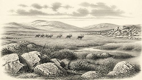
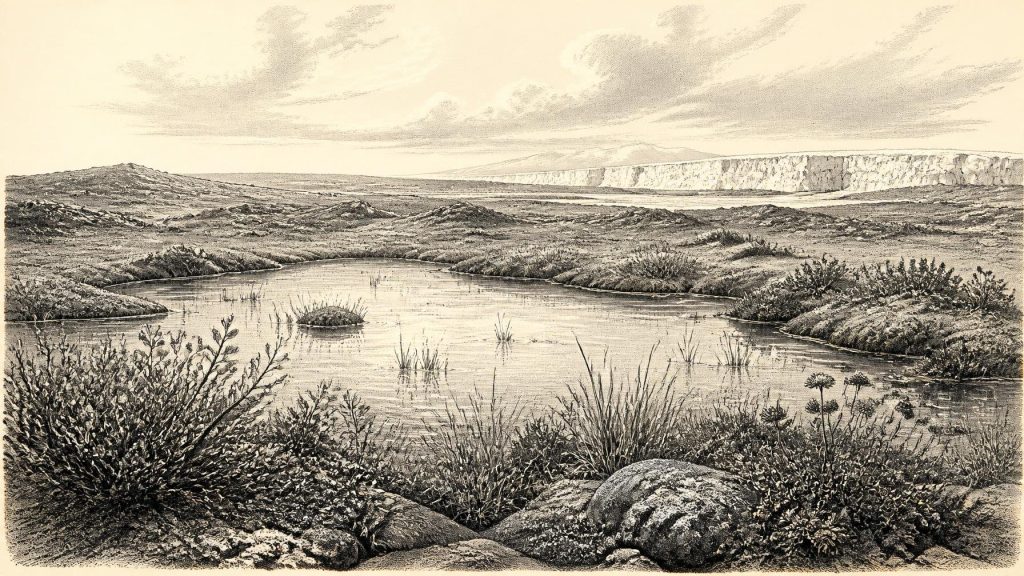
The organic bed preserves pollen, mosses and plant macrofossils, alongside small animal remains. Their combination points to open tundra or tundra-like vegetation rather than woodland. Sedges and mosses grew around shallow water; bogbean, an aquatic or wetland plant, and alternate water-milfoil indicate freshwater conditions. Dwarf willow, mountain avens and other plants associated with cold, exposed settings signal a landscape of low vegetation, seasonal stress and limited shelter. These are not merely picturesque species lists. They demonstrate that enough unfrozen ground, light and summer warmth existed for plants to flower, set seed and contribute material to a pond or marsh.
Yet Derryvree was not an oasis of benign climate. The same assemblage points to permafrost-influenced terrain and a short growing season. The landscape may have alternated between snow cover, frozen ground, meltwater and shallow open water. Wind would have mattered. In a largely treeless environment it could strip snow from ridges, redistribute fine sediment and make exposure more severe. The result was a mosaic: wet hollows with mosses and aquatic plants, sedgy margins, gravelly or frost-disturbed ground, and expanses in which vegetation was low and discontinuous. The modern drumlin country conceals this older scene under later deposits and soils.
Climate change on the scale of centuries or even decades was a defining condition of MIS 3 across the North Atlantic region. Greenland ice-core records and marine sequences reveal abrupt oscillations between relatively milder interstadials and colder stadials. Ireland lay at the Atlantic edge of north-west Europe, where temperature, snowfall, sea ice and the behaviour of nearby ice masses could change together. The Derryvree evidence belongs to that unstable world. It is safest to describe local ice-free conditions during the dated interval, not to claim that all Ireland was simultaneously ice-free, or that the island’s climate was uniform.
Cork’s Cave Fauna
In southern Ireland, Castlepook Cave near Doneraile, County Cork, supplies a different kind of evidence. Excavations there from the late nineteenth and early twentieth centuries recovered more than 2,000 bones from a complex limestone cave system. Its Ice Age fauna includes woolly mammoth, reindeer, giant deer, brown bear, wolf, Arctic fox, mountain hare, lemmings and spotted hyaena. The National Museum of Ireland preserves significant material, including a spotted-hyaena skull. Geological Survey Ireland describes Castlepook as Ireland’s richest vertebrate-fossil site for the period leading towards the Last Glacial Maximum.
Those animals should not all be imagined standing together outside the cave in 30,707 BCE. A cave collection can accumulate over a long time and through several processes: animals may die naturally, predators may drag prey inside, water can move bones, and excavation can disturb or mix layers. Direct dating has shown that Castlepook contains material of differing ages. Improved radiocarbon pretreatment has also revised older results, placing some mammals securely in MIS 3 and suggesting that giant deer and spotted hyaena disappeared locally before the Last Glacial Maximum, perhaps around 40,000 calibrated years ago. The cave establishes the presence of a diverse cold-stage fauna in Ireland over a lengthy span; it does not date every species to the same moment.
Nevertheless, the fauna has major implications. Large herbivores such as mammoth, reindeer and giant deer required substantial plant resources across the wider landscape. Their predators and scavengers, including wolves and spotted hyaenas, point to functioning food webs rather than isolated animal arrivals. Ireland was not simply a sterile fringe beneath permanent ice. At intervals, accessible land supported mobile communities of mammals adapted to open country. Lower sea levels altered coastlines and narrowed or removed some sea barriers, making faunal movement from Britain and the continental shelf more feasible than it would be today. But exact routes, timings and population sizes remain unknown.
The Human Question
A reindeer femur from Castlepook has made this period especially significant and especially contentious. The bone has been reported as bearing a mark consistent with cutting by a sharp stone tool, and a modern date on the bone has been presented as about 33,000 years old. If the mark is genuinely anthropogenic and contemporary with the animal’s death, it could indicate the butchery of reindeer in Ireland during MIS 3. That would extend the possible human record on the island many millennia earlier than the better-established terminal-Pleistocene evidence from Alice and Gwendoline Cave in County Clare.
But this is a possible action, not proof of a settlement. The bone derives from an old, complex cave assemblage rather than a modernly excavated occupation floor. It does not come with a demonstrably associated hearth, stone-tool collection, dwelling, human remains, food store or repeated pattern of butchery. A date on bone collagen dates the animal, not the precise moment when a surface mark was made. Official museum guidance still states that no clear evidence has emerged for human presence in Ireland during the Palaeolithic. The responsible conclusion is therefore narrow: Castlepook presents an important, debated indication that people may have visited Ireland or processed an animal in the wider period, while a human community here at this exact date remains unproven.
No Polities, No Proven Trade
That evidential limit determines what can be said about society. There is no basis for identifying Irish political groups, leaders, alliances, warfare, diplomacy, kinship rules, religion, art, language or learning in 30,707 BCE. Nor is there evidence for farming, domesticated animals, permanent villages, trade networks or maritime exchange. Upper Palaeolithic groups elsewhere in Europe used sophisticated stone technologies, ornaments and art, but importing those cultural achievements into Ireland without Irish finds would be speculation. The most that may be inferred is that, if people did reach the island, they would have faced a demanding seasonal environment and would probably have depended on mobility, close knowledge of animal movements and portable resources. That is a general inference from hunter-gatherer lifeways, not an established fact about a particular Irish group.
There was likewise no ‘Ireland’ in the political or cultural sense of later history. There was an island-shaped landmass whose shoreline, climate and connections to neighbouring lands differed markedly from those of the present. The Irish Sea basin and surrounding shelves were transformed by lower sea level, but the exact configuration changed through time and must not be reduced to a simple land bridge. For the animals represented at Castlepook, the decisive issue was not modern nationality but whether routes of suitable open habitat existed across the changing British-Irish landscape.
The Approach of Greater Ice
The Derryvree freshwater interval belongs before the full expansion of the last Irish Ice Sheet. By the Last Glacial Maximum, broadly between about 27,000 and 23,000 calendar years before present in many reconstructions of the Irish and British-Irish system, ice would cover much more of Ireland and its continental shelf. This later advance helps explain the extreme thinness of Ireland’s early archaeological record. Moving ice eroded bedrock, reworked sediment and removed or buried surfaces on which camps, tracks and artefacts might once have existed. Survival of the Derryvree plants and Castlepook bones was exceptional, dependent on burial in a protected basin or cave.
For this reason, the historical value of the nominal year is not an imagined episode but a window onto evidence. Derryvree preserves a brief ecological archive of wet ground and tundra vegetation between ice advances. Castlepook preserves animal bones that reveal broader Ice Age food webs and a provocative, unresolved hint of human activity. Together they show an Ireland capable, at times, of sustaining freshwater life and large mammals well before later glaciation remade the land. They also insist on humility: at 30,707 BCE, calibrated ranges, deposits and individual bones tell the story more honestly than any invented event ever could.
Primary Sources
- A Middle Midlandian Freshwater Series at Derryvree, Maguiresbridge, County Fermanagh, Northern Ireland
- Palaeoecology
- Exploring controls of the early and stepped deglaciation on the western margin of the British-Irish Ice Sheet
- A reconsideration of the radiocarbon dating of the Marine Isotope Stage 3 fauna from southern Ireland
- Castlepook Cave
- The Irish Quaternary Fauna Project
- Occurrence of mammalia relicts at site Castlepook Cave
- Spotted Hyena Skull
- Prehistoric Details
- The Archaeological Heritage of County Cork
- Archaeology Research Excavation Grant 2022
- 32564: Castlepook Cave, Castlepook South, Cork
- New insights on the fauna of Ireland's Younger Dryas and Early Holocene from Alice & Gwendoline Cave
- New insights on the fauna of Ireland's Younger Dryas and Early Holocene from Alice & Gwendoline Cave
- Reconstructing the last Irish Ice Sheet 2: a geomorphologically-driven model of ice sheet growth, retreat and dynamics
- Growth and retreat of the last British-Irish Ice Sheet, 31,000 to 15,000 years ago: the BRITICE-CHRONO reconstruction
- Spatio-temporal dynamics of speleothem growth and glaciation in the British Isles
- An ocean–ice coupled response during the last glacial: a view from a marine isotopic stage 3 record south of the Faeroe Shetland Gateway
- Quaternary
- Quaternary Site Descriptions
- Outreach and Education Resources
- Field Guides