Frosted Mosses30627 BCE
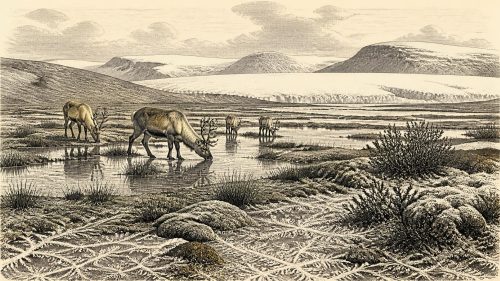
Although 30,627 BCE cannot identify a specific Irish event, Derryvree near Maguiresbridge, County Fermanagh, provides an ecological record broadly spanning this period. Freshwater organic sediments, trapped between glacial tills, preserve pollen, plants, mosses and insects from a cold, treeless periglacial wetland. Sedges, aquatic species, dwarf willow and arctic-alpine herbs indicate shallow water and open tundra-like ground. Cave remains, especially at Castlepook, demonstrate diverse Pleistocene fauna, including reindeer, mammoth and predators, though assemblages span long periods. A possibly cut-marked reindeer bone suggests human activity, but no secure settlement evidence exists. Later glaciation subsequently obscured or destroyed much contemporary landscape evidence there.
Dateline
“30,627 BCE” is a modern calendar label, not a date that can be matched to an Irish event, ruler, settlement or individual. At this depth in time there is no annual historical record for Ireland, and even scientific dating normally produces broad probability ranges rather than a single calendar year. The responsible subject is therefore Ireland around this point: a Late Pleistocene, or Upper Palaeolithic-era, landscape within the last Ice Age, known principally through sediments, fossil plants, animal remains and glacial deposits.
The closest unusually informative Irish evidence comes from Derryvree, near Maguiresbridge in County Fermanagh. Its organic freshwater sediments were radiocarbon dated to 30,500 +1,170/−1,030 radiocarbon years before present. Calibration turns such a measurement into a broad calendar interval, not a precise anniversary: published discussions place the horizon approximately within 36,900–31,700 calibrated years before present, or roughly 34,950–29,750 BCE. The nominal year used here falls within that wide span. It cannot establish what occurred in Ireland in one particular season, let alone on one day.
A Wetland Sealed by Ice
Derryvree is significant because roadworks in 1969 exposed freshwater silts and fine sands between two tills. Till is the unsorted mixture of clay, stones and debris laid down by glacier ice. The sequence therefore records three large-scale changes: ice had earlier affected the locality; a period followed in which standing or slow-moving fresh water and organic sediment could accumulate; and later ice advanced again, burying the wetland beneath a further cover of till. The deposits are not a village floor or a camp, but they preserve something rarer for this period: a local ecological archive from a landscape later profoundly altered by ice.
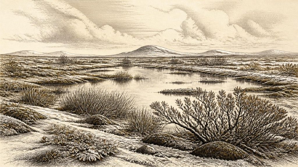
The organic layer contained poorly preserved pollen, plant macrofossils, mosses and insect evidence. These remains support the interpretation of a cold, treeless, periglacial environment. Periglacial does not simply mean ‘under a glacier’. It describes ground shaped by intense freezing and thawing at or beyond the margin of permanent ice: frost-sorted soils, seasonal meltwater, sparse vegetation and short growing seasons. Derryvree shows that an Ice-Age Ireland was not uniformly sealed beneath an ice sheet at all times. At least in this Fermanagh locality, a biologically active freshwater hollow existed during the formation of the organic bed.
Low Plants, Shallow Water
The evidence points to a tundra or muskeg-like mosaic rather than forest. Mosses and sedges were important parts of the wet ground. Finds reported from the Derryvree flora include cold-adapted or open-ground plants such as mountain avens (Dryas octopetala), dwarf willow, lesser clubmoss and sandwort, alongside wetland plants including bogbean (Menyanthes trifoliata) and water-milfoil. Their combined significance is more useful than any one species in isolation. Aquatic plants indicate freshwater; sedges and mosses suggest saturated margins; low shrubs and arctic-alpine herbs indicate exposed, treeless ground nearby.
This was not necessarily a featureless snowfield. In a short summer, shallow pools, sedge fringes and damp mossy ground could be productive pockets within a harsher wider terrain. Equally, the fossils do not justify a picturesque reconstruction of every Fermanagh hillside. They represent the conditions in and around one depositional basin over an extended period. Wind exposure, snow cover, groundwater, slope and distance from ice would have created local variation. The best reconstruction is of a cold, open and seasonally changeable landscape, not a single uniform biome across the whole island.
There is no evidence here for cultivated fields, domesticated animals, permanent houses, roads or managed woodland. Agriculture lay tens of millennia in the future. Nor can the Derryvree flora tell us what language anyone may have spoken, what beliefs they held, or whether people were present at the pool. Its value lies in setting the environmental limits within which animal movement—and any human movement—would have occurred.
Animals in a Changing Faunal World
Irish cave deposits show that the island supported a much richer Late Pleistocene fauna than its later historic fauna might suggest. Castlepook Cave near Doneraile, County Cork, is particularly important. Reassessment and radiocarbon dating of its old collections identified remains attributed to mammoth, reindeer, giant deer, spotted hyaena, brown bear, wolf, Arctic fox, mountain hare and lemmings, although the specimens do not all date to one moment and must not be treated as a single living herd.
Some Castlepook dates are pre-Last Glacial Maximum and broadly relevant to this remote era. They show that open, cold environments in southern Ireland could support large herbivores and their predators. Reindeer are especially consistent with open northern landscapes; mammoth and hyaena make clear that Ireland’s Pleistocene animal world was unlike that of later millennia. Yet cave assemblages also demand caution. Many were excavated in the late nineteenth and early twentieth centuries, before modern recovery methods. Bones could have been brought into caves by carnivores, moved by water, disturbed by later activity or accumulated over thousands of years. A cave fauna is powerful evidence for regional ecological possibilities, but not a census of one year.
The Human Question
The most striking, but still limited, possible indication of people near this broad horizon is a reindeer femur from Castlepook. Ruth Carden has interpreted a deep mark on it as damage made by a sharp stone tool during butchery. County Cork’s heritage publication presents the specimen as a Palaeolithic object of about 31,000 BCE, held in the National Museum of Ireland – Natural History collections. If the incision is confirmed as a human-made cut mark and belongs to the same broad age as the bone, it would indicate that one or more Upper Palaeolithic people handled a reindeer in Ireland far earlier than the island’s securely documented post-glacial settlement record.
That conclusion must remain narrow. The find is a single marked bone from an old cave collection, not a sealed occupation surface. No securely associated stone-tool assemblage, hearth, built shelter, human burial, artwork or food-processing area of this age has been recovered in Ireland. Nor can the bone show whether hunters killed the animal, butchered it elsewhere, entered the cave themselves, or whether scavengers later carried part of the carcass inside. A date on bone establishes when the animal died within a range; it does not date the act of cutting to a particular calendar year.
Accordingly, there is no responsible basis for describing an Irish polity, diplomacy, warfare, tribal territory, religious institution, trade network or settled community in 30,627 BCE. There are no named leaders and no evidence for political borders. If people did visit, the environmental and faunal context makes highly mobile hunting and scavenging groups a plausible interpretation, but it remains an interpretation drawn from the wider European Upper Palaeolithic, not a demonstrated Irish social system. No direct evidence proves continuity between any such visitors and Ireland’s much later hunter-gatherer populations.
Before the Major Ice Advance
In broader geological terms, this was a time of unstable climatic conditions before or during the growth towards the Last Glacial Maximum, when the British–Irish Ice Sheet later reached far greater extent. Modern reconstructions emphasise that the ice sheet expanded and retreated dynamically across different sectors rather than advancing as one simple, simultaneous wall. The upper till at Derryvree is material evidence that renewed glaciation subsequently overwhelmed or passed across the locality, helping to preserve the older wetland layer while also destroying or concealing much of the contemporary land surface.
That later ice action helps explain why Ireland’s record is so fragmentary. Potential camps on exposed ground may have been eroded, buried, reworked or remain undiscovered beneath later deposits. Absence of excavated settlements is not proof that no person ever arrived; neither is it permission to imagine a populated Ice-Age Ireland. Around this nominal year, Derryvree’s mosses, sedges and freshwater plants provide the clearest securely grounded story: an open, cold wetland landscape existed in Fermanagh, while Ireland’s animal communities and possible human visitors remain visible only in scattered, carefully qualified traces.
Source References
Hover over a number to see the source. Select it to open the source.

- [1] A Middle Midlandian Freshwater Series at Derryvree, Maguiresbridge, County Fermanagh, Northern Ireland
- [2] Palaeoecology
- [3] Figure 6.— The Subdivision of the Quaternary Period in Ireland
- [4] The Irish Quaternary Fauna Project
- [5] The Irish Quaternary Fauna Project
- [6] First Evidence of a Late Upper Palaeolithic Human Presence in Ireland
- [7] First Evidence of a Late Upper Palaeolithic Human Presence in Ireland
- [8] New Insights on the Fauna of Ireland’s Younger Dryas and Early Holocene from Alice & Gwendoline Cave
- [9] New Insights on the Fauna of Ireland’s Younger Dryas and Early Holocene
- [10] Heritage Artefacts of County Cork
- [11] The IntCal20 Northern Hemisphere Radiocarbon Age Calibration Curve (0–55 cal kBP)
- [12] IntCal History
- [13] Growth and Retreat of the Last British–Irish Ice Sheet, 31,000 to 15,000 Years Ago: the BRITICE-CHRONO Reconstruction
- [14] BRITICE Glacial Map, Version 2: A Map and GIS Database of Glacial Landforms of the Last British–Irish Ice Sheet
- [15] Extent and Timing of the Last Glacial Maximum (LGM) in Britain and Ireland: A Review
- [16] Trimlines, Blockfields and the Vertical Extent of the Last Ice Sheet in Southern Ireland
- [17] Timing and Pace of Ice-Sheet Withdrawal Across the Marine–Terrestrial Transition West of Ireland During the Last Glaciation
- [18] Character of Advance and Retreat of the Southwest Sector of the British-Irish Ice Sheet During the Last Glaciation
- [19] Exploring Controls of the Early and Stepped Deglaciation on the Western Margin of the British-Irish Ice Sheet
- [20] Early Midlandian–Middle Midlandian, Pleistocene, Northern Ireland
- [21] The Last Eurasian Ice Sheets – A Chronological Database and Time-Slice Reconstruction, DATED-1
- [22] The Mesolithic in Ireland: When Was It?
- [23] Arenaria norvegica in Ireland
- [24] Dryas octopetala
Primary Sources
- A Middle Midlandian Freshwater Series at Derryvree, Maguiresbridge, County Fermanagh, Northern Ireland
- Palaeoecology
- Figure 6.— The Subdivision of the Quaternary Period in Ireland
- The Irish Quaternary Fauna Project
- The Irish Quaternary Fauna Project
- First Evidence of a Late Upper Palaeolithic Human Presence in Ireland
- First Evidence of a Late Upper Palaeolithic Human Presence in Ireland
- New Insights on the Fauna of Ireland’s Younger Dryas and Early Holocene from Alice & Gwendoline Cave
- New Insights on the Fauna of Ireland’s Younger Dryas and Early Holocene
- Heritage Artefacts of County Cork
- The IntCal20 Northern Hemisphere Radiocarbon Age Calibration Curve (0–55 cal kBP)
- IntCal History
- Growth and Retreat of the Last British–Irish Ice Sheet, 31,000 to 15,000 Years Ago: the BRITICE-CHRONO Reconstruction
- BRITICE Glacial Map, Version 2: A Map and GIS Database of Glacial Landforms of the Last British–Irish Ice Sheet
- Extent and Timing of the Last Glacial Maximum (LGM) in Britain and Ireland: A Review
- Trimlines, Blockfields and the Vertical Extent of the Last Ice Sheet in Southern Ireland
- Timing and Pace of Ice-Sheet Withdrawal Across the Marine–Terrestrial Transition West of Ireland During the Last Glaciation
- Character of Advance and Retreat of the Southwest Sector of the British-Irish Ice Sheet During the Last Glaciation
- Exploring Controls of the Early and Stepped Deglaciation on the Western Margin of the British-Irish Ice Sheet
- Early Midlandian–Middle Midlandian, Pleistocene, Northern Ireland
- The Last Eurasian Ice Sheets – A Chronological Database and Time-Slice Reconstruction, DATED-1
- The Mesolithic in Ireland: When Was It?
- Arenaria norvegica in Ireland
- Dryas octopetala