Castlepook Mammal30398 BCE
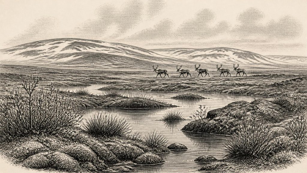
Around 30,398 BCE, Ireland lay within Marine Isotope Stage 3, during later Midlandian glaciation. Derryvree, County Fermanagh, preserves freshwater silts between glacial tills, recording a temporary ice-free tundra wetland of pools, mosses, sedges, dwarf shrubs and cold-adapted plants. Radiocarbon evidence provides broad chronological ranges, not an exact calendar year. Castlepook Cave, County Cork, contains reindeer, mammoth, giant deer, bear, wolf, hyaena and lemming remains, indicating open, severe landscapes and complex food webs. A possibly cut-marked reindeer bone may suggest brief Upper Palaeolithic human activity, but lacks supporting settlement evidence. Ice, changing sea levels and advancing glaciers continually reshaped environmental possibilities.
Dateline
30,398 BCE is a modern chronological label, not a date that can be recovered at calendar-year precision from the Irish Ice Age record. No written calendar, annual sediment sequence or securely dated human event permits a history of one particular year. The responsible history of Ireland at this point is therefore a history of broad climatic phases, deposits and fossils. The nominal year falls within Marine Isotope Stage 3, during the later Midlandian glaciation, before the Last Glacial Maximum. The most useful Irish evidence comes from a freshwater deposit at Derryvree, near Maguiresbridge in County Fermanagh, and from animal remains in Castlepook Cave near Doneraile, County Cork. Together they show a difficult, changing land of open tundra, shallow water, mobile animals and encroaching ice—not an Ireland for which kingdoms, peoples or events can be named.
Dating a Deep Past
The distinction between radiocarbon and calendar time is crucial. In 1969 roadworks cut through a drumlin at Derryvree and exposed fine sands and organic freshwater silts between two separate layers of till, the unsorted sediment laid down by glacier ice. Organic material from the middle deposit yielded the conventional radiocarbon determination BIRM-166: 30,500 years BP, with a substantial uncertainty of +1,170/−1,030 years. In radiocarbon terminology, “present” means AD 1950. A radiocarbon age is not directly interchangeable with a BCE year, because the concentration of atmospheric carbon-14 has varied over time.
Modern calibration, especially IntCal20, confirms that an age of this antiquity must be represented by broad probability ranges rather than a precise date. The Derryvree measurement is best understood as evidence for a lengthy interval in the later part of Marine Isotope Stage 3, broadly spanning the mid-to-late 30,000s calendar years BP in published discussion, rather than as proof that the wetland existed in 30,398 BCE itself. The sequence supplies a secure order of events: ice deposited the lower till; a freshwater and tundra environment developed; later ice or ice-related deposition sealed that landscape below the upper till. That relative sequence is firmer than any attempt to convert it into an anniversary.
A Wetland Between Ice Advances
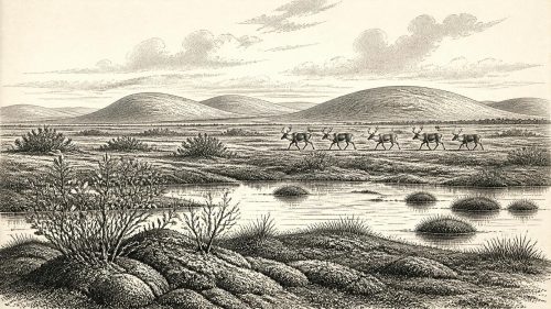
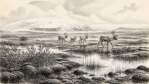
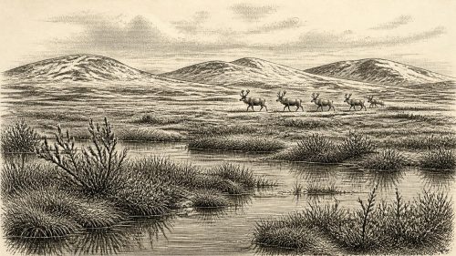
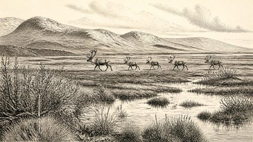
Derryvree is exceptionally important because it preserves life between glacial episodes. The organic-rich silts contained plant and animal remains of a full-glacial, periglacial environment. The original investigators described open tundra vegetation, while later syntheses have characterised the setting as treeless muskeg: wet, mossy ground with pools and sluggish freshwater rather than a forested countryside. Macrofossils include bogbean (Menyanthes trifoliata) and mountain avens (Dryas octopetala), species well suited to cold conditions. Other evidence indicates mosses, sedges, dwarf willow, juniper and aquatic plants, alongside small invertebrates able to survive a short growing season.
This was not a uniform white wilderness. In the immediate vicinity of the deposit there must have been open or slow-moving water, saturated margins and patches of vegetation capable of producing and preserving organic material. Seasonal thaw supplied water and sediment; frozen ground and harsh winters constrained roots, drainage and soil formation. The evidence supports a mosaic of shallow pools, sedge- and moss-rich wet ground, exposed mineral surfaces and low tundra vegetation. It does not support woodland, farmland, permanent villages or a stable landscape comparable with modern Fermanagh.
The drumlin that later enclosed the deposit should not be imagined as it appears today. Its familiar streamlined form is a product of glacial processes, while the surrounding surface has been repeatedly remodelled by ice, meltwater, frost and later soils. Derryvree’s value lies precisely in the accident of preservation: later glacial sediment buried a small episode of living landscape. Without that burial, much of its plant and insect evidence would have been eroded or decayed.
Ice, Sea and Regional Change
Ireland’s geography was unstable at this scale of time. The British–Irish Ice Sheet was building towards its maximum extent, conventionally placed later, around 27,000–23,000 calibrated years BP for extensive shelf-edge ice around Ireland. Reconstructions differ in details of timing, thickness and flow, and the island was not necessarily covered uniformly at every earlier moment. Derryvree demonstrates that northern inland Ireland had at least one locally ice-free freshwater interval before a later advance. It cannot, by itself, map conditions across every coast, upland or valley.
Sea level was far lower than today because much water was stored in continental ice sheets. That altered the outlines of the Irish Sea basin and exposed parts of the continental shelf, but it does not justify a simple picture of a dependable dry land bridge from Ireland to Britain or continental Europe. Ice margins, tidal channels, proglacial lakes and rapidly changing coasts mattered as much as reduced sea level. Any movement of animals or people would have depended on local conditions and routes that remain poorly known. The strongest conclusion is regional connection and environmental change, not an assured overland highway.
Castlepook’s Animal World
At Castlepook Cave, also known as Mammoth Cave, near Doneraile in north County Cork, excavations and museum collections have yielded an unusually rich Pleistocene faunal assemblage. Reindeer are especially numerous; other finds include woolly mammoth, giant deer, brown bear, wolf, spotted hyaena and Arctic lemming. The dates from the cave do not represent one single occupation horizon: bones accumulated through different episodes, and carnivores appear to have carried carcass parts into the cave. The assemblage nevertheless establishes that cold-adapted and open-country animals inhabited, or at least moved through, parts of Ireland during this broader climatic era.
Reindeer are particularly evocative of the landscape. Their presence is compatible with open, largely treeless country capable of supporting grazing animals, while hyaena and wolf point to a predator-rich food web. Mammoth and giant deer remains widen the picture but must not be compressed into a single imagined herd or season. A cave bone collection is a filtered record: it tells us what was deposited, preserved and recovered, not a complete census of all animals living nearby. Yet Castlepook and Derryvree complement one another. The Fermanagh deposit records cold wetland vegetation; the Cork cave records larger animals moving through a severe, open environment.
The Human Question
A reindeer femur from Castlepook has made this period historically significant and archaeologically contentious. Ruth Carden has interpreted a deep linear mark on the bone as a cut made with a sharp stone tool during butchery. County Cork heritage material places the object broadly at about 31,000 BCE. If that interpretation is accepted, it indicates that Upper Palaeolithic people reached Ireland at least briefly, vastly earlier than the formerly accepted evidence for post-glacial settlement. It would document an act of carcass processing, not a named community or permanent colonisation.
Caution is essential. No associated stone-tool assemblage, hearth, dwelling, human bone or securely excavated camp of this age has been identified in Ireland. Castlepook’s deposits were investigated long ago and contain material affected by carnivore activity and complex cave processes. The marked femur is therefore an important clue, not a licence to populate the island with a known hunting society. Comparisons with Upper Palaeolithic groups elsewhere in north-west Europe can suggest what a hypothetical visitor might have needed—fire, warm clothing, stone tools, knowledge of animal movement and social networks—but none of those practices is directly demonstrated in Ireland at this date.
What Cannot Be Written
There are no political affairs, rulers, borders, diplomatic relations, battles, religious institutions, artistic traditions, schools or trade networks that can responsibly be assigned to Ireland in 30,398 BCE. There is likewise no basis for naming tribes, languages, kinship systems or beliefs. Even if the Castlepook mark records human butchery, it does not reveal how many people were present, whether they returned, where they came from or what they thought of the landscape. Silence in the record is not proof that no social life existed; it is a limit on what the surviving evidence can identify.
The economic reality that can be supported is ecological rather than commercial. Plants fixed a small seasonal supply of biomass; herbivores converted it into mobile food; predators and scavengers redistributed carcasses; frost, water and ice shaped where life could persist. For any humans who may have entered this landscape, hunting and scavenging are plausible interpretations, but no Irish evidence yet demonstrates an organised economy, exchange system or settled pattern of life.
The history of Ireland around this nominal year is thus not an annal of people but an environmental threshold. Derryvree records a cold freshwater tundra temporarily established between ice advances. Castlepook preserves a scattered animal archive, and perhaps a humanly modified reindeer bone. These traces show that Ice-Age Ireland was neither timeless nor simply empty: it was a changing north-western landscape in which wetlands, herds, predators and ice margins repeatedly altered the possibilities for life.
Source References
Hover over a number to see the source. Select it to open the source.

- [1] Middle Midlandian Freshwater Series at Derryvree, Maguiresbridge, County Fermanagh, Northern Ireland
- [2] Middle Midlandian Freshwater Series at Derryvree, Maguiresbridge, County Fermanagh, Northern Ireland
- [3] The IntCal20 Northern Hemisphere Radiocarbon Age Calibration Curve (0–55 cal kBP)
- [4] The IntCal20 Northern Hemisphere Radiocarbon Age Calibration Curve (0-55 cal kBP)
- [5] IntCal Data
- [6] OxCal
- [7] Figure 6.— The Subdivision of the Quaternary Period in Ireland
- [8] Menyanthes trifoliata
- [9] Dryas octopetala
- [10] The Irish Quaternary Fauna Project
- [11] Heritage Artefacts of County Cork
- [12] On the Cave of Castlepook, Near Doneraile, Co. Cork
- [13] Exploring the British–Irish Ice Sheet: New Geochronological Constraints on the Last Glacial Cycle in Ireland
- [14] Pattern and Timing of Retreat of the Last British-Irish Ice Sheet
- [15] Ireland: Submerged Prehistoric Sites and Landscapes
- [16] Late Pleistocene Chronostratigraphy and Ice Sheet Limits, Southern Ireland
- [17] Reconstructing the Last Irish Ice Sheet 2: A Geomorphologically-Driven Model of Ice Sheet Growth, Retreat and Dynamics
- [18] Early Deglaciation of the British-Irish Ice Sheet on the Atlantic Shelf Northwest of Ireland Driven by Glacioisostatic Depression and High Relative Sea Level
- [19] Late Quaternary Changes in Climate
- [20] The Colonization of Ireland: A Human Ecology Perspective
- [21] Anthropogenic Changes to the Holocene Nitrogen Cycle in Ireland
- [22] Conserving Quaternary Geoheritage in Northern Ireland
- [23] A Critical Review and Re-Investigation of the Pleistocene Deposits of Northern Ireland
- [24] An Island World? Hunter-Gatherers in Ireland
Primary Sources
- Middle Midlandian Freshwater Series at Derryvree, Maguiresbridge, County Fermanagh, Northern Ireland
- Middle Midlandian Freshwater Series at Derryvree, Maguiresbridge, County Fermanagh, Northern Ireland
- The IntCal20 Northern Hemisphere Radiocarbon Age Calibration Curve (0–55 cal kBP)
- The IntCal20 Northern Hemisphere Radiocarbon Age Calibration Curve (0-55 cal kBP)
- IntCal Data
- OxCal
- Figure 6.— The Subdivision of the Quaternary Period in Ireland
- Menyanthes trifoliata
- Dryas octopetala
- The Irish Quaternary Fauna Project
- Heritage Artefacts of County Cork
- On the Cave of Castlepook, Near Doneraile, Co. Cork
- Exploring the British–Irish Ice Sheet: New Geochronological Constraints on the Last Glacial Cycle in Ireland
- Pattern and Timing of Retreat of the Last British-Irish Ice Sheet
- Ireland: Submerged Prehistoric Sites and Landscapes
- Late Pleistocene Chronostratigraphy and Ice Sheet Limits, Southern Ireland
- Reconstructing the Last Irish Ice Sheet 2: A Geomorphologically-Driven Model of Ice Sheet Growth, Retreat and Dynamics
- Early Deglaciation of the British-Irish Ice Sheet on the Atlantic Shelf Northwest of Ireland Driven by Glacioisostatic Depression and High Relative Sea Level
- Late Quaternary Changes in Climate
- The Colonization of Ireland: A Human Ecology Perspective
- Anthropogenic Changes to the Holocene Nitrogen Cycle in Ireland
- Conserving Quaternary Geoheritage in Northern Ireland
- A Critical Review and Re-Investigation of the Pleistocene Deposits of Northern Ireland
- An Island World? Hunter-Gatherers in Ireland