

Crag Cave’s Thaw Signals31408 BCE
31,408 BCE is a modern nominal date, not a recoverable Irish year. During climatically unstable Marine Isotope Stage 3, Ireland contained varying ice, tundra wetlands and occasional milder conditions. Derryvree, County Fermanagh, preserves freshwater sediments indicating treeless, seasonal, periglacial habitat with plants, insects and pools before later glaciation. Crag Cave calcite shows intermittent above-freezing water circulation in south-west Ireland. Castlepook Cave’s fauna includes reindeer, mammoth, giant deer, carnivores and hyena, although deposits span millennia. A possibly stone-cut reindeer bone may indicate human butchery, but cannot prove occupation. No securely dated settlements, tools, institutions or practices are known; evidence remains fragmentary.
Dateline
31,408 BCE is a useful modern label, but it cannot describe a recoverable “year” in Irish prehistory. There was no calendar in Ireland, no written record, and no archaeological sequence precise enough to identify events within twelve months. In conventional years before present, this nominal date falls about 33,358 years before AD 1950, within Marine Isotope Stage 3, a long and climatically unstable part of the last glacial cycle. The responsible history of Ireland at this point is therefore not a chronicle of rulers or battles, but a reconstruction from sediments, fossil bones, cave minerals and the changing margins of ice.
A Date Within Broad Ranges
The closest well-dated Irish environmental evidence comes from Derryvree near Maguiresbridge, County Fermanagh. Organic silts and fine sands were exposed there during road works in 1969, trapped between two separate sheets of glacial till within a drumlin. A conventional radiocarbon measurement, Birm-166, returned an age of 30,500 radiocarbon years before present, with substantial uncertainty. Later calibration places the deposit broadly between about 36,900 and 31,700 calibrated years before present, or approximately 34,950–29,750 BCE. That range includes 31,408 BCE, but it does not prove that the Derryvree sediments accumulated in that exact year.
This distinction matters. Radiocarbon dating measures the decay of carbon isotopes in once-living material; converting its result into calendar years depends on calibration curves and probability ranges. A buried deposit can also represent years, decades or longer periods of accumulation. Derryvree is consequently a rare local window onto conditions around the requested date, not an annual report from all Ireland. Its importance lies precisely in showing that, amid the wider cold stage, part of northern Ireland supported freshwater and terrestrial life before later ice overran the area.
An Uneven Ice-Age Ireland
Ireland was not a single, fixed landscape. During the last glacial cycle, ice advanced and retreated repeatedly, while climate could alter markedly over centuries or millennia. Around the later part of Marine Isotope Stage 3, conditions were deteriorating towards the major expansion of the British–Irish Ice Sheet. Modern reconstructions indicate that ice was accumulating in Irish uplands by around 31,000 years ago and that the ice sheet subsequently expanded rapidly. Yet the evidence for its earliest growth is less secure than the evidence for later retreat, and it should not be projected uniformly backwards across the island.
For 31,408 BCE, the safest picture is regional variation. Some high ground and northern sectors may have nourished glaciers or expanding ice masses; elsewhere, especially in protected lowland settings, ice-free terrain and wetlands existed at least during intervals. The Derryvree sequence, lying between two tills, records one such interval. The later glaciers did more than cover ground: their erosion and deposition reworked older landscapes, removing or burying evidence. This helps explain why the archaeological record for this age is extraordinarily sparse. Absence of a camp is not proof that no person ever visited, but it is equally not evidence that settlement existed.
Derryvree’s Periglacial Wetland
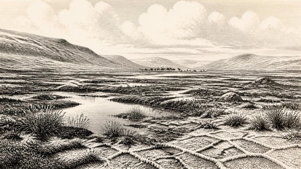
The Derryvree sediments provide the clearest evidence for everyday environment. Their pollen, plant remains and invertebrates indicate open tundra rather than woodland: a treeless, cold landscape subject to periglacial processes, where repeated freezing and thawing affected the ground. Researchers described a muskeg-like setting of shallow pools, wet organic ground and abundant plant matter, edged by mosses. Sedges and cold-adapted plants occurred alongside aquatic species, including bogbean. Such evidence shows that this was not a lifeless white wilderness. Water, vegetation, insects and small-scale habitats persisted, even though winters were severe and the growing season short.
It would be wrong, however, to turn this into a familiar modern bog. The word “muskeg” is a useful ecological comparison, not an exact reconstruction of a present-day Irish place. Nor can a single exposure establish the weather across the island. What it does demonstrate is an open, wet and strongly seasonal landscape in Fermanagh, with enough summer productivity to sustain a food web. The setting would have been vulnerable to abrupt climatic shifts: a relatively milder interval could permit liquid water and plant growth, while renewed cold could freeze soils, reduce vegetation and aid the advance of ice.
Signals From Limestone Caves
Evidence from Crag Cave in County Kerry reinforces the wider picture of instability. Uranium-thorium dates from calcite formations show that speleothems grew episodically through the last glacial period, including Marine Isotope Stage 3. In a shallow cave system, calcite growth requires water to circulate and is most plausible when mean annual temperatures are above freezing. These mineral layers do not date a particular day in 31,408 BCE, nor do they describe an open-air settlement. They do show that south-west Ireland experienced intermittent climatic amelioration rather than unbroken deep freeze.
That contrast between cave calcite in Kerry and organic freshwater deposits in Fermanagh is valuable. Both are independent environmental archives, yet each has limits. A cave’s drips reflect local hydrology as well as temperature; a wetland reflects one basin rather than the whole island. Together they support an interpretation of Ireland as a climatically dynamic western edge of north-west Europe, where habitable patches could appear and contract as conditions changed.
Reindeer, Hyenas and a Fragmentary Fauna
Castlepook Cave, also called Mammoth Cave, near Doneraile in north County Cork, supplies the principal Irish mammal archive for this broad period. Its collections include remains of reindeer, woolly mammoth, giant deer, brown bear, wolf, Arctic fox and spotted hyena. The National Museum of Ireland identifies Castlepook as Ireland’s most important site for mammals of the last cold stage. New radiocarbon work has shown that several older cave dates needed revision, with some fauna substantially older than once thought; the assemblage belongs to a span of time, not one simultaneous animal community.
The animals nevertheless make ecological sense in an open cold-country mosaic. Reindeer could exploit tundra vegetation, while large carnivores and scavengers made use of carcasses. A spotted-hyena skull from Castlepook is tangible evidence that a predator now confined to Africa once ranged in Ireland. Mammoth and giant deer remains indicate that very large herbivores also entered this world at some point in the last cold stage. But no responsible reconstruction should place every species together beside a single pool in 31,408 BCE. Cave deposits accumulated through natural death, carnivore activity, water movement and early excavation, and their dates cover thousands of years.
The Human Question at Castlepook
The most provocative evidence relevant to this date is a reindeer femur from Castlepook bearing a deep mark interpreted by palaeozoologist Ruth Carden as damage from a stone tool during butchery. County Cork’s heritage publication presents the bone as dating to around 30,000 BCE; public reporting has described it as roughly 33,000 years old. If the mark is confirmed as a fresh-bone cut made by people and associated with the animal’s death, it would point to an Upper Palaeolithic human visit to Ireland tens of millennia before the island’s previously accepted late-glacial evidence.
That conditional language is essential. Castlepook was excavated in the early twentieth century, before modern standards of stratigraphic recording, and its deposits have a complicated history. There is no securely associated stone-tool assemblage, hearth, floor, shelter, human burial or human bone demonstrating a settled community in Ireland around this date. The National Museum of Ireland continues to state that no clear evidence for human presence in Palaeolithic Ireland has yet emerged. The reindeer femur is therefore best treated as an important but unresolved indication of possible carcass processing, not proof of permanent occupation.
No Polities, No Recorded Society
There can be no history of Irish political affairs, diplomacy or named conflict for 31,408 BCE. No people, language, clan, territory or institution is known from Ireland at this time. Even if hunter-gatherers briefly reached the island, a cut-marked bone could reveal only one practical act: the processing of an animal. It cannot establish their number, sex, ancestry, route of travel, social structure or length of stay. Nor can it demonstrate trading relationships. Stone tools may have been carried by mobile hunters elsewhere in Upper Palaeolithic Europe, but no comparable Irish tool kit has been securely tied to this horizon.
Religion, art and learning are equally beyond the evidence. Upper Palaeolithic communities elsewhere in Europe created art, ornaments and sophisticated lithic technologies, but continental comparison is context, not evidence for equivalent practices in Ireland. There are no Irish ritual sites, monuments, images, graves or teaching places securely dated to the thirty-second millennium BCE. Agriculture, livestock keeping, pottery and permanent villages all belong to much later chapters of Irish prehistory. The economy visible here is ecological rather than commercial: plants, water, herbivores, carnivores and, perhaps, occasional human foragers negotiating a demanding cold environment.
A Landscape Before Later Ireland
The lasting significance of 31,408 BCE is not an invented episode but a threshold. Derryvree shows a tundra wetland beneath later glacial deposits; Crag Cave records periods when liquid water again moved through limestone; Castlepook preserves a cold-stage fauna and the possibility of a human encounter with reindeer. These are fragments, but exceptionally important ones. They reveal that the land which would eventually become Ireland had environments, animals and perhaps fleeting visitors long before the first securely documented human settlement. Its history at this depth is written not in chronicles, but in silt, bone, pollen and calcite.
Primary Sources
- A Middle Midlandian Freshwater Series at Derryvree, Maguiresbridge, County Fermanagh, Northern Ireland
- A reconsideration of the radiocarbon dating of the Marine Isotope Stage 3 fauna from southern Ireland
- Episodic speleothem deposition tracks the terrestrial impact of millennial-scale last glacial climate variability in SW Ireland
- Episodic speleothem deposition tracks the terrestrial impact of millennial-scale last glacial climate variability in SW Ireland
- Growth and retreat of the last British–Irish Ice Sheet, 31,000 to 15,000 years ago: the BRITICE-CHRONO reconstruction
- BRITICE-CHRONO maps and GIS data of the last British-Irish Ice Sheet 31 to 15 ka
- Exploring controls of the early and stepped deglaciation on the western margin of the British Irish Ice Sheet
- Late Pleistocene chronostratigraphy and ice sheet limits, southern Ireland
- Stratigraphic and palaeo-geomorphological evidence for the glacial-deglacial history of the last British-Irish Ice Sheet in the north-western Irish Sea
- The timing and magnitude of the British–Irish Ice Sheet between Marine Isotope Stages 5d and 2: implications for glacio-isostatic adjustment, high relative sea levels and ‘giant erratic’ emplacement
- Figure 6.— The subdivision of the Quaternary Period in Ireland
- Irish Quaternary Association Guide 16: Fermanagh
- Prehistoric Details
- Stone Age
- Spotted Hyena Skull
- Heritage Artefacts of County Cork
- The Irish Quaternary Fauna Project
- Occurrence of mammalia relicts at site Castlepook Cave
- Pleistocene vertebrates in the British Isles
- Origin of British and Irish mammals: disparate post-glacial colonisation and species introductions
- Could brown bears (Ursus arctos) have survived in Ireland during the Last Glacial Maximum?
- The Island of Ireland: Drowning the Myth of an Irish Land-bridge?
- New insights on the fauna of Ireland's Younger Dryas and Early Holocene from Alice & Gwendoline Cave
- Spatio-temporal dynamics of speleothem growth and glaciation in the British Isles