Derryvree Beneath the Till31977 BCE
Around 31,977 BCE, or c. 34,000 cal BP, Ireland was a climatically unstable Late Pleistocene landscape approaching expansion of the last Irish Ice Sheet. Organic lake and freshwater deposits beneath till at Derryvree and Greenagho, County Fermanagh, show that parts of north-central Ireland were ice-free, supporting open tundra and periglacial environments. Offshore evidence indicates later ice advances, chiefly after this period. No archaeological evidence demonstrates human occupation: Palaeolithic and Mesolithic finds cannot be projected backwards. Glacial erosion, redeposition and subsequent sea-level rise hinder preservation. Thus this date records environmental transformation, with advancing ice, water and sediments shaping the future landscape.

Dateline
The label 31,977 BCE is a modern way of locating a point far beyond the reach of written history, personal memory or calendar keeping. It should not be mistaken for a year that anyone in prehistoric Ireland could have named, nor for a date at which archaeology can identify an event, a ruler, a battle or a settlement. In archaeological usage it corresponds approximately to 33,926 calibrated years before AD 1950 (cal BP), the conventional reference point for ‘Before Present’ dating. At this depth of time, even well-dated deposits normally yield ranges rather than single years. The responsible subject is therefore Ireland around c. 34,000 cal BP: an interval in the Late Pleistocene when climates shifted rapidly and the last great Irish ice sheet was beginning, but had not yet reached its fullest extent.
A Landscape Near a Threshold
Modern Ireland is used here as a geographical shorthand. There was no Irish state, no people called Irish, and no political territory with fixed borders. The island’s present coastlines were also a poor guide to the land and sea of the time. Global sea level was substantially lower than today because immense volumes of water were stored in continental ice sheets. Yet lower sea level did not automatically create a convenient dry crossing between Ireland and Britain: local land levels and water depths were altered by the changing weight of ice, while the Irish Sea basin remained a major environmental barrier. Any discussion of travel or contact must therefore remain conditional rather than imagining a simple land bridge.
In the broad climatic sequence, this date falls within Marine Isotope Stage 3, a long, unstable phase before the conventional global Last Glacial Maximum, usually placed at roughly 26,500–19,000 cal BP. It was not a uniform ‘Ice Age’ landscape. North Atlantic climates swung repeatedly between colder stadials and relatively milder interstadials, sometimes over timescales far shorter than the archaeological periods familiar from later prehistory. Such variation matters because glacier growth, vegetation and the accessibility of coastal and inland terrain did not change everywhere at once.
The best current Irish evidence places c. 34,000 cal BP close to a major transition, not at a secure moment of island-wide ice cover. Research on the last Irish component of the British–Irish Ice Sheet indicates that north-central Ireland was ice-free until at least about 34 ka, before substantial ice-sheet build-up and expansion. This is a conclusion from dated sediments and landforms, not a photograph of one day in one place. It means that, around the nominal year, conditions could have differed markedly between districts, and that the precise timing of advancing ice margins remains uncertain.
Evidence Beneath Later Ice
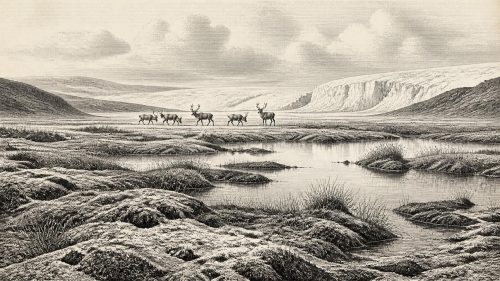
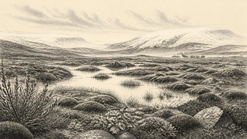
The key evidence is geological. At Derryvree near Maguiresbridge in County Fermanagh, organic freshwater silts and fine sands lay between thick sheets of glacial sediment. Their radiocarbon measurement, calibrated to approximately 36,900–31,700 cal BP, demonstrates that an ice-free episode preceded the deposition of the later tills. The preserved flora and fauna have been interpreted as indicating open tundra vegetation and a periglacial climate: cold ground conditions shaped by freezing and thawing rather than dense woodland.
Nearby evidence from Greenagho, also in Fermanagh, is similarly important. Organic material in lacustrine deposits beneath till has produced an age range of roughly 37,200–35,700 cal BP. Together, these sites provide a minimum constraint: ice had not yet overridden those particular deposits by the time they formed. They do not prove that every valley in Ireland was open, nor can they establish what happened in 31,977 BCE specifically. Their value lies in showing that the later ice sheet expanded over landscapes which, during parts of late Marine Isotope Stage 3, had supported lakes, sediments, plants and invertebrate life.
Offshore records extend this story. Marine shells reworked into deposits at Glenulra in western Ireland imply that adjacent Donegal Bay had open water during much of the period before the westward expansion of the last ice sheet. Farther offshore, bathymetry, seismic profiles, sediment cores and dates show that ice later reached the Atlantic shelf edge west of Ireland and that the Irish Sea Ice Stream later surged south-west across the Celtic Sea shelf. Those impressive ice limits chiefly belong to the later part of the glacial cycle, especially about 27,000–23,000 cal BP, rather than to the nominal date under discussion. They explain why c. 34 ka is best viewed as a prelude: the landscape was approaching an episode that would greatly remodel it.
No Demonstrated Community
There is no accepted archaeological evidence for people living in Ireland around 34,000 cal BP. No securely dated hearth, stone-tool assemblage, dwelling, grave, butchered animal bone or artwork from this time has been identified on the island. That absence needs to be stated plainly. It is not evidence that humans were incapable of reaching the region: Homo sapiens occupied parts of Britain and continental Europe during the Upper Palaeolithic. But neither proximity nor possibility is proof of an Irish population.
The distinction is especially important because Ireland’s earliest reported evidence of human activity is vastly later. A modified brown-bear bone from Alice and Gwendoline Cave, County Clare, has been dated to the terminal Pleistocene, approximately 11,060–10,440 cal BP; its cut marks have been argued to record human handling. Clearer, more substantial Mesolithic settlement evidence appears only around 8000 BCE. These discoveries are historically important, but they cannot be projected backwards more than twenty millennia to fill the silence at c. 34,000 cal BP.
Later glaciation also helps explain why the record is difficult. Advancing ice eroded bedrock, incorporated earlier sediments and redeposited material as till; meltwater reworked valleys and basins; rising seas subsequently drowned parts of former coastal landscapes. A fleeting Upper Palaeolithic camp, if one ever existed, would have faced poor odds of preservation and discovery. This is a reasonable explanation for why evidence may be scarce, but it is not a licence to claim a lost settlement. Archaeology must distinguish a preservation problem from positive proof.
Life Without a Social Record
Because no community is demonstrated, there can be no evidence-led account of political affairs, diplomacy, conflict, kinship, religion, language, learning, art or trade in Ireland at this date. There were no known leaders, alliances, ceremonial centres or exchange networks on the island. Nor should later Gaelic traditions, medieval origin stories or the monuments of the Neolithic be treated as remote memories of this landscape. They belong to radically different societies separated from c. 34,000 cal BP by tens of thousands of years.
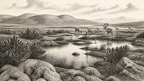
What can be described is the setting in which any human visitor would have had to operate. The Fermanagh deposits suggest sparse, open ground rather than the oak-, elm- and hazel-rich woodland of the much later Holocene. Short growing seasons, severe winter cold, exposed terrain and frequent climatic shifts would have constrained plant productivity and animal distributions. Lakes, rivers, patches of tundra vegetation and seasonally changing snow or ice would have mattered more than fields, roads or enduring built settlements. If people crossed into any ice-free part of Ireland, their presence would most plausibly have been mobile and temporary; that is an inference from the environment and wider Upper Palaeolithic lifeways, not an Irish find.
Likewise, animals should be approached cautiously. The fossil and sedimentary record can reveal environmental communities, but it does not give a complete census for this particular year. A cold, open habitat is compatible with grazing and browsing mammals and their predators, while freshwater deposits preserve evidence of smaller organisms and plants. It does not permit confident claims that a named herd, hunting party or species occupied a particular Irish valley in 31,977 BCE. The famous giant deer later associated with Ireland is not an appropriate emblem for this date simply because it became part of the island’s Pleistocene story.
Ice as the Main Agent of Change
The central development was environmental and regional: the growth and movement of ice. The last Irish Ice Sheet was part of the larger British–Irish Ice Sheet system, whose sectors interacted across the Irish Sea and Atlantic shelf. Its advance was not merely a climatic backdrop. Ice could strip soils and weathered rock, deepen or redirect valleys, carry boulders far from their sources and lay down thick tills, sands and gravels. Much of the physical texture of modern Ireland—drumlins, streamlined rock, moraines, meltwater channels and glacially altered lowlands—was shaped or overprinted during this wider glacial history.
However, landscape features visible today cannot all be assigned to one advance or one year. Scientists combine field mapping with sediment stratigraphy, radiocarbon dating, optically stimulated luminescence dating, cosmogenic-nuclide exposure ages and offshore geophysics to reconstruct sequences. Each method has a different strength and uncertainty. For instance, a date from organic material beneath till can show that the site was ice-free when the material accumulated, whereas an exposure age on a boulder can help estimate when ice retreated and left it exposed. The resulting chronologies are powerful but necessarily probabilistic.
At the eventual local maximum, attained asynchronously in different sectors between roughly 30,000 and 22,000 cal BP, ice covered much of Ireland and extended offshore in several directions. Some high ground may have stood above erosive ice or supported thin, cold-based ice, but this varied by region and phase. The future advance was therefore neither a single wall arriving on a single date nor a uniformly thick blanket. Around c. 34,000 cal BP, Ireland was entering the long and uneven process by which this icy landscape was assembled.
What This Date Means
For Ireland, 31,977 BCE is not a year of kings, communities or monuments. It is a scientifically useful waypoint in deep time: approximately 34,000 cal BP, within a climatically volatile Late Pleistocene and close to the build-up of the last Irish ice sheet. The strongest local evidence comes from sediments beneath later glacial deposits, particularly in County Fermanagh, which preserve an ice-free, cold, open environment within calibrated ranges spanning the nominal date. The strongest conclusion about people is negative but important: none are securely evidenced in Ireland then.
That restraint is not a failure of history. It is the history appropriate to the evidence. Before Ireland’s human story can be told through camps, tools, meals, ritual and exchange, the island’s ground itself had to pass through the transformations of the last glacial cycle. Around 31,977 BCE, climate, water, sediments and expanding ice—not human politics—were the principal forces making the future archaeological landscape.
Primary Sources
- Trimlines, blockfields and the vertical extent of the last ice sheet in southern Ireland
- Trimlines, blockfields and the vertical extent of the last ice sheet in southern Ireland
- Advance and retreat of the marine-terminating Irish Sea Ice Stream into the Celtic Sea during the Last Glacial: Timing and maximum extent
- Ice sheet extension to the Celtic Sea shelf edge at the Last Glacial Maximum
- Oscillating retreat of the last British-Irish Ice Sheet on the continental shelf offshore Galway Bay, western Ireland
- Late Pleistocene chronostratigraphy and ice sheet limits, southern Ireland
- Maximum extent and dynamic behaviour of the last British–Irish Ice Sheet west of Ireland
- Dimensions and chronology of the last ice sheet in Western Ireland
- Exploring controls of the early and stepped deglaciation on the western margin of the British Irish Ice Sheet
- Restricted cirque glaciers in the Wicklow Mountains, Ireland, during the Nahanagan Stadial (Greenland Stadial-1/Younger Dryas)
- Stratigraphic and palaeo-geomorphological evidence for the glacial-deglacial history of the last British-Irish Ice Sheet in the north-western Irish Sea
- British–Irish Ice Sheet and polar front history of the Goban Spur, offshore southwest Ireland over the last 250,000 years
- The Antiquity of Man in Ireland
- The Late-Glacial Sequence in Britain and Ireland
- The Mesolithic in Ireland: when was it?
- First evidence of a Late Upper Palaeolithic human presence in Ireland
- New insights on the fauna of Ireland's Younger Dryas and Early Holocene from Alice & Gwendoline Cave
- Palaeolithic Ireland – New evidence emerges from the Emerald Isle
- Quaternary
- IE GSI Quaternary Geomorphology 50K Ireland MapServer
- IE GSI Quaternary Geomorphology 50K Ireland Feature Service Metadata
- Outreach and Education Resources
- Field Guides
- The IntCal20 Northern Hemisphere Radiocarbon Age Calibration Curve (0–55 cal kBP)
- Radiocarbon Dating and Chronological Modelling: Radiocarbon Dating
- Rapid glaciation and a two-step sea level plunge into the Last Glacial Maximum
- The role of ocean and atmospheric dynamics in the marine-based collapse of the last Eurasian Ice Sheet