Fermanagh’s Juniper Muskeg31777 BCE
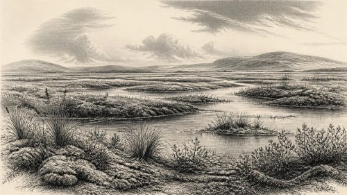
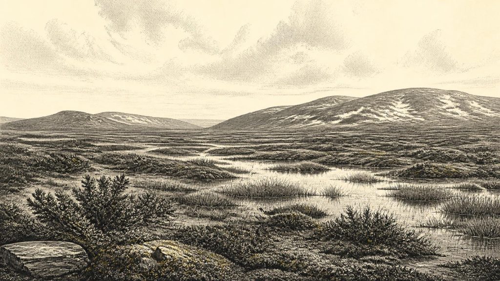
About 31,777 BCE is a modern chronological approximation within MIS 3, not a precisely documented Irish date. Organic sediments beneath till at Derryvree, Fermanagh, indicate an ice-free interval with wet, treeless tundra or muskeg, supporting grasses, sedges, juniper and mosses. Greenagho provides related but earlier evidence. Insects, cave calcite and faunal remains reveal severe, unstable glacial conditions and Ice Age animals, including mammoth, reindeer and hyaena. Cave deposits cannot represent one moment. No secure evidence establishes human settlement; a possibly cut reindeer bone suggests only a tentative visit. Subsequent British-Irish Ice Sheet expansion transformed and obscured these landscapes over time.
Dateline
The label 31,777 BCE must not be mistaken for a date at which Ireland’s history can be read year by year. No written record, settlement sequence or archaeological layer offers that degree of precision. It is a modern calendar conversion used to orient a much older and more uncertain chronology. The responsible setting is the later part of Marine Isotope Stage 3 (MIS 3), within the last glacial cycle. Radiocarbon measurements from relevant Irish deposits calibrate into broad probability ranges, not single calendar years; a revised calibration curve may alter those ranges again. The closest securely dated environmental sequence, at Derryvree near Maguiresbridge in County Fermanagh, has been placed broadly between about 36,900 and 31,700 calibrated years before present. That span overlaps the notional date, but it does not demonstrate that a particular event occurred in the year called 31,777 BCE.
A Landscape Read Through Sediment
The most illuminating Irish evidence comes not from monuments or villages, but from sediments trapped beneath later glacial deposits. At Derryvree, organic silts lay between two tills: deposits of debris left by moving ice. Before later ice covered the site, its waterlogged sediments preserved pollen, mosses and other biological traces. Their value lies in this sequence. They show that part of Fermanagh was ice-free long enough for freshwater and wet-ground environments to develop, before a subsequent phase of ice-sheet advance buried the evidence.
The fossil assemblage has been interpreted as a treeless tundra or muskeg landscape. Grasses and sedges dominate, accompanied by juniper and herbaceous plants, while the moss record points to persistently wet ground. ‘Muskeg’ is a useful descriptive term for this boggy, peaty tundra terrain, but it should not conjure a uniform wilderness. Local conditions would have varied sharply between shallow pools, sedge beds, exposed mineral ground and better-drained patches. Seasonal thaw, frost action and waterlogging governed what could grow and where animals could move.
Nearby Greenagho, also in County Fermanagh, preserves an earlier but related window beneath till. Its lacustrine organic deposits have yielded a calibrated range of roughly 37,200–35,700 years before present. Greenagho and Derryvree should not be merged into one imaginary simultaneous landscape. They are separate sites, with separate age estimates and depositional histories. Together, however, they establish an important point: northern Ireland was not continuously entombed beneath the growing last ice sheet throughout this part of MIS 3. There were intervals in which open ground, freshwater habitats and cold-adapted plant communities persisted.
Cold, But Not Featureless
At the time represented by Derryvree’s later deposits, Ireland was cold and largely without woodland in the sampled region. That does not mean it resembled a white, lifeless ice cap. The pollen and plant remains instead suggest an open, low-growing vegetation cover, sustained during a climatic phase colder and more seasonal than present. Insects from comparable northern Irish deposits strengthen that picture. Species with modern distributions in Arctic Fennoscandia indicate cold conditions; ecological reconstructions have proposed cool summers and very severe winters. Such numerical reconstructions are estimates derived from the ecological tolerances of fossil beetles, not thermometer readings taken in prehistoric Fermanagh.
Crag Cave in County Kerry provides a different sort of evidence for climatic instability. Calcite speleothems grow only where liquid water passes through cave rock, and uranium-thorium dates show that deposition occurred episodically during MIS 3. The record indicates repeated shifts between phases mild enough for water circulation and colder stadials in which growth stopped. It does not supply a weather report for any named year, nor does a Kerry cave prove that conditions in Fermanagh were identical. It does show that Ireland lay within a North Atlantic climate system capable of rapid, substantial oscillations. A seemingly stable ecological reconstruction may therefore represent only one interval in a fluctuating glacial world.
Animals and Cave Archives
South-western Ireland offers the period’s most conspicuous vertebrate evidence. Castlepook Cave, also known as Mammoth Cave, near Doneraile in north County Cork has produced more than 2,000 animal bones from old excavations. The assemblage includes woolly mammoth, reindeer, giant deer, brown bear, wolf, fox, Arctic fox, lemmings and spotted hyaena. It confirms that Ireland supported, at various points during the Middle and Late Pleistocene, fauna now wholly absent from the island. The cave was an animal repository rather than a straightforward snapshot of one living community.
That qualification matters. The bones came from passages and chambers excavated principally in the early twentieth century, under standards far less exacting than present practice. Water movement, disturbance, the mixing of deposits and the long use of a cave by scavengers can bring remains of differing dates into apparent association. Modern re-dating has shown that some earlier determinations from southern Irish caves underestimated their age, while individual Castlepook specimens belong to a long span. Accordingly, mammoth, hyaena and reindeer remains make a strong case for a cold-stage fauna in Ireland, but they cannot responsibly be assembled into a single herd seen crossing Cork on this particular calendrical date.
Spotted hyaena deserves particular notice because it reminds us that caves were active ecological places. Hyaenas could accumulate carcass parts, gnaw bones and use sheltered chambers as dens; wolves, bears and people, if present, would have encountered a dangerous, competitive landscape rather than an empty hunting preserve. Reindeer and giant deer indicate large herbivores capable of exploiting open vegetation, but their abundance, migration routes and seasonality in Ireland remain unknown. So too do the exact coastlines and crossing routes available at any one moment. Lower sea levels exposed more of the continental shelf, yet proximity to Britain or the European mainland should not be converted automatically into a proven land bridge or an established route of movement.
The Unsettled Human Question
There is no securely excavated dwelling, hearth, burial, stone-tool assemblage or occupation floor in Ireland that can be assigned to around 31,777 BCE. This absence rules out claims for an Irish polity, chiefdom, named people, language, formal religion, diplomacy or regular trade at this date. It also means that everyday life cannot be reconstructed as if a resident community were known. There are no houses from which to infer household size, no stores of food, no ornaments, no ritual deposits and no evidence for teaching or craft traditions on the island at this time.
One find makes the question more interesting but also more difficult. A reindeer femur from the historic Castlepook collection has been publicly reported as carrying a deep mark interpreted as possible cutting or chopping with a stone tool, and the animal has been described as dating to about 33,000 years ago. If microscopic study and secure association ultimately confirm that interpretation, it could indicate a brief Upper Palaeolithic episode of human handling or butchery in Ireland during the general period before the Last Glacial Maximum. It would be an exceptional discovery.
It is not, however, evidence for permanent settlement. The bone was not recovered from a modernly excavated living surface accompanied by a tool-kit and hearth. A radiocarbon result dates an animal’s death within a probability range; it does not, by itself, date a person’s visit, identify the location of butchery or establish a population’s duration. Marks on bone must be differentiated from carnivore damage, trampling, sediment movement, excavation marks and later handling. The later, published butchered brown-bear patella from Alice and Gwendoline Cave in County Clare demonstrates that careful analysis can establish human activity in Ireland during the terminal Pleistocene, about twenty millennia after the period considered here. It cannot fill the much earlier evidential gap.
Approaching Glacial Transformation
The dominant long-term development was environmental: the expansion of the British-Irish Ice Sheet. Derryvree and Greenagho are important partly because their organic deposits were later overridden or covered by ice-related sediments. They record conditions before a major transformation of the land. Recent reconstructions differ in details, yet broadly indicate that much of the last Irish ice sheet expanded after the interval represented by these northern Irish organic deposits, reaching southern and offshore limits much later, particularly after about 26,000 calibrated years before present.
For people, had small mobile groups entered Ireland during favourable episodes, that impending expansion would have made any occupation precarious. For animals, it altered forage, shelter, watercourses and connections between regions. For the landscape, advancing ice later eroded, transported and buried deposits, helping explain why the archaeological record is so slight. Absence of evidence is never proof that no person entered Ireland, but in this case the known record supports caution rather than a crowded prehistoric narrative.
What Can Be Said Responsibly
Ireland around the notional date of 31,777 BCE belonged to a cold, unstable North Atlantic world, not yet the familiar wooded island of later prehistory. In Fermanagh, the best directly relevant evidence points to open, wet, treeless ground with grasses, sedges, juniper and mosses during an ice-free interval. In Cork, cave deposits show that large mammals and formidable carnivores formed part of the wider Ice Age fauna, though not necessarily at the same moment or in the same place. The possibility of an early human visit remains a research question centred on a single remarkable bone, not a licence to invent a society.
That restraint is not a deficiency. It is the history appropriate to deep time: one recovered from silts, pollen, cave calcite, bones and calibrated ranges, with the limits of each source kept visible. The Ireland of this period has no kings, battles or treaties that scholarship can name. It has a marshy Fermanagh tundra, an evolving cave archive in Cork, and an ice sheet whose eventual growth would overwrite much of what came before.
Primary Sources
- A Middle Midlandian Freshwater Series at Derryvree, Maguiresbridge, County Fermanagh, Northern Ireland
- Middle Midlandian Interstadial Deposits at Greenagho, Near Belcoo, County Fermanagh, Northern Ireland
- Irish Pleistocene Biostratigraphy
- The Irish Quaternary Fauna Project
- Trimlines, Blockfields and the Vertical Extent of the Last Ice Sheet in Southern Ireland
- Trimlines, Blockfields and the Vertical Extent of the Last Ice Sheet in Southern Ireland
- Episodic Speleothem Deposition Tracks the Terrestrial Impact of Millennial-Scale Last Glacial Climate Variability in SW Ireland
- A Reconsideration of the Radiocarbon Dating of the Marine Isotope Stage 3 Fauna from Southern Ireland
- Castlepook Cave, County Geological Site Report
- Pleistocene Vertebrates in the British Isles
- Maximum Extent and Dynamic Behaviour of the Last British–Irish Ice Sheet West of Ireland
- Oscillating Retreat of the Last British-Irish Ice Sheet on the Continental Shelf Offshore Galway Bay, Western Ireland
- Response of the Irish Ice Sheet to Abrupt Climate Change During the Last Deglaciation
- Growth and Retreat of the Last British-Irish Ice Sheet, 31,000 to 15,000 Years Ago
- Dimensions and Chronology of the Last Ice Sheet in Western Ireland
- Vertical Dimensions and Age of the Wicklow Mountains Ice Dome, Eastern Ireland, and Implications for the Extent of the Last Irish Ice Sheet
- The Colonization of Ireland: A Human Ecology Perspective
- First Evidence of a Late Upper Palaeolithic Human Presence in Ireland
- New Insights on the Fauna of Ireland's Younger Dryas and Early Holocene from Alice & Gwendoline Cave
- The IntCal20 Northern Hemisphere Radiocarbon Age Calibration Curve (0–55 cal kBP)
- Heritage Artefacts of County Cork 2021
- Archaeological Excavations at Castlepook Cave, Co. Cork