
Maguirebridge’s Winter Wetland31580 BCE
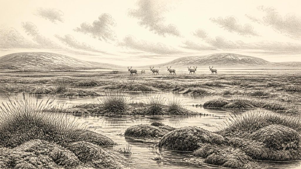
At the notional date of 31,580 BCE, Ireland lay within the climatically unstable Marine Isotope Stage 3. At Derryvree near Maguiresbridge, freshwater silts and organic deposits between glacial tills record an ice-free interval around 33,500 calibrated years BP. Mosses, sedges and insects indicate a cold, open tundra wetland with shallow pools and peat-rich ground. Other Fermanagh deposits suggest local non-glacial phases, while cave evidence shows climatic fluctuation and cold-adapted mammals, including reindeer and mammoth. No secure human occupation is known; a marked reindeer bone from Castlepook Cave only raises the possibility of a brief human visit. Later ice buried it.
Dateline
The label 31,580 BCE cannot describe a dated event in Ireland. No writing, named people, political communities or calendar system survives from this depth of time, and modern calendar-year precision is unavailable. It is best treated as a convenient point within the Late Pleistocene, roughly 33,530 years before AD 1950. The most relevant evidence falls within broader calibrated ranges rather than a single year. Around this notional date, Ireland lay in Marine Isotope Stage 3 (MIS 3), a long, climatically unstable part of the last Ice Age, before the fullest expansion of the last British–Irish Ice Sheet.
A Date Inside a Range
The strongest chronological anchor is not a settlement but an environmental deposit at Derryvree, near Maguiresbridge in County Fermanagh. Roadworks in 1969 cut through a drumlin and revealed fine sands and organic freshwater silts enclosed between two distinct layers of till: sediment deposited directly by glacier ice. The lower till shows that ice had previously occupied the locality; the freshwater beds show that an ice-free interval followed; the upper till records a later glacial advance. This is a sequence of changing landscapes, not an annual diary.
Organic material from the Derryvree deposits produced the conventional radiocarbon determination Birm-166, 30,500 +1,170/−1,030 radiocarbon years BP. Because radiocarbon years do not equal calendar years, the result requires calibration and carries a wide uncertainty. Recent modelling places the ice-free evidence broadly around 33,500 ± 1,200 calibrated years BP, while discussion of the determination gives an approximate calibrated span of 36,900–31,700 years BP. The requested date therefore belongs plausibly within the wider world represented by Derryvree, but cannot be assigned to a particular sediment layer, season, plant or animal.
Freshwater Between Glaciers
Derryvree provides an unusually vivid corrective to the notion that Ice-Age Ireland was always an unbroken white sheet. Its organic beds contained freshwater mosses and sedges, with insect remains indicative of cold northern conditions. Researchers interpreted the assemblage as open tundra within a periglacial regime: ground shaped by repeated freezing and thawing near, but not necessarily beneath, glacier ice. Insect evidence suggests a muskeg-like local environment, with wet peat-rich ground, mossy margins, shallow pools and abundant decaying vegetation.
This was not a familiar Irish bog, nor a sheltered lakeside landscape. Trees did not form woodland here. The growing season was probably short, winters severe, and drainage strongly affected by frost and frozen ground. Yet the sediments demonstrate a functioning wetland ecosystem: water could pond, plants could take root, insects could complete their life cycles and organic matter could accumulate. The landscape was cold and exposed, but it was not lifeless.
Other Fermanagh sites reinforce the picture while also warning against over-confidence. Inter-till freshwater or organic deposits have been reported at Hollymount near Maguiresbridge and at Greenagho near Belcoo. Their dates and correlations are less secure than historians might wish, but together they indicate that parts of northern Ireland experienced non-glacial intervals during the Middle Midlandian. Such sites illuminate local conditions. They do not prove that every part of the landmass now called Ireland was ice-free, equally habitable or ecologically connected at the same moment.
An Unstable Ice-Age Island
At 31,580 BCE, Ireland’s later political geography had no meaning. There was no Ireland as a state, no border, no kingdom and no human diplomacy that can be recovered from the evidence. “Ireland” here means the land and continental shelf that would later form the modern island. Sea level was lower than today because much water was stored in global ice sheets, so shorelines lay differently and broad coastal plains existed in places now submerged. Lower seas, however, did not automatically create an easy land route from Britain or continental Europe; the changing Irish Sea, channels, currents, seasonal ice and coastlines mattered greatly.
Climate was also volatile rather than steadily worsening. Cave calcite from Crag Cave in County Kerry records episodes when liquid water percolated through shallow karst and speleothems could grow. Such growth is associated with relatively milder intervals within the last glacial cycle, while its interruption reflects colder conditions. Derryvree and Crag Cave thus preserve different kinds of evidence for a wider truth: north-west Europe repeatedly shifted between comparatively tolerable interstadial conditions and harsher stadials over centuries or millennia.
The major Irish ice-sheet advance still lay ahead. Current reconstructions indicate that much of Ireland remained ice-free until about 32,000 calibrated years BP, although the exact timing, thickness and extent of earlier ice remain subjects of research. By the global Last Glacial Maximum, conventionally about 26,000–19,000 calibrated years BP, the last British–Irish Ice Sheet had expanded across much or all of the island and far onto the surrounding continental shelf. The Derryvree wetland survived only because later ice buried its sediments rather than eroding them entirely.
Animals in Open Country
Southern Irish caves offer complementary, though often disturbed, evidence for the mammals that could occupy Ireland during MIS 3. Castlepook Cave near Doneraile, County Cork, is especially important. Collections made there in the early twentieth century include remains attributed to reindeer, woolly mammoth, giant deer, brown bear, wolf, Arctic fox, mountain hare, lemmings and spotted hyaena. Redating has shown that some bones formerly assigned to later periods are substantially older, confirming that elements of this cold-adapted fauna occurred in Ireland before the Last Glacial Maximum.
The cave record should not be read as a single living community gathered in one valley on one day. Caves may act as animal dens, traps, shelters, drainage routes and sediment stores; bones can be moved by carnivores, water, collapse and excavation. Nor does a species list establish the exact landscape around Derryvree. Nevertheless, the combined evidence supports an Ireland with open grassland-tundra mosaics and wet ground capable of sustaining large grazers and their predators. Reindeer were suited to such country, while hyaenas and wolves imply food webs more complex than a simple frozen wilderness.
The Human Question
No securely excavated camp, hearth, dwelling, tool assemblage or human burial is known in Ireland from around 31,580 BCE. This absence is decisive when discussing settlement. It means that a resident population, social organisation, language, kinship system, political authority and territorial boundaries cannot responsibly be reconstructed. There is likewise no evidence for trade routes, seaborne exchange, diplomacy or warfare. The archaeological record supports an environmental history first and a human history only as a carefully limited possibility.
That possibility centres on a reindeer femur from Castlepook Cave. The specimen has been publicly presented as dating to about 33,000 years ago and carries a deep linear mark interpreted by palaeozoologist Ruth Carden as damage made by a sharp stone implement while fresh tissue was being removed. If the interpretation is sustained, it would be remarkable evidence for a brief Upper Palaeolithic human encounter with a reindeer carcass in Ireland long before the better-attested post-glacial settlement of the island.
But the distinction between evidence and interpretation matters. Radiocarbon dating establishes the age of the animal bone, not automatically the date, maker or place of the incision. The bone derives from an old cave collection, rather than a modern excavation of an intact occupation floor containing associated tools, fire residues and butchered refuse. Natural breakage, carnivore activity, sediment movement and recovery history must be excluded before a mark can bear such historical weight. The prudent conclusion is not that Ireland had a settled human population, but that Castlepook raises a serious and still limited question about a possible visit by people.
Life, Culture and Silence
If people did reach Ireland in this period, they would have belonged to mobile Upper Palaeolithic societies known elsewhere in Europe to have used stone tools and to have relied on seasonal knowledge of animals, weather and terrain. Reindeer could have supplied meat, fat, hide, sinew and bone. That wider comparison can explain what butchery might involve; it cannot demonstrate that such practices, clothing, art, beliefs or social customs occurred in Ireland. No Irish evidence of ceremony, imagery, burial, teaching or symbolic life can be assigned to this date.
There was therefore no identifiable religion, culture of learning or economy in the normal historical sense. There may have been animal movement through productive corridors and, perhaps, rare human movement at Europe’s Atlantic edge. Yet the durable facts are humbler and more powerful: freshwater lay between older and later glaciers at Derryvree; tundra plants and cold-adapted insects lived there; large mammals occupied suitable parts of the island; and the climate was changing towards the great glaciation to come. Maguirebridge’s buried wetland is not a record of a year. It is a narrow, precious window onto an Irish landscape repeatedly made, altered and concealed by ice.
Primary Sources
- A Middle Midlandian Freshwater Series at Derryvree, Maguiresbridge, County Fermanagh, Northern Ireland
- Early Midlandian–Middle Midlandian, Pleistocene, Northern Ireland
- The Irish Quaternary Fauna Project
- A Reconsideration of the Radiocarbon Dating of the Marine Isotope Stage 3 Fauna from Southern Ireland
- Episodic Speleothem Deposition Tracks the Terrestrial Impact of Millennial-Scale Last Glacial Climate Variability in SW Ireland
- Exploring Controls of the Early and Stepped Deglaciation on the Western Margin of the British Irish Ice Sheet
- Timing and Pace of Ice-Sheet Withdrawal Across the Marine–Terrestrial Transition West of Ireland During the Last Glaciation
- Maximum Extent and Dynamic Behaviour of the Last British–Irish Ice Sheet West of Ireland
- Late Pleistocene Chronostratigraphy and Ice Sheet Limits, Southern Ireland
- Radiocarbon Constraints on the Age of the Maximum Advance of the British-Irish Ice Sheet in the Celtic Sea
- Dimensions and Chronology of the Last Ice Sheet in Western Ireland
- Timing, Pace and Controls on Ice Sheet Retreat: An Introduction to the BRITICE-CHRONO Transect Reconstructions of the British–Irish Ice Sheet
- New Insights on the Fauna of Ireland's Younger Dryas and Early Holocene from Alice & Gwendoline Cave
- Could Brown Bears (Ursus arctos) Have Survived in Ireland During the Last Glacial Maximum?
- Anthropogenic Changes to the Holocene Nitrogen Cycle in Ireland
- Our Ancient Landscapes: Hunter-Gatherers in Ireland
- Heritage Artefacts of County Cork
- Landscapes and Environments of the Last Glacial-Interglacial Transition: A Time of Amazingly Rapid Change in Ireland
- The Quaternary of Fermanagh and West Tyrone: Field Guide
- Crag Cave Speleothem Study: IQUA Newsletter 64