Maguiresbridge’s Coldwater Silts31409 BCE
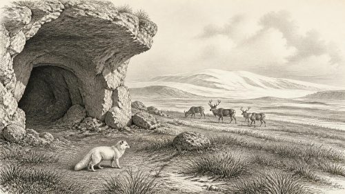
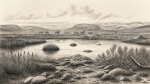
Around 31,409 BCE, Ireland lay within Marine Isotope Stage 3 of the Last Glacial Period, though evidence cannot identify events in a single year. Freshwater silts at Derryvree, County Fermanagh, accumulated between glacial episodes and indicate cold, treeless, tundra-like wetlands with shallow water and sparse vegetation. Their calibrated age range plausibly includes this date, but does not establish island-wide conditions. Castlepook Cave, County Cork, preserves mixed remains of mammoth, reindeer, giant deer and other fauna, showing wider ecological connections. A possibly butchered reindeer bone may indicate a brief human visit, but no evidence demonstrates permanent Palaeolithic occupation, settlements or institutions.

Dateline
The label 31,409 BCE is a modern way of locating a point deep in the last Ice Age, not a date at which Ireland’s past can be observed year by year. It falls about 33,360 calendar years before AD 1950, the conventional ‘present’ used in radiocarbon chronology. At that depth of time, no Irish document, seasonal record, settlement sequence or event horizon can resolve a particular calendar year. The responsible historical setting is the later part of Marine Isotope Stage 3, within the Last Glacial Period but before the fullest extent of the Last Glacial Maximum. Evidence can illuminate broad spans of centuries or millennia; it cannot tell us what happened in Ireland during this numbered year.
A Landscape Between Ice Advances
The most useful Irish evidence comes from Derryvree townland, near Maguiresbridge in County Fermanagh. Road works in 1969 cut through a drumlin and exposed freshwater silts and fine sands lying between two thick tills: stony sediments laid down by glacier ice. This was an extraordinary survival. The organic, water-laid deposits recorded an interval when ice was absent locally, before the ground was again overridden or closely affected by a later advance. Pollen, plant macrofossils, mosses and insect remains were recovered from the buried sequence, making Derryvree a rare environmental archive from an otherwise badly erased period of Irish prehistory.
An organic sample from the Derryvree freshwater series produced a radiocarbon determination of about 30,500 radiocarbon years BP, with a substantial uncertainty. Published calibrations have placed that deposit broadly around 36,900–31,700 calendar years BP, approximately 34,950–29,750 BCE. The conversion matters. A radiocarbon measurement is not itself a calendar date: atmospheric carbon-14 varied through time, and calibration curves translate the measurement into a probability range. The range means that 31,409 BCE belongs plausibly within the broad Derryvree interval, but it cannot be singled out as the age of a particular layer, pond, animal or human action.
This distinction is more than technical caution. The freshwater bed is evidence for a landscape and climate regime over a span of time; it is not a diary of one year. Moreover, deposits beneath later ice can be displaced, compressed or incompletely preserved. The two tills at Derryvree firmly demonstrate glacial episodes before and after the freshwater accumulation, but they do not provide an annually precise timetable for the movement of every ice margin across Ireland.
Open Ground and Shallow Water
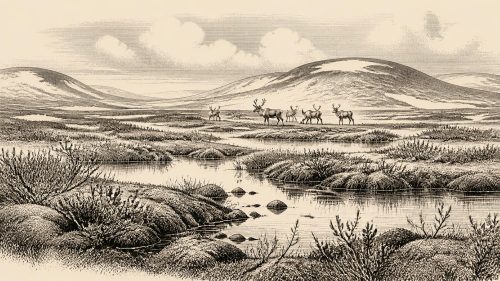
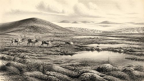
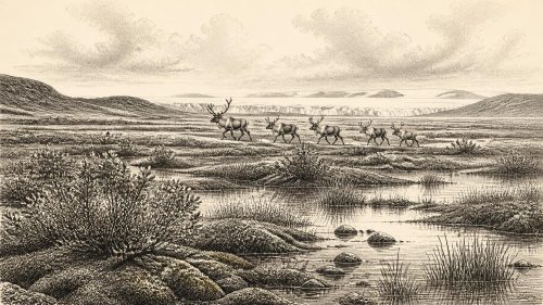
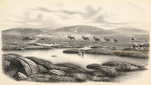
The biological evidence from Derryvree indicates an open, treeless tundra-like landscape under periglacial conditions. Rather than imagining modern Ireland stripped of its woods, it is better to picture a colder world with sparse plant cover, exposed mineral ground, wet mossy hollows, sedge-rich margins and shallow pools. The assemblage included plants associated with cold, wet and open environments, while insect evidence reinforced the picture of a severe climate. Local water and vegetation nevertheless supported life. Derryvree was not simply an empty white expanse: it was a patchwork of saturated ground, freshwater and low-growing plants.
Such evidence also corrects an easy misconception about an Ice Age island. ‘Glacial’ did not mean that every part of Ireland was permanently buried beneath unbroken ice throughout every millennium. Ice sheets waxed, thinned, advanced and retreated; their margins, their thickness and their relation to sea level changed. Recent work on the British–Irish Ice Sheet stresses that its pre-Last Glacial Maximum history remains less securely known than its later growth and retreat. There are indicators of glaciation before the climatic maximum, including ice-rafted debris and landform evidence, but the timing and geographical extent of individual advances in Marine Isotope Stage 3 are still debated.
For the date in question, then, a precise national map would claim more certainty than the evidence permits. Derryvree supports the existence of ice-free or non-glacial local conditions in Fermanagh during its dated interval. It does not prove that all of Ireland was open ground at 31,409 BCE. Conversely, evidence for early ice growth elsewhere warns against treating the island as uniformly hospitable. Ireland was a changing edge-land in a north-west European climatic system, where sea, ice, exposed land and periglacial terrain could all reorganise routes available to plants and animals.
Animals Before the Maximum Cold
Cave deposits in southern Ireland offer a second, very different source of evidence. Castlepook Cave near Doneraile, County Cork, has yielded a large and chronologically mixed Late Pleistocene faunal collection. It includes mammoth, reindeer, giant deer, brown bear, spotted hyaena, fox, hare and lemmings. Direct radiocarbon dating shows that some animals belonged to the long period before the Last Glacial Maximum, while others are considerably younger. The cave therefore demonstrates that Ireland, at different times before the maximum cold, formed part of a wider animal world connected to Britain and continental Europe.
The faunal evidence must not be compressed into a single imagined ‘Ice Age herd’. The dated bones span many thousands of years, and cave assemblages are shaped by carnivore activity, natural deaths, water movement, roof collapse, excavation methods and later disturbance. Researchers have also re-dated material using improved pretreatment methods, finding that several older determinations required reconsideration. What is secure is that cold-adapted and open-country mammals reached Ireland during the broader pre-maximum period. What is less secure is whether all listed species lived together, or how abundant they were, at any one time.
At roughly this chronological horizon, the relevant economy was ecological rather than human. Reindeer and giant deer could exploit open vegetation; mammoths required substantial plant biomass; predators and scavengers depended upon prey, carrion and accessible denning places. Their presence suggests intermittent biological corridors rather than an isolated island fauna. Lower global sea levels altered coastlines, although the exact shape of land and water passages shifted with local ice loading and relative sea level. It is reasonable to infer movement between Ireland and neighbouring landmasses over longer periods. It would not be reasonable to claim a known migration route, a named crossing or a regular seasonal journey in 31,409 BCE.
The Human Question at Castlepook
Human presence is the most important uncertainty. A reindeer femur from Castlepook, recovered during early twentieth-century excavations and later re-examined, has been publicised as bearing a deep mark consistent with stone-tool butchery. It has been associated broadly with about 31,000 BCE, making it directly relevant to this era. If the mark is confirmed as anthropogenic, it would indicate that people reached Ireland far earlier than the long-accepted post-glacial settlement record. It would be evidence for a brief human episode involving an animal carcass, not automatically for a permanent population.
That qualification is essential. Castlepook has not yet produced a securely associated stone-tool assemblage, hearth, dwelling floor, burial, food store or stratified occupation surface of this antiquity. Its old faunal collections have complicated provenances, and the cave itself contains remains accumulated over a long interval. The femur is therefore best described as a significant possible Palaeolithic trace, under active archaeological scrutiny, rather than proof that Ireland possessed a settled hunter-gatherer community at this precise date. The National Museum of Ireland’s more general account of prehistory still reflects the wider caution that clear Palaeolithic human occupation has not been established.
Even if people did visit, no responsible source allows us to reconstruct their language, kinship, political authority, beliefs, clothing, dwellings or seasonal round in Ireland. Nor is there evidence for Irish diplomacy, organised warfare, territorial government, ritual monuments, art or formal trade at this point. Upper Palaeolithic communities elsewhere in Europe possessed sophisticated technologies and social worlds, but importing those particulars into Ireland would turn continental analogy into invented Irish history. The safer conclusion is narrower: a humanly modified reindeer bone may signal a short-lived visit by people capable of using stone tools in a difficult northern environment.
No Polities, but a Deep Environmental History
Accordingly, the chief development around 31,409 BCE was environmental instability, not political change. Ireland’s later historical regions, communities and institutions did not exist. There were no farms, villages, fields, ports or trade networks documented on the island. Forest had not yet become the dominant cover familiar from the warmer post-glacial world, and agriculture lay tens of millennia in the future. Settlement, if it occurred at all, was probably fleeting and left only the most fragile archaeological signature.
Yet this interval matters because it establishes the scale of Ireland’s prehistory. Beneath the familiar landscape of drumlins, bogs and pasture lies evidence that water once pooled among cold open vegetation at Derryvree, while mammal bones accumulated in Cork caves during changing phases of the Ice Age. Later ice repeatedly remodelled the terrain and destroyed or buried many traces. The scarcity of evidence is therefore itself historical: it reflects both limited human activity, if any, and the extraordinary power of glaciers to erase the places where evidence might once have survived.
For 31,409 BCE, the most accurate portrait is consequently one of calibrated ranges, layered sediments and cautious inference. In Fermanagh, freshwater silts preserve the memory of a cold, open wetland between glacial episodes. In Munster, caves preserve pieces of a wider Late Pleistocene fauna, alongside an unresolved but potentially momentous indication of human butchery. These are not fragments from which to invent a lost Irish tribe or a dated event. They are enough, however, to show that Ireland was already part of a dynamic Ice Age world whose animals, climates and possible visitors predated the island’s better-known human story by many millennia.
Primary Sources
- A Middle Midlandian Freshwater Series at Derryvree, Maguiresbridge, County Fermanagh, Northern Ireland
- The Irish Quaternary Fauna Project
- A Reconsideration of the Radiocarbon Dating of the Marine Isotope Stage 3 Fauna from Southern Ireland
- Freshwater Organic Deposits and Stratified Sediments Between Early and Late Midlandian (Devensian) Till Sheets, at Aghnadarragh, County Antrim, Northern Ireland
- Aghnadarragh
- Figure 6.— The Subdivision of the Quaternary Period in Ireland
- The Timing and Magnitude of the British–Irish Ice Sheet Between Marine Isotope Stages 5d and 2: Implications for Glacio-Isostatic Adjustment, High Relative Sea Levels and ‘Giant Erratic’ Emplacement
- Growth and Retreat of the Last British–Irish Ice Sheet, 31,000 to 15,000 Years Ago: the BRITICE-CHRONO Reconstruction
- Timing, Pace and Controls on Ice Sheet Retreat: an Introduction to the BRITICE-CHRONO Transect Reconstructions of the British–Irish Ice Sheet
- Project Findings Provide Essential Insight into the Last British–Irish Ice Sheet
- Character of Advance and Retreat of the Southwest Sector of the British-Irish Ice Sheet During the Last Glaciation
- Oscillating Retreat of the Last British-Irish Ice Sheet on the Continental Shelf Offshore Galway Bay, Western Ireland
- Early Deglaciation of the British-Irish Ice Sheet on the Atlantic Shelf Northwest of Ireland Driven by Glacioisostatic Depression and High Relative Sea Level
- Timing and Pace of Ice-Sheet Withdrawal Across the Marine–Terrestrial Transition West of Ireland During the Last Glaciation
- Vertical Dimensions and Age of the Wicklow Mountains Ice Dome, Eastern Ireland, and Implications for the Extent of the Last Irish Ice Sheet
- Last Glacial Maximum Cirque Glaciation in Ireland and Implications for Palaeoclimate
- New Data for the Last Glacial Maximum in Great Britain and Ireland
- Sedimentary Ancient DNA Reveals Late Pleistocene Faunal Connectivity Between Ireland and Eurasia
- Prehistoric Details
- Castlepook Cave, Castlepook South
- The Archaeological Heritage of County Cork
- Ireland’s Palaeolithic Archaeology – Fleeting Footprints in a Frozen Land
- The IntCal20 Northern Hemisphere Radiocarbon Age Calibration Curve (0–55 cal kBP)
- Marine20—The Marine Radiocarbon Age Calibration Curve (0–55,000 cal BP)