Derryvree’s Cold-Water Biota31350 BCE
Circa 31,350 BCE, Ireland lay within the climatically unstable Late Pleistocene MIS 3, not a recordable historical year. At Derryvree, County Fermanagh, freshwater sediments between glacial tills, dated broadly to 36,900–31,700 cal BP, reveal treeless periglacial wetlands supporting grasses, sedges, juniper, mosses, aquatic plants and insects. Castlepook Cave, County Cork, preserves MIS 3 fauna including mammoth, reindeer, giant deer, bear, wolf, hare, lemmings and hyaena, indicating open habitats and ecological links abroad. A possibly cut-marked reindeer bone suggests fleeting human activity, but no settlement is proven. Later ice advances destroyed or buried much evidence, leaving only a fragmentary environmental record.
Dateline
Modern calendar-year precision is not available for Ireland in 31,350 BCE. The label is a retrospective convenience, not a year anyone on the island could have named, recorded or remembered. Expressed in the archaeological convention of calibrated years before AD 1950, it falls at roughly 33,300 cal BP. This was the Late Pleistocene, within Marine Isotope Stage 3 (MIS 3): a long, climatically unsettled part of the last Ice Age. The evidence cannot identify what happened in one twelve-month period. It can, however, illuminate a broad environmental horizon encompassing this notional date through fossils, sediments, pollen, insect remains and the difficult chronology of glacier advances.
The most responsible account is therefore not an annual chronicle of rulers, battles or settlements. No written record exists; nor is there evidence for Irish states, chiefs, territorial boundaries or diplomatic relations. Instead, Ireland appears as a changing north-west European landscape, sometimes capable of supporting wetlands and large mammals, and later subjected to the destructive force of expanding ice. Its history at this depth of time survives only in rare pockets that escaped erosion, or in cave collections whose original excavation methods leave important questions unresolved.
A Date Within a Wide Range
The Irish site most useful for understanding this period is Derryvree, near Maguiresbridge in County Fermanagh. Road works in 1969 exposed a revealing sequence beneath a drumlin, the streamlined hill formed by glacial action. An older layer of till, the unsorted sediment deposited by ice, lay below freshwater silts, sands and organic material; another till covered them. The order is decisive evidence. A glacier had crossed the locality, then conditions changed sufficiently for freshwater sediment and organic remains to accumulate, before a later ice advance sealed the deposit.
Organic material from the Derryvree sequence produced a conventional radiocarbon result of about 30,500 ± 1,170 radiocarbon years BP. Radiocarbon years are not calendar years: past atmospheric carbon-14 levels varied, and measurements must be calibrated using an internationally maintained curve. The size of the laboratory uncertainty, the great age of the sample and the shape of the calibration curve all make a broad interval more credible than a neat date. Published discussion places the Derryvree freshwater episode broadly at about 36,900–31,700 cal BP, or roughly 34,950–29,750 BCE. Thus 31,350 BCE lies within the range, but cannot be assigned to a particular layer, pool, plant or season.
Wet Ground Between Glaciers
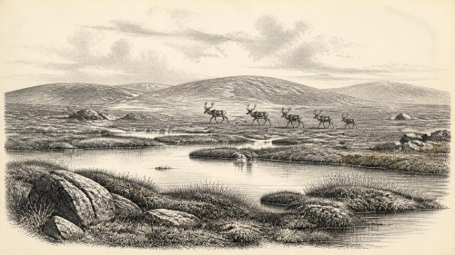
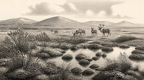
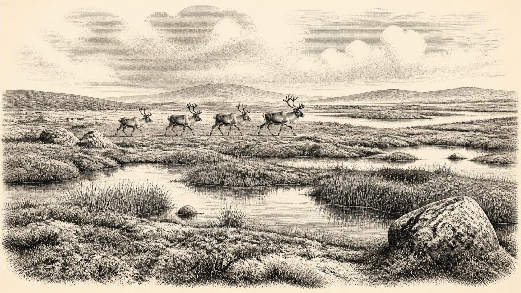
Derryvree is important because it contradicts the simple image of an Ireland permanently buried under ice. Its plant remains, pollen and insects indicate an open, treeless, periglacial environment. Grasses, sedges, juniper and herbs formed much of the vegetation, while mosses and aquatic or waterside plants occupied wet hollows. Insect evidence points to a muskeg-like setting: waterlogged ground with small open pools, decaying plant matter and mossy margins. The local landscape was not a forest, nor a temperate meadow resembling modern Fermanagh. It was a cold, exposed mosaic in which drainage, freezing and thawing mattered greatly.
This evidence supports a modest but important conclusion. At least locally, during the interval represented at Derryvree, water could remain available and plants, insects and other parts of a food web could flourish through short growing seasons. It does not prove that all Ireland had the same vegetation or climate. A deposit under one Fermanagh drumlin is a local archive, not an island-wide photograph. Yet it establishes that parts of the island contained active terrestrial and freshwater habitats during a middle phase of the last glaciation.
An Unstable Atlantic Climate
MIS 3 was marked across the North Atlantic region by abrupt shifts between relatively milder interstadials and colder stadials. Greenland ice-core records show that these transitions could be large and rapid on geological timescales. Their precise local expression in Ireland remains harder to reconstruct, but Derryvree’s wetland sequence belongs to this wider unstable climate system. A landscape could alter markedly over centuries and millennia as temperature, precipitation, sea ice, permafrost and the position of glacier margins changed.
At roughly 33,300 cal BP, Ireland was approaching the growth phase that culminated in the Last Glacial Maximum. Modern reconstructions of the British–Irish Ice Sheet begin at about 31,000 years ago and demonstrate how quickly ice expanded thereafter, but they should not be projected backwards too confidently onto every district at 33,300 cal BP. The Derryvree succession itself preserves the essential regional point: glaciation was episodic. Areas that had supported shallow freshwater and tundra vegetation could subsequently be overridden, buried and altered by ice. This repeated remodelling helps explain why the archaeological record is so sparse.
Castlepook’s Animal World
Far to the south, Castlepook Cave near Doneraile in north County Cork provides the principal Irish record of animal life broadly comparable with this interval. Also known as Mammoth Cave, it was excavated mainly in the early twentieth century and produced an extraordinary collection of Pleistocene bones. Later study and improved radiocarbon pretreatment have shown that some earlier dates were too young. Re-dating has placed elements of the fauna substantially earlier, within MIS 3, and has sharpened the case for a distinctive pre-Last Glacial Maximum Irish fauna.
The collection includes evidence for woolly mammoth, reindeer, giant deer, brown bear, wolf, foxes, mountain hare or Arctic hare, lemmings and spotted hyaena. The National Museum of Ireland’s Castlepook hyaena skull is an especially striking reminder that Ireland’s former animal communities were unlike those of the historic island. Large grazing and browsing animals imply open feeding country; predators and scavengers imply a food web capable, at times, of sustaining substantial carnivores. This was not a single, simultaneous ‘Ice Age menagerie’. Bones accumulated at different moments, and species may have used different habitats and routes. Their value lies in establishing the range of animals that reached Ireland during the broader period.
Caves Are Not Campsites
Castlepook also illustrates the limits of the evidence. Antiquarian excavations recovered major collections but did not apply the stratigraphic recording, sampling and dating standards expected today. Cave deposits can be disturbed by water, animal activity, collapse, digging and later mixing. A bone found in a cave need not mean that the animal lived there, died there, or arrived at the same time as every other specimen. Some animals may have used caves as dens or shelters; others may have been carried in by carnivores, moved by water or deposited through natural processes.
For that reason, Castlepook cannot safely furnish a detailed picture of daily life in 31,350 BCE. It does show that Ireland, or at least accessible parts of it, was ecologically connected to the changing animal world of Britain and continental north-west Europe. Lower global sea levels altered coastal geography and exposed more of the continental shelf than exists today, but a reduced sea level did not automatically create a simple dry-land route. Waterways, ice, tides, terrain and the timing of glacial advances all affected movement. The routes taken by any particular animal remain unknown.
The Human Question
A reindeer femur from Castlepook has made this period central to debate about Ireland’s earliest possible human activity. The bone has been reported as roughly 33,000 years old and bears a deep linear mark interpreted by zooarchaeologist Ruth Carden as damage made by a sharp stone implement while fresh bone was being processed. If that interpretation is confirmed, it would indicate a brief Upper Palaeolithic human encounter with a reindeer carcass in Ireland during MIS 3, far earlier than the island’s formerly accepted archaeological record.
But the distinction between possibility and proof is vital. A single modified bone is not a settlement. No securely associated stone-tool assemblage, hearth, dwelling, human remains, repeated occupation surface or permanent community has yet been demonstrated for Ireland at this date. Nor does the mark by itself identify the number, origins, language, kinship system or intentions of any people involved. Current work at Castlepook seeks surviving deposits and better context precisely because the old collection cannot answer all those questions. The evidence responsibly supports a hypothesis of fleeting human presence, not a populated Palaeolithic Ireland.
What Cannot Be Recovered
There is consequently no evidence from 31,350 BCE for political affairs, warfare between human groups, diplomacy, agriculture, livestock keeping, trade networks, monuments, formal burial practice or organised religion in Ireland. It would be misleading to fill such silences with analogies from later Irish prehistory or from better-preserved Upper Palaeolithic sites elsewhere in Europe. Reindeer and mammoth bones reveal animal ecology, not an Irish hunting economy; a possible cut-mark reveals an action, not a society.
Culture and learning are equally beyond direct recovery. If people did reach the island, they would have brought knowledge of movement, weather, food and stone technology developed in wider Upper Palaeolithic Europe. That is a reasonable contextual possibility, not evidence for a particular Irish tradition. The durable cultural achievement visible today is scientific: the painstaking re-examination of old museum collections, renewed cave excavation, radiocarbon measurement and environmental reconstruction are gradually turning fragments into a more reliable account.
A Landscape Before Oblivion
The period represented by 31,350 BCE was therefore one of environmental opportunity shadowed by climatic instability. Wetlands near Derryvree supported cold-adapted plant and insect communities. Open country elsewhere could sustain large herbivores and predators, as Castlepook’s fauna demonstrates. But advancing ice would later erase, bury or scatter much of the evidence, while sea-level and geographical change repeatedly reshaped possible connections with neighbouring lands. Ireland’s story here is not yet one of established communities. It is a story of tundra water, migrating animals, uncertain human traces and a landscape whose most revealing archives were hidden beneath later glacial deposits.
Primary Sources
- A Middle Midlandian Freshwater Series at Derryvree, Maguiresbridge, County Fermanagh, Northern Ireland
- Irish Pleistocene Biostratigraphy
- Figure 6.— The Subdivision of the Quaternary Period in Ireland
- A Reconsideration of the Radiocarbon Dating of the Marine Isotope Stage 3 Fauna from Southern Ireland
- The Irish Quaternary Fauna Project
- Spotted Hyena Skull
- 2022:564 – Castlepook Cave, Castlepook South, Cork
- Archaeology Research Excavation Grant 2022: Final Report
- Archaeological Heritage of County Cork
- Heritage Artefacts of County Cork
- Castlepook Caves
- The IntCal20 Northern Hemisphere Radiocarbon Age Calibration Curve (0–55 cal kBP)
- Growth and Retreat of the Last British–Irish Ice Sheet, 31,000 to 15,000 Years Ago: the BRITICE-CHRONO Reconstruction
- The Timing and Magnitude of the British–Irish Ice Sheet Between Marine Isotope Stages 5d and 2
- Growth and Retreat of the Last British–Irish Ice Sheet, 31,000 to 15,000 Years Ago: the BRITICE-CHRONO Reconstruction
- Dansgaard–Oeschger Events in Climate Models: Review and Baseline Marine Isotope Stage 3 Protocol
- Marine Isotope Stage 3 Sea Level Fluctuations: Data Synthesis and New Outlook
- The Island of Ireland: Drowning the Myth of an Irish Land-bridge?
- Ireland: Submerged Prehistoric Sites and Landscapes
- New Insights on the Fauna of Ireland’s Younger Dryas and Early Holocene from Alice & Gwendoline Cave