Derryvree’s Mossy Interlude31349 BCE
31,349 BCE is not a recoverable Irish historical year but a point within unstable Late Pleistocene MIS 3. At Derryvree, County Fermanagh, organic sediments between glacial tills record a locally ice-free, cold, wet, treeless landscape of freshwater pools, mosses, sedges, grasses, juniper and insects, later buried by ice. Comparable northern sites confirm alternating glacial conditions. Castlepook Cave, County Cork, preserves diverse Ice Age fauna, including mammoth and reindeer, while a possibly cut-marked reindeer bone suggests, but does not prove, human activity. No settlement or polity is evidenced. The date chiefly illuminates shifting habitats, uncertain chronologies and survival of environmental evidence.

Dateline
31,349 BCE is a modern chronological label, not a date that can be recovered as a particular year in Irish evidence. No people in Ireland kept a calendar of this kind; there are no written records, named communities, settlements or events that can be attached to it. At this depth of time, radiocarbon dates have broad uncertainties and require calibration. The responsible subject is therefore not an imagined episode in a single year, but Ireland during a wider Late Pleistocene interval that includes the notional date: Marine Isotope Stage 3 (MIS 3), in the last Ice Age.
In simple calendar arithmetic, the requested year lies roughly 33,300 years before AD 1950, the reference point conventionally used for ‘before present’ (BP). It falls within the broad calibrated age range often associated with the important Derryvree deposit near Maguiresbridge, County Fermanagh: approximately 36,900–31,700 calibrated years BP, or about 34,950–29,750 BCE. That range must not be mistaken for proof that the Derryvree wetland existed throughout every one of those years, still less that its fossils describe the weather on a particular day in 31,349 BCE. It is, however, unusually close and relevant evidence for the Irish landscape around this point.
A Wetland Between Ice Sheets
Derryvree is valuable because it preserves a sequence that later ice did not wholly destroy. Road works exposed fine sands, silts and organic-rich sediments within a drumlin, a streamlined hill made largely by glacial action. These freshwater deposits lay between two tills: unsorted sediments laid down by glacier ice. Their order is clear. An earlier glacial advance deposited the lower till; a period without local ice then allowed water, sediment, plants and insects to accumulate; later ice advanced again, sealing the wetland below another till.
The organic layer produced the radiocarbon determination BIRM-166, conventionally reported as 30,500 radiocarbon years BP with a large error margin. Calibration against changing past atmospheric radiocarbon levels translates such a result into a much broader and irregular calendar range. This is why a date such as 31,349 BCE should be used only as a waypoint within a long environmental history. It cannot identify an annual political, social or climatic occurrence.
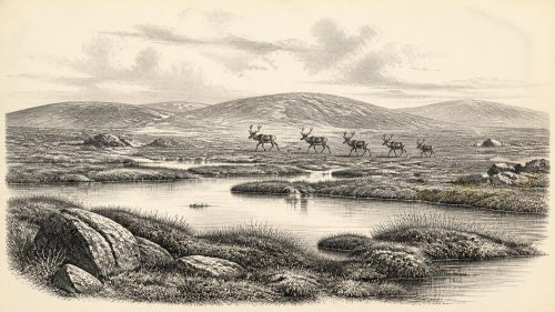
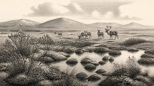
The contents of the Derryvree sediments provide the evidence. Pollen indicates vegetation dominated by grasses, sedges, juniper and herbs rather than woodland. Plant macrofossils include freshwater and wet-ground species, while the moss assemblage and insects add detail unavailable from pollen alone. Together they support the interpretation of a cold, largely treeless, waterlogged landscape, commonly described as tundra or muskeg-like ground: shallow pools and peaty, plant-rich hollows surrounded by open terrain. This was not the frozen, featureless island often imagined by later audiences. It was a changing periglacial environment in which liquid freshwater persisted locally during at least part of the year.
Similar evidence elsewhere in northern Ireland gives Derryvree a regional context. Inter-till organic deposits at Hollymount near Maguiresbridge, Greenagho near Belcoo and Aghnadarragh in County Antrim demonstrate that the Midlandian cold stage was not a single, uniform blanket of ice. Each site has its own chronology and limitations, and they should not be treated as one simultaneous landscape. Yet taken together they show alternating glacial and non-glacial conditions, with cold open environments surviving in intervals and places beyond the immediate reach of ice.
Cold Country, Not Permanent Ice
During MIS 3, climate in the North Atlantic region was highly unstable. Greenland ice-core records show abrupt swings between relatively milder interstadials and colder stadials on millennial timescales. The Irish record is too sparse and its dates too imprecise to assign Derryvree securely to one named Greenland event or to reconstruct a temperature for 31,349 BCE. What can be said is more modest: Derryvree documents a time when this part of Fermanagh was locally ice-free, cold and wet, before a later advance covered the deposit.
Much of Ireland’s familiar relief was being shaped by these repeated episodes of erosion, deposition and frost action. In exposed places, bare mineral ground, gravel, shallow soils and seasonally saturated hollows probably lay beside more sheltered moss and sedge communities. Winter conditions were severe; the fossil evidence points to northern, cold-adapted habitats. Summer growth, though brief, was sufficient to sustain freshwater plants and invertebrates. The contrast between a damp organic basin and nearby open ground helps explain why a single label such as ‘tundra’ should not be taken to mean one uniform vegetation cover.
The greatest expansion of the last British–Irish Ice Sheet came later, chiefly during MIS 2. Reconstructions differ in particulars, but the major Last Glacial Maximum belongs broadly to the period after this article’s horizon, rather than to 31,349 BCE itself. The crucial point is regional variation. Ice could advance, retreat or thin in different sectors at different times, while suitable habitat persisted temporarily elsewhere. A later ice sheet then removed or buried much of the evidence that might otherwise reveal the extent of these landscapes more clearly.
Animals at Castlepook
County Cork offers a separate, important window onto Late Pleistocene Ireland. Castlepook Cave, near Doneraile in the Awbeg Valley, has yielded a remarkable collection of animal remains from old excavations and more recent work. The collection includes bones attributed to woolly mammoth, reindeer, giant deer, brown bear, wolf, Arctic fox, hare, lemmings and spotted hyaena. Some direct dates show that members of this fauna were present in Ireland during broadly comparable parts of MIS 3.
Those bones establish that Ireland could support, or at least be reached by, a varied Ice Age fauna. Reindeer and mammoth imply open, productive grazing country at a landscape scale; predators and scavengers such as hyaenas point to food webs with substantial animal biomass. But the cave collection is not a census of one valley in one season. It was accumulated through animal activity, natural movement of bone, changing cave conditions and early twentieth-century excavation methods. Different specimens may be thousands of years apart. Castlepook therefore supports a general picture of Late Pleistocene fauna, not a precise reconstruction of Derryvree or a single living community in 31,349 BCE.
Nor should animal remains be turned automatically into a map of a continuous land bridge. Sea levels were lower than today during the Ice Age, but the changing geography of the Irish Sea and the routes by which animals reached the island remain complex. Evidence does not responsibly permit a claim that people or herds simply walked to Ireland across a known land connection at this precise time. The archaeological question is one of changing coasts, ice margins, sea levels and possible crossings, not a settled fact about one route.
The Human Question
Castlepook is also central to the debated possibility of an earlier human presence in Ireland. A reindeer femur from the cave has been reported as about 33,000 years old and bears a deep linear mark interpreted by zoologist Ruth Carden as damage made with a sharp stone implement, possibly during butchery. If that interpretation is confirmed, it would show that Upper Palaeolithic people handled a reindeer in Ireland during the Ice Age, far earlier than the long-established evidence for later hunter-gatherers.
The limits are as important as the possibility. A radiocarbon date on the femur dates the death of the reindeer, not necessarily the exact moment when its surface was marked. A mark must separately be distinguished from carnivore damage, trampling, excavation damage or other taphonomic processes. Above all, Castlepook has not yet produced a securely associated settlement surface, hearth, stone-tool assemblage, dwelling, burial or repeated occupation layer of this age. It cannot demonstrate a resident population, a named group, or a continuous human history on the island.
The secure published evidence for people in Ireland remains much later: a cut-marked brown-bear patella from Alice and Gwendoline Cave in County Clare, dated to the terminal Pleistocene at roughly 12,810–12,590 calibrated years BP. That comparison does not make the Castlepook claim unimportant. Rather, it explains why it is under careful scrutiny. Around 31,349 BCE, the most accurate formulation is that human presence is possible but unproven; sustained settlement is not evidenced.
No Polities, No Recorded Religion
There is consequently no evidence for political affairs, diplomacy, warfare, institutions, religion, learned traditions, trade networks or social ranks in Ireland at this time. These are not missing chapters awaiting the right king’s name; they are categories for which the surviving Irish record provides no direct basis. A possible short visit by mobile hunters would not, by itself, demonstrate a population large enough to maintain a territory, exchange system or ceremonial life on the island.
Equally, the absence of such evidence is not evidence that Upper Palaeolithic people elsewhere lacked culture. Across Europe, Homo sapiens communities made stone tools, tailored clothing, ornaments and images, and maintained social links across considerable distances. Yet it would be an error to project those better-documented continental practices onto Ireland without Irish artefacts or securely dated occupation deposits. For this island, everyday life can only be described through the environmental conditions that any visitor or animal had to negotiate: cold seasons, open ground, wet hollows, large herbivores, predators and a landscape liable to be transformed by renewed glaciation.
What This Date Can Mean
The historical importance of 31,349 BCE lies not in an invented Irish event but in the rare survival of evidence from a world largely erased by later ice. Derryvree shows freshwater, mosses, sedges, insects and open vegetation persisting in Fermanagh during a cold MIS 3 interval. Castlepook confirms an Ice Age fauna in Cork and preserves a provocative, unresolved sign of possible human activity. Together they replace a simplistic image of an entirely ice-covered, lifeless Ireland with a more compelling and cautious one: a region of shifting habitats on the margin of ice, briefly hospitable in places, but without a recoverable year-by-year human narrative.
Primary Sources
- Early Midlandian–Middle Midlandian, Pleistocene, Northern Ireland
- The Quaternary of Fermanagh
- The Quaternary of Ireland: A Field Guide
- Exploring Controls of the Early and Stepped Deglaciation on the Western Margins of the British–Irish Ice Sheet
- Growth and Retreat of the Last British–Irish Ice Sheet, 31,000 to 15,000 Years Ago: The BRITICE-CHRONO Reconstruction
- Extent and Deglacial Chronology of the Last British–Irish Ice Sheet: Implications of Exposure Dating Using Cosmogenic Isotopes
- Episodic Speleothem Deposition Tracks the Terrestrial Impact of Millennial-Scale Last Glacial Climate Variability in SW Ireland
- Spatio-Temporal Dynamics of Speleothem Growth and Glaciation in the British Isles
- The IntCal20 Northern Hemisphere Radiocarbon Age Calibration Curve (0–55 cal kBP)
- The IntCal20 Approach to Radiocarbon Calibration Curve Construction: A New Methodology Using Bayesian Splines and Errors-in-Variables
- A Middle Midlandian Fresh-Water Series at Derryvree, Maguiresbridge, County Fermanagh, Northern Ireland
- Middle Midlandian Interstadial Deposits at Greenagho, Near Belcoo, County Fermanagh, Northern Ireland
- Freshwater Organic Deposits and Stratified Sediments Between Early and Late Midlandian (Devensian) Till Sheets, at Aghnadarragh, County Antrim, Northern Ireland
- The Quaternary History of Ireland
- Irish Pleistocene Biostratigraphy
- The Irish Quaternary Fauna Project
- Heritage Artefacts of County Cork
- Archaeological Heritage of County Cork
- 32564: Castlepook Cave, County Cork
- The Problem of a Late Quaternary Landbridge Between Britain and Ireland
- First Evidence of a Late Upper Palaeolithic Human Presence in Ireland
- First Evidence of a Late Upper Palaeolithic Human Presence in Ireland
- New Insights on the Fauna of Ireland’s Younger Dryas and Early Holocene from Alice & Gwendoline Cave
- Introduction to the Late Quaternary and Holocene of Northern Ireland