Maguirebridge’s Tundra Waters31240 BCE
31,240 BCE denotes a broad Late Pleistocene dating window, not a recoverable Irish calendar year. Freshwater sediments buried between tills at Derryvree, near Maguiresbridge, indicate a locally ice-free, treeless tundra mosaic of pools, sedges, mosses and sparse plants during unstable cold conditions. The growing British–Irish Ice Sheet altered landscapes and coastlines, while connections beyond Ireland remain uncertain. Castlepook Cave’s mixed, disturbed fauna, including mammoth, reindeer and predators, demonstrates varied cold-country habitats but not a single contemporaneous community. A possibly butchered reindeer bone may indicate brief human presence, yet lacks associated artefacts. Evidence securely supports ecological reconstruction, not conventional human history.
Dateline
31,240 BCE is a modern calendar label, not a recoverable year in Ireland’s archaeological record. It falls roughly 33,200 years before the conventional radiocarbon reference year of AD 1950, in the Late Pleistocene and within Marine Isotope Stage 3. Neither written testimony, dated settlement layers nor annual natural archives permit history at calendar-year resolution here. The responsible approach is therefore to examine evidence whose calibrated ranges overlap this point: buried freshwater sediments at Derryvree near Maguiresbridge in County Fermanagh, cave faunas in County Cork, and the wider reconstruction of growing ice across Ireland and Britain.
What emerges is not a tale of Irish kingdoms, named peoples or a fixed population. It is a portrait of a cold and unstable landscape, locally capable of sustaining plants and animals, while increasingly vulnerable to renewed glaciation. Whether people briefly entered that landscape remains an important but unresolved question. The evidence is unusually evocative precisely because it is so sparse.
Dating a Cold Interval
The label 31,240 BCE should not be confused with a precise environmental moment. Radiocarbon years, calendar years and geological phases are different measures. A radiocarbon determination from the key Derryvree deposit, BIRM-166, was published as 30,500 years BP, with an uncertainty of approximately a thousand years. Subsequent discussions have placed its calibrated span broadly around 36,900–31,700 calendar years BP. That wide interval overlaps the date considered here, but it does not prove that every plant, insect or sediment in the deposit belongs to 31,240 BCE itself.
Such qualifications matter. Ice-age climates changed abruptly on scales of centuries and millennia; deposits may accumulate over long periods; and later ice, floodwater and frost can disturb older materials. Ireland’s Late Pleistocene chronology has also been revised repeatedly as radiocarbon techniques, calibration curves, ice-sheet modelling and re-examination of museum collections have improved. A year-by-year article at this depth must therefore describe a dated window rather than claim an event.
A Freshwater Bed Beneath the Drumlin
Derryvree is the strongest environmental witness close to this date. In 1969, road works cut through a drumlin two kilometres north-east of Maguiresbridge. Between two substantial sheets of glacial till lay silts and fine sands formed in freshwater conditions. The organic layers preserved pollen, plant macrofossils, mosses and invertebrate remains. Because later glacier ice deposited till both below and above the freshwater series, the exposure records an interval when this part of Fermanagh was not buried beneath ice.
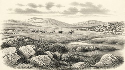
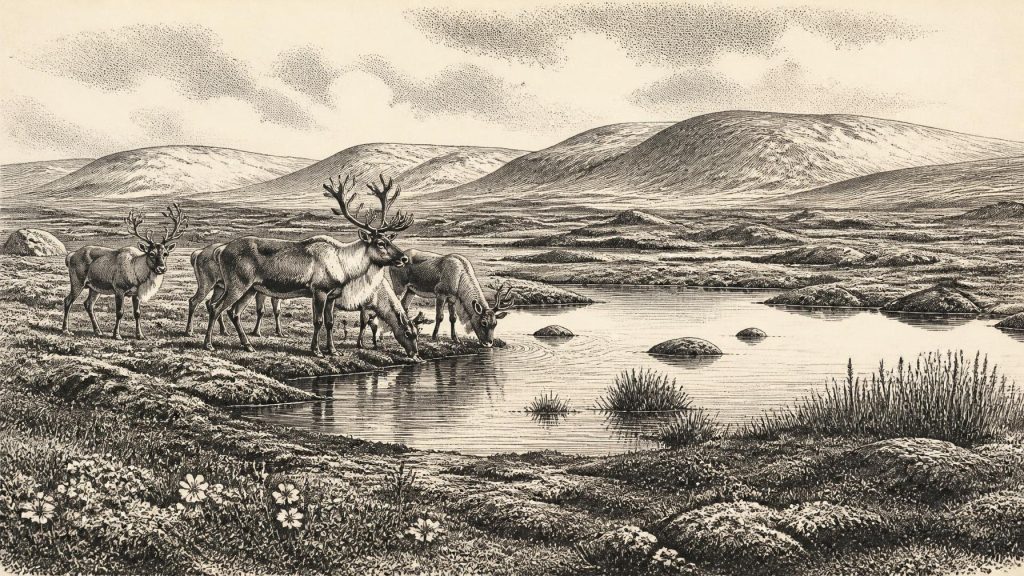
The assemblage indicated treeless, open tundra and a periglacial regime: a severe climate in which freezing and thawing shaped ground and shallow waters. Mosses, sedges and small herbaceous plants could colonise saturated hollows and exposed mineral soils. Fossils associated with cold, wet ground and freshwater settings—including bogbean and water-milfoil—show that this was not a uniform desert of snow and stones. Pools, sedge margins, mossy ground and sparsely vegetated drier patches formed a shifting mosaic.
There is an important distinction between evidence and reconstruction. The fossils directly demonstrate that particular plants and small animals lived or were deposited in and near freshwater at Derryvree. Calling the wider setting a tundra wetland is an interpretation, albeit a well-supported one, drawn from their ecological requirements and from the sediments enclosing them. It does not entitle us to picture every valley in Ireland in the same way. Local relief, drainage, proximity to ice and season all mattered.
Ice, Water and a Changing Coastline
At this time the British–Irish Ice Sheet was building towards its later maximum, rather than sitting in a single unchanging configuration. Major syntheses place the principal build-up after roughly 35,000–32,000 years ago, with extensive maximum ice much later, approximately 27,000–21,000 years ago. More recent reconstructions emphasise that expansion was asynchronous: separate sectors advanced, retreated and reorganised at different times. The Derryvree sequence is especially valuable because it provides terrestrial evidence for a local ice-free interval amid that complicated history.
For people living in the modern island, it is tempting to ask whether Ireland was then joined to Britain or mainland Europe. Lower global sea levels exposed more continental shelf than today, but the changing Irish Sea basin cannot responsibly be reduced to a simple, proven land bridge. Animal colonisation demonstrates connectivity of some sort over long periods, not the exact route taken in any particular generation. Ice margins, sea crossings, exposed coastal plains and possible short-lived corridors remain matters for scientific reconstruction, not settled facts.
Nor did “Ireland” have its modern shorelines. The Atlantic shelf, river mouths and lowlands were differently arranged as sea level fell, land rose or sank under ice loading, and glaciers altered drainage. The familiar counties and towns are used only to locate evidence. Derryvree and Castlepook were not places in a political landscape; they were portions of a wider north-west European ecological frontier.
Animals at Castlepook
The most striking Irish animal evidence comes from Castlepook Cave, also known as Mammoth Cave, near Doneraile in north Cork. Excavations from the early twentieth century recovered a large and now incomplete collection of bones from cave sands and chambers. The surviving fauna includes reindeer, woolly mammoth, brown bear, giant deer, wolf, Arctic fox, lemmings and spotted hyaena. These finds demonstrate that, during parts of the Middle and Late Midlandian cold stage, Ireland supported or received a fauna very different from that of the present day.
Yet Castlepook must not be treated as a snapshot. Bones span a long period, later water movement disturbed deposits, and many early excavations did not meet modern standards of stratigraphic recording. Individual radiocarbon dates establish the ages of individual specimens, not an instant when all listed species shared one valley. Reassessment of radiocarbon samples has moreover suggested that some apparently younger dates were affected by contamination and that giant deer and spotted hyaena may have disappeared locally well before the Last Glacial Maximum. A hyaena was therefore not necessarily roaming Cork at the precise date represented by 31,240 BCE.
The cave nonetheless conveys the character of the available habitats. Reindeer and mammoth are consistent with open, productive cold-country landscapes; brown bear, wolf and hyaena point to a food web able to sustain large carnivores and scavengers. Carnivores themselves helped create the archive, carrying prey remains into sheltered spaces. Castlepook was probably less a settlement site than a repeatedly used natural repository, perhaps including a den in some phases. Its evidence tells us more securely about animal presence and cave processes than about a single coherent community.
The Uncertain Human Trace
A reindeer femur from Castlepook has attracted exceptional attention because it has been reported as roughly 33,000 years old and as bearing a deep mark interpreted as stone-tool damage made during butchery. If that interpretation survives full specialist scrutiny, it would represent Ireland’s earliest known indication of human activity by a very large margin. It would suggest that Upper Palaeolithic hunter-gatherers reached, or at least briefly visited, the western edge of the European landmass during an ice-age interval.
It cannot, however, establish a resident population, a camp, an ancestry or an Irish “first people”. There are no securely associated stone tools, hearths, dwellings, burials or repeatedly occupied surfaces of this age in Ireland. Bone-surface marks require taphonomic assessment because trampling, breakage, carnivore activity and sediment abrasion can sometimes resemble human modification. The 2022 investigation at Castlepook located surviving deposits and recovered fauna, but found no cultural artefacts. The right conclusion is neither dismissal nor certainty: the bone is a serious and potentially transformative claim, but still a solitary one.
Life Without Institutions
No political affairs, diplomacy, leadership structures or organised warfare can be identified for Ireland around this date. There are no names, monuments, boundaries, settlements or artefact assemblages from which to infer them. If people did enter the island, comparison with Upper Palaeolithic societies elsewhere suggests small mobile groups dependent on knowledge of terrain, weather, animal behaviour and seasonal resources. That comparison may help frame possibilities; it is not direct Irish evidence.
The same restraint applies to economy, trade, learning and religion. Reindeer carcasses could have supplied meat, hide, sinew, bone and fat, but no Irish assemblage demonstrates how such materials were processed, shared or exchanged at this time. No ritual place, image, grave or symbolic object can be assigned to 31,240 BCE in Ireland. The most defensible cultural history is one of practical environmental knowledge potentially carried by mobile visitors, not of institutions that can be named or mapped.
The major development was environmental rather than political: an Ireland of cold freshwater hollows and open ground was entering a phase in which advancing ice would become increasingly decisive. Derryvree preserves a moment when life persisted between glacial advances. Castlepook preserves animals whose remains survived chance deposition, excavation and later scientific reassessment. Together they show that Ireland was neither an empty abstraction nor a knowable human society. It was a changing Ice Age landscape, rich in ecological possibility but poor in the durable evidence from which conventional history is made.
Primary Sources
- A Middle Midlandian Freshwater Series at Derryvree, Maguiresbridge, County Fermanagh, Northern Ireland
- Quaternary Deposits and Glacial Stratigraphy in Ireland
- The Irish Quaternary Fauna Project
- A Reconsideration of the Radiocarbon Dating of the Marine Isotope Stage 3 Fauna from Southern Ireland
- Extent and Timing of the Last Glacial Maximum (LGM) in Britain and Ireland: A Review
- Growth and Retreat of the Last British–Irish Ice Sheet, 31 000 to 15 000 Years Ago: the BRITICE-CHRONO Reconstruction
- Early Deglaciation of the British-Irish Ice Sheet on the Atlantic Shelf Northwest of Ireland Driven by Glacioisostatic Depression and High Relative Sea Level
- Exploring Controls of the Early and Stepped Deglaciation on the Western Margin of the British-Irish Ice Sheet
- BRITICE Glacial Map, Version 2: A Map and GIS Database of Glacial Landforms of the Last British–Irish Ice Sheet
- Pattern and Timing of Retreat of the Last British-Irish Ice Sheet
- New Data for the Last Glacial Maximum in Great Britain and Ireland
- Cork County Geological Site Report: Castlepook Cave
- Spotted Hyena Skull
- 2022:564 – Castlepook Cave, Castlepook South, Cork
- The Exploration of Castlepook Cave, Co. Cork. With 3 Plates
- Proceedings of the Royal Irish Academy: The Exploration of Castlepook Cave, County Cork
- Palaeoecology
- Figure 6.— The Subdivision of the Quaternary Period in Ireland
- Archaeological Heritage of County Cork
- Heritage Artefacts of County Cork
- The Mesolithic in Ireland: When Was It?
- Could Brown Bears (Ursus arctos) Have Survived in Ireland During the Last Glacial Maximum?
- Stoats (Mustela erminea) Provide Evidence of Natural Overland Colonization of Ireland
- New Insights on the Fauna of Ireland's Younger Dryas and Early Holocene from Alice & Gwendoline Cave