

Derryvree’s Arctic Waterline31271 BCE
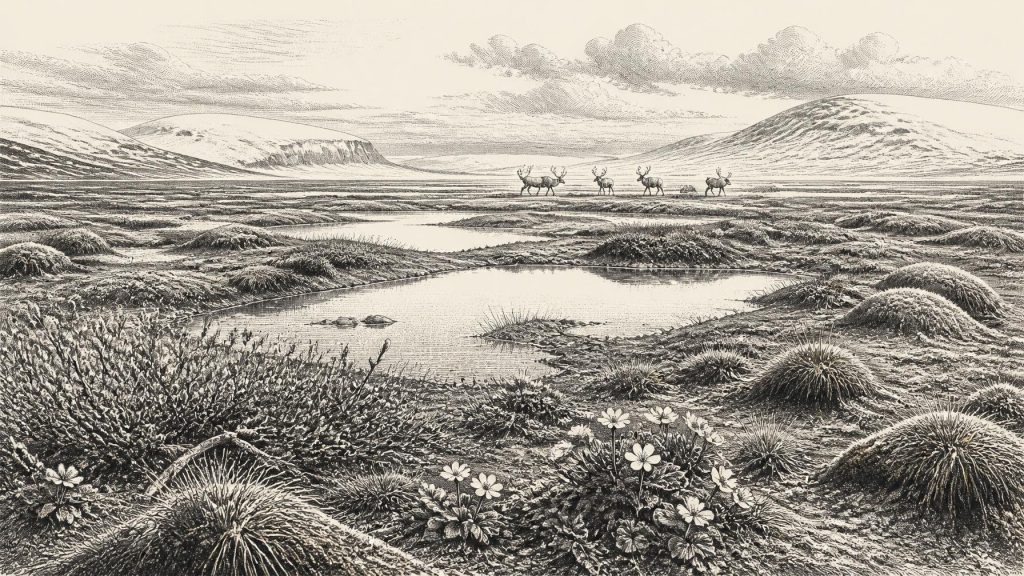
31,271 BCE is not a recoverable Irish year but falls within Marine Isotope Stage 3, before the Last Glacial Maximum. At Derryvree, County Fermanagh, sediments between glacial tills record wetlands during an ice-free interval, dated broadly to 34,950–29,750 BCE. Plant and insect remains indicate cold, open tundra-like terrain with wet habitats. Ireland supported varied fauna, including reindeer, giant deer, mammoth and predators, though species were not necessarily contemporaneous. Castlepook Cave offers a stone-tool butchery mark on reindeer bone, suggesting fleeting human activity, not settlement. Ice margins, sea levels and access routes changed; no evidence supports societies, farming, trade or beliefs.
Dateline
The label 31,271 BCE gives a useful position on a modern timeline, but it must not be mistaken for a recoverable year in Ireland’s human past. No calendar used on the island can be projected so far back, and neither archaeology, radiocarbon dating nor palaeoclimate evidence can identify an occurrence in this particular twelve-month period. The responsible subject is therefore Ireland during the broad interval in which this nominal date falls: the Late Pleistocene, within Marine Isotope Stage 3 (MIS 3), before the Last Glacial Maximum.
This was not the familiar green and wooded island of later prehistory. It was a changing northern landscape in which ice, bare ground, shallow freshwater, tundra vegetation and mobile animal populations all mattered. Much of the evidence is fragmentary because subsequent glaciers eroded, rearranged or buried older deposits. Yet a handful of sites, especially Derryvree near Maguiresbridge in County Fermanagh and Castlepook Cave near Doneraile in County Cork, permit a cautious reconstruction. They illuminate episodes and environments, not a national narrative or an event dated precisely to 31,271 BCE.
Dating a Buried Landscape
The nearest valuable environmental archive is Derryvree, where roadworks in 1969 cut through a drumlin and revealed sands, silts and organic sediments between two tills. Till is the unsorted debris deposited by moving glacier ice. The sequence matters as much as any individual specimen: an earlier ice advance left the lower till; freshwater and wetland deposits accumulated during a non-glacial interval; a later glacier overrode and sealed them beneath more till. It is an unusually clear demonstration that this locality had a period of open water and wet ground between episodes of glaciation.
Organic material from the Derryvree deposits produced a conventional radiocarbon determination of about 30,500 ± 1,200 radiocarbon years before present. Calibrated estimates published in discussions of the sequence place it broadly around 36,900–31,700 calendar years BP, or approximately 34,950–29,750 BCE. The modern label 31,271 BCE lies within that broad span. It does not, however, date a particular pool, plant, insect or season, still less establish that all Ireland shared Derryvree’s conditions at that instant. Radiocarbon ages require calibration because atmospheric carbon-14 has varied through time, and uncertainties at this depth of time are substantial.
Derryvree is consequently evidence for a local landscape during a lengthy cold-stage interval, rather than a photograph of the whole island. It nonetheless makes an essential point: around the notional date, at least parts of north-central Ireland could sustain freshwater habitats between glacial advances. The island’s Ice Age history was not a simple alternation between total ice cover and temperate forest. It included shifting margins, cold but productive refuges, wetlands and open ground.
Wetland Amid Open Tundra
The plant and animal remains in the Derryvree organic beds suggest cold, treeless or very sparsely wooded country. Mosses, sedges and other herbaceous plants were suited to wet soils, while records cited from the deposits include cold-adapted species such as mountain avens, dwarf willow and juniper. These remains support an interpretation of low, open vegetation with damp hollows, shallow pools and patches of more sheltered growth. They do not justify imagining a uniform carpet of tundra from Cork to Donegal. Topography, exposure, drainage and proximity to ice would have made conditions highly local.
Insects and plant macrofossils are especially valuable because they record habitats at a finer scale than a general statement about climate. A wetland basin could preserve aquatic or waterside plants even while surrounding slopes remained dry, frost-shattered and exposed to severe winds. Such a setting offered seasonal resources: edible plants for animals, water, sheltered ground and perhaps corridors along valleys. It would still have been a demanding place, with short growing seasons and abrupt climatic shifts characteristic of the North Atlantic during MIS 3.
There is no evidence for cultivated fields, livestock, houses, monuments, pottery, textile production or managed woodland. None should be inferred from the presence of wetland vegetation. The Derryvree record predates Ireland’s securely attested farming communities by tens of millennia and even precedes the island’s demonstrable long-term human settlement by a vast interval.
Animals at the Western Edge
The Irish Quaternary Fauna Project and subsequent re-dating work show that Ireland supported a more varied mammal fauna during parts of MIS 3 than older accounts once allowed. Cave and other deposits have yielded evidence from different phases for reindeer, giant deer, brown bear, wolf, Arctic fox, hare, spotted hyaena and woolly mammoth. These animals were not necessarily contemporaries at every site, nor did every species occupy every region simultaneously. Their dated bones instead demonstrate repeated animal access to Ireland before the Last Glacial Maximum.
Castlepook Cave is central to this picture. Its faunal collection was assembled largely through early twentieth-century excavations and comes from deposits whose original layers were disturbed or incompletely recorded. Modern ultrafiltration and accelerator radiocarbon dating have shown that several southern Irish cave bones are older than earlier conventional dates suggested. That revision has strengthened the case for a pre-Last Glacial Maximum fauna, while also making clear why individual cave finds must be handled carefully: bones may have been moved by carnivores, water, excavation or later disturbance.
Reindeer are particularly evocative, but they should not be made into a symbol of a settled ‘reindeer people’ in Ireland. Herds may have entered during favourable windows, following open-country forage across landscapes that differed sharply from the later island. Predators could have followed them. A cave containing animal bone was not automatically a human camp; it may have been a carnivore den, a trap, a place where remains washed in, or some combination of these processes over thousands of years.
Ice, Sea and Changing Connections
At this time the British–Irish Ice Sheet was developing towards its later maximum, but its build-up was neither instantaneous nor spatially uniform. Research on Derryvree, Greenagho and western Irish landforms indicates that some areas retained ice-free or less heavily glaciated intervals before the fullest Last Glacial Maximum conditions. Large-scale reconstructions are strongest for the period from roughly 31,000 calendar years BP onwards; they show a dynamic ice sheet whose advancing and retreating margins transformed drainage, sediment movement and access to habitats.
It would be wrong to state that Ireland was wholly ice-free in 31,271 BCE, or wholly covered by ice. The evidence supports a mosaic interpreted from deposits of different ages and places. Derryvree records freshwater conditions in Fermanagh during one interval; mountain trimlines, tills, offshore sediments and exposure dates constrain ice elsewhere and often later. The later Last Glacial Maximum, conventionally placed at about 26,000–20,000 years ago, would erase or conceal much of the evidence from the preceding period.
Sea levels were lower than today because much water was stored in continental ice sheets. That changed the configuration of coasts and shallow seas, but it does not permit a simple claim of a dry land bridge from Ireland to Britain at this date. Connections and barriers varied with sea level, ice extent, marine channels and the practical realities of traversing cold terrain. For large mammals, intermittent dispersal routes are a reasonable interpretation; for people, the evidence is much less secure.
The Human Question at Castlepook
A fragment of reindeer femur from Castlepook has attracted attention because it bears a deep mark interpreted by its analyst as damage made with a sharp stone tool during fresh-bone butchery. It has been associated in heritage publications with an age of about 33,000 BCE. If that interpretation and chronological association are sustained, it would be an exceptionally early indication that one or more people handled a reindeer carcass in Ireland during the Upper Palaeolithic.
The limits are crucial. The bone comes from an antiquarian cave collection rather than a modernly excavated occupation surface. No stone tool has been found in direct association with it; nor is there a securely associated hearth, shelter, food-processing area, human bone or repeated set of butchery marks. The mark cannot tell us whether people killed the animal, scavenged it, or processed it elsewhere before carnivores or natural processes brought the bone into the cave. The National Museum of Ireland accordingly continues to describe clear evidence for Palaeolithic human presence as absent.
Thus the most careful conclusion is not that Ireland possessed a population, tribe, polity or permanent settlement in 31,271 BCE. It is that Castlepook raises a serious possibility of fleeting human activity during a period when reindeer and other cold-stage animals reached the island. Any visitors would probably have been highly mobile foragers using perishable gear and stone tools, but even that is an inference from wider Upper Palaeolithic Europe rather than something demonstrated by an Irish settlement.
No Kingdoms, No Recorded Beliefs
Political affairs, diplomacy and organised warfare cannot be recovered for Ireland at this date. There are no documents, named groups, forts, graves, weapons assemblages or settlement plans from which institutions or conflicts could responsibly be inferred. Equally, there is no evidence for formal religion, ritual monuments, art traditions or systems of learning on the island. Silence in the record is not proof that no person ever travelled there; it is a warning against supplying stories that the evidence cannot bear.
Nor is there evidence for trade in the usual historical sense. The movement of animals and the possible movement of people across changing western European landscapes are not evidence for exchange networks, commerce or diplomatic contact. The most meaningful ‘economy’ visible here is ecological: plants captured energy during short summers; herbivores converted it into meat and hides; predators and scavengers exploited herds and carcasses; ice and meltwater repeatedly altered the ground on which all moved.
What This Date Can Mean
For Ireland, 31,271 BCE is best understood as a point within a long environmental interval rather than a year of recorded history. Derryvree preserves the strongest local testimony: an Arctic-alpine wetland existed between glacial episodes in Fermanagh. Castlepook demonstrates that an unexpectedly rich fauna reached southern Ireland and preserves a provocative, still limited possible trace of human carcass processing. Together they replace an empty Ice Age map with a more complicated one—one of water, vegetation, animals, unstable ice margins and perhaps occasional people at Europe’s north-western edge.
Primary Sources
- The Irish Quaternary Fauna Project
- A reconsideration of the radiocarbon dating of the Marine Isotope Stage 3 fauna from southern Ireland
- Trimlines, blockfields and the vertical extent of the last ice sheet in southern Ireland
- Dimensions and chronology of the last ice sheet in Western Ireland
- Oscillating retreat of the last British-Irish Ice Sheet on the continental shelf offshore Galway Bay, western Ireland
- The timing and magnitude of the British–Irish Ice Sheet between Marine Isotope Stages 5d and 2: implications for glacio-isostatic adjustment, high relative sea levels and ‘giant erratic’ emplacement
- Growth and retreat of the last British–Irish Ice Sheet, 31,000 to 15,000 years ago: the BRITICE-CHRONO reconstruction
- Project findings provide essential insight into the last British–Irish ice sheet
- BRITICE-CHRONO: Project introduction
- BRITICE-CHRONO: Aims, hypotheses and outcomes
- BRITICE-CHRONO (BRT) Multibeam, Geophysical and Sampling Survey 2014/6_JC106: BRITICE CHRONO (part 1): Irish Sea
- Irish Quaternary Association Field Guide 16: Fermanagh
- Figure 6—The subdivision of the Quaternary Period in Ireland
- The Stratigraphic Position and Age of the Gortian
- Prehistoric Details
- Guide to the National Museum of Ireland
- Heritage Artefacts of County Cork
- Archaeology Research Excavation Grant 2022
- New insights on the fauna of Ireland’s Younger Dryas and Early Holocene from Alice & Gwendoline Cave
- The IntCal20 Northern Hemisphere Radiocarbon Age Calibration Curve (0–55 cal kBP)
- Advances in Irish Quaternary Studies
- The Quaternary History of Ireland








