BIRM-166’s Sedge Catalogue30477 BCE
30,477 BCE is not a recoverable Irish year but falls within a broad radiocarbon interval represented by Derryvree, County Fermanagh. There, freshwater silts between glacial tills, including sample BIRM-166, record a temporary cold, open wetland landscape of sedges, mosses, herbs, dwarf willow and juniper before renewed ice advance. Elsewhere, changing ice conditions varied regionally. Castlepook Cave’s long faunal sequence demonstrates that mammoth, giant deer, reindeer and predators occupied southern Ireland at differing times, not necessarily together. No secure evidence establishes human settlement then; a possibly cut-marked reindeer bone remains uncertain. The article therefore reconstructs environment, not political or social history.

Dateline
“30,477 BCE” is a modern chronological label, not a year for which Ireland has a recoverable diary of events. It lies roughly 32,426 years before AD 1950, the conventional reference point for radiocarbon dating, but no Irish deposit can responsibly be assigned to that individual calendar year. There were no written records, named communities or dated political events. The evidence instead comes from geological layers, fossil plants, insects and animal bones whose ages are expressed as measurements with margins of error and, where possible, as broad calibrated ranges. Around this point in the Late Pleistocene, Ireland was part of a severely cold, unstable north-west European world moving towards the Last Glacial Maximum.
A Range Rather Than a Year
The closest especially informative Irish archive is at Derryvree, near Maguiresbridge in County Fermanagh. Road works in 1969 cut through a drumlin and exposed an extraordinary sequence: a lower sheet of glacial till, freshwater silts and fine sands containing organic remains, and a later upper till. The order is important evidence in itself. Glacier ice had first laid down debris at the site; afterwards, a non-glacial interval allowed water, mud and living things to accumulate in a basin; later ice advanced again and buried the record beneath more till. This is not evidence for a settlement, but for changing conditions in one small part of Ireland.
An organic sample from the Derryvree freshwater deposits, BIRM-166, yielded a conventional radiocarbon age of 30,500 years BP, with a substantial uncertainty of +1,170 and −1,030 years. Published calibrations have placed the relevant interval broadly at about 36,900–31,700 calibrated years BP. The modern label 30,477 BCE falls within that wide window, but it does not identify a particular season, generation or moment in the deposit’s formation. Calibration curves are periodically improved as new atmospheric and geological records are incorporated. The honest historical conclusion is therefore limited but valuable: Derryvree illuminates an interval relevant to this date, not the date itself.
Water Between the Ice Advances
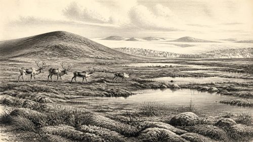
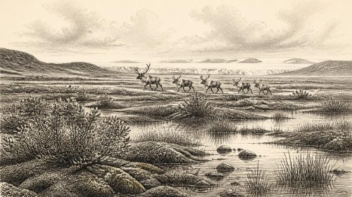
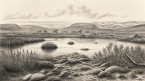
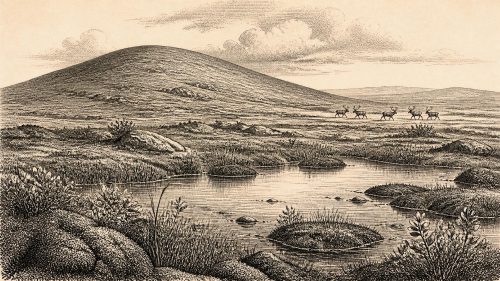
The Derryvree silts preserve a landscape very unlike modern Ireland, though not simply a featureless white desert. Freshwater mosses and sedges, along with pollen and insect evidence, indicate cold, open ground around standing or slow-moving water. Plant remains associated with the sequence include aquatic and wetland species, while low woody plants such as dwarf willow and juniper indicate that sheltered patches could support more than bare mineral soil. Grasses, herbs, mossy margins and shallow pools would have made a varied tundra or tundra-steppe mosaic. Trees, however, were absent or exceedingly scarce; there was no closed woodland comparable with later post-glacial Ireland.
Such a setting would have changed sharply across short distances. A pool edge, seep, sheltered hollow or south-facing slope could sustain plant cover and insects during the growing season, while exposed ridges suffered wind, frost and seasonal thaw. The sediments do not permit a precise reconstruction of temperature, snowfall or the position of every glacier front in 30,477 BCE. They do demonstrate that north-central Ireland was not continuously smothered by ice throughout the earlier part of the last glaciation. Equally, the two tills enclosing the freshwater bed show that this locally productive world was temporary. It was eventually overridden or buried as ice conditions returned.
An Island of Moving Ice
Ireland’s wider glacial history cautions against drawing a single all-island map from Fermanagh. Other sites, including Greenagho near Belcoo and Hollymount near Maguiresbridge, also preserve evidence for cold, non-glacial intervals, but their chronologies and environments are not identical. Ice, snowfields, exposed ground, river valleys and temporary wetlands varied by region and through time. Large modern reconstructions of the British–Irish Ice Sheet show major ice-sheet growth from about 31,000 years ago, with expansion towards the Last Glacial Maximum. That broad trend is well supported; its exact local expression in any Irish valley at this nominated BCE year is not.
Ice was also an agent of historical loss. Later glaciers eroded soils, shifted sediments and scoured away many surfaces on which people or animals might once have left traces. This helps explain why Ireland has a sparse Upper Palaeolithic archaeological record compared with parts of Britain and continental Europe. Absence of evidence is not proof that no person ever crossed the region in this long period. Yet erosion is not a licence to turn possibility into fact. What survives must set the limits of the story.
Castlepook’s Long Faunal Record
For animal life, Castlepook Cave near Doneraile in north County Cork is indispensable. Also called Mammoth Cave, it has produced more than 2,000 bones and is Ireland’s richest vertebrate archive for the period leading up to the Last Glacial Maximum. Direct radiocarbon dates from individual bones span a long interval, approximately 45,700 to 19,950 radiocarbon years BP. The assemblage includes woolly mammoth, giant deer, reindeer, brown bear, wolf and spotted hyaena, with Arctic fox and lemmings among later cold-stage material. Reindeer and giant deer specimens have dates plausibly relevant to the broad period under discussion.
That does not mean all these creatures met one another, or that Castlepook presents a single living community at 30,477 BCE. Cave deposits accumulated over millennia and were disturbed by water, excavation and animal activity. Spotted hyaenas may themselves have carried prey remains into the cave. The bones nevertheless establish an important point: southern Ireland could sustain, at different times in Marine Isotope Stage 3, a substantial cold-climate mammal fauna. Grazers and browsers exploited open vegetation; large predators and scavengers followed them. The Irish landscape was ecologically connected to neighbouring lands during intervals when animal movement was possible, even though its exact routes and timing remain matters for research.
The Human Question
There is no securely excavated house, hearth, stone-tool assemblage, burial, artwork or occupation floor in Ireland that can be assigned to this period. A reindeer femur from Castlepook has been reported as bearing a possible mark made by a stone tool and has attracted attention as a potential indication of human butchery around 33,000 years ago. It is a significant lead, but it cannot yet demonstrate a resident population, a named archaeological culture, or even a particular visit in 30,477 BCE. The bone derives from older cave investigations, rather than a modern, securely associated occupation context; the relationship between the mark, the bone’s date and human action requires continuing specialist scrutiny.
The firmer peer-reviewed evidence for people in Ireland remains much later: a butchered brown-bear bone from Alice and Gwendoline Cave, County Clare, dated to roughly 12,810–12,590 calibrated years BP. It proves Late Upper Palaeolithic human activity after the Last Glacial Maximum, not an unbroken human presence from the earlier cold stages. Accordingly, it would be irresponsible to populate Ireland in 30,477 BCE with established hunting bands, to name their language or ancestry, or to attach them to later Irish peoples. At most, Castlepook raises the possibility of brief Upper Palaeolithic human contact with this changing faunal landscape.
What Cannot Be Recovered
Political affairs, diplomacy and warfare leave no identifiable evidence for Ireland at this depth of time, because no securely attested human society can be reconstructed here. Nor is there evidence for farming, stock-keeping, trade networks, permanent villages, ritual monuments, formal religion or systems of learning. The wetland plants and cave fauna reveal conditions in which animals lived, fed, migrated and died; they do not reveal human institutions. Even a genuine butcher’s mark would indicate a practical encounter with an animal, not a settlement hierarchy or a territorial order.
Everyday life can therefore be described only negatively and conditionally. If people did enter Ireland during one of these earlier windows, they would have faced an exposed, seasonal and dangerous environment, where knowledge of animal movements, shelter and changing ice would have been essential. That is an inference from climate and ecology, not direct evidence from an Irish camp. The strongest historical development appropriate to this date is environmental: a cold but locally living landscape, documented in freshwater sediments and cave bone archives, standing between episodes of glaciation. BIRM-166’s sedges, mosses and silts make that otherwise vanished Ireland briefly legible.
Primary Sources
- A Middle Midlandian Freshwater Series at Derryvree, Maguiresbridge, County Fermanagh, Northern Ireland
- Middle Midlandian Interstadial Deposits at Greenagho, Near Belcoo, County Fermanagh, Northern Ireland
- Early Midlandian–Middle Midlandian, Pleistocene, Northern Ireland
- Quaternary Geology and Geomorphology of the Fermanagh Drumlin Field: IQUA Field Guide
- A Reconsideration of the Radiocarbon Dating of the Marine Isotope Stage 3 Fauna from Southern Ireland
- The Irish Quaternary Fauna Project
- First Evidence of a Late Upper Palaeolithic Human Presence in Ireland
- New Insights on the Fauna of Ireland’s Younger Dryas and Early Holocene from Alice & Gwendoline Cave
- The IntCal20 Northern Hemisphere Radiocarbon Age Calibration Curve (0–55 cal kBP)
- Growth and Retreat of the Last British–Irish Ice Sheet, 31,000 to 15,000 Years Ago: the BRITICE-CHRONO Reconstruction
- Late Pleistocene Chronostratigraphy and Ice Sheet Limits, Southern Ireland
- Last Glacial Maximum Cirque Glaciation in Ireland and Implications for Reconstructions of the Irish Ice Sheet
- Castlepook Cave: County Geological Site Report
- 2022:564 – Castlepook Cave, Castlepook South, Cork
- Occurrence of Mammalia Relicts at Site Castlepook Cave
- The Exploration of Castlepook Cave, Co. Cork
- Heritage Artefacts of County Cork 2021
- Could Brown Bears (Ursus arctos) Have Survived in Ireland During the Last Glacial Maximum?
- Phylogeographic, Ancient DNA, Fossil and Morphometric Analyses Reveal Ancient and Modern Introductions of a Large Mammal: the Complex Case of Red Deer (Cervus elaphus) in Ireland
- Investigating Seasonal Mobility in Irish Giant Deer Megaloceros giganteus Through Strontium Isotope Analysis