Cork Reindeer, Fermanagh Sedges31125 BCE
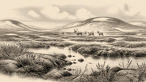
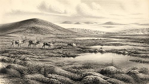
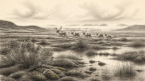
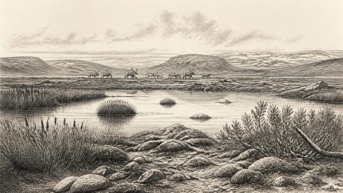
Around the notional date of 31,125 BCE, Ireland was an unstable Ice Age landscape, not a documented human society. Derryvree, County Fermanagh, preserves freshwater sediments between glacial tills, indicating cold, open wetlands with sedges, mosses, dwarf willow and aquatic plants during an ice-free interval. Other northern deposits confirm fluctuating local conditions. Castlepook Cave, County Cork, contains time-mixed remains of reindeer, mammoth, giant deer, hyaena and other cold-stage animals. A cut-marked reindeer bone may indicate Upper Palaeolithic human activity, but no settlement is proven. Lower seas did not guarantee easy routes; later glaciation obscured earlier evidence across much of the island.
Dateline
“31,125 BCE” is a modern chronological label, not a date at which an identifiable Irish event occurred. At this depth in time, calendar-year precision is unavailable. The label falls roughly 33,074 years before AD 1950, the conventional “present” of radiocarbon dating, but neither people nor environmental deposits in Ireland can responsibly be assigned to that individual year. The most useful comparison is with the later part of Marine Isotope Stage 3, a climatically unstable portion of the last glacial cycle, and with dated Irish evidence spanning broad intervals rather than single years.
For Ireland, this is not a history of kings, communities, named places or recorded migrations. It is a history reconstructed from buried freshwater sediment, pollen and plant fragments, insect remains, cave deposits, animal bone and changing ice. The evidence indicates that parts of the island could support tundra-like and wetland habitats before the Last Glacial Maximum. It does not permit a claim that Ireland was continuously inhabited, politically organised or even visited by people in precisely 31,125 BCE.
A Date Within a Range
The closest environmental evidence comes from Derryvree, near Maguiresbridge in County Fermanagh. Roadworks in 1969 exposed a drumlin cut by a remarkable sequence: a lower glacial till, freshwater silts and fine sands containing organic material, and a second, upper till. This is an unusually clear local record of an interval in which ice had retreated or was absent long enough for water, sediment and vegetation to occupy the ground, before glacier ice again crossed the area and sealed the deposit.
Organic material from Derryvree produced the conventional radiocarbon determination BIRM-166, about 30,500 radiocarbon years before present, with a large error range. Such a measurement is not a calendar date. Radiocarbon ages must be calibrated against changing concentrations of atmospheric carbon-14, and calibrations at this age remain broader and more model-dependent than those for recent millennia. Published discussions therefore place the Derryvree freshwater episode broadly in the Middle Midlandian cold-stage record, with calendar ranges extending across several thousand years. A range in the order of c. 36,900–31,700 calibrated years before present has been used for its wider context. The notional year 31,125 BCE can fall within that broad horizon, but it cannot identify the formation of a particular pool, leaf, insect or animal remain.
This distinction matters. Derryvree is not evidence for a village beneath a drumlin. It is evidence for an ice-free freshwater environment at some point between glacial advances. Its value lies precisely in its physical sequence: water and organic life accumulated on a landscape that was subsequently overridden, buried and preserved by ice.
Fermanagh’s Cold Wetland
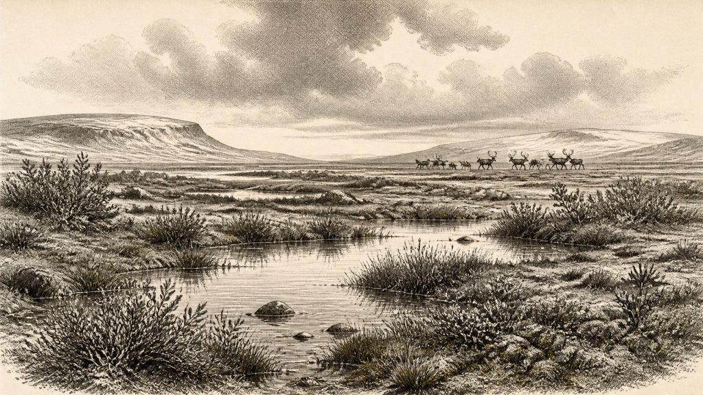
The Derryvree sediments preserve a severe, open environment rather than woodland. Plant evidence includes sedges, mosses, dwarf willow, bogbean, water-milfoil, mountain-avens and other cold-adapted or wetland taxa. Pollen, macrofossils and insect evidence from Derryvree and comparable northern sites indicate sparse vegetation with patches of marsh, shallow water and exposed mineral ground. This was not the dense green Ireland familiar today. Trees, if present at all locally, were not forming a closed forest; the landscape was shaped by cold, wind, frost and short growing seasons.
Such evidence supports careful inferences about everyday ecological conditions. Pools and saturated ground would have offered shelter, water and vegetation in a predominantly treeless terrain. Sedges and aquatic plants reveal that fresh water persisted seasonally or longer. Mosses and low shrubs imply sheltered microsites amid an otherwise raw landscape. They do not reveal human planting, stock-keeping or a managed economy. Agriculture, permanent field systems and domesticated animals lay tens of millennia in the future.
Other deposits in Northern Ireland, notably at Greenagho near Belcoo and at Aghnadarragh near Lough Neagh, reinforce the wider picture. They record phases of open, cold ground between episodes of ice advance. Together, they demonstrate that glaciation was neither a simple, uninterrupted white cover nor a single event. Ice margins, periglacial processes, lakes, wetlands and tundra vegetation shifted repeatedly. Regional conditions could differ sharply: a freshwater basin in Fermanagh tells us much about its locality, but should not be treated as a weather report for every part of Ireland.
Reindeer Country in Cork
Southern cave deposits add a different form of evidence. Castlepook Cave, near Doneraile in north County Cork, is Ireland’s most important known archive of pre-Last Glacial Maximum vertebrates. Its complex chambers and deposits have yielded remains attributed to reindeer, woolly mammoth, giant deer, brown bear, wolf, red fox, Arctic fox, mountain hare, collared lemming, Norwegian lemming and spotted hyaena. The species list evokes an open, cold landscape able to support large grazers and browsers, smaller Arctic-adapted mammals and powerful scavengers or predators.
The cave does not provide a single moment frozen in time. Bones may have entered through carnivore activity, natural deaths, water movement and changing cave entrances; historic excavation also disturbed contexts. Modern redating has shown that some older Irish cave determinations understated the antiquity of specimens, while different animals in the same cave may represent different episodes. The responsible conclusion is that Ireland hosted, or was repeatedly reached by, a varied cold-stage fauna during Marine Isotope Stage 3. It is not safe to assemble every species into one simultaneous herd outside Castlepook in 31,125 BCE.
Spotted hyaena is especially significant. Its presence in Castlepook’s fauna shows that Ice Age Ireland was not merely an Arctic desert. Hyaenas occupied varied open habitats and could accumulate bones in caves, complicating any attempt to identify human activity from animal remains alone. Mammoth and giant deer similarly point to wider routes across north-west Europe and adequate forage over substantial areas, but their fossils do not establish a stable local population in every Irish region.
The Human Question
One Castlepook specimen has transformed discussion while also requiring restraint: a reindeer femur reported as bearing a deep mark interpreted by zooarchaeologist Ruth Carden as having been made by a sharp stone tool during carcass processing. Public heritage accounts place the bone at roughly 33,000 years ago, commonly rendered as around 31,000 BCE. If the mark is confirmed as anthropogenic and contemporary with the fresh bone, it would show that Upper Palaeolithic people handled a reindeer in Ireland far earlier than the previously secure evidence for post-glacial settlement.
That is a major possibility, not a licence to invent a Palaeolithic Irish population. No associated hearth, living floor, stone-tool assemblage, dwelling, human remains or cemetery has yet established a settlement at Castlepook for this period. A marked bone cannot tell us whether people hunted the animal, found a carcass, removed meat or hide, broke it for marrow, or made a brief stop before moving on. Nor does it reveal their language, kinship system, beliefs or relations with other groups.
If people did reach Ireland during this broad interval, the most defensible analogy is with mobile Upper Palaeolithic hunter-gatherers elsewhere in north-west Europe: small groups capable of using stone tools, exploiting animal and plant resources, making clothing and maintaining social connections across large territories. This is interpretation based on wider European evidence, not a direct description of a named Irish band. At present, Ireland offers a possible trace of human action, not proof of a durable society.
Routes, Seas and No Frontiers
There were no Irish states, borders, diplomacy or organised warfare that archaeology can identify. “Politics” in any meaningful sense is beyond the record. Nor is there evidence for trade into Ireland. Yet Ireland was part of a wider north-west European environmental system. Global sea level was much lower than today during the glacial cycle, but the Irish Sea region was also affected by changing ice masses and crustal movements. Lower sea level must not be simplified into a certain land bridge or an easy walk from Britain or continental Europe. Any human or animal movement depended on the changing combination of coastline, ice, river systems, weather and available habitat.
The greatest development relevant to this date was environmental rather than political: the approach of more extensive glaciation. The Last Glacial Maximum came later, broadly between about 26,000 and 19,000 years ago, when ice became far more extensive across Ireland and neighbouring regions. At the time represented by Derryvree and Castlepook, there were still ecological windows: cold wetlands in the north, open-animal landscapes in the south, and routes that could intermittently permit recolonisation. Those windows were fragile. Later ice would erode landscapes, rearrange sediments and greatly reduce the chance that traces of any early visitors survived.
Thus Ireland around the notional date of 31,125 BCE is best understood as a changing Ice Age landscape rather than an early nation. Fermanagh’s buried freshwater sediments demonstrate local life between glacial episodes; Cork’s caves preserve a striking, though time-mixed, fauna; and one reindeer bone raises the unresolved possibility of a human encounter. The evidence is powerful precisely because it is limited: it gives Ireland a deep Palaeolithic prospect, while insisting that the story remains one of ranges, environments and probabilities rather than an invented year-by-year event.
Primary Sources
- A Middle Midlandian Freshwater Series at Derryvree, Maguiresbridge, County Fermanagh, Northern Ireland
- A reconsideration of the radiocarbon dating of the Marine Isotope Stage 3 fauna from southern Ireland
- The Irish Quaternary Fauna Project
- The IntCal20 Northern Hemisphere Radiocarbon Age Calibration Curve (0–55 cal kBP)
- IntCal
- Castlepook Cave: County Geological Site Report
- Heritage Artefacts of County Cork
- The Archaeological Heritage of County Cork
- Figure 6: The subdivision of the Quaternary Period in Ireland
- Aghnadarragh
- Clogher Valley
- The Geological Heritage of County Leitrim
- Last Glacial Maximum cirque glaciation in Ireland and implications for reconstructions of the Irish Ice Sheet
- New data for the Last Glacial Maximum in Great Britain and Ireland
- Ireland: Submerged Prehistoric Sites and Landscapes
- A North-Western Habitat: the Paleoethology and Colonisation of a European Peninsula
- The Exploration of some caves near Castletownroche, Co. Cork
- Pleistocene vertebrates in the British Isles
- New insights on the fauna of Ireland’s Younger Dryas and Early Holocene from Alice & Gwendoline Cave
- The Mesolithic in Ireland: when was it?
- Ireland's Palaeolithic Archaeology – Fleeting Footprints in a Frozen Land
- Freshwater organic deposits and stratified sediments between early and late Midlandian (Devensian) till sheets, at Aghnadarragh, County Antrim, Northern Ireland