Derryvree’s Tundra Seedbed31346 BCE
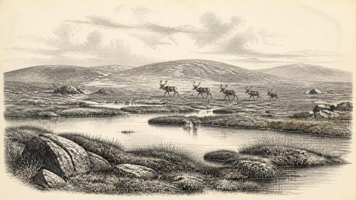
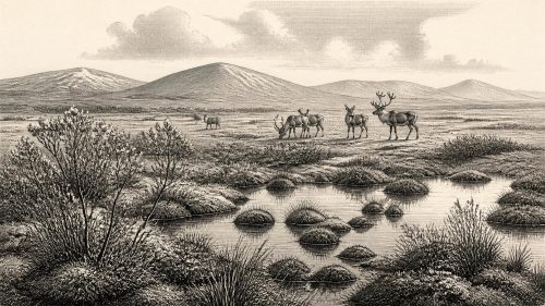
31,346 BCE is a modern nominal date within a broad Late Pleistocene range, rather than a recoverable Irish year. At Derryvree, County Fermanagh, organic sediments between glacial tills record an ice-free, cold, treeless tundra wetland with freshwater plants, mosses and sedges. Castlepook Cave, County Cork, preserves MIS 3 remains of mammoth, reindeer, giant deer, predators and other cold-adapted fauna, though these did not necessarily coexist. A marked reindeer femur may indicate brief human carcass processing, but cannot prove settlement. Lower sea levels may have enabled animal movement, while routes remain uncertain. Evidence reveals changing environments, not societies, events or polities.
Dateline
The label 31,346 BCE is a modern chronological convenience, not a year that can be recovered from the Irish archaeological record. No calendar, written testimony, named community or dated event survives from this depth of time. In archaeological terms it falls roughly 33,295 calendar years before AD 1950, during the Late Pleistocene and Marine Isotope Stage 3 (MIS 3), a long and climatically volatile part of the last Ice Age. Modern radiocarbon calibration allows broad age estimates, not annual precision. The responsible history of Ireland at this point must therefore be built from sediment layers, pollen, plant remains, animal bones, cave deposits and the changing evidence of ice.
A Date Within Ranges
This nominal date lies close to the later part of a broad interval represented at Derryvree, near Maguiresbridge in County Fermanagh. Roadworks in 1969 cut through a drumlin and exposed a remarkable sequence: glacial till below, freshwater silts and organic sediments in the middle, and another till above. Till is the unsorted debris left by glacier ice. The sequence therefore demonstrates a simple but important fact: between two episodes of glacial activity, this part of Fermanagh was not under ice and supported a living freshwater and terrestrial environment.
The central organic deposit produced radiocarbon determination BIRM-166, conventionally reported as 30,500 radiocarbon years before present, with a substantial uncertainty. Calibration produces a much wider calendar-age range, generally placed around 36,900–31,700 calibrated years before present. The requested year can fall within such a range, but it cannot be assigned to a particular layer, season, plant, animal or human action. It is better understood as a notional point within the Derryvree interval than as the date of an event.
That distinction matters because radiocarbon years and calendar years are not interchangeable. Atmospheric carbon-14 has varied through time, while old deposits may contain reworked material or have been disturbed by frost, water and ice. Improved calibration curves and laboratory methods have transformed Pleistocene chronology, but their results remain probability ranges. They tell historians when a landscape or bone is likely to belong; they do not make the Ice Age legible as an annal.
A Freshwater World Beneath Fermanagh
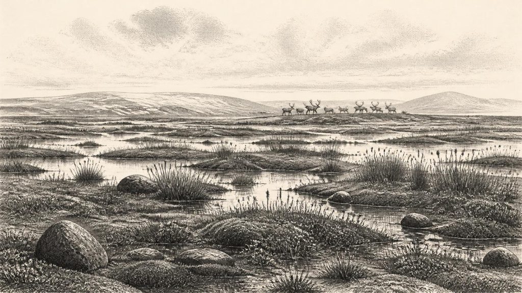
Derryvree is among the most informative Irish windows onto this broad period because it preserves organic evidence normally erased by later glaciation. Its silts and fine sands contained poorly preserved herb pollen, plant macrofossils, mosses and invertebrate remains. Together they indicate cold, open, treeless tundra or tundra-like ground, with shallow freshwater, saturated soils and mossy, sedge-rich patches. Earlier writers used the word “muskeg” for this mixture of wet peat-forming ground, pools and low vegetation.
The flora included plants adapted to cold and wet conditions, rather than a forested Irish landscape. Bogbean, water-milfoil, sedges, mosses and arctic-alpine herbs point to standing or slowly moving water fringed by damp vegetation. Pollen evidence was limited and imperfect, but the overall picture is not of woodland. A few grains that might suggest trees cannot securely demonstrate nearby forest: pollen can travel far, and the local macrofossil evidence favours sparse cover in a severe periglacial setting.
Periglacial does not mean permanently glaciated. It describes terrain shaped by intense cold near ice margins or in cold climates: seasonal freezing and thawing, unstable wet ground, patterned soils and short productive summers. Such a landscape could support plants, insects and grazing animals, yet be highly seasonal and vulnerable to abrupt change. Derryvree should not be stretched into a map of the whole island. It establishes local conditions in south Fermanagh during a broad interval; Ireland’s coasts, uplands, valleys and western Atlantic margins could have differed considerably.
Castlepook’s Animal Archive
The other indispensable Irish source lies far to the south-west. Castlepook Cave, also called Mammoth Cave, near Doneraile in County Cork, has produced Ireland’s most important assemblage of mammals from the last cold stage. Excavations undertaken principally in the early twentieth century recovered bones of woolly mammoth, reindeer, giant deer, brown bear, wolf, fox, mountain hare, lemmings and spotted hyaena. The National Museum of Ireland preserves much of this historic collection, including a skull of the hyaena.
These finds demonstrate that Ireland was not an ecological blank before the Last Glacial Maximum. At various times in MIS 3, sizeable grazing animals and formidable predators reached the island. Reindeer and mammoth evoke open grazing country; lemmings and hare reinforce the evidence for cold conditions; hyaena remains show that large carnivores were present. Yet a cave assemblage is not a census of one valley in one year. Carnivores may have dragged in prey, water may have shifted bones, animals may have died naturally in or near the cave, and nineteenth- and early twentieth-century excavation recorded contexts far less precisely than modern fieldwork requires.
Recent accelerator mass spectrometry re-dating has made the Castlepook evidence more significant and more complicated. Ruth Carden, Thomas Higham and Peter Woodman found that several Castlepook samples were between roughly 5,000 and 12,000 radiocarbon years older than earlier determinations had suggested. Their work places important components of the fauna firmly within MIS 3 and suggests that some species, including giant deer and spotted hyaena, had disappeared locally before the Last Glacial Maximum. The results also underline that animals represented in the cave need not all have lived together, or occupied the site in the same generation.
At 31,346 BCE, it is therefore reasonable to envisage parts of Ireland as cold, open country capable of sustaining migratory or mobile large mammals and their predators. It would be irresponsible to claim that every listed species shared the same hillside, that any particular herd crossed the Awbeg valley in that year, or that Castlepook was a fixed hyaena den throughout the entire interval. The evidence supports recurrent animal presence across millennia, not a tableau frozen to the modern date.
The Reindeer Femur Question
A fragment of reindeer femur from Castlepook gives this period exceptional human interest. It has been reported as dating to about 33,000 years ago and bears a deep linear modification which zooarchaeologist Ruth Carden has interpreted as a cut or chop made on fresh bone with a sharp stone implement during carcass processing. If that interpretation is confirmed, the bone is potentially Ireland’s earliest evidence for human activity, vastly earlier than the better-established terminal-Pleistocene and Mesolithic records.
Its implications must nevertheless be expressed with care. The radiocarbon result dates the death of the reindeer, not automatically the moment a mark was made, the place where the animal was killed, or the duration of a visitor’s stay. Identification of a tool mark is a specialist taphonomic judgement, distinct from the chemical date. Moreover, the bone came from an old collection rather than a modern excavation of a sealed occupation floor. There is no securely associated stone-tool assemblage, hearth, dwelling, burial, human bone or repeatedly occupied campsite of comparable age published from Ireland.
For that reason, the femur may support a hypothesis of brief Upper Palaeolithic human visitation or carcass processing; it cannot demonstrate an established settlement, continuous population or a named “first Irish” people. Nor can it reveal whether people hunted the animal, scavenged it, removed hide or sinew, broke it for marrow, or processed it elsewhere before the bone reached the cave. Recent excavations at Castlepook have sought surviving deposits in a cave badly affected by earlier digging, but corroborating evidence remains essential.
Routes, Coasts and Uncertain Connections
Sea level was lower than today during much of the last glacial cycle, and Ireland’s outlines and surrounding shallow seas differed greatly from the modern map. This helped animals move between north-western Europe, Britain and Ireland during favourable intervals. It does not, however, justify an assertion that a permanent land bridge existed at this exact time, or that people followed a known route. The configuration of ice, sea, coasts and habitable land changed repeatedly, while later ice sheets and rising seas removed or buried much of the evidence.
The wider north-west European setting confirms that Homo sapiens groups existed elsewhere and were highly adaptable hunter-gatherers with stone technologies, clothing, social networks and, in some regions, ornaments and art. None of those facts can be transferred wholesale to Ireland. No Irish artefact assemblage of this age identifies a cultural tradition, and there is no local evidence for art, ritual, language, kinship system or exchange network. Continental parallels provide context for what a short visit might have involved, not proof of what occurred here.
No Polities, No Recorded Conflict
Political affairs, diplomacy, warfare, formal religion, learning and trade cannot responsibly be reconstructed for Ireland in this year. There are no chiefs, tribes, treaties, shrines, territories, weapons caches or exchanges that can be named from the evidence. Even “society” is visible only indirectly, and then only if the reindeer mark eventually proves human-made. The established evidence concerns ecology: cold-ground vegetation, freshwater habitats, animal movements, predators and the advance and retreat of ice.
Economy, if people did reach Ireland, would have been based on immediate hunter-gatherer practices rather than farming, metalwork, markets or permanent villages. That is an inference from the broader Upper Palaeolithic world, not an excavated Irish economy. The safest conclusion is also the most revealing. Ireland around this nominal date was a changing Ice Age landscape whose surviving history lies beneath tills, within cave bones and in minute wetland remains. It was not yet the settled, named and politically divided island of later history.
Why the Evidence Matters
Derryvree and Castlepook show why prehistoric history must preserve uncertainty rather than conceal it. One site records freshwater life between ice advances in Fermanagh; the other records an unexpectedly rich succession of large mammals in Cork. Together they overturn any simple image of an Ireland continuously smothered by ice or wholly empty of terrestrial life before the Last Glacial Maximum. They also show the limits imposed by time-averaged deposits, lost contexts and a geological record repeatedly reworked by ice.
The principal development around 31,346 BCE is therefore environmental, not political: Ireland occupied an unstable middle phase of the last glacial cycle, with local ice-free ground, tundra wetlands and periodic access for cold-adapted fauna. A single reindeer bone raises the possibility that people were present too. It is an important possibility, not a licence to invent a community, an expedition or an event. Future excavation, microscopic analysis, direct dating and work on undisturbed deposits may refine the story; for now, the integrity of the evidence lies in its calibrated ranges and carefully stated limits.
Primary Sources
- A reconsideration of the radiocarbon dating of the Marine Isotope Stage 3 fauna from southern Ireland
- The Irish Quaternary Fauna Project
- Spotted Hyena Skull
- Palaeoecology
- Figure 6.— The subdivision of the Quaternary Period in Ireland
- Quaternary Deposits and Glacial Stratigraphy in Ireland
- Advances in Irish Quaternary Studies
- Growth and Retreat of the Last British–Irish Ice Sheet, 31,000 to 15,000 Years Ago: the BRITICE-CHRONO Reconstruction
- Growth and Retreat of the Last British–Irish Ice Sheet, 31,000 to 15,000 Years Ago: the BRITICE-CHRONO Reconstruction
- Dimensions and Chronology of the Last Ice Sheet in Western Ireland
- Vertical Dimensions and Age of the Wicklow Mountains Ice Dome, Eastern Ireland, and Implications for the Extent of the Last Irish Ice Sheet
- Late Pleistocene Chronostratigraphy and Ice Sheet Limits, Southern Ireland
- Sedimentology and Chronology of the Advance and Retreat of the Last British-Irish Ice Sheet on the Continental Shelf West of Ireland
- Deglaciation Chronology of the Donegal Ice Centre, North-West Ireland
- The IntCal20 Northern Hemisphere Radiocarbon Age Calibration Curve (0–55 cal kBP)
- IntCal
- A Stratigraphic Framework for Abrupt Climatic Changes During the Last Glacial Period Based on Three Synchronized Greenland Ice-Core Records: Refining and Extending the INTIMATE Event Stratigraphy
- 32564 – CASTLEPOOK CAVE, Castlepook South, Cork
- Heritage Artefacts of County Cork
- Ireland’s Palaeolithic Archaeology – Fleeting Footprints in a Frozen Land
- New Insights on the Fauna of Ireland's Younger Dryas and Early Holocene from Alice & Gwendoline Cave
- A Stratigraphical Basis for the Last Glacial Maximum (LGM)