Fermanagh’s Subglacial Bogbean31118 BCE
Dateline
31,118 BCE is a modern chronological label, not a year that anyone in Ireland could have recorded, named or commemorated. It falls roughly 33,070 calendar years before AD 1950, the conventional reference point for “before present” dates. At such depth in time, calendar-year precision is unavailable. The responsible account is therefore built from calibrated ranges, buried sediments, cave fauna and ice-sheet evidence rather than from dated events. Around this notional year, Ireland belonged to the Late Pleistocene, within the climatically unstable Marine Isotope Stage 3 of the last Ice Age.
A Date Within a Range
The closest Irish environmental archive is at Derryvree, near Maguiresbridge in County Fermanagh. A road cutting exposed organic freshwater silts and fine sands preserved between two bodies of glacial till: unsorted sediment deposited directly by ice. Their order tells an important story. Ice affected the locality; a wet, ice-free interval then allowed freshwater deposits and living communities to accumulate; later glacial activity buried the record beneath further till.
Organic matter from the Derryvree bed yielded a conventional radiocarbon determination of 30,500, with an uncertainty of roughly 1,100 radiocarbon years. Radiocarbon years are not calendar years, especially so far back: atmospheric carbon-14 changed through time, and calibration converts a laboratory measurement into a probability range rather than an exact date. Published calibrations have placed the deposit broadly at about 36,900–31,700 calibrated years before present, or approximately 34,950–29,750 BCE. The requested year lies within that broad window, but cannot be attached to a particular plant, pool, animal or human action. Derryvree is an environmental sequence accumulated over millennia, not a diary.
Fresh Water Between Advances
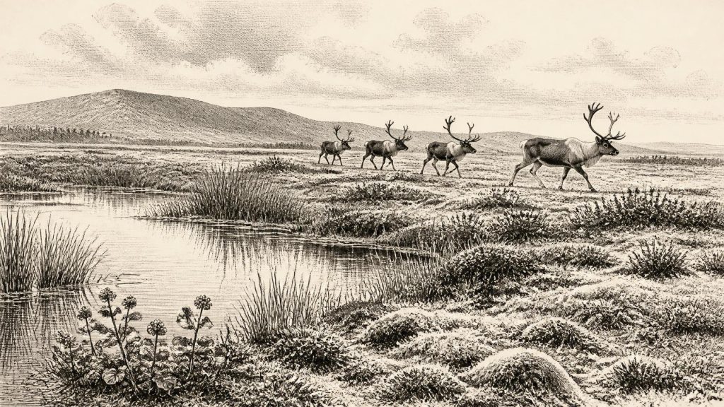
The evidence from Derryvree establishes a treeless, cold and wet landscape. Pollen, plant macrofossils, mosses and insects were recovered from the organic sediments. They point to open tundra or tundra-steppe vegetation, with sedges, grasses, herbs and low-growing plants rather than the oak, hazel and elm woodland associated with much later prehistoric Ireland. A fossil seed of bogbean, Menyanthes trifoliata, is particularly evocative. This is a plant of shallow freshwater margins and marshes, demonstrating that local water bodies and wet ground existed despite the severe regional climate.
Mountain-avens and other cold-adapted plants indicate exposed ground and short growing seasons. Mosses are important because they can preserve local conditions more precisely than pollen carried over long distances. A few tree-pollen grains do not prove that woodland stood nearby; they may have blown in from afar or been reworked from older sediments. The stronger conclusion is that the Fermanagh basin supported a patchwork of cold-water pools, marshy ground and sparse open vegetation. Seasonal thaw would have produced waterlogged hollows even while frost action, long winters and periglacial processes shaped the wider terrain.
Not an Unbroken Freeze
“Ice Age” should not suggest that every part of Ireland was continuously sealed beneath one uniform ice sheet. The Derryvree deposit exists because there was an interval sufficiently ice-free for a freshwater ecosystem to form. At Crag Cave in County Kerry, uranium-thorium dates from stalagmites show that calcite growth occurred episodically during Marine Isotope Stage 3. Dripstone can grow only when liquid water moves through soil and limestone above a cave. These records therefore support the view that the long cold stage contained milder or wetter episodes, although they do not show that Fermanagh and Kerry shared the same weather at the same moment.
Interpretation becomes less secure when moving from local deposits to a map of the entire island. The exact extent of Irish ice during earlier parts of the Midlandian glaciation remains debated, because later glaciers eroded and rearranged older surfaces. What is secure is that major ice expansion lay ahead: the maximum phase of the last British–Irish Ice Sheet is generally placed much later, around 26,000–20,000 years ago, varying by sector. Around 31,118 BCE, Ireland was already part of a changing cold-world system, but not simply the featureless ice-covered island of popular imagination.
Castlepook’s Animal Evidence
County Cork provides a second, very different archive. Castlepook Cave, near Doneraile in the Blackwater valley, has yielded Ireland’s richest known assemblage of pre-Last Glacial Maximum vertebrate remains. Its deposits include bones of woolly mammoth, reindeer, giant deer, brown bear, wolf, fox, Arctic fox, mountain hare, collared lemming, Norwegian lemming and spotted hyaena. The Irish Quaternary Fauna Project concluded that a broad range of mammals reached Ireland between at least about 45,000 and 20,000 years ago. This establishes that Ireland was not biologically isolated from the wider north-west European landmass throughout the period.
Yet cave assemblages must not be treated as a single instant photograph. Castlepook was excavated largely in the late nineteenth and early twentieth centuries, while cave sediments had been disturbed, mixed and accumulated through varied processes. Carnivores dragged in prey; animals died naturally; water moved bones; excavators worked before modern recording standards. Direct dates on individual specimens are therefore more useful than old layer labels, but even radiocarbon results from the 1990s have required reassessment as laboratory pretreatment has improved. The fauna demonstrates a changing Late Pleistocene animal world in Ireland, not necessarily one herd, one predator community or one season at 31,118 BCE.
Reindeer are especially relevant to the landscape suggested at Derryvree. They are compatible with open, cold country and seasonal movement across broad grazing terrain. Mammoth and giant deer signal that large herbivores could enter Ireland during favourable phases; hyaenas and wolves indicate predators and scavengers exploiting those animals. Their presence has implications for food webs, movement corridors and habitats, but it does not justify imagining an intact “mammoth-steppe” everywhere on the island. Ireland’s Atlantic setting, wet ground, limestone caves, rivers and changing ice margins created local ecological mosaics.
The Human Question
There is no securely excavated settlement, hearth, stone-tool assemblage, burial or dwelling in Ireland that can be assigned to this precise period. Consequently, there is no evidence for political communities, rulers, warfare, diplomacy, religious institutions, formal learning or trade networks in the ordinary historical sense. No language spoken in Ireland can be identified, and no later Irish tradition can responsibly be projected back into this time.
A reindeer femur from Castlepook has nonetheless made the question of human presence more urgent. It has been presented as bearing a mark made on fresh bone by a sharp stone implement and has been publicised as evidence that people may have butchered reindeer in Ireland about 33,000 years ago. If that interpretation withstands continued specialist scrutiny, it would be evidence for a brief Upper Palaeolithic visit or activity episode, not proof of permanent settlement. The bone was not necessarily cut inside the cave; it may be discarded material later moved into the cave system. A radiocarbon measurement dates the animal bone, while the identification of a cut mark is a separate taphonomic judgement. Those two evidential steps must remain distinct.
Mobility Rather Than Society
The most that can responsibly be proposed for human life is conditional. Small, mobile hunting groups elsewhere in north-west Europe used stone tools, fire, animal food and skin clothing, and followed seasonal opportunities. If people reached Ireland during this interval, their activities may have centred on large-animal carcasses, temporary stopping places and routes made more accessible by lower sea levels. But no Irish material culture currently permits a reconstruction of their camp routines, kinship, beliefs, exchange practices or relations with other groups. Absence of evidence is partly a consequence of later glacial erosion and rising seas, which removed or submerged many possible sites; it is not positive evidence that people certainly were absent.
The economy that can be demonstrated is ecological rather than human. Wetlands supported aquatic plants and insects; open ground fed herbivores; predators and scavengers exploited carcasses; seasonal water and frost repeatedly altered the usable landscape. Any human economy remains hypothetical. There is likewise no basis for claims of Irish trade, maritime travel or diplomacy. Mainland connections and lowered sea levels made movement across the broader region more feasible than in later times, but the actual routes by which animals, and perhaps people, reached Ireland remain uncertain.
What This Year Can Mean
The significance of 31,118 BCE lies not in a named event but in an unusually fragile body of evidence. Derryvree preserves freshwater life during an ice-age interval because it was sealed between glacial deposits. Castlepook preserves bones because caves can trap, protect and concentrate remains otherwise lost from the landscape. Crag Cave preserves mineral growth that records episodes when water could percolate through the ground. Together these archives show an Ireland of cold open habitats, active wetlands, large mammals and profound environmental instability.
They also set firm limits on storytelling. This was not an Ireland of kingdoms, monuments or recorded ancestors. It was a landscape repeatedly transformed by climate and ice, where animal populations entered and vanished, and where a possible human trace remains compelling but unresolved. Modern calendar precision can supply the label “31,118 BCE”; archaeology can supply calibrated ranges and carefully tested observations. Between them lies a deep past best understood not as silence, but as evidence that must be read at the scale on which it survives.
Primary Sources
- A Middle Midlandian Freshwater Series at Derryvree, Maguiresbridge, County Fermanagh, Northern Ireland
- The Irish Quaternary Fauna Project
- A Reconsideration of the Radiocarbon Dating of the Marine Isotope Stage 3 Fauna from Southern Ireland
- New Insights on the Fauna of Ireland's Younger Dryas and Early Holocene from Alice & Gwendoline Cave
- The Exploration of Castlepook Cave, County Cork, Being the Third Report from the Committee Appointed to Explore Irish Caves
- Castlepook Cave: County Geological Site Report
- Heritage Artefacts of County Cork
- Archaeology Research Excavation Grant 2022: Final Report
- Castlepook Cave Excavation, County Cork, 2022
- Irish Quaternary Vertebrates
- Pleistocene Vertebrates in the British Isles
- The Subdivision of the Quaternary Period in Ireland
- Menyanthes trifoliata in Fermanagh: Fossil Record
- Dryas octopetala in Fermanagh: Fossil Record
- Episodic Speleothem Deposition Tracks the Terrestrial Impact of Millennial-Scale Last Glacial Climate Variability in SW Ireland
- Spatio-Temporal Dynamics of Speleothem Growth and Glaciation in the British Isles
- The IntCal20 Northern Hemisphere Radiocarbon Age Calibration Curve (0–55 cal kBP)
- IntCal: Radiocarbon Dating Research
- Last Glacial Maximum Cirque Glaciation in Ireland and Implications for Reconstructions of the Irish Ice Sheet
- Late Pleistocene Chronostratigraphy and Ice Sheet Limits, Southern Ireland
- Stratigraphic and Palaeo-Geomorphological Evidence for the Glacial-Deglacial History of the Last British-Irish Ice Sheet in the North-Western Irish Sea
- Exploring Controls of the Early and Stepped Deglaciation on the Western Margin of the British Irish Ice Sheet
- Dimensions and Chronology of the Last Ice Sheet in Western Ireland
- Scientific Dating of Pleistocene Sites: Scientific Dating Methods
