Mammoth Cave Hindleg31187 BCE
About 31,187 BCE, Ireland lay within the climatically unstable Late Pleistocene, not a recoverable historical year. Radiocarbon calibration permits only broad chronological ranges. At Derryvree, County Fermanagh, freshwater sediments between glacial tills record a locally ice-free, cold, treeless tundra interval, although not an ice-free island. Castlepook Cave, County Cork, contains diverse fauna, including a reindeer femur possibly cut with a stone tool. If confirmed, this may indicate early human activity, but proves neither settlement nor continuity. No institutions, culture or migration route can be identified. Environmental shifts, advancing ice, coastlines and sparse evidence define threshold period in Irish deep history.
Dateline
The label 31,187 BCE is a modern point on a calendar, not a year that can be recovered from Ireland’s prehistoric record. No annals, named communities, rulers, settlements or events exist for it. At this depth of time, the responsible unit of history is a broad, calibrated archaeological and environmental interval. The date falls at about 33,100 years before AD 1950, during the Late Pleistocene and Marine Isotope Stage 3 (MIS 3), when North Atlantic climates altered sharply over millennia and sometimes much more quickly. Ireland was not yet the familiar green, wooded island of later prehistory. Its evidence is fragmentary: sediments sealed beneath ice deposits, cave bones, fossils, landforms and a single particularly provocative reindeer bone from north Cork.
A Calendar Point, Not a Chronicle
Modern calendar precision should not be mistaken for prehistoric precision. Radiocarbon years are not calendar years: the amount of atmospheric carbon-14 has varied, so laboratory measurements must be calibrated against internationally revised curves. Beyond 30,000 years ago, calibrated results commonly span centuries or millennia. The value of the date 31,187 BCE is therefore positional. It directs attention to a late MIS 3 horizon, rather than identifying an Irish spring, a particular hunt or an individual life. Even the most relevant Irish deposits may begin or end well away from this notional year.
This was also a changing world rather than a single uniform “Ice Age”. MIS 3, conventionally extending roughly from 57,000 to 29,000 years ago, was marked by repeated cold stadials and relatively milder interstadials. Those shifts affected temperature, vegetation, ice growth, sea level and the routes available to animals. Ireland lay on the north-western edge of Europe, exposed to Atlantic weather systems and increasingly affected by the growth of the British-Irish Ice Sheet. It is inappropriate, however, to imagine the whole island under one unchanging blanket of ice in 31,187 BCE. Different regions could have had markedly different conditions, and the chronology of ice expansion remains an active research field.
Derryvree Between the Tills
The strongest Irish environmental evidence close to this broad horizon comes from Derryvree near Maguiresbridge, County Fermanagh. Roadworks exposed organic-rich freshwater silts and fine sands trapped between two tills: unsorted sediment laid down by glacier ice. The sequence supplies a secure relative order. Ice had previously crossed the locality; afterwards, ice was absent locally long enough for freshwater deposits, plants and small animals to accumulate; then a renewed glacial advance covered the evidence with fresh till. This is not proof of an ice-free Ireland in every direction, but it is compelling evidence of an ice-free interval at Derryvree.
The organic material, known as BIRM-166, produced a conventional radiocarbon age of about 30,500 ± 1,200 radiocarbon years before present. Published calibrations place it broadly between about 36,900 and 31,700 calibrated years before present. Thus 31,187 BCE lies near, but not securely inside, the younger edge of this substantial range depending on the conversion used; it cannot be assigned to a particular bed, plant, insect or season. The useful conclusion is environmental rather than annual: north-central Ireland had experienced a cold but locally non-glacial phase before the major later expansion of the last Irish ice sheet.
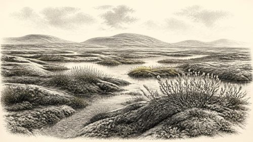
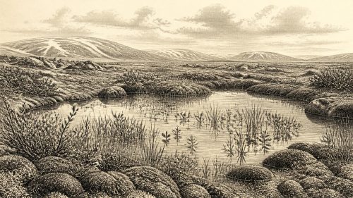
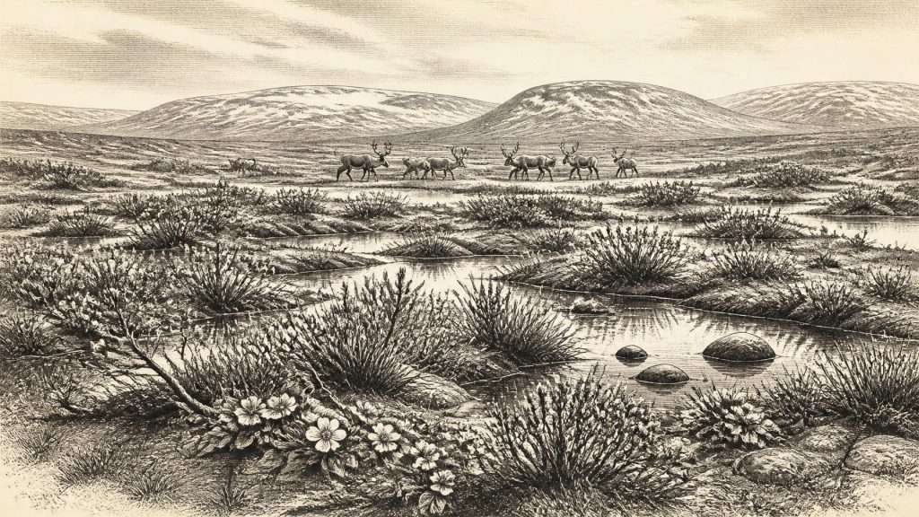
Derryvree’s fossils suggest an open, treeless and wet landscape. Plant remains associated with cold conditions, including bogbean, mountain-avens and lesser clubmoss, point to tundra-like or muskeg environments with pools, sedges and saturated ground. Such evidence does not permit a precise reconstruction of annual temperatures, yet it decisively rules out the later Irish landscape of dense temperate woodland, fields and enclosed farms. Seasonal freezing and thawing would have shaped soils and watercourses. In sheltered hollows, summer growth could be surprisingly productive; across exposed ground, wind, frost and sparse vegetation would have dominated.
The Reindeer Bone at Castlepook
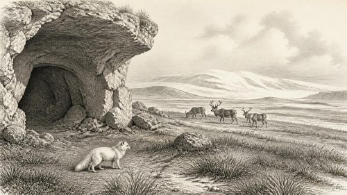
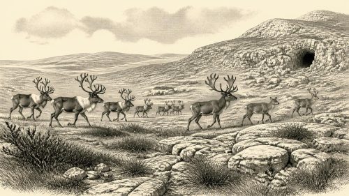
County Cork provides the most arresting, though more contested, evidence relevant to human history. Castlepook Cave, also known as Mammoth Cave or Doneraile Cave, near Doneraile, has yielded Ireland’s richest known Late Pleistocene vertebrate assemblage. Its bones include reindeer, brown bear, wolf, fox, hare, lemmings, spotted hyaena, giant deer and woolly mammoth. Cave deposits are not straightforward domestic rubbish: carnivores may have dragged carcasses inside, animals may have died naturally, water may have moved material, and many earlier finds were recovered before modern excavation standards. Each specimen must therefore be assessed in its own context.
A reindeer femur from Castlepook has special importance because it bears a deep mark interpreted by zooarchaeologist Ruth Carden as having been made on fresh bone with a sharp stone implement during carcass processing. Public accounts have connected the specimen with an age of about 33,000 years ago. If that interpretation is sustained, it would be Ireland’s earliest known indication of human activity by a very large margin. But evidence and interpretation must remain separate. The bone may date the animal’s death, while the diagnosis and timing of the incision are distinct questions; no securely associated hearth, stone-tool assemblage, dwelling floor, burial or repeated occupation surface has yet established a settled Palaeolithic community in Ireland.
The safest conclusion is significant but limited. Around this broader period, reindeer moved through or lived in southern Ireland, and one specimen may preserve evidence that a person used a stone tool on its carcass. That would imply practical knowledge of animal anatomy, cutting implements and food processing. It does not demonstrate a permanent camp at Castlepook, a population size, a language, ancestry, named migration route or continuous occupation of the island. Nor can it identify the people involved as a particular archaeological culture merely by comparison with Upper Palaeolithic groups elsewhere in Europe.
Society Without Institutions
There is no evidence for political affairs, diplomacy, formal leadership, territorial states or organised warfare in Ireland at this time. Such categories require records that the island does not preserve. If humans were present, the plausible social scale is small, mobile foraging parties rather than villages or polities. Reindeer would have supplied meat, marrow, hide, sinew and bone, while other animals offered opportunities and dangers. That reconstruction is an inference from the possible butchery evidence and from wider Upper Palaeolithic practices, not a directly excavated Irish campsite.
For the same reason, religion, art, language, learning and trade cannot be described as specifically Irish realities in 31,187 BCE. No Irish ritual site, grave, figurative art, ornament or exchange network of this age is securely known. People elsewhere in Europe made complex tools and art during the Upper Palaeolithic, but proximity is not evidence of contact. The absence of such finds in Ireland may reflect both a genuinely sparse human presence and the destructive effects of later glaciation, which eroded or buried older landscapes. It is more accurate to say that the record is silent than to populate it with imagined hunters, shamans or clans.
A Landscape on the Edge of Ice
Environmental change was the central historical force. The Derryvree sequence shows that ice margins advanced and retreated through time; later evidence indicates that the last Irish ice sheet grew extensively after about 34,000 years ago and reached its maximum extent much later, broadly between 27,000 and 23,000 calibrated years before present. At its maximum, ice covered Ireland and extended onto surrounding shelves, but that later outcome should not be projected backwards as a condition already complete in 31,187 BCE.
Lower global sea level changed the shape of surrounding coasts, although it did not automatically create an easy land bridge from Ireland to Britain. The geography of the Irish Sea was controlled by fluctuating sea level, isostatic movement of the land and ice-sheet behaviour. Any movement of animals or people into Ireland had to be understood within that changing palaeogeography, perhaps across exposed lowlands, ice-connected terrain, shallow channels or short sea crossings at different times. Present evidence does not permit a confident route for the possible Castlepook visitors.
For Ireland around 31,187 BCE, then, the most important development was neither a kingdom nor a battle but the unstable relationship between cold, water, animals and ice. Fermanagh preserves a freshwater tundra interval sealed between glaciers. Cork preserves a cave fauna, including a reindeer femur that may carry the trace of a human tool. Together they make this a threshold in Irish deep history: a period in which life was possible in some places, but in which the evidence for people remains tantalisingly slight and the advancing ice would later erase much of what once existed.
Primary Sources
- A Reconsideration of the Radiocarbon Dating of the Marine Isotope Stage 3 Fauna from Southern Ireland
- The Irish Quaternary Fauna Project
- Trimlines, Blockfields and the Vertical Extent of the Last Ice Sheet in Southern Ireland
- Late Pleistocene Chronostratigraphy and Ice Sheet Limits, Southern Ireland
- Dimensions and Chronology of the Last Ice Sheet in Western Ireland
- Growth and Retreat of the Last British–Irish Ice Sheet, 31,000 to 15,000 Years Ago: The BRITICE-CHRONO Reconstruction
- Pattern and Timing of Retreat of the Last British-Irish Ice Sheet
- Maximum Extent and Dynamic Behaviour of the Last British–Irish Ice Sheet West of Ireland
- Oscillating Retreat of the Last British-Irish Ice Sheet on the Continental Shelf Offshore Galway Bay, Western Ireland
- Last Glacial Maximum Cirque Glaciation in Ireland and Implications for Reconstructions of the Irish Ice Sheet
- Ireland: Submerged Prehistoric Sites and Landscapes
- The Problem of a Late Quaternary Landbridge Between Britain and Ireland
- Deglaciation, Earth Crustal Behaviour and Sea-Level Changes in the Determination of Insularity: A Perspective from Ireland
- The IntCal20 Northern Hemisphere Radiocarbon Age Calibration Curve (0–55 cal kBP)
- Marine20—The Marine Radiocarbon Age Calibration Curve (0–55,000 cal BP)
- Dansgaard–Oeschger Events in Climate Models: Review and Baseline Marine Isotope Stage 3 Protocol
- Fast and Slow Components of Interstadial Warming in the North Atlantic During the Last Glacial
- Cork Geological Heritage: Castlepook Cave
- Heritage Artefacts of County Cork
- Ireland’s Palaeolithic Archaeology – Fleeting Footprints in a Frozen Land
- First Evidence of a Late Upper Palaeolithic Human Presence in Ireland
- Figure 6—The Subdivision of the Quaternary Period in Ireland