

Mosses Below Maguiresbridge31130 BCE
Around 31,130 BCE, Ireland lay within the climatically unstable Marine Isotope Stage 3, although no evidence can date events to that precise year. At Derryvree near Maguiresbridge, County Fermanagh, freshwater organic sediments between glacial tills record an ice-free interval before renewed glaciation. Mosses, sedges and cold-adapted insects indicate open, treeless tundra wetland. Comparable Fermanagh deposits and Kerry cave formations show variable conditions. Cave fauna demonstrates intermittent presence of cold-adapted mammals, but cannot reconstruct a single moment. Possible cut marks on a reindeer bone suggest early human activity, yet remain unconfirmed. Later ice advances buried these fragile environmental records across Ireland.
Dateline
Modern calendar-year precision is not available for Ireland in 31,130 BCE. No written chronology, settlement sequence or annually resolved environmental record can identify an event in this particular year. The date is a modern convention: it falls roughly 33,080 years before AD 1950, the reference point conventionally used in radiocarbon dating. The most responsible approach is therefore to place it within a broad calibrated interval and to distinguish direct evidence from interpretation. Ireland was then in the Late Pleistocene, within Marine Isotope Stage 3, a climatically unstable part of the last glacial cycle that preceded the later Last Glacial Maximum.
A Date Within a Long Cold Phase
The most relevant Irish evidence comes from Derryvree, near Maguiresbridge in County Fermanagh. Road construction in 1969 cut through a drumlin and exposed an exceptional sequence: organic freshwater silts and fine sands lay between two substantial sheets of till, the unsorted sediment left by glacier ice. The order of events is secure even when the exact dates are not. Ice had first crossed the locality and deposited the lower till; later, glacier cover was absent long enough for water, sediment, plants and invertebrates to accumulate; finally, renewed ice advance laid down the upper till and sealed the wetland beneath it.
Eric Colhoun and his colleagues obtained a conventional radiocarbon age of 30,500 years BP from the Derryvree organic material, with a large laboratory uncertainty of +1,170 and −1,030 years. Calibration against changing atmospheric carbon levels produces a broad age range, commonly cited at approximately 36,900–31,700 calibrated years BP. The modern date of 31,130 BCE lies within that range, but it does not identify the beginning or end of the deposit, nor a particular season in which its plants grew. Derryvree can illuminate conditions around this point in deep time; it cannot be made into a diary entry for a numbered year.
The terminology itself requires care. Older Irish schemes called this interval the Derryvree Cold Phase, within the Middle Midlandian, the Irish name for part of the last glacial period. The word “cold phase” is preferable to imagining an unbroken blanket of ice over the whole island. The buried wetland demonstrates that this Fermanagh locality was ice-free during part of the interval. It does not prove that all Ireland was ice-free simultaneously. Ice margins, upland glaciers, coasts and lowland basins could have differed sharply over relatively short distances and times.
A Freshwater Tundra
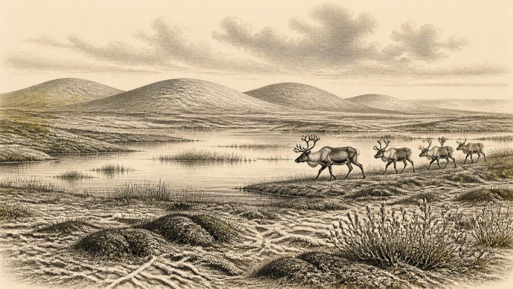
What survived at Derryvree is environmental evidence rather than an archaeological settlement. Its flora included freshwater mosses and sedges, while its insect fauna had a cold northern character. Pollen was poorly preserved, but the combined evidence indicates open, treeless ground with wet hollows and freshwater habitats: a periglacial landscape shaped by severe cold, seasonal freezing and brief growing seasons. It was not the familiar green, wooded Ireland of later prehistory. Nor was it necessarily a featureless snow desert. Mossy margins, sedge-rich shallows, pools, mineral ground and sparse herbaceous vegetation formed a patchwork in which living things could persist.
Related deposits strengthen that cautious reconstruction. At Hollymount, also near Maguiresbridge, and at Greenagho near Belcoo, organic sediments preserved between tills show that parts of Fermanagh experienced non-glacial cold conditions during the Middle Midlandian. Their chronologies are imperfect and should not be forced into a single, island-wide episode. Nonetheless, they demonstrate that wet ground and organic sediments could develop between major glacial advances. The value of these sites is precisely their local specificity: they show that northern Irish lowlands contained refuges of freshwater life during a long period otherwise poorly represented in the archaeological record.
Crag Cave in County Kerry offers a different kind of evidence. Its stalagmites formed only intermittently during the last glacial period, when liquid water could circulate through the shallow cave system. Uranium-series dates show that climatic ameliorations occurred repeatedly during Marine Isotope Stage 3. Such evidence does not make Derryvree warm; rather, it confirms that Ireland’s climate was highly variable on millennial scales. Cold conditions, modest thaws, renewed freezing and expanding ice belonged to the wider rhythm of the period.
Animals on a Changing Island
Southern Irish caves provide a complementary, though time-averaged, picture of animal life. Castlepook Cave near Doneraile in County Cork has yielded one of Ireland’s richest Pleistocene faunal collections. The assemblage includes remains attributed to reindeer, woolly mammoth, giant deer, brown bear, wolf, Arctic fox, mountain hare, lemmings and spotted hyaena. Taken together, these animals reveal that Ireland was intermittently connected to wider north-west European ecological networks and could sustain cold-adapted grazers, predators and scavengers. Reindeer, lemmings and Arctic fox especially suit the open, cold conditions independently indicated at Derryvree.
Yet Castlepook must not be treated as a census for 31,130 BCE. Cave deposits can contain material accumulated across long spans of time, carried in by carnivores, water or people, and disturbed by later activity and early excavation. Improved radiocarbon procedures have also shown that some older dates obtained from Irish cave fauna require reassessment. The sound conclusion is broad but important: a varied Ice Age fauna lived in Ireland during Marine Isotope Stage 3. It cannot establish that every species named above shared one valley, one season or one moment.
Sea level was lower than today, exposing large areas of continental shelf around north-west Europe and altering the shape of Ireland’s coasts and surrounding seas. This helped make animal movements possible during suitable intervals, but it does not supply a mapped land bridge or a known route for any particular year. Glaciers, cold seas, estuaries and changing shorelines could all obstruct movement. The arrival of mammals is evidence that passages existed at some stages; it is not proof that Ireland was continuously accessible or that people travelled along the same routes.
The Human Question
Political affairs, diplomacy, kingdoms and organised warfare cannot responsibly be described for Ireland at this date. There are no named communities, leaders, monuments, cultivated fields, houses, toolkits or burials securely attributable to 31,130 BCE. There is equally no evidence for trade in the later prehistoric sense. If people visited Ireland, they would have been small, highly mobile Upper Palaeolithic hunting and gathering groups rather than a permanent farming population. That is an inference from the wider European context, not a demonstrated social history of this island.
A reindeer femur from Castlepook has brought that possibility into sharp focus. Reported in 2021 as bearing marks consistent with processing by a stone tool, it was presented as evidence of human activity in Ireland about 33,000 years ago. If that interpretation is confirmed through further taphonomic study and secure contextual work, it would indicate that people processed a reindeer carcass in Ireland during the early Upper Palaeolithic. It would not, however, demonstrate a village, a permanent population, a social hierarchy or continuous occupation. The bone derives from an old cave collection rather than a modern excavation of an undisturbed living surface, so caution is essential.
There is no defensible basis for assigning religion, language, artistic traditions or formal learning to Ireland in this year. European hunter-gatherers elsewhere made complex stone technologies, ornaments and cave art, but importing those achievements wholesale into Ireland would turn possibility into fiction. Fire, hides, meat, bone and antler may have been useful resources for any visitors, while reindeer and other animals could have structured seasonal movement. These are reasonable ecological possibilities, not evidence for an Irish camp at Derryvree or Castlepook.
Before the Major Ice Advance
At 31,130 BCE Ireland was not yet at the best-established maximum of the last British–Irish Ice Sheet. The major expansion came thousands of years later, with maximum extent in the Irish sector broadly around 25,000–23,000 years ago. Geological evidence increasingly depicts the earlier ice sheet as dynamic: it advanced, retreated and changed form rather than simply appearing everywhere at once. The Derryvree wetland belongs to this larger history of changing margins. Eventually, renewed ice covered its basin, deposited upper till and buried the evidence that now permits a glimpse of the landscape.
The principal history of this notional year is therefore not a royal succession or a battle, but the precarious persistence of life in a changing cold environment. Around the broad calibrated interval containing 31,130 BCE, part of Fermanagh supported freshwater mosses, sedges and cold-adapted insects beneath open skies. Elsewhere on the island, large mammals moved through landscapes that later ice would scour, bury or rearrange. Whether people briefly joined that animal world remains an important but unresolved question. Derryvree’s sediments make the firmer contribution: they preserve an Irish tundra wetland between episodes of ice, and they remind us how much of the earliest human and environmental past survives only by geological accident.
Primary Sources
- A Middle Midlandian Freshwater Series at Derryvree, Maguiresbridge, County Fermanagh, Northern Ireland
- Early Midlandian–Middle Midlandian, Pleistocene, Northern Ireland
- Palaeoecology
- Figure 6.— The Subdivision of the Quaternary Period in Ireland
- The Irish Quaternary Fauna Project
- New Insights on the Fauna of Ireland's Younger Dryas and Early Holocene from Alice & Gwendoline Cave
- The Timing and Magnitude of the British–Irish Ice Sheet Between Marine Isotope Stages 5d and 2: Implications for Glacio-Isostatic Adjustment, High Relative Sea Levels and ‘Giant Erratic’ Emplacement
- Stratigraphic and Palaeo-Geomorphological Evidence for the Glacial-Deglacial History of the Last British-Irish Ice Sheet in the North-Western Irish Sea
- Episodic Speleothem Deposition Tracks the Terrestrial Impact of Millennial-Scale Last Glacial Climate Variability in SW Ireland
- Trimlines, Blockfields and the Vertical Extent of the Last Ice Sheet in Southern Ireland
- Maximum Extent and Dynamic Behaviour of the Last British–Irish Ice Sheet West of Ireland
- New Data for the Last Glacial Maximum in Great Britain and Ireland
- Aghnadarragh
- Clogher Valley
- Deposits of the Last Glaciation
- Introduction to the Glacial Sand and Gravel Landscapes of Northern Ireland
- Archaeological Heritage of County Cork
- Heritage Artefacts of County Cork
- Archaeology Research Excavation Grant 2022: Final Report
- The Geology of Ireland: Cenozoic, Tertiary and Quaternary