

Maguiresbridge’s Frozen Reedland31096 BCE
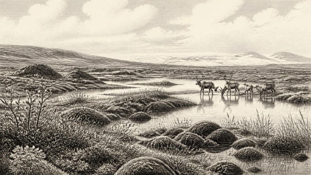
Labelled 31,096 BCE, this period cannot be reconstructed as a single Irish year, but through fragmentary environmental evidence. At Derryvree near Maguiresbridge, freshwater silts between glacial tills, radiocarbon dated broadly to 36,900–31,700 years ago, preserve tundra wetland plants and animals, indicating cold, ice-margin conditions before renewed glaciation. Ireland’s ice cover was dynamic, not uniformly continuous. Castlepook Cave fossils show reindeer, mammoth and other cold-country mammals reached Ireland when lower sea levels enhanced connectivity. A marked reindeer bone may indicate an early human visit, but lacks contextual proof. No evidence establishes permanent settlement, polities, trade, or institutions; the record remains ecological.
Dateline
The label 31,096 BCE is a modern filing device, not a date at which an event in Ireland can be placed. Nobody on the island recorded years, and archaeology cannot identify a particular season, journey or human lifetime so far back. In conventional calendar terms, the label falls roughly 33,000 years before AD 1950, within the later part of the Pleistocene and Marine Isotope Stage 3. What can responsibly be written is therefore a history of evidence: buried sediments, fossils, cave deposits and the later action of ice. Their dates are ranges, their geographical reach is limited, and their interpretation remains open to revision.
Dating a Landscape, Not a Year
The closest detailed Irish environmental archive is at Derryvree, near Maguiresbridge in County Fermanagh. Roadworks in 1969 exposed a sequence within a drumlin: organic freshwater silts and fine sands lay between two substantial sheets of till, the unsorted debris deposited by glacier ice. The organic material yielded the conventional radiocarbon determination BIRM-166, 30,500 radiocarbon years before present, with a considerable uncertainty of +1,170 and −1,030 years. Later publications have expressed its calibrated range broadly as about 36,900–31,700 calendar years before present. The modern label 31,096 BCE sits within that broad span, but this does not mean that the deposit formed in that one year. It represents conditions accumulated over a long interval and dated by a technique whose precision diminishes at such depth in time.
That distinction matters. Derryvree is not a national weather station, nor an annual diary. It demonstrates that, before renewed glaciation sealed the deposit beneath till, this part of north-central Ireland contained freshwater and supported a cold-climate biological community. It cannot prove that every district of Ireland was ice-free at once, that the island had a uniform climate, or that the same plants and animals were present continuously throughout the dated range. The proper scale is a changing regional landscape at the margin of expanding and retreating ice.
Freshwater Beneath the Drumlin
The Derryvree silts preserve an unexpectedly rich assemblage of plant and animal remains. Mosses, sedges, dwarf willow and other low-growing plants point to open, treeless tundra or muskeg-like wetland rather than forest. Aquatic and wet-ground species, including bogbean, indicate standing or slow-moving freshwater in pools, shallow channels and saturated ground. Insects and other small remains reinforce the picture of severe, continental conditions, although not a lifeless polar desert. During the brief productive season, plants colonised exposed sediment and wet hollows; during the long cold season, frost, snow, wind and frozen ground would have dominated.
The scene should not be imagined as a uniform blanket of marsh. A periglacial environment is a mosaic. Fine sediment accumulated in quiet water, while nearby slopes and exposed ridges could have been dry, stony and vulnerable to frost action. Dwarf shrubs and herb-rich patches may have occupied better-drained ground; sedges and mosses flourished where meltwater collected. Such habitats could sustain insects, small mammals and grazing animals, yet they were fragile and readily transformed as climate, drainage and ice margins changed. The later glacier did more than cover this wetland: it compressed the evidence into the body of a drumlin and removed or reworked much of the surrounding landscape.
Before the Ice-Sheet Maximum
At this horizon Ireland was within the last glacial cycle, but it was not yet at the best-established maximum of the last British–Irish Ice Sheet. Modern reconstructions place the ice sheet’s greatest overall volume at about 23,000 years before present, while recognising that maximum extent and advance differed greatly between sectors. Research also indicates earlier growth, retreat and readvance during Marine Isotope Stage 3. The record is therefore incompatible with an old simple picture in which Ireland was either entirely frozen or entirely open country for a single uninterrupted Ice Age.
Derryvree is important precisely because it preserves evidence of an ice-free interval between glacial deposits. Similar pre-maximum evidence from northern Ireland and elsewhere has helped demonstrate that ice-sheet history was dynamic. Yet the exact limits, thickness and timing of individual ice masses remain debated, particularly for the earlier part of the last glaciation. A responsible reconstruction for around 31,096 BCE is consequently cautious: some Irish terrain was capable of supporting freshwater wetlands and tundra vegetation during the broad Derryvree interval, while glaciers were already a decisive force in the regional environment and would later advance across much of the island.
Animals and Open Country
Southern Irish caves provide a different kind of evidence. Castlepook Cave, near Doneraile in north Cork, has yielded one of Ireland’s most significant Pleistocene faunal collections. Reindeer, woolly mammoth, giant deer, brown bear, wolf and spotted hyaena are among the animals associated with the wider cave record, although their remains do not all belong to one moment or one identical habitat. Recent redating has shown that several older cave chronologies require revision and that some fauna belongs much earlier in Marine Isotope Stage 3 than previously supposed. A cave assemblage is also a selective archive: carnivores may drag in prey, animals may die naturally, and water, excavation practices and later disturbance can mix deposits.
Even with those cautions, the fauna makes an important point. Ireland was not ecologically isolated in the absolute sense implied by its modern sea boundaries. Lower global sea level exposed large areas of the continental shelf, and animal movement between Ireland, Britain and mainland Europe was at times more feasible than it is now. The routes, coastlines and water barriers changed repeatedly, however; no single land bridge can simply be assumed for every date or species. Reindeer and mammoth remains demonstrate that cold-open-country mammals reached Ireland, not that they formed stable herds everywhere on the island, nor that people followed them.
The Human Question at Castlepook
The possibility of human activity is the most arresting, and the least secure, part of this distant Irish history. A reindeer femur from Castlepook has been publicly described as carrying a deep mark consistent with cutting or chopping by a stone implement, and the animal bone has been associated with an age of roughly 33,000 years. If the mark was made by a person while the bone was fresh, it would suggest a remarkably early Upper Palaeolithic visit to Ireland: perhaps the processing of a reindeer carcass by a small mobile party.
That conditional wording is essential. The find is not a securely excavated occupation floor with stone tools, hearths, repeated butchery waste or human remains. The date of an animal’s death is not automatically the date of a surface modification, and old cave collections often lack the stratigraphic control expected today. Marks on bone require specialist taphonomic assessment because trampling, carnivore damage, sediment abrasion and breakage can sometimes resemble deliberate modification. Nor is there yet a published settlement sequence at Castlepook that establishes an enduring population in Ireland at this time. The bone is a serious lead, not a licence to write a story of permanent colonisation.
No Polities, No Proven Trade
There is no evidence from around this horizon for political communities, leaders, diplomacy, warfare, territorial boundaries or organised religion in Ireland. There are no known houses, camps, graves, ornaments, artworks, monuments, written signs or locally attributable stone-tool industries securely dating to 31,096 BCE. It would be misleading to fill that silence with imagined clans, shamans, rituals or hunting expeditions.
The same restraint applies to economy and trade. If people did make a brief crossing, they would have required knowledge, planning and tools, but the Irish evidence does not reveal their route, social organisation, exchange networks or whether they returned. Animal movement and exposed shelf landscapes show potential connectivity; they do not demonstrate commerce. The best-supported account of everyday life is therefore ecological rather than social: wet ground, sparse vegetation, harsh winters, seasonal biological productivity and the recurrent disruption of ice.
What the Evidence Means
Ireland around the notional year 31,096 BCE was not an ancestral kingdom awaiting later historical actors. It was a physically unstable part of north-west Europe, repeatedly remodelled by climate and glaciation. At Derryvree, freshwater sediment preserves a cold wetland community that existed before ice again overran the site. At Castlepook, fossils reveal that large Ice Age mammals reached southern Ireland, while one marked reindeer bone raises an unresolved question about exceptionally early human presence.
Those records are fragmentary, but they are valuable precisely because they resist certainty. They show that Irish history at this depth begins not with rulers or chronicles, but with mud beneath a drumlin, bones in limestone caves and the difficult scientific work of establishing what each can, and cannot, tell us.
Primary Sources
- A Middle Midlandian Freshwater Series at Derryvree, Maguiresbridge, County Fermanagh, Northern Ireland
- The Late Quaternary History of East-Central Ireland
- Trimlines, Blockfields and the Vertical Extent of the Last Ice Sheet in Southern Ireland
- A Reconsideration of the Radiocarbon Dating of the Marine Isotope Stage 3 Fauna from Southern Ireland
- Growth and Retreat of the Last British–Irish Ice Sheet, 31,000 to 15,000 Years Ago: the BRITICE-CHRONO Reconstruction
- The Timing and Magnitude of the British–Irish Ice Sheet Between Marine Isotope Stages 5d and 2
- Deglaciation Chronology of the Donegal Ice Centre, North-West Ireland
- Extent and Timing of the Last Glacial Maximum in Britain and Ireland: a Review
- New Data for the Last Glacial Maximum in Great Britain and Ireland
- Figure 6: The Subdivision of the Quaternary Period in Ireland
- References and Recommended Reading
- Occurrence of Mammalia Relicts at Site Castlepook Cave
- Castlepook Cave, Castlepook South, County Cork, Excavation Report 2022
- First Evidence of a Late Upper Palaeolithic Human Presence in Ireland
- New Insights on the Fauna of Ireland's Younger Dryas and Early Holocene from Alice & Gwendoline Cave
- The Irish Quaternary Association
- Outreach and Education Resources
- Mammoth Cave (Castlepook Cave), County Cork
- IAH Ireland Field Trip 2014 Guide
- The IntCal20 Northern Hemisphere Radiocarbon Age Calibration Curve (0–55 cal kBP)