BIRM-166 and the Fermanagh Thaw30992 BCE
The modern label 30,992 BCE cannot identify a precise Irish event, but overlaps the calibrated range of BIRM-166, a freshwater deposit at Derryvree, County Fermanagh. Sediments between tills show a locally ice-free MIS 3 interval, with treeless, sedge-rich wetland, pools, bogbean, mosses and cold-adapted insects. Ireland’s climate and ice cover varied regionally before the Last Glacial Maximum; Crag Cave records milder episodes. Castlepook Cave fauna demonstrates cold-stage reindeer, mammoth, giant deer, predators and lemmings, though deposits are not contemporaneous. A possibly cut-marked reindeer bone suggests, but cannot prove, human presence. Glacial erosion and disturbance limit conclusions; settlement evidence is absent.
Dateline
“30,992 BCE” is a modern calendar label, not a year that can be recovered from Irish evidence. No written record, annual chronology or event horizon permits precision on that scale. The date falls within the later Pleistocene, broadly Marine Isotope Stage 3 (MIS 3), a climatically unstable part of the last Ice Age. The responsible approach is therefore to ask what dated deposits, animal remains and glacial landforms can reveal about Ireland within a wide interval around this notional year, while distinguishing observation from interpretation.
The strongest chronological bridge is a buried freshwater deposit at Derryvree, near Maguiresbridge in County Fermanagh. Its conventional radiocarbon determination, BIRM-166, was 30,500 +1,170/−1,030 radiocarbon years before present. Calibration converts this into a broad range of roughly 36,900–31,700 calibrated years before present, rather than a single calendar year. In the convention where “present” is AD 1950, 30,992 BCE lies within that wide range. That does not mean the Derryvree mud was laid down in that year, only that it is the best Irish environmental archive relevant to this stretch of deep time.
A Wetland Between Glaciers
Derryvree was exposed during road works in 1969, when a cut through a drumlin revealed organic-rich freshwater silts and fine sands enclosed between two thick tills. Tills are sediments deposited directly by ice. Their sequence is decisive: an earlier glacier crossed the locality; an interval then allowed freshwater sediment, plants and small animals to accumulate; a later advance buried the deposit beneath new glacial debris. The evidence establishes locally ice-free conditions in this part of Fermanagh during the interval represented by the organic bed. It cannot demonstrate that every region of Ireland was free of ice at the same moment.
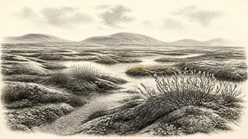
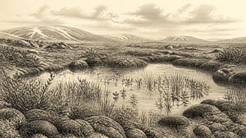
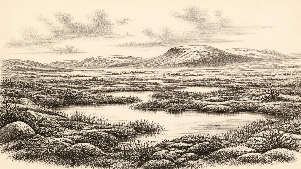
The deposit gives an unusually intimate, though still partial, view of an Irish cold-stage landscape. Pollen, plant macrofossils, mosses and insects indicate open, treeless terrain rather than woodland. Grasses and sedges were important, with juniper and herb pollen also recorded. Mosses flourished around waterlogged ground, while a fossil seed of bogbean (Menyanthes trifoliata) confirms shallow freshwater conditions. The insect fauna has a cold, northern character. Together these observations support an interpretation of muskeg-like wetland: mossy, sedge-rich ground interspersed with pools and saturated channels, set within sparse tundra vegetation.
This was not a timeless white wilderness. Summer growth, standing water and plant litter sustained small wetland ecosystems, even though winters were severe and the ground was shaped by frost. Nor should modern bogs be projected backwards unchanged. The landscape was periglacial: intensely seasonal, largely treeless and vulnerable to freezing, thawing, erosion and changing drainage. Derryvree’s plants reveal what could grow in one protected basin; they do not provide a complete map of the island.
Ice Sheet in the Making
At this date Ireland stood before, rather than at, the fullest extent of the Last Glacial Maximum. Later, between roughly 26,500 and 19,000 calibrated years before present, ice covered much or probably all of the island and heavily eroded its earlier surface deposits. Research on the British–Irish Ice Sheet shows that its growth was regionally uneven. Some northern and marine sectors advanced early, while the evidence from Derryvree and other Fermanagh sites records exposed ground in north-central Ireland before the major expansion of the last Irish ice sheet.
That regional variation matters. “Ireland” was not a uniform environmental unit: ice margins, uplands, river basins, caves and coastal lowlands responded differently to climatic shifts. Lower sea levels also made the surrounding geography very different from that of the modern island, although the exact routes available to animals or people at any particular moment remain uncertain. Crag Cave in County Kerry preserves another kind of evidence. Episodes of stalagmite growth there during MIS 3 indicate periods when liquid water could penetrate cave systems, signalling climatic amelioration on a broader south-western Irish scale. Such records reinforce the picture of fluctuation, not a simple march towards ever colder conditions.
These geological changes had a lasting historical consequence. Later ice scoured and rearranged much of the land surface, destroyed many potential campsites and mixed sediments. The scarcity of very early archaeological sites in Ireland is therefore partly a preservation problem. Yet erosion is not a complete explanation: it cannot turn isolated environmental indications into proof of settlement. The record has to be read for what it retains, and for what it has lost.
Animals of the Open Country
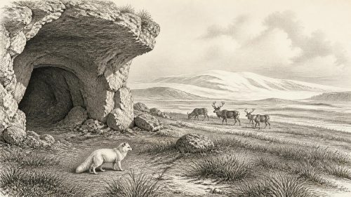
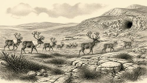
Caves in the south, especially Castlepook Cave near Doneraile in County Cork, preserve the principal Irish faunal evidence for MIS 3. Re-dating of bones held by the National Museum of Ireland has shown that older radiocarbon methods often made specimens appear too young. Improved pretreatment placed several Castlepook animals much further back in the glacial period. The assemblage includes reindeer, Arctic fox, wolf, brown bear, giant deer, woolly mammoth, spotted hyaena and lemmings.
It would be mistaken, however, to picture all of these animals meeting on one day in a single Cork valley. Cave deposits accumulated over long periods through carnivore activity, natural deaths, water movement and earlier excavation. Individual dates vary widely. The secure conclusion is that cold-stage animal communities reached Ireland during MIS 3, and that the island could support sizeable herbivores and predators before the glacial maximum. Reindeer and Arctic fox fit open, cold habitats; mammoth, giant deer and hyaena point to a richer and more varied large-mammal history than Ireland possesses today.
For everyday ecology, the Fermanagh wetland and the Cork cave complement one another. Derryvree shows plants, water and small invertebrates in a northern basin. Castlepook shows the wider animal world, but not a precisely contemporary food chain. Both are archives of intervals, not snapshots.
The Human Question
The possibility of people in Ireland at this depth of time remains exceptionally important and exceptionally narrow. A reindeer femur from Castlepook, in the National Museum of Ireland collection, has been publicised as approximately 30,000 years old and as bearing a sharp mark interpreted as possible stone-tool butchery. If that interpretation is confirmed, it would show that a person handled a reindeer in Ireland during the Upper Palaeolithic, dramatically earlier than the well-established post-glacial settlement record.
But the limits are as important as the possibility. A date on bone establishes the age of the animal’s death within an uncertainty range; it does not automatically date a surface mark or establish how the bone reached the cave. Castlepook was excavated in the early twentieth century, its deposits were disturbed, and its fauna accumulated through several processes. No securely associated hearth, stone-tool assemblage, dwelling floor, burial, repeated campsite or butchered-bone concentration has been published for this horizon. A single potentially modified bone cannot tell us population size, season of visit, language, kinship or whether any visitors returned.
If people did enter Ireland around this broad period, they were most plausibly small, mobile hunter-gatherer parties exploiting a changing cold-country landscape, not founders of a documented permanent population. That is an interpretation drawn from the ecological setting and wider European Upper Palaeolithic comparisons, not an established Irish settlement narrative.
What Cannot Be Written
There were no recoverable Irish states, rulers, borders, diplomacy or wars in 30,992 BCE. No evidence identifies a political community, a treaty, a raid or a territory. Nor is there Irish evidence from this horizon for farming, villages, trade networks, monuments, formal religion, art, schools or writing. The named galleries of Castlepook—such as Elephant Hall and Hyaena Hall—are modern excavation labels, not ancient places of assembly or ritual.
Absence of evidence does not prove that people could never have crossed or briefly used the land. It does mean that the historian must resist filling the silence with imagined chiefs, camps or ceremonies. The most meaningful development is environmental: local ice retreat or absence allowed Fermanagh wetland life to persist; colder phases and advancing ice later sealed that evidence; and animal remains in southern caves survived to demonstrate an unexpectedly complex Ice Age fauna.
For Ireland around this notional year, BIRM-166 is therefore more valuable than a fabricated event. Its moss-rich mud records open pools, sedges, bogbean and cold-adapted life in a temporary ice-free landscape. Castlepook records animals moving through another Irish region across the long span of MIS 3. Together they show an Ireland that was neither empty in every biological sense nor securely inhabited in the historical sense: a shifting, severe and regionally varied land whose evidence must be measured in calibrated ranges, deposits and probabilities.
Primary Sources
- A Middle Midlandian Freshwater Series at Derryvree, Maguiresbridge, County Fermanagh, Northern Ireland
- A reconsideration of the radiocarbon dating of the Marine Isotope Stage 3 fauna from southern Ireland
- New insights on the fauna of Ireland’s Younger Dryas and Early Holocene from Alice and Gwendoline Cave, County Clare
- Radiocarbon constraints on the age of the maximum advance of the British-Irish Ice Sheet in the Celtic Sea
- Late Pleistocene chronostratigraphy and ice sheet limits, southern Ireland
- Trimlines, blockfields and the vertical extent of the last ice sheet in southern Ireland
- Growth and retreat of the last British–Irish Ice Sheet, 31,000 to 15,000 years ago: the BRITICE-CHRONO reconstruction
- Exploring controls of the early and stepped deglaciation on the western margin of the British Irish Ice Sheet
- Episodic speleothem deposition tracks the terrestrial impact of millennial-scale last glacial climate variability in SW Ireland
- Early Midlandian–Middle Midlandian, Pleistocene, Northern Ireland
- Palaeoecology
- The Subdivision of the Quaternary Period in Ireland
- Heritage Artefacts of County Cork
- Ireland: Submerged Prehistoric Sites and Landscapes
- Introduction to the Late Quaternary and Holocene of Northern Ireland
- The IntCal20 Northern Hemisphere Radiocarbon Age Calibration Curve (0–55 cal kBP)
- The IntCal20 Northern Hemisphere radiocarbon age calibration curve (0–55 kcal BP)
- OxCal: Radiocarbon Calibration and Analysis
- The Dungarvan Valley Caves Project: First Interim Report
- Radiocarbon Constraints on the Age of the Maximum Advance of the British-Irish Ice Sheet in the Celtic Sea
- Episodic Speleothem Deposition Tracks the Terrestrial Impact of Millennial-Scale Last Glacial Climate Variability in SW Ireland
- Growth and Retreat of the Last British-Irish Ice Sheet, 31,000 to 15,000 Years Ago: the BRITICE-CHRONO Reconstruction