Unglaciated Interval30970 BCE
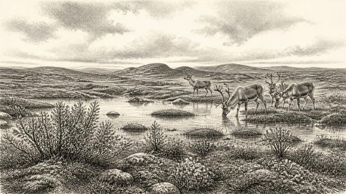
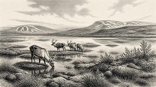
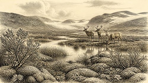
Although 30,970 BCE is a modern label rather than a datable Irish year, Derryvree near Maguiresbridge provides evidence for conditions within its broad timeframe. Freshwater silts and organic sediments, lying between glacial tills, record a temporary non-glacial interval in south Fermanagh. Pollen, mosses and plant remains indicate treeless, wet, periglacial tundra with sedges, grasses, juniper, shallow pools and seasonal frost. Cave deposits elsewhere show cold-adapted mammals, including mammoth and reindeer, during the wider period, but not necessarily locally together. No secure evidence establishes human settlement. Environmental volatility preceded widespread Irish ice cover after about 29,000 years ago as glaciation intensified.
Dateline
A Date Without a Diary
30,970 BCE is a modern calendar label imposed on a period that cannot be resolved in calendar years. No inscription, settlement layer or securely dated human object allows us to describe events in Ireland in that particular year. In archaeological terms, it falls about 32,900 calendar years before AD 1950, within the later part of the Late Pleistocene and broadly within Marine Isotope Stage 3, a climatically unstable phase of the last Ice Age. The responsible account is therefore one of dated ranges, deposits and cautious comparisons, not of named rulers, battles or annual happenings.
The most important Irish evidence near this point comes from an unlikely source: silts and organic sediment exposed during roadworks at Derryvree, near Maguiresbridge in County Fermanagh. The deposit is valuable because it records a brief environmental interval between episodes of glaciation. It does not demonstrate what happened across the whole island, and still less what occurred in one numbered year. Yet it offers a rare, direct glimpse of an Irish landscape that later ice partly buried and reshaped.
Freshwater Between Two Ice Advances
In 1969, a road cutting passed through a drumlin at Derryvree, roughly two kilometres north-east of Maguiresbridge. Beneath and above the exposed freshwater sediments lay tills: unsorted mixtures of clay, stones and other debris deposited by glacial ice. The sequence is decisive in its basic meaning. Ice had occupied the locality, then conditions permitted fine sands, silts and organic material to accumulate in freshwater or waterlogged ground, before a later advance deposited another till over them.
Organic material from the freshwater bed produced the conventional radiocarbon determination BIRM-166, 30,500 radiocarbon years before present, with a sizeable uncertainty of plus 1,170 and minus 1,030 years. Radiocarbon years are not identical to calendar years. Calibration against changing atmospheric carbon-14 levels produces a broad calendar range, commonly expressed at approximately 36,900–31,700 calibrated years before present. The label 30,970 BCE falls towards the young end of, and close to, that range. It is consequently reasonable to use Derryvree to illuminate conditions around this date, but not to assign every layer or organism there to 30,970 BCE itself.
The same caution applies to ice. Ireland was not simply either ‘frozen’ or ‘ice-free’. The British–Irish Ice Sheet changed in extent and form over long periods, while local topography, snow accumulation, meltwater and shifting margins produced different conditions in different regions. Derryvree shows that south Fermanagh experienced a non-glacial interval between ice advances. It cannot prove that all coasts, uplands and interior lowlands were simultaneously open country.
A Treeless, Waterlogged Country
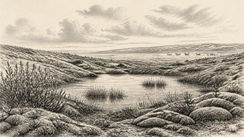
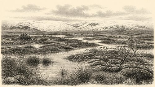
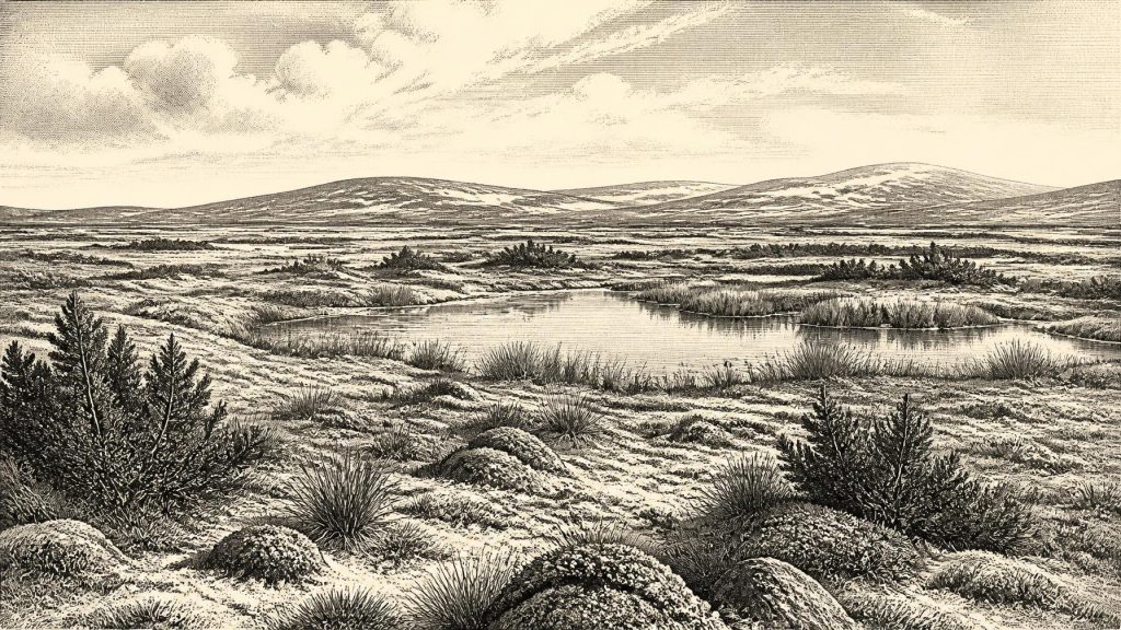
Derryvree’s biological remains point firmly towards cold, open conditions. Poorly preserved pollen was dominated by herbaceous plants rather than trees. Plant macrofossils included a remarkable assemblage of mosses, while other evidence indicates grasses, sedges, low herbs and juniper. Aquatic and wet-ground plants, including bogbean and water-milfoil, suggest shallow freshwater, saturated margins and pools amid sedge-rich vegetation. The excavators described a periglacial setting: a landscape shaped by intense frost, seasonal thaw and a short growing season beyond, or between, major ice-sheet advances.
This was not a wood-filled version of modern Fermanagh. Trees were absent or exceedingly scarce locally. The open vegetation has often been described as tundra, though the word should not conjure a uniform plain. The fossil record instead implies a patchwork of wet hollows, shallow water, mossy ground, sedges and drier, sparsely vegetated surfaces. Snow cover, frozen ground and meltwater would have changed seasonally. In such a landscape, a few sheltered spots could sustain richer plant communities than wind-exposed ridges or frost-heaved ground only a short distance away.
This wetland evidence is particularly important because the later Irish landscape has been so heavily modified by ice, sea-level change, peat formation, farming and settlement. Derryvree is not a picturesque reconstruction based on guesswork; it is a sealed sample of pollen, plant fragments, insects and sediment. Nevertheless, its significance is local and environmental. It preserves an ecosystem, not a complete map of Ireland.
Animals in the Irish Ice-Age Record
Cave deposits, especially at Castlepook or Mammoth Cave near Doneraile in north Cork, show that Ireland supported a striking Late Pleistocene fauna during parts of the broader pre-Last Glacial Maximum interval. The Irish Quaternary Fauna Project identified evidence for animals including woolly mammoth, reindeer, giant deer, brown bear, wolf, fox, Arctic fox, spotted hyaena, mountain hare and both collared and Norwegian lemmings. These remains demonstrate that cold-adapted and open-country mammals reached Ireland during the last Ice Age.
Castlepook is highly informative, but its cave deposits also require restraint. Material was collected during early excavations from complex sediments, and bones may have accumulated through carnivore activity, natural deaths, movement by water and later disturbance. Individual radiocarbon measurements date parts of the faunal record rather than a single, neatly bounded animal community. It would therefore be unsafe to imagine every listed species standing together in Fermanagh in 30,970 BCE. The better conclusion is that Ireland, at different points in this long climatic interval, could sustain a cold-climate fauna consistent with extensive open vegetation.
A reindeer femur from Castlepook has recently been publicised as bearing a possible stone-tool cut or chop mark, and as evidence for human activity around 33,000 years ago. If that interpretation is confirmed through full contextual and taphonomic study, it would be of exceptional importance. For now it cannot support a story of established population, hunting territories or repeated occupation. A marked bone would show at most a human encounter with an animal, not a settlement, camp, kin group or cultural tradition.
People: What Cannot Yet Be Said
There is no securely demonstrated human settlement in Ireland at this date. No excavated hearth, stone-tool assemblage, dwelling, burial, art site or human bone can be assigned to around 30,970 BCE. The National Museum of Ireland accordingly treats the Palaeolithic human record as unproven in the sense required for a settled archaeological sequence, while research on the butchered brown-bear bone from Alice and Gwendoline Cave in County Clare indicates a much later Late Upper Palaeolithic human presence, around 12,500 years ago.
This absence matters to every conventional category of a year-by-year history. There is no evidence for Irish political affairs, diplomacy, warfare, law, leadership, religion, language, artistic practice, formal learning, trade or household economy at this point. Nor is there evidence from which to infer seasonal camps, clothing, food-sharing or ritual. Humans lived elsewhere in north-west Europe during the Upper Palaeolithic, and Britain has a far richer record. But proximity is not proof of an Irish population. Lower sea levels altered coastlines and passages, yet Ireland’s changing geography and climate made crossing, survival and archaeological preservation separate questions.
It is possible that brief human incursions occurred and left no surviving trace, especially given later glacial erosion. That is a research question, not a fact. The distinction is vital: the loss of evidence may explain silence, but it cannot be used to fill that silence with imagined communities.
Regional Change on an Iceward Threshold
The wider climatic setting was volatile. Greenland ice-core records show abrupt shifts during Marine Isotope Stage 3, and the growth of the British–Irish Ice Sheet was not a smooth, island-wide advance. At Derryvree, the very existence of freshwater sediment between tills records environmental change on a substantial scale: conditions once allowed water, plants and small animals to establish, but later ice overrode or sealed the ground. By the Last Glacial Maximum, after roughly 29,000 years ago, ice cover became much more extensive across Ireland.
For Ireland around 30,970 BCE, then, the principal development was not human politics but environmental instability. Parts of the island could be open, cold and ecologically productive enough for tundra vegetation and large mammals; other districts may have lain closer to expanding ice or beneath it. The evidence preserves neither a stable homeland nor an empty white wilderness. It instead reveals a changing northern Atlantic borderland in which wetlands briefly flourished between glacial episodes.
What Derryvree Leaves Us
Derryvree’s freshwater bed is a small archive with large implications. Its pollen, mosses, plant remains and sediments establish that one part of Ireland supported treeless, wet tundra-like vegetation during a pre-maximum interval of the last Ice Age. Cave faunas show that cold-adapted mammals had entered the island during the wider period. Neither line of evidence establishes a society in Ireland in 30,970 BCE.
That limitation is not a failure of history. It is the history. At this depth of time, the most truthful annual overview follows the evidence at its own scale: a buried Fermanagh wetland, animals moving through open country, ice returning, and a calendar year that survives only as a modern label for a world no person recorded.
Source References
Hover over a number to see the source. Select it to open the source.

- [1] A Middle Midlandian Freshwater Series at Derryvree, Maguiresbridge, County Fermanagh, Northern Ireland
- [2] Palaeoecology: Field Guide No. 16
- [3] The Irish Quaternary Fauna Project
- [4] Pleistocene Vertebrates in the British Isles
- [5] Irish Cave Exploration
- [6] First Evidence of a Late Upper Palaeolithic Human Presence in Ireland
- [7] Revisiting Alice and Gwendoline Cave, Co. Clare: New Light on the 1902 Excavations
- [8] New Insights on the Fauna of Ireland's Younger Dryas and Early Holocene from Alice & Gwendoline Cave
- [9] Prehistoric Details
- [10] Ireland’s Earliest Settlers: Evidence for an Irish Palaeolithic
- [11] The Timing and Magnitude of the British–Irish Ice Sheet Between Marine Isotope Stages 5d and 2
- [12] Growth and Retreat of the Last British–Irish Ice Sheet, 31,000 to 15,000 Years Ago: the BRITICE-CHRONO Reconstruction
- [13] Pattern and Timing of Retreat of the Last British-Irish Ice Sheet
- [14] Dimensions and Chronology of the Last Ice Sheet in Western Ireland
- [15] The Evolution of the Terrestrial-Terminating Irish Sea Glacier During the Last Glaciation
- [16] Timing and Pace of Ice-Sheet Withdrawal Across the Marine–Terrestrial Transition West of Ireland During the Last Glaciation
- [17] Maximum Extent and Readvance Dynamics of the Irish Sea Ice Stream and Irish Sea Glacier Since the Last Glacial Maximum
- [18] The IntCal20 Northern Hemisphere Radiocarbon Age Calibration Curve (0–55 cal kBP)
- [19] The Subdivision of the Quaternary Period in Ireland
- [20] Castlepook Cave, County Cork, 2022
- [21] Mammoth Cave, County Cork
- [22] Occurrence of Mammalia Relicts at Site Castlepook Cave
Primary Sources
- A Middle Midlandian Freshwater Series at Derryvree, Maguiresbridge, County Fermanagh, Northern Ireland
- Palaeoecology: Field Guide No. 16
- The Irish Quaternary Fauna Project
- Pleistocene Vertebrates in the British Isles
- Irish Cave Exploration
- First Evidence of a Late Upper Palaeolithic Human Presence in Ireland
- Revisiting Alice and Gwendoline Cave, Co. Clare: New Light on the 1902 Excavations
- New Insights on the Fauna of Ireland's Younger Dryas and Early Holocene from Alice & Gwendoline Cave
- Prehistoric Details
- Ireland’s Earliest Settlers: Evidence for an Irish Palaeolithic
- The Timing and Magnitude of the British–Irish Ice Sheet Between Marine Isotope Stages 5d and 2
- Growth and Retreat of the Last British–Irish Ice Sheet, 31,000 to 15,000 Years Ago: the BRITICE-CHRONO Reconstruction
- Pattern and Timing of Retreat of the Last British-Irish Ice Sheet
- Dimensions and Chronology of the Last Ice Sheet in Western Ireland
- The Evolution of the Terrestrial-Terminating Irish Sea Glacier During the Last Glaciation
- Timing and Pace of Ice-Sheet Withdrawal Across the Marine–Terrestrial Transition West of Ireland During the Last Glaciation
- Maximum Extent and Readvance Dynamics of the Irish Sea Ice Stream and Irish Sea Glacier Since the Last Glacial Maximum
- The IntCal20 Northern Hemisphere Radiocarbon Age Calibration Curve (0–55 cal kBP)
- The Subdivision of the Quaternary Period in Ireland
- Castlepook Cave, County Cork, 2022
- Mammoth Cave, County Cork
- Occurrence of Mammalia Relicts at Site Castlepook Cave