Cork Reindeer, Fermanagh Silt30787 BCE
30,787 BCE is a modern label within MIS 3, not a precisely recoverable Irish year. Derryvree, County Fermanagh, preserves freshwater sediments between tills, dated broadly to 36,900–31,700 cal BP, indicating treeless wetland vegetation during an ice-free interval. Crag Cave supports climatic instability. Before maximum glaciation, Ireland contained shifting ice, exposed ground and meltwater; lowered seas did not guarantee access. Castlepook Cave, County Cork, preserves mixed fauna accumulated over millennia, including reindeer and mammoth. A modified reindeer femur may indicate human butchery, but remains unconfirmed. No secure settlements, tools, hearths or social history demonstrate sustained human occupation; later glaciation obscured evidence.
Dateline
30,787 BCE is a modern calendar label, not a year that can be recovered from Ireland’s archaeological record. It falls roughly 32,700 years before the radiocarbon convention of “present” in AD 1950, within the Late Pleistocene and Marine Isotope Stage 3 (MIS 3). No Irish deposit can identify an event, a person or even a season in that notional year. The responsible frame is therefore a broad one: calibrated date ranges, layered sediments and animal remains. The most relevant evidence suggests a cold, unstable island-edge landscape, subject to sharp climatic shifts and moving ice, rather than a settled human country.
A key range comes from Derryvree near Maguiresbridge, County Fermanagh. Roadworks in 1969 exposed organic freshwater silts and fine sands trapped between two distinct tills in a drumlin. Till is debris laid down directly by glacier ice; the sequence therefore records ice deposition, an interval in which water and vegetation occupied the locality, and then a later ice advance that sealed the evidence. Organic material from the bed produced the radiocarbon determination BIRM-166, 30,500 +1,170/-1,030 radiocarbon years BP. Using modern calibration, scholarship places this broadly at about 36,900–31,700 cal BP. The requested calendar label lies within that wide range, but cannot be pinned to a point within it.
Wetland Between Ice Advances
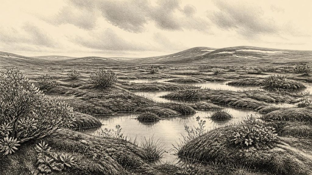
Derryvree is important because it offers a local environmental record where settlements, tools and hearths are absent. Plant remains, pollen, mosses and insects indicate a treeless, open environment commonly described as tundra or muskeg: wet, peaty ground with pools, sedges, grasses, herbs and low-growing plants. Fossil evidence includes cold-adapted vegetation such as dwarf willow, mountain avens, bogbean and lesser clubmoss. These remains do not recreate a single picturesque scene. They accumulated over time, and the species represented had different ecological requirements. Taken together, however, they show a harsh but living freshwater landscape, not a continent-wide desert of ice.
Such evidence also warns against treating all of Ireland as environmentally uniform. Derryvree records one basin in the north-western part of the island, while caves and landforms elsewhere preserve different episodes. Around the later part of MIS 3, climate in the North Atlantic region repeatedly swung between relatively milder interstadials and colder stadials. U-series dates from speleothems in Crag Cave, County Kerry, show that calcite sometimes formed during MIS 3, which requires liquid water circulating through the cave system and conditions above the freezing threshold for at least part of the year. That does not demonstrate warmth by modern standards, nor does it date Derryvree precisely, but it independently supports a pattern of abrupt environmental change rather than unbroken deep freeze.
An Island Approaching Maximum Glaciation
The date sits before the fullest expansion of the last British–Irish Ice Sheet, conventionally placed mainly between about 27,000 and 21,000 years ago, after an earlier build-up beginning around 35,000–32,000 years ago. Consequently, it would be misleading either to show the whole island securely ice-covered in 30,787 BCE or to call it wholly ice-free. Ice-sheet margins advanced and retreated unevenly; local ice, permafrost, meltwater and exposed ground made a shifting mosaic. The drumlin at Derryvree itself was eventually shaped by glacial action, but the buried organic bed preserves an interval when that place supported shallow water and vegetation before later ice overran it.
Sea level was far lower globally than today because so much water was stored in ice sheets. Yet lower sea level alone does not establish a walkable route into Ireland at this date. The geography of the Irish Sea, ice connections and possible exposed corridors remains complex, while Ireland’s insularity has long constrained the movement of plants, animals and people. Any humans who reached the island during this period would have had to negotiate a difficult north-west European landscape and, depending on the route and conditions, water or ice barriers. There is no evidence for regular traffic, exchange networks or a stable migration corridor around 30,787 BCE.
The Castlepook Animal Archive
The richest Irish evidence for mammals before the Last Glacial Maximum comes from Castlepook Cave near Doneraile in north County Cork. Early excavators recovered a large, mixed collection from chambers evocatively named Hyenahall and Elephant Hall. Later assessment and radiocarbon dating established that the cave’s bones represent a long span of the Middle and Late Ice Age, rather than one synchronous animal community. Its fauna includes woolly mammoth, giant deer, reindeer, brown bear, spotted hyaena, wolf, Arctic fox and lemmings. Individual remains range from roughly 45,700 to 19,950 years BP, and cave sediments were disturbed by water, carnivores and antiquarian excavation.
That mixed history matters. Castlepook confirms that cold-adapted and large grazing animals reached Ireland during the broader period, and that predators used or influenced caves. It does not prove that mammoth, reindeer, hyaena and every other species stood together outside the cave in 30,787 BCE. Nor does the presence of animal bone make the cave a human settlement. Hyaenas could have dragged carcass parts into shelter; animals could have died there naturally; water could have moved material; and later digging obscured original associations. Castlepook is a powerful archive of changing fauna, but one that must be read bone by bone and layer by layer.
A Reindeer Femur and a Cautious Claim
The most consequential possible human clue is a reindeer femur from Castlepook reported by zooarchaeologist Ruth Carden as bearing a deep modification consistent with a stone-tool cut or chop made while fresh bone was being processed. Public discussion has associated this evidence with human activity about 33,000 years ago. If that interpretation is confirmed by continued microscopic, taphonomic and chronological research, it would push evidence for human handling of animal remains in Ireland far earlier than the securely documented post-glacial record.
But the claim must remain narrower than the excitement it naturally generates. The bone is not an excavated hearth with a lithic assemblage, a dwelling floor, a burial or a stratified campsite. No associated stone tool identifies the technology; no human bone identifies the visitors; and the disturbed cave context cannot establish whether people lived nearby, arrived briefly to butcher a carcass, or returned repeatedly. Nor can it establish their language, ancestry, social organisation or route into Ireland. A cut-mark interpretation is evidence under investigation, not a licence to populate the island with an imagined tribe.
Lives Beyond the Evidence
Across north-west Europe, Upper Palaeolithic people certainly made sophisticated stone, bone and antler tools, organised hunting, used fire, travelled across large territories and created art. These wider comparisons make a brief Irish visit conceivable. They cannot demonstrate that the same practices occurred in Ireland at this time. Irish evidence offers no securely dated house, camp, quarry, artwork, grave, ritual deposit or tool-kit for 30,787 BCE. There are therefore no recoverable political affairs, rulers, alliances, conflicts, diplomacy or institutions. Likewise, there is no basis for claiming local religious rites, formal learning, trade, farming, herding or permanent settlement.
The absence is historically meaningful. This was long before agriculture, metalworking, writing, monuments and the named peoples of later Irish tradition. If people did enter the island during MIS 3, their presence may have been episodic and vulnerable to environmental change, then erased or buried by subsequent glaciation. The archaeological record is particularly poor because later ice and meltwater scoured landscapes, while rising seas submerged former coastal zones. Ireland’s first substantial evidence of enduring human lifeways belongs much later, with Mesolithic settlement after the Ice Age.
What Can Be Said Responsibly
Around the modern label 30,787 BCE, Ireland was part of an Ice Age frontier. At Derryvree, a freshwater wetland supported cold-climate plants and insects during a broad ice-free interval bracketed by tills. At Castlepook, an assemblage accumulated over many millennia, preserving the remains of animals adapted to open, cold environments and the possibility of very early human carcass processing. These are not fragments from an Irish “year zero”; they are difficult, incomplete records of climate, water, animals and perhaps people. Their value lies precisely in that restraint: they show a changing landscape capable of sustaining life, while refusing to tell more than the evidence can bear.
Primary Sources
- A Middle Midlandian Freshwater Series at Derryvree, Maguiresbridge, County Fermanagh, Northern Ireland
- The Irish Quaternary Fauna Project
- A Reconsideration of the Radiocarbon Dating of the Marine Isotope Stage 3 Fauna from Southern Ireland
- Extent and Timing of the Last Glacial Maximum (LGM) in Britain and Ireland: A Review
- Trimlines, Blockfields and the Vertical Extent of the Last Ice Sheet in Southern Ireland
- Exploring Controls of the Early and Stepped Deglaciation on the Western Margin of the British Irish Ice Sheet
- Growth and Retreat of the Last British–Irish Ice Sheet, 31,000 to 15,000 Years Ago: The BRITICE-CHRONO Reconstruction
- Episodic Speleothem Deposition Tracks the Terrestrial Impact of Millennial-Scale Last Glacial Climate Variability in SW Ireland
- The IntCal20 Northern Hemisphere Radiocarbon Age Calibration Curve (0–55 cal kBP)
- Radiocarbon Calibration
- OxCal
- Castlepook Cave, County Geological Site Report
- The Archaeological Heritage of County Cork
- Heritage Artefacts of County Cork
- Castlepook Cave, Castlepook South, County Cork: Excavations 2022
- Archaeology Research Excavation Grant 2022: Final Report
- The Quaternary History of Fermanagh and Tyrone: Field Guide
- The Quaternary Period in Ireland: Subdivision and Correlation
- Our Ancient Landscapes: Hunter-Gatherers in Ireland
- The Problem of a Late Quaternary Landbridge Between Britain and Ireland
- New Insights on the Fauna of Ireland's Younger Dryas and Early Holocene from Alice & Gwendoline Cave
- Dimensions and Chronology of the Last Ice Sheet in Western Ireland
