

Moss-Rich Mud Below Till30807 BCE
Around 30,807 BCE, Ireland lay in an unstable MIS 3 Ice Age environment, not a documented historical era. Organic silts beneath till at Derryvree, County Fermanagh, dated broadly to this period, show locally ice-free tundra wetland between glacial advances, supporting mosses, sedges, freshwater life and cold-adapted plants. Castlepook Cave, County Cork, preserves remains of mammoth, reindeer, giant deer and predators, indicating episodically rich open-country fauna. A cut-marked reindeer bone may signal brief human carcass processing, but cannot establish settlement or population. Subsequent ice-sheet expansion reshaped Ireland, making these fragmentary deposits vital evidence for its pre-maximum glacial landscapes and ecological history.
Dateline
30,807 BCE is a modern label placed on a time far beyond the reach of annals, rulers’ lists or exact calendar dates. It should not be read as the date of a known Irish event, a battle, a settlement or a birth. In the conventional archaeological system it falls roughly 32,800 years before AD 1950, within the later part of the last Ice Age, or Marine Isotope Stage 3 (MIS 3). The responsible history of Ireland at this horizon is therefore a history of deposits, bones, pollen, insects and landforms rather than named people. It can describe a changing environment and assess a possible human trace; it cannot supply a year-by-year chronicle in the ordinary sense.
The closest important chronological guide is a set of organic silts found beneath a drumlin at Derryvree, near Maguiresbridge in County Fermanagh. A radiocarbon measurement on this material, BIRM-166, gave an age of 30,500 ± 1,100 radiocarbon years before present. Calibration, which adjusts radiocarbon measurements for past variation in atmospheric carbon-14, places the deposit broadly at about 36,900–31,700 calibrated years before present: approximately 34,950–29,750 BCE. The nominal year considered here lies within that broad range, but cannot be fixed to a particular layer, season or generation.
Evidence Between Two Ice Advances
Derryvree matters because its stratigraphy preserves a sequence of dramatic change. Organic, freshwater sediments and fine sands lay between two deposits of till, the unsorted debris left by glacial ice. This order shows that ice had affected the locality, then ceased to cover it long enough for a wetland or shallow-water environment to develop, before a later advance buried the record. The site is not a weather station for the whole island, and its date range does not mean every part of Ireland was ice-free at once. Yet it decisively demonstrates that north-central Ireland had locally ice-free ground during part of MIS 3.
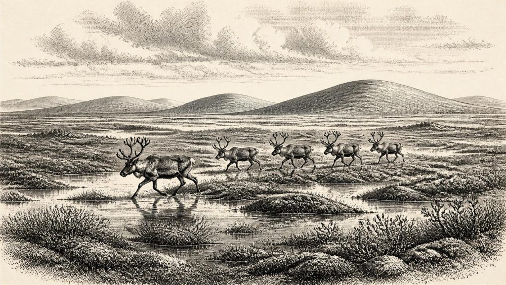
Later glaciers did much to erase or disturb earlier landscapes, which makes this survival unusually valuable. The mud was rich in plant remains and has been interpreted as recording a treeless, waterlogged, tundra-like or muskeg environment. In everyday terms, this was not the green, hedged and farmed Ireland of later millennia. It was an exposed, cold landscape of wet ground, shallow pools and sparse vegetation, shaped by frost, meltwater and short growing seasons. Such conditions could still sustain specialised plants, insects and animals; “cold” did not mean lifeless.
An Open, Changeable Landscape
The fossil evidence from Derryvree and comparable Irish deposits supports an open landscape rather than closed woodland. Mosses, sedges and other hardy plants could occupy damp ground, while dwarf shrubs and herbs grew where drainage allowed. Plant remains including mountain-avens, dwarf willow and other cold-adapted taxa have helped researchers reconstruct conditions that were severe but variable. The presence of freshwater organisms and vegetation is particularly important: it indicates that, for at least part of the period recorded, there was liquid water and an active local ecosystem rather than permanent glacier ice at the site.
Climate did not change gently from one stable state to another. MIS 3 across the North Atlantic was marked by abrupt millennial-scale oscillations between relatively milder interstadials and colder stadials. The Derryvree date range has been tentatively compared with a cluster of Greenland interstadials, though such correlations remain broad rather than exact. Ireland’s position at the Atlantic edge made it especially sensitive to shifts in ocean circulation, sea ice, snowfall and the paths of storms. A landscape capable of supporting pools and vegetation could, over longer intervals, give way to more intensely frozen ground or be overwhelmed by renewed ice.
This was also a landscape in motion. The great British–Irish Ice Sheet had not yet reached the maximum extent associated with the Last Glacial Maximum, generally placed later, around 27,000–21,000 years ago, with regional differences in timing. Research on the growth of that ice sheet suggests that substantial expansion occurred after the period represented at Derryvree. Thus 30,807 BCE belongs to an unstable pre-maximum world: one in which ice had already transformed Irish terrain and would transform it again, but where pockets of land and freshwater habitat remained available.
Animals in the Cork Caves
County Cork provides a second, very different archive. Castlepook Cave, also called Mammoth Cave, near Doneraile has yielded Ireland’s richest known assemblage of pre-Last Glacial Maximum vertebrate remains. Its deposits include bones of woolly mammoth, reindeer, giant deer, brown bear, wolf, fox, mountain hare, lemmings and spotted hyaena. Not every specimen belongs to one moment, and cave sediments can be mixed by water, carnivores, collapse and earlier excavation. Nevertheless, the assemblage demonstrates that Ireland was periodically visited or inhabited by a much richer Ice Age fauna than survives on the island today.
The animals should not be assembled into an imagined parade marching across every Irish valley in 30,807 BCE. Their bones accumulated over extended periods and under several processes. Hyaenas may have used caves as dens; carnivores could drag in carcass parts; water could move bones from their original resting places. Modern re-dating has also shown that some older radiocarbon results from Irish caves need revision. What Castlepook securely offers is ecological perspective: a cold, open Irish landscape could support large herbivores and the predators or scavengers that followed them.
Reindeer are especially relevant to this date. They were well suited to open, cold country and could have moved across broad seasonal ranges. Mammoth remains point to the presence, at least intermittently, of the wider mammoth-steppe fauna familiar from north-western Europe. Brown bears and hyaenas show that this was not a simplified world of grazing animals alone. Their presence also reminds us that caves were places with their own histories, used by animals long before archaeologists and antiquarians began removing bones from them.
A Possible Human Trace
A reindeer femur fragment from Castlepook has given this period exceptional historical interest. The bone has been presented by County Cork heritage authorities as dating to about 31,000 BCE, broadly close to the horizon considered here. Zooarchaeologist Ruth Carden identified a deep incision consistent with cutting or chopping by a sharp stone tool during carcass processing. If that interpretation is confirmed, it would indicate human activity in Ireland far earlier than the better-established terminal Pleistocene evidence from County Clare.
That conditional language is essential. The femur came from an older collection, not a recently excavated occupation floor with a hearth, stone tools, butchered-animal concentration and securely associated dates. Dating establishes the age of the reindeer bone, not independently the moment when its mark was made. Nor does one marked bone identify the people responsible, prove a permanent population, or reveal where the animal was killed. Carnivore damage, breakage, trampling, weathering and excavation history must all be distinguished carefully from human modification. Renewed excavation at Castlepook is important precisely because intact deposits may allow these questions to be tested.
If people did reach Ireland in this broad period, the evidence presently supports only a modest interpretation: a short visit by a very small, mobile Upper Palaeolithic party, perhaps handling a carcass, rather than a demonstrated settlement. There is no known house, burial, hearth, tool kit or camp from Ireland securely datable to 30,807 BCE. It is possible that later ice and sea-level change destroyed or submerged evidence, but absence cannot itself be turned into proof of a lost population.
Society Without States
There is no evidence for political affairs, diplomacy, territorial kingdoms, formal conflict or named communities in Ireland at this time. Even if the Castlepook mark proves human, it would testify to an act of subsistence, not to an Irish polity. The likely social scale of any visitors would have been small and flexible, comparable in broad terms with mobile hunter-gatherer groups elsewhere in Upper Palaeolithic Europe. That is an informed comparison, not an excavated Irish social structure.
Likewise, there is no direct Irish evidence for religious practice, art, language, formal learning, exchange networks or trade at this date. People capable of reaching Ireland would have brought knowledge, tools and social traditions, but none can be reconstructed from the reindeer femur alone. The island’s changing coastlines and lower global sea levels may have made crossings shorter or routes different from those of today, yet the evidence does not establish a walkable land bridge, a regular sea route or commercial contact. Ireland’s practical economy, insofar as it can be discussed at all, was the ecology of wild resources: water, fuel, shelter and animals.
What This Horizon Means
The most important development around 30,807 BCE was environmental rather than political. Ireland was not simply an island entombed beneath unchanging ice. Derryvree records an interval of locally ice-free, cold wetland in Fermanagh, while Castlepook preserves evidence of an Ice Age animal community in Cork and a provocative possible sign of human carcass processing. Both archives are fragmentary; both survived only because sediment, cave conditions and later study preserved traces against considerable odds.
The future for these landscapes was harsh. Ice-sheet growth eventually expanded across much of Ireland, scouring ground, rerouting drainage and removing many of the settings in which people or animals might have left evidence. The moss-rich mud below till therefore has unusual historical force. It preserves not a single day in 30,807 BCE, but a real interval in which cold water, resilient plants and Ice Age animals occupied parts of Ireland before the great advance remade the island.
Primary Sources
- A Reconsideration of the Radiocarbon Dating of the Marine Isotope Stage 3 Fauna from Southern Ireland
- Castlepook Cave
- Heritage Artefacts of County Cork
- 2022:564 – Castlepook Cave, Castlepook South, Cork
- Archaeology Research Excavation Grant 2022
- First Evidence of a Late Upper Palaeolithic Human Presence in Ireland
- New Insights on the Fauna of Ireland's Younger Dryas and Early Holocene from Alice & Gwendoline Cave
- Introduction to the Late Quaternary and Holocene of Northern Ireland
- Figure 6.— The Subdivision of the Quaternary Period in Ireland
- Trimlines, Blockfields and the Vertical Extent of the Last Ice Sheet in Southern Ireland
- Extent and Timing of the Last Glacial Maximum (LGM) in Britain and Ireland: A Review
- Growth and Retreat of the Last British–Irish Ice Sheet, 31,000 to 15,000 Years Ago: The BRITICE-CHRONO Reconstruction
- Timing and Pace of Ice-Sheet Withdrawal Across the Marine–Terrestrial Transition West of Ireland During the Last Glaciation
- Dimensions and Chronology of the Last Ice Sheet in Western Ireland
- The IntCal20 Northern Hemisphere Radiocarbon Age Calibration Curve (0–55 cal kBP)
- IntCal Publications
- Growth, Dynamics and Deglaciation of the Last British-Irish Ice Sheet: The Deep-Sea Ice-Rafted Detritus Record
- Stratigraphic and Palaeo-Geomorphological Evidence for the Glacial-Deglacial History of the Last British-Irish Ice Sheet in the North-Western Irish Sea
- The Deglaciation of the Western Sector of the Irish Ice Sheet from the Inner Continental Shelf to its Terrestrial Margin
- Subglacial Bedforms of the Irish Ice Sheet
- The Stratigraphic Position and Age of the Gortian