Derryvree’s Buried Pond30736 BCE
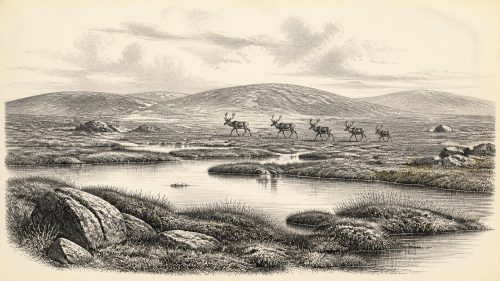
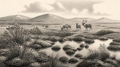
Around 30,736 BCE, Ireland’s archaeological record cannot identify a single calendar year, but Derryvree, County Fermanagh, documents an ice-free MIS 3 interval. Freshwater sediments between tills, broadly dated 36,900–31,700 cal BP, preserve tundra vegetation, including mosses, sedges, mountain avens, dwarf willow and aquatic plants, indicating a cold pond or wetland. Castlepook Cave fauna show intermittent cold-stage mammal communities, including mammoth, reindeer and predators. A marked reindeer femur may indicate human butchery around 31,000 BCE, but lacks secure contextual evidence. No settlement, polity, trade or religion is demonstrable. Later glaciation buried and fragmented this exceptional environmental record across much of Ireland.
Dateline
30,736 BCE is a useful modern filing point, not a date that can be observed in the archaeological record of Ireland. No community on the island used a calendar capable of naming such a year, and neither an artefact nor a sediment layer can be tied responsibly to one twelve-month interval so far back. Expressed in the specialist convention of calibrated years before AD 1950, it corresponds approximately to 32,686 cal BP. The safest setting is the Late Pleistocene, within Marine Isotope Stage 3 (MIS 3), an unstable middle part of the last Ice Age. The closest major Irish environmental archive, at Derryvree near Maguiresbridge in County Fermanagh, belongs broadly to this world rather than demonstrably to this exact year.
Derryvree matters because it preserves a rare interval in which north-west Ireland was not covered by glacier ice. A road cutting through a drumlin in 1969 exposed freshwater silts, fine sands and organic material between two separate sheets of till. The lower till records an earlier ice advance; the upper till shows that ice later returned and buried the intervening landscape. Between them lies the evidence for a cold, exposed freshwater environment. The original radiocarbon determination, Birm-166, was 30,500 +1,170/−1,030 radiocarbon years BP. It is not equivalent to a calendar year. Published calibrated treatments place the deposit broadly at about 36,900–31,700 cal BP, a range that includes the approximate calendar position represented by 30,736 BCE.
A Pond Beneath a Future Drumlin
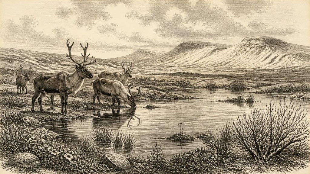
The Derryvree sediments provide the clearest responsible picture of one Irish locality around this very remote period. Their plant and animal remains indicate an open tundra or tundra-like mosaic under periglacial conditions: ground repeatedly affected by hard frost, thaw, sparse cover and short growing seasons. This was not a forested Ireland, nor necessarily an unbroken white wilderness. It was a landscape in which vegetation could occupy wet hollows and sheltered ground while severe cold shaped the wider terrain.
Fossil evidence from the freshwater beds includes mosses, sedges and cold-tolerant flowering plants. Mountain avens (Dryas octopetala), dwarf willow, bogbean (Menyanthes trifoliata) and lesser clubmoss are especially revealing. Mountain avens and dwarf willow belong to open, cold environments; bogbean and water-milfoil point to standing or slow-moving fresh water. These finds do not reconstruct every hill, valley or season in Fermanagh. They do show that, during the formation of the deposit, a local pond or wetland supported aquatic plants and a low, treeless flora beside it.
Such evidence is important precisely because later glaciation erased or disturbed much older ground surface across Ireland. The Derryvree pond was eventually overridden and sealed by ice-derived sediment. Its survival is therefore exceptional, not typical. It demonstrates ice-free conditions at that spot during part of MIS 3, but cannot prove that the whole island was simultaneously open, nor establish the precise width of glaciers elsewhere. Ireland’s ice cover advanced and retreated in complex regional patterns, and the far more extensive Last Glacial Maximum lay ahead. Reconstructions show ice reaching the Atlantic shelf north-west of Ireland by roughly 26,800 cal BP, several millennia after the broad Derryvree interval.
Cold Country, Living Water
The Derryvree record corrects a common misconception: an Ice-Age Ireland was not always wholly entombed beneath an ice sheet. At this point in the last glacial cycle, at least some places could offer exposed ground, fresh water and summer plant growth. Yet its ecology was constrained. There is no evidence here for arable fields, managed pasture, permanent villages or woodland resources. The productive months would have been brief; winters were long, and seasonal freezing and thawing were central forces in the making of soils, slopes and wetlands.
Animal bones from caves, especially in the south, give a broader but less tightly controlled picture. Castlepook Cave near Doneraile, County Cork—historically also called Mammoth Cave—has yielded an extraordinary Ice-Age assemblage: woolly mammoth, reindeer, giant deer, brown bear, wolf, foxes, Arctic fox, mountain hare, lemmings and spotted hyaena. This is compelling evidence that Ireland was at times reached by continental-style cold-stage mammal communities. It also signals a food web more varied and dangerous than anything known in later historic Ireland: large grazing and browsing animals, smaller cold-adapted mammals, and formidable predators and scavengers.
There are, however, strict limits to what a cave bone list can tell us. Castlepook was excavated principally in the early twentieth century, before modern recording standards, and caves accumulate remains through many processes: animals die naturally, carnivores drag in carcasses, water redeposits bones, and people may sometimes carry material in. Different specimens may also be separated by thousands of years. The assemblage should therefore not be imagined as a single herd watched by a single group of hunters in 30,736 BCE. Modern reassessment and new dating programmes have shown how much older radiocarbon results can change when samples are treated and measured with improved methods.
The Human Question at Castlepook
One Castlepook find gives this period exceptional archaeological importance. A reindeer femur in the National Museum of Ireland collection has been dated to around 33,000 years ago and bears a deep mark interpreted by zooarchaeologist Ruth Carden as having been made with a sharp stone tool during butchery. Cork County heritage material accordingly presents it as possible evidence that Palaeolithic hunters handled reindeer in north Cork around 31,000 BCE. If the interpretation is confirmed, it would be a strikingly early trace of human activity in Ireland and would transform the older assumption that people first arrived only after the great ice retreat.
But it must remain a carefully qualified claim. The dated bone establishes the age of the reindeer’s death, not automatically the date or agency of the surface mark. It came from an old cave collection rather than a modern excavation of an intact occupation floor. No securely associated hearth, stone-tool assemblage, dwelling, human burial or repeatedly used hunting camp of comparable age has yet been recovered in Ireland. The bone may record a brief episode of carcass processing by people; it does not demonstrate a settled population, continuous occupation, a named cultural group or a route by which people arrived.
The distinction is especially important because the better-established evidence for humans in Ireland is much later. Research at Alice and Gwendoline Cave in County Clare has identified a butchered brown-bear bone dated to the terminal Pleistocene, around 12,800–12,600 cal BP. Recent work stresses both the importance of old museum collections and the rarity of securely dated Irish evidence. In that wider context, the Castlepook femur is best treated as a provocative, potentially decisive clue awaiting fuller corroboration, not as a finished history of the first Irish people.
No Polities, No Proven Trade
For political affairs, conflict, diplomacy, religion, formal learning and trade, the honest answer is that the evidence is silent. There were no documented kingdoms, frontiers, rulers, treaties, shrines or schools; indeed, there is no writing from which a political or religious world could be recovered. It would be misleading to impose later Irish identities, Celtic language, tribal names or national boundaries upon this deep past.
If people did visit Ireland during this part of MIS 3, comparison with Upper Palaeolithic lifeways elsewhere in north-west Europe suggests small, mobile groups able to exploit seasonally available animals and materials. That is an inference, not an Irish observation. The likely practical concerns would have been shelter, fire, stone for cutting tools, hides, meat, weather and safe movement through unfamiliar ground. Nothing currently supports claims for permanent settlement, farming, livestock keeping, long-distance exchange networks or ritual monuments in Ireland at this date.
Movement between Ireland, Britain and continental Europe remains a central but unresolved question. Lower global sea levels changed coastlines and narrowed or reconfigured sea passages, while glaciers and frigid waters created barriers of their own. The presence of cold-stage mammals proves that colonisation occurred at least intermittently, but it does not reveal a single dry land bridge, a regular migration corridor or the manner of every crossing. Ireland was a peripheral and environmentally changeable part of the north-west European world, not an isolated ecological capsule.
A Landscape Before the Great Advance
The most important development represented by 30,736 BCE is therefore environmental rather than political: Ireland contained, at least regionally and intermittently, habitable cold-stage landscapes before the later expansion of the last ice sheet. Derryvree preserves the local evidence of fresh water and hardy vegetation; Castlepook preserves the broader reality of large mammals and carnivores; one reindeer femur raises the possibility of a human encounter with that world.
None of these archives permits a diary entry for a particular year. Together, they replace an empty prehistoric blank with a more vivid but properly bounded picture: frost-worked open ground, shallow wetlands, low Arctic-alpine plants, reindeer and mammoth country, and caves whose deposits hold evidence of animals, carnivores and perhaps fleeting people. The subsequent advance of ice would bury, scour and fragment much of that record, making each surviving layer and bone unusually valuable.
Primary Sources
- A Middle Midlandian Freshwater Series at Derryvree, Maguiresbridge, County Fermanagh, Northern Ireland
- A Reconsideration of the Radiocarbon Dating of the Marine Isotope Stage 3 Fauna from Southern Ireland
- The Irish Quaternary Fauna Project
- New Insights on the Fauna of Ireland’s Younger Dryas and Early Holocene from Alice & Gwendoline Cave
- First Evidence of a Late Upper Palaeolithic Human Presence in Ireland
- The Colonization of Ireland: A Human Ecology Perspective
- Exploring Controls of the Early and Stepped Deglaciation on the Western Margin of the British Irish Ice Sheet
- Growth and Retreat of the Last British–Irish Ice Sheet, 31,000 to 15,000 Years Ago: the BRITICE-CHRONO Reconstruction
- Timing and Pace of Ice-Sheet Withdrawal Across the Marine–Terrestrial Transition West of Ireland During the Last Glaciation
- Early Deglaciation of the British-Irish Ice Sheet on the Atlantic Shelf Northwest of Ireland Driven by Glacioisostatic Depression and High Relative Sea Level
- New Data for the Last Glacial Maximum in Great Britain and Ireland
- Radiocarbon Constraints on the Age of the Maximum Advance of the British–Irish Ice Sheet in the Celtic Sea
- Ireland: Submerged Prehistoric Sites and Landscapes
- Episodic Speleothem Deposition Tracks the Terrestrial Impact of Millennial-Scale Last Glacial Climate Variability in SW Ireland
- Figure 6.— The Subdivision of the Quaternary Period in Ireland
- Archaeological Heritage of County Cork
- Heritage Artefacts of County Cork
- 2022:564 — Castlepook Cave, Castlepook South, Cork
- BSBI: Menyanthes trifoliata
- BSBI: Selaginella selaginoides
- BSBI: Dryas octopetala
- Sedimentary and Foraminiferal Records of Late Quaternary Environmental Change West of Ireland and Implications for the Last British–Irish Ice Sheet
- Trimlines, Blockfields and the Vertical Extent of the Last Ice Sheet in Southern Ireland
- Landscapes and Environments of the Last Glacial-Interglacial Transition: A Time of Amazingly Rapid Change in Ireland