

BIRM-166’s Long Season30598 BCE
About 30,598 BCE, Ireland was not a recorded society but a changing Pleistocene environment within Marine Isotope Stage 3. At Derryvree, County Fermanagh, freshwater organic deposits between glacial tills demonstrate an ice-free wetland interval, dated broadly rather than precisely, amid recurring ice advances. Plants indicate cold, treeless tundra with shallow water and sedge-rich margins. Lower sea levels and shifting ice affected access to Ireland. Cave remains show reindeer, mammoth and other cold-adapted fauna. A cut-marked Castlepook reindeer bone suggests possible early human activity, but confirms neither settlement nor continuity. Together, evidence reveals intermittent habitats supporting life before later maximum glaciation.
Dateline
30,598 BCE is a modern chronological label, not a year that anyone in Pleistocene Ireland could have named or recorded. There was no Irish calendar, writing, settlement chronology or historical testimony from which to recover an event in this particular year. The date translates only approximately to 32,500 calendar years before AD 1950, and even that conversion should not imply precision. For this depth of time, radiocarbon measurements, their calibration, and the time-span represented by natural sediments are more meaningful than a single BCE year.
The responsibly recoverable history of Ireland at this point belongs to the later part of the Pleistocene, within Marine Isotope Stage 3. It is an environmental and archaeological history built from glacial deposits, pollen, plant macrofossils, insects, animal bones and a very small number of possible human traces. Its principal lesson is not that Ireland was uniformly frozen or uniformly hospitable, but that conditions changed sharply across time and place. Ice, exposed ground, shallow freshwater, tundra vegetation and mobile animal populations could all form parts of the Irish landscape during the broad interval relevant to 30,598 BCE.
A Date Within a Range
The most informative evidence close to this nominal date comes from Derryvree near Maguiresbridge, County Fermanagh. Roadworks exposed a sequence within a drumlin: glacial till below, freshwater and organic deposits in the middle, and another thick till above. Till is sediment laid down directly by glacier ice. The sequence therefore establishes an important order of events. Ice had covered the locality; a period followed in which open or slow-moving freshwater and wet ground developed; then ice returned and sealed the deposits beneath later glacial material.
Organic sediment from this inter-till freshwater series produced the conventional radiocarbon determination BIRM-166, approximately 30,500 radiocarbon years before present, with a substantial laboratory uncertainty. A radiocarbon age is not identical to a calendar age: atmospheric carbon-14 has varied through time, and calibration produces broad probability ranges rather than a single exact date. Modern calibration places the result broadly around 36,900–31,700 calibrated years before present, approximately 34,950–29,750 BCE. The requested year falls within that wide range, but cannot be isolated within it. Derryvree is consequently evidence for an interval, not a diary entry for 30,598 BCE.
That distinction matters. A layer of silt may represent years, centuries or longer, while a radiocarbon determination dates carbon-bearing material rather than every plant, animal or event in a deposit. Nor does one Fermanagh exposure prove that all of Ireland had the same weather, vegetation or ice cover at the same instant. What it securely shows is that an ice-free freshwater environment existed at Derryvree between two episodes of glacial deposition.
Wet Ground at the Ice Margin
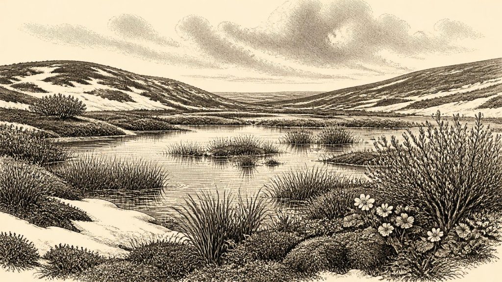
The biological remains at Derryvree give this otherwise abstract stratigraphy a living setting. They include freshwater and wetland plants, mosses, sedges and aquatic forms, alongside species suited to cold, open conditions. Mountain-avens, dwarf willow and other arctic-alpine elements indicate a treeless or nearly treeless landscape around the water. The evidence does not support later images of a densely wooded, settled Ireland. It points instead to low vegetation, exposed mineral ground, wet margins, seasonal cold and a short growing season.
Yet this was not simply a blank white wilderness. Freshwater plants and mosses require local water, and the sediments preserve an ecological mosaic: shallow water, saturated soils, sedge-rich margins and open tundra beyond them. Such places could be productive in the brief warmer season, offering vegetation for herbivores and sheltered ground for smaller animals. Frost action, snow cover and violent seasonal variation probably shaped daily conditions far more than any stable annual cycle familiar in modern Ireland.
The wider climate system was also unstable. Greenland ice-core records show that the last glacial period contained abrupt shifts between colder stadials and relatively milder interstadials. Correlating a particular Irish deposit precisely with a named Greenland event is difficult, especially where radiocarbon uncertainty is large. Nonetheless, Derryvree belongs to a world in which climatic changes could alter snow cover, vegetation, animal movements and the behaviour of ice sheets within comparatively short geological intervals. Its freshwater horizon is valuable precisely because it preserves a local pause in a landscape repeatedly transformed by ice.
Ice, Land and Changing Routes
Ireland’s geography was markedly unlike that of today. Global sea level was lower during the last glacial period, exposing more of the continental shelf, while glaciers and ice-dammed waters reshaped routes across the Irish Sea region. It would be misleading, however, to draw a simple land bridge and assume easy travel. Access depended on the changing extent of ice, the nature of the terrain, rivers and coasts, and conditions on the land between Ireland and Britain or continental Europe.
Research on the British–Irish Ice Sheet demonstrates that its growth and retreat were not one smooth, island-wide process. Its maximum extent was reached later than the date considered here, while different sectors advanced and retreated at different times. Derryvree’s paired tills and intervening wetland are a local reminder of that dynamism. By about 30,598 BCE, some Irish landscapes had evidently provided ice-free ecological niches, but the long-term trajectory was towards the much more extensive glaciation of the Last Glacial Maximum.
There were no political frontiers, kingdoms or diplomatic relations to describe. Nor is there evidence for ports, exchange networks or managed territory. The meaningful regional change was environmental: the shifting balance between ice, water, exposed land and vegetation determined where animals, and perhaps people, could move. In this sense, glacial geography was the closest equivalent to politics: it regulated opportunity, isolation and survival without institutions or written agreements.
Animals in a Cold Landscape
Southern Irish caves, especially Castlepook Cave near Doneraile in County Cork, preserve a different but complementary archive. The Irish Quaternary Fauna Project and later re-dating work have shown that Ireland supported a considerably richer Pleistocene fauna than the modern island. Finds from cave collections include reindeer, woolly mammoth, giant deer, brown bear, wolf, Arctic fox, lemmings and spotted hyaena. They demonstrate that animals repeatedly reached Ireland during the broad period from at least about 45,000 to 20,000 years ago.
Those species should not be assembled into a single illustrated herd for one exact year. Cave deposits may mix material accumulated over long periods, and revised radiocarbon techniques have shown that some older measurements were unreliable or too young. The safest conclusion is that cold-adapted and open-country animals formed part of Ireland’s wider Marine Isotope Stage 3 fauna. Reindeer are particularly relevant to the cold, relatively open environments suggested by Derryvree; mammoth and hyaena attest to ecological connections extending far beyond the island.
The caves also caution against treating fossils as straightforward records of everyday animal abundance. Carnivores may have dragged carcasses into caves; water, collapse and earlier excavations can disturb layers; and preservation is highly selective. A bone proves that an animal, or material from it, reached a place. It does not by itself reveal herd size, migration route, season, or the full food web of a particular valley.
The Human Question
A reindeer femur from Castlepook has made this period especially significant for Irish prehistory. The bone has been reported as roughly 31,000 BCE and bears a deep mark interpreted as having been made by a sharp stone tool during butchery. If that interpretation is sustained, it would provide a strikingly early indication that people handled a reindeer carcass in Ireland during the Upper Palaeolithic.
Its importance requires restraint. The dated bone is close in broad age to the period discussed here, but neither its radiocarbon result nor the cut mark can establish an activity on the precise modern date of 30,598 BCE. Nor has a securely associated camp, hearth, stone-tool assemblage, dwelling, burial, human bone or occupation surface of that age been identified at Castlepook. One modified bone could indicate a short visit by hunters or scavengers; it cannot demonstrate permanent settlement, population size, language, ancestry or continuous occupation.
Accordingly, society and everyday life remain largely unknowable. If people were present, they would have depended on knowledge, co-operation, clothing, fire and mobile subsistence appropriate to a severe Upper Palaeolithic world; these are reasonable inferences from the wider north-west European context, not direct observations from Ireland. No Irish evidence from this date identifies households, gender roles, kin groups, ritual places, art, music or a system of belief. There is likewise no basis for describing trade, organised conflict or diplomacy.
What This Moment Represents
The enduring importance of about 30,598 BCE lies in the quality of the questions that the evidence permits. Derryvree records a cold freshwater refuge between glacial advances. Castlepook and other caves show that large mammals reached Ireland during the same broad climatic era. A marked reindeer femur raises, but does not settle, the possibility of exceptionally early human activity. Together, these records replace an old picture of an entirely lifeless, permanently ice-covered island with a more demanding one: an Ireland of changing habitats, interrupted access and fragmentary survival.
This was not yet a human historical landscape in the usual sense. It had no recoverable rulers, towns, religions or treaties. But it was already a place with environmental histories: wetlands formed and vanished, ice advanced, plants colonised bare ground, and animals navigated a changing north-west European world. The sediments beneath the Fermanagh drumlins are therefore not merely prelude. They are the earliest surviving chapters of Ireland’s long, uneven capacity to sustain life.
Primary Sources
- Early Midlandian–Middle Midlandian, Pleistocene, Northern Ireland
- Growth and Retreat of the Last British–Irish Ice Sheet, 31,000 to 15,000 Years Ago: the BRITICE-CHRONO Reconstruction
- A Reconsideration of the Radiocarbon Dating of the Marine Isotope Stage 3 Fauna from Southern Ireland
- The Irish Quaternary Fauna Project
- The Colonization of Ireland: A Human Ecology Perspective
- First Evidence of a Late Upper Palaeolithic Human Presence in Ireland
- New Insights on the Fauna of Ireland's Younger Dryas and Early Holocene from Alice & Gwendoline Cave
- Heritage Artefacts of County Cork
- Figure 6.— The Subdivision of the Quaternary Period in Ireland
- Irish Association for Quaternary Studies Guide 13
- Freshwater Organic Deposits and Stratified Sediments Between Early and Late Midlandian (Devensian) Till Sheets, at Aghnadarragh, County Antrim, Northern Ireland
- Trimlines, Blockfields and the Vertical Extent of the Last Ice Sheet in Southern Ireland
- Investigating Seasonal Mobility in Irish Giant Deer Megaloceros giganteus Through Strontium Isotope Analysis
- The Late Quaternary History of East-Central Ireland
- Match Points Used for Synchronization of NGRIP, GRIP, and GISP2
- The Greenland Ice Core Chronology 2005, 15–42ka. Part 1: Constructing the Time Scale
- High-Resolution Record of Northern Hemisphere Climate Extending into the Last Interglacial Period
- Significance of Uncertain Phasing Between the Onsets of Stadial–Interstadial Transitions in Different Greenland Ice Core Proxies
- Radiocarbon Dates from the Oxford AMS System: Archaeometry Datelist 31
- A Middle Midlandian Freshwater Series at Derryvree, Maguiresbridge, County Fermanagh, Northern Ireland



