Derryvree’s Mountain-Avens30682 BCE
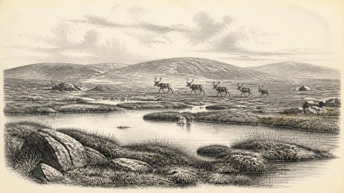
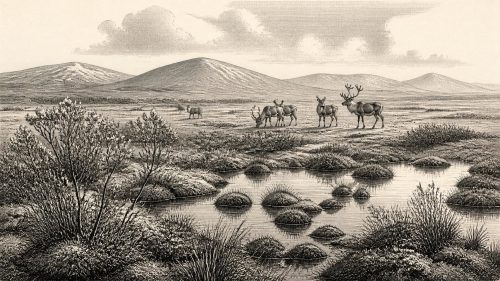
Around 30,682 BCE, Ireland’s history is reconstructed chiefly from the Derryvree freshwater deposits in County Fermanagh, preserved between glacial tills. Their broad radiocarbon range indicates an ice-free local interval during volatile MIS 3 conditions, not a precisely datable year. Mosses, sedges, dwarf willow, mountain-avens and aquatic plants reveal open, treeless periglacial tundra-steppe with pools and wet margins. Cave fauna from southern Ireland suggests cold-adapted communities including reindeer, mammoth, giant deer, predators and scavengers, though deposits are mixed. Human presence remains unproven: a butchered bone cannot establish settlement. No farming or permanent communities existed. Later ice expansion buried and erased evidence.
Dateline
The label 30,682 BCE is useful only as a modern point of reference. It does not identify an Irish event, ruler, settlement or generation. At this depth in time, calendar-year precision is impossible: the date falls about 32,631 years before AD 1950, within the Late Pleistocene and Marine Isotope Stage 3 (MIS 3), a climatically volatile phase of the last Ice Age. The most responsible account is therefore built from broad, calibrated ranges and from deposits that accumulated over centuries or millennia, not from an imagined twelve-month chronicle.
The key Irish evidence is the Derryvree freshwater sequence near Maguiresbridge, County Fermanagh. Roadworks in 1969 exposed organic silts and fine sands enclosed between two thick sheets of till: unsorted sediment laid down by glacier ice. Organic material from the middle deposit produced a conventional radiocarbon age of 30,500 +1,170/−1,030 years BP. Calibrated with modern curves, this is commonly expressed as roughly 36,900–31,700 cal BP, or approximately 34,950–29,750 BCE. The nominal year considered here lies within that broad range, but cannot be pinned to an individual bed, season, community or episode at Derryvree.
A Wetland Between Glaciers
Derryvree’s importance lies in its sequence. An earlier glacier deposited the lower till. Ice then ceased to occupy the locality long enough for freshwater sediments, plant remains and small animal evidence to accumulate in a basin. Later glacial activity buried that organic archive beneath another till. This demonstrates an ice-free interval at the site; it does not prove that every part of Ireland was simultaneously ice-free, nor that the precise extent of ice can be mapped for 30,682 BCE. Ireland’s older Pleistocene landscapes were repeatedly eroded, overridden and concealed by later ice, so such surviving windows are exceptionally valuable.
Older Irish Quaternary terminology associated deposits of this kind with the Middle Midlandian, part of the wider Devensian cold stage known in Britain and Ireland. The Derryvree material has also been related, cautiously, to a span of Greenland interstadials, rather than securely matched to one brief climatic oscillation. Greenland ice cores show that MIS 3 was marked by abrupt shifts between relatively milder and colder conditions, but the chronological resolution of Irish sediments does not justify assigning a named Greenland event to a particular year at Maguiresbridge.
Open Ground, Pools and Frost
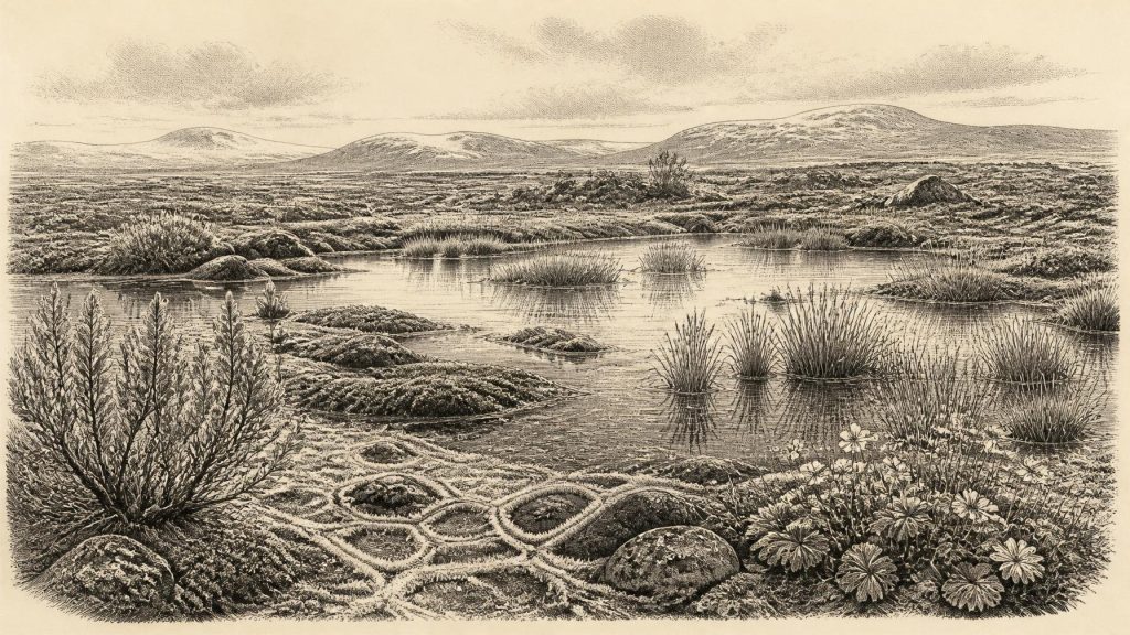
The fossils at Derryvree provide the clearest picture of local conditions. They indicate an open, treeless tundra or tundra-steppe setting with periglacial ground conditions: cold soil subject to seasonal freezing and thawing, rather than a forested Ireland or an unbroken sheet of glacier ice. Mosses and sedges grew around freshwater. Plant evidence includes dwarf willow, mountain-avens, bogbean, lesser clubmoss and alternate water-milfoil. Taken together, these remains show that the basin contained open water and wet margins while the surrounding country supported sparse, cold-adapted vegetation.
That combination deserves emphasis. Bogbean and water-milfoil are not signs of a mild woodland landscape; they are evidence that freshwater habitats could persist within a severe climate. Dwarf willow and mountain-avens, meanwhile, point to exposed ground, short growing seasons and vegetation able to withstand cold. The reconstructed landscape was probably a mosaic. Low hollows could hold pools, sedge beds and mossy mud; slightly raised, better-drained ground could carry herbs, grasses and small shrubs; frost action, snow cover and fluctuating runoff would repeatedly alter the available habitat.
The evidence is local, but it changes the scale on which prehistoric Ireland should be imagined. Around this time there was no familiar island of green fields, enclosed farms and wooded valleys. Sea levels were substantially lower than today, and coastlines lay farther out on the continental shelf. Yet the exact shape of Irish coasts, channels and routes at any particular moment cannot be recovered from Derryvree alone. What can be said is that both water and ice were dynamic forces: advancing glaciers, meltwater, wetlands, exposed ground and changing sea level made Ireland an unstable environment rather than a fixed geographical stage.
Animals in an Unsettled Landscape
Other Irish sites help flesh out this environmental setting, especially Castlepook Cave, also known as Mammoth Cave, near Doneraile in north County Cork. Its mixed cave deposits have yielded remains attributed to mammoth, reindeer, giant deer, brown bear, wolf, Arctic fox, lemmings and spotted hyaena. The cave assemblage is not a neatly sealed snapshot: antiquarian excavation and later disturbance mean that bones from different ages may have become mixed. Nevertheless, renewed radiocarbon work confirms that several mammals were present in Ireland during MIS 3, and indicates that some species, including giant deer and spotted hyaena, had disappeared locally before the Last Glacial Maximum.
The animal evidence supports, but must not be overextended beyond, the Derryvree picture. Reindeer and lemmings suit cold, open habitats; Arctic fox likewise belongs to a northern, exposed fauna. Mammoth and giant deer evoke large herbivores moving through broad landscapes, while wolves and hyaenas indicate scavenging and predation. Their presence does not mean that every species ranged across Ireland at once, or that any particular herd passed Derryvree in 30,682 BCE. It does show that Ireland could periodically sustain complex cold-stage animal communities during MIS 3. Caves may have served as dens, traps, shelters or places where bones accumulated through carnivore activity as well as natural processes.
People: A Necessary Caution
The most important historical restraint concerns humans. No securely dated settlement, hearth, stone-tool assemblage, dwelling floor, grave or food-processing area can be assigned to Ireland in this particular year or to the Derryvree interval. A reindeer bone from Castlepook has been reported as bearing marks made while fresh, interpreted as evidence of butchery and therefore possible human activity around 33,000 years ago. That claim is significant, but a single modified bone is not the same as a securely excavated camp, and its relationship to the cave’s complex deposits limits what can be inferred about occupation. It cannot demonstrate a resident population, a named group, a migration route or continuous human presence.
Accordingly, political affairs, diplomacy and organised warfare are absent from the evidence. There are no polities, leaders, boundaries, treaties or battle sites to describe. Nor can religion, language, music, teaching or art be responsibly reconstructed for Ireland at this date. If people did reach the island or its then-expanded western approaches during milder windows, they may have been highly mobile hunter-gatherers operating in very small numbers, but that is an inference from wider Upper Palaeolithic comparisons, not a documented Irish social history. The archaeological record cannot yet distinguish a brief visit from longer occupation.
Economy Without Farms or Trade
There was no agricultural economy in Ireland around 30,682 BCE. Farming, livestock herding, metalworking, pottery, monuments and permanent villages all belong to far later periods. The only plausible human subsistence economy, if humans were present at all, would have centred on hunting, scavenging, gathering and the opportunistic use of animal and plant resources. But Derryvree records environment, not a human menu: it cannot establish what anyone ate, which tools they used, how labour was organised or whether materials moved between Ireland and Britain.
Trade and diplomacy therefore cannot be written into this landscape. Lower sea level may have changed distances and exposed shelf areas, but a physical possibility of travel is not evidence that people travelled, exchanged goods or maintained social networks. The responsible conclusion is more modest. The Derryvree wetland and the southern cave fauna indicate that parts of Ireland contained ecological opportunities during a harsh, fluctuating interval of the Ice Age. Those opportunities could have mattered to animals, and potentially to people, but the evidence does not yet permit a narrative of settlement or contact.
Approaching Greater Ice Growth
Derryvree also matters because it precedes a profound transformation. The last British–Irish Ice Sheet expanded strongly after this broader interval and reached its greatest overall volume around 23,000 years ago, during the Last Glacial Maximum. Later ice movement reshaped Irish relief, spread tills, altered drainage and destroyed or buried much of the surface evidence that might otherwise illuminate earlier landscapes. The wetland’s survival beneath till is thus both fortunate and instructive: it preserves proof that a cold but living Ireland existed before the great expansion of ice.
For 30,682 BCE, then, the best history is an environmental one. At Derryvree, at some point within a wide calibrated span that includes this modern year-label, freshwater lay among mosses, sedges and Arctic-alpine plants in an open periglacial landscape. Elsewhere, cold-adapted mammals occupied parts of Ireland during MIS 3. Whether humans briefly joined them remains an important but unresolved question. Precision ends there; the evidence is compelling precisely because it preserves a landscape without pretending to supply a calendar-year story.
Primary Sources
- A Middle Midlandian Freshwater Series at Derryvree, Maguiresbridge, County Fermanagh, Northern Ireland
- Early Midlandian–Middle Midlandian, Pleistocene, Northern Ireland
- Exploring Controls of the Early and Stepped Deglaciation on the Western Sector of the British–Irish Ice Sheet
- Growth and Retreat of the Last British–Irish Ice Sheet, 31,000 to 15,000 Years Ago: the BRITICE-CHRONO Reconstruction
- A Reconsideration of the Radiocarbon Dating of the Marine Isotope Stage 3 Fauna from Southern Ireland
- The Irish Quaternary Fauna Project
- Episodic Speleothem Deposition Tracks the Terrestrial Impact of Millennial-Scale Last Glacial Climate Variability in SW Ireland
- A Stratigraphic Framework for Abrupt Climatic Changes During the Last Glacial Period Based on Three Synchronized Greenland Ice-Core Records
- The IntCal20 Northern Hemisphere Radiocarbon Age Calibration Curve (0–55 cal kBP)
- The Timing and Magnitude of the British–Irish Ice Sheet Between Marine Isotope Stages 5d and 2
- Trimlines, Blockfields and the Vertical Extent of the Last Ice Sheet in Southern Ireland
- Freshwater Organic Deposits and Stratified Sediments Between Early and Late Midlandian (Devensian) Till Sheets, at Aghnadarragh, County Antrim, Northern Ireland
- Middle Midlandian Interstadial Deposits at Greenagho, Near Belcoo, County Fermanagh, Northern Ireland
- Clogher Valley
- BSBI: Dryas octopetala
- BSBI: Menyanthes trifoliata
- BSBI: Salix herbacea
- BSBI: Myriophyllum alterniflorum
- BSBI: Selaginella selaginoides
- New Insights on the Fauna of Ireland’s Younger Dryas and Early Holocene from Alice & Gwendoline Cave
- Phylogeographic, Ancient DNA, Fossil and Morphometric Analyses Reveal Ancient and Modern Introductions of Stoats (Mustela erminea) to Ireland