

Derryvree’s Pre-Glacial Wetlands30600 BCE
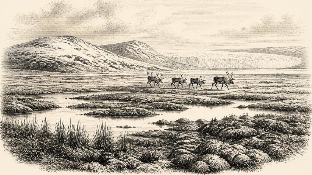
Around 30,600 BCE, Ireland lay within a climatically unstable Late Pleistocene interval as the British-Irish Ice Sheet expanded. Lower seas linked it to Britain and Europe, though coasts and ice margins shifted. At Derryvree, County Fermanagh, organic deposits between glacial tills record a cold, treeless wetland supporting hardy plants during an interval between ice advances. Castlepook Cave fauna indicates that reindeer, mammoth and predators could occupy or reach Ireland. A marked reindeer femur may indicate human butchery, but disturbed context and absent associated artefacts prevent confirmation of Palaeolithic settlement. Evidence therefore depicts a shifting ecological frontier, not a settled landscape.
Dateline
“30,600 BCE” is a modern label for a point in the Late Pleistocene, not a year recorded, named or experienced within any Irish calendar. It equates arithmetically to about 32,550 years before AD 1950, the conventional “present” used in radiocarbon work, but that does not give the date calendar-year precision. At this depth in time, radiocarbon determinations carry substantial uncertainties and must be calibrated; environmental deposits can often be placed only within broad ranges. The responsible subject, therefore, is not an event in one exact year, but Ireland during the unstable later part of Marine Isotope Stage 3, as climates deteriorated towards the Last Glacial Maximum.
An Island in Deep Time
Ireland was then part of the north-western fringe of Europe, exposed to rapid climatic shifts and to the growth and movement of the British–Irish Ice Sheet. The familiar coastline, woods, fields, bogs and settlements of later Ireland did not exist. Sea level was far lower than it is now because immense quantities of water were held in continental ice sheets. The extent of dry land, marine channels, seasonal sea ice and glacier margins changed through time, so it is unsafe to imagine a fixed modern island or a single permanent route into it. What is clear is that Ireland’s geography was environmentally connected to Britain and the wider European north-west in ways later seas would greatly reduce.
Scholars differ over the detailed timing and pattern of ice growth across Ireland. Broad syntheses indicate that the island was not yet uniformly smothered by the ice cover that reached its greatest extent during the Last Glacial Maximum, conventionally placed roughly between 27,000 and 19,000 calibrated years before present. Recent ice-sheet reconstructions also show that advance and maximum extent varied greatly between sectors. Around the notional date used here, some ground may have remained exposed while ice expanded in particular regions. The evidence does not justify a map with a sharply drawn coast of ice for 30,600 BCE; it supports a changing, cold and increasingly glaciated landscape.
The Derryvree Evidence
The most illuminating Irish archive for this broad interval lies at Derryvree near Maguiresbridge in County Fermanagh. There, organic-rich silts and fine sands were found between two tills: deposits left directly by separate episodes of glaciation. The sequence is exceptionally important because the organic layer preserves evidence of an interval when freshwater and vegetation existed between ice advances. Its conventional radiocarbon determination, BIRM-166, was reported as 30,500 ± 1,200 radiocarbon years before present. Calibration gives a broad range, reported in later discussion as approximately 36,900–31,700 calibrated years before present. That range encompasses a long span rather than a single moment.
Derryvree cannot prove that its marsh lay exactly where, or precisely when, a visitor using the modern label 30,600 BCE might expect it. It does, however, securely demonstrate the sort of environmental window available in north-central Ireland during this phase of the Ice Age. The organic deposits have been interpreted as recording a cold, treeless muskeg or wetland landscape: shallow freshwater, waterlogged ground and low vegetation rather than closed forest. Such places were biological refuges on an otherwise exposed terrain. Mosses, sedges and other hardy wetland and arctic-alpine plants could exploit damp ground during seasons when liquid water was available, while frost, snow cover and permafrost-like conditions constrained growth for much of the year.
This is evidence, not a complete scene. Sediment, pollen, plant remains and insects reveal habitats and processes more readily than they reveal annual temperatures, animal numbers or the appearance of every valley. Still, the Derryvree layer corrects a misleading picture of an Ireland that was simply blank, white and lifeless before the Last Glacial Maximum. Cold landscapes contained ecological mosaics: ponds, wet hollows, mineral soils, exposed gravel, sheltered slopes and snow patches. Their distribution altered as glaciers advanced, meltwater drained and the climate oscillated.
Animals at the Atlantic Edge
Caves and old fossil collections provide the principal evidence for larger animals in Ice Age Ireland, although they must be used cautiously. Castlepook Cave, also known as Mammoth Cave, near Doneraile in north County Cork produced a notable assemblage during early twentieth-century excavations. It includes remains attributed to such cold-stage animals as reindeer, woolly mammoth, brown bear, wolf, Arctic fox and spotted hyaena. Not every species need have occupied the district simultaneously, and a cave assemblage does not necessarily represent animals living in the cave. Carnivores may have carried bones inside; water, collapse and older excavation methods could mix material from different episodes.
Nevertheless, the fauna shows that Ireland could support, or at least receive, large mammals associated with the open grassland, herb-rich steppe and tundra environments of Pleistocene north-west Europe. Reindeer are especially evocative because they could move seasonally across very large territories. Mammoth and large deer required substantial forage, while hyaenas and wolves point to predator–scavenger relationships around carcasses. These animals were neither symbols nor resources of an identifiable Irish people. They are fossil evidence for food webs operating in a severe landscape. Their movements may also have followed shifting corridors of favourable grazing, avoiding deep ice, extensive meltwater and the most barren terrain.
In everyday ecological terms, survival depended upon seasonality. Plants had short growing periods; grazing animals had to find enough forage; predators followed prey or scavenged losses. Rivers and pond margins offered water and vegetation, but flooding, freezing and sediment movement could remake them quickly. The later glacier did more than cover land: it eroded, buried and rearranged deposits, helping to explain why the Irish record of this age is so fragmentary. The scarcity of sites is thus not, by itself, proof that no life was present.
The Reindeer Femur Question
One Castlepook object has brought the question of people into this period. A reindeer femur in the National Museum of Ireland’s collection has been publicised by County Cork heritage authorities as dating to about 31,000 BCE and as bearing a deep mark interpreted by zooarchaeologist Ruth Carden as made by a sharp stone tool during butchery. If that interpretation is accepted, it suggests that one or more Upper Palaeolithic people handled a reindeer carcass in Ireland during the broader climatic period close to this article’s nominal date.
The conclusion must remain deliberately narrow. A radiocarbon date on bone dates the death of the animal, not automatically the making of a surface mark, the location of butchery, or the length of a human visit. Identifying a cut mark is a taphonomic judgement, distinct from establishing the bone’s age. Castlepook is an old and disturbed cave collection, not a modern excavation of an intact camp floor. No securely associated stone-tool assemblage, hearth, built shelter, human burial, occupation surface or concentration of food waste of comparable age has yet been published there. The National Museum of Ireland consequently continues to state that clear evidence of Palaeolithic human presence in Ireland has not emerged.
The femur should therefore be treated as a potentially transformative trace, rather than as proof of permanent settlement. It may represent butchery by a small mobile party, but it cannot identify the people involved, their language, culture, route of travel, duration of stay or relationship to later inhabitants. It does not show that they hunted the reindeer rather than encountered a carcass, nor that the cave was their dwelling. Further dating, microscopic study of bone modification and discovery of securely stratified artefacts would be needed to strengthen the case.
No Politics, but Possible Mobility
Political affairs, diplomacy and organised conflict cannot responsibly be reconstructed for Ireland at this point. There are no names, polities, monuments, written records, cemeteries or settlement plans. Nor is there evidence for trade in the ordinary historical sense. If people were present, the most that can be inferred from the Castlepook claim is a possible episode of highly mobile hunter-gatherer activity using a sharp stone edge. Comparable Upper Palaeolithic communities elsewhere in Europe made sophisticated stone tools, travelled widely and maintained social networks, but importing those richly documented societies wholesale into Ireland would be analogy, not evidence.
Religion, art and learning are similarly beyond recovery here. No Irish cave art, ritual deposit or symbolic object has been securely tied to this period. The absence of evidence is not evidence that people lacked beliefs or knowledge; it means that Ireland’s surviving record cannot reveal them. The real historical development around 30,600 BCE is environmental: viable wetland and open-ground habitats existed intermittently in a land entering a harsher glacial phase. That changing ecological frontier determined which plants and animals could persist, and whether any human visitors could have found food, shelter and passage.
What This Date Can Mean
A year-by-year history normally follows human decisions and dated events. For 30,600 BCE, Ireland must instead be approached through stratigraphy, fossil bones and palaeoenvironmental reconstruction. Derryvree’s silts preserve the strongest local indication that cold freshwater wetlands and treeless vegetation formed during an interval between glaciations. Castlepook preserves a broader, complicated record of Pleistocene fauna and one contested possible sign of human carcass processing. Together they show an Ireland that was neither timeless wilderness nor a settled country: it was a dynamic Atlantic-edge landscape, rich enough in particular places to sustain life, but vulnerable to the advancing power of ice.
Primary Sources
- Pattern and Timing of Retreat of the Last British-Irish Ice Sheet
- Growth and Retreat of the Last British–Irish Ice Sheet, 31,000 to 15,000 Years Ago: The BRITICE-CHRONO Reconstruction
- Trimlines, Blockfields and the Vertical Extent of the Last Ice Sheet in Southern Ireland
- Dating Constraints on the Last British-Irish Ice Sheet: A Map and Database
- Radiocarbon Constraints on the Age of the Maximum Advance of the British–Irish Ice Sheet in the Celtic Sea
- Ireland: Submerged Prehistoric Sites and Landscapes
- The Colonization of Ireland: A Human Ecology Perspective
- The Irish Quaternary Fauna Project
- New Insights on the Fauna of Ireland’s Younger Dryas and Early Holocene from Alice & Gwendoline Cave
- New Insights on the Fauna of Ireland’s Younger Dryas and Early Holocene from Alice & Gwendoline Cave
- Figure 6.—The Subdivision of the Quaternary Period in Ireland
- The Glacial Deposits of the Maguiresbridge Area, County Fermanagh, Northern Ireland
- Prehistoric Details
- Heritage Artefacts of County Cork
- Archaeological Heritage of County Cork
- Anthropogenic Changes to the Holocene Nitrogen Cycle in Ireland
- The Ice Age in Ireland
- The Work of Ice
- The Mesolithic in Ireland: When Was It?
- Response of the Irish Ice Sheet to Abrupt Climate Change During the Last Deglaciation







