Derryvree’s Sedgebank30514 BCE
Thirty thousand five hundred and fourteen BCE is a modern chronological label, not a recorded Irish year. Derryvree, County Fermanagh, preserves freshwater silts and organic deposits between glacial tills, showing a locally ice-free, periglacial wetland during Marine Isotope Stage 3. Its plants, mosses and insects indicate sedgy, Arctic-alpine vegetation and shallow water. Cave finds at Castlepook, County Cork, include mammoth, reindeer, hyena and other cold-climate fauna. A cut-marked reindeer femur may indicate brief human carcass processing, but cannot prove settlement. Subsequent expansion of the British-Irish Ice Sheet destroyed or buried evidence, leaving an unstable, intermittently habitable Late Pleistocene landscape overall.

Dateline
The label 30,514 BCE is useful only as a point on a modern timeline. It cannot identify an event in a particular Irish year, season or generation. At this depth of time there were no written records, calendars, named communities or datable settlements on the island. The responsible evidence comes instead from radiocarbon measurements, layers of sediment, fossil plants and insects, animal bones, cave deposits and the traces left by advancing ice. Together they illuminate an interval of the Late Pleistocene, rather than a single calendar year.
In archaeological convention, this nominal date lies roughly 32,464 years before AD 1950. Its closest Irish environmental reference point is the Derryvree deposit near Maguiresbridge, County Fermanagh. Organic material there produced a conventional radiocarbon determination of 30,500 ± 1,100 radiocarbon years BP. Radiocarbon years are not calendar years: changing atmospheric carbon levels require calibration, and a measurement with such a large uncertainty converts into a broad probability range. Published calibration discussions place Derryvree broadly within the mid-to-late 30,000s calibrated years BP, approximately 34,950–29,750 BCE. Thus 30,514 BCE falls within a defensible broad horizon, but it is not the date of the pool, every plant fossil, or a human occurrence at Derryvree.
A Freshwater Interval Beneath Ice
Derryvree was exposed by road works in 1969, when a cutting passed through a drumlin: one of the streamlined hills which now characterise much of Fermanagh. The section was remarkable because freshwater silts, fine sands and organic mud lay between two deposits of glacial till. The lower till records an earlier occupation by ice. Above it, the freshwater sediments show that ice had withdrawn from this locality long enough for water, plants, invertebrates and sediment to accumulate. The upper till records a later return or expansion of glacier ice which sealed the evidence beneath it.
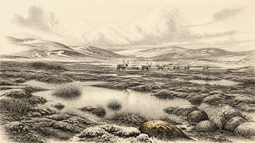
This sequence is more valuable than a dramatic single fossil because it preserves environmental change in order. It does not show a stable, temperate Ireland. Rather, it demonstrates that during a cold interval of Marine Isotope Stage 3, parts of the north of the island could contain open water and wet ground between episodes of glaciation. The landscape was periglacial: shaped by severe frost, seasonal thaw and sparse vegetation, while remaining locally capable of supporting shallow freshwater habitats.
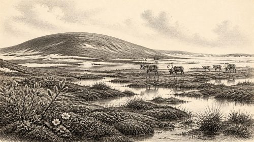
Pollen from the deposit was poorly preserved, but it was dominated by herbaceous types. Plant macrofossils and mosses added much clearer evidence. The assemblage includes plants associated with open, cold ground and wet places, rather than woodland. Sedges and grasses were important components of the wider vegetation; dwarf willow, mountain avens and other Arctic-alpine plants are consistent with the kind of flora reconstructed from the deposit and comparable north-west European sites. Aquatic and wetland plants, including water-milfoil and bogbean, indicate that water stood or moved slowly enough for a small but productive freshwater community to flourish. Insects similarly support the interpretation of mossy, plant-rich wet ground with pools.
Such evidence should not be pictured as an unbroken blanket of tundra. A drumlin hollow, its water margin, exposed mineral ground, mossy patches and better-drained ridges would each have offered different conditions. Nor can the fossils tell us whether the Derryvree pool was open in a particular month of 30,514 BCE. They do show, however, that an ice-free local landscape existed for a meaningful period within a rigorously cold climatic regime.
Animals in a Cold Island World
The animal evidence for this wider phase is concentrated in cave collections, above all at Castlepook Cave, also known as Mammoth Cave, near Doneraile in north County Cork. Antiquarian excavations there recovered remains of woolly mammoth, reindeer, brown bear, fox, hare, lemming and spotted hyena. The National Museum of Ireland holds part of this exceptional collection. Direct dating and later reassessment show that mammals reached Ireland during several Late Pleistocene phases, although individual cave deposits are often disturbed and cannot simply be treated as intact living surfaces.
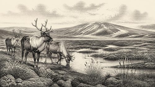
Spotted hyena is particularly revealing. It was not a visitor from an African-style savannah but part of the Late Pleistocene fauna of north-west Europe, able to exploit large carcasses in a cold, open landscape. Mammoth and reindeer point to habitats with substantial grazing and browsing resources, while predators and scavengers show that animal carcasses could be redistributed, gnawed, broken and carried into caves. That matters because bones do not automatically document human behaviour. Cave assemblages may result from carnivores, water movement, old excavation practices and later disturbance as well as from people.
Sea levels were lower than today as global ice expanded, and the configuration of the Irish Sea region differed greatly from the modern coastline. Yet the exact routes by which particular animals reached Ireland, and whether any continuous land connection existed at a given moment, remain debated. Faunal presence establishes movement into and through the region; it does not prove a single migration route, a regular corridor or a permanent human population.
The Castlepook Question
A reindeer femur from Castlepook is the most important, and most carefully limited, archaeological clue for this broad period. Re-examined by zooarchaeologist Ruth Carden, it bears a deep linear modification interpreted as a mark made by a sharp stone tool while a carcass was fresh. Accelerator radiocarbon dating has been publicly described as placing the bone at about 33,000 years old, broadly around the period considered here. If the mark is confirmed as anthropogenic and contemporary with the bone, it would be evidence that a person processed a reindeer in Ireland far earlier than the previously accepted terminal-Pleistocene human traces.
Its importance must not be inflated into a settled Ice Age Ireland. A marked limb bone does not provide a house, hearth, camp floor, stone-tool assemblage, grave, artwork, language or named archaeological culture. The femur derives from an old cave collection rather than a newly excavated, sealed occupation layer. It cannot identify how many people were present, whether they hunted the reindeer or encountered a carcass, how long they stayed, or whether they returned. It is evidence for a possible act of carcass processing, not for a community.
Accordingly, political affairs, diplomacy and organised conflict cannot be reconstructed for Ireland at this date. There is no basis for imagining chiefs, territories, alliances or warfare. Equally, religion, ceremony, formal learning and artistic traditions are beyond the reach of the surviving evidence. The absence is not a judgement on the capacities of any possible visitors; it is a statement about what Irish deposits presently preserve.
Everyday Life Without a Settlement
If people did reach Ireland in this interval, their likely presence was fleeting and highly mobile. Across Upper Palaeolithic Europe, small hunter-gatherer groups relied on detailed knowledge of animal movements, raw materials, weather and seasonal terrain. A reindeer carcass could supply meat, fat, hide, sinew, bone and antler. But this is a general comparison, not direct proof of particular practices at Castlepook. Ireland has no securely excavated camp of this age from which to infer food preparation, shelter construction, kinship or the division of labour.
The same restraint applies to economy and trade. There is no evidence for farming, herding, metalworking, pottery, coinage, markets or long-distance exchange networks in Ireland around this notional date. The relevant economy, if humans were present, would have been immediate subsistence: acquiring and processing animal and plant resources in a severe environment. Reindeer, mammoth and hyena remains document ecology and animal dispersal, not commerce. Even the stone tool implied by the Castlepook mark has not itself been recovered.
Environmental knowledge would nonetheless have been essential. Wet ground at Derryvree could offer water, mosses, edible or useful plants and insects, while exposed uplands and ridges were vulnerable to wind and frost. The contrast between the Fermanagh wetland archive and the Cork cave fauna also warns against treating Ireland as uniform. Regional conditions varied with elevation, drainage, distance from ice and the changing shape of the ice sheet.
Approaching the Glacial Maximum
This relatively open interval did not last indefinitely. Later growth of the British–Irish Ice Sheet transformed the island. Geological reconstructions show that, by about 26,800 calibrated years BP, ice was grounded on the outer Atlantic shelf west of Ireland; large parts of Ireland were subsequently overridden, eroded and buried beneath ice-derived deposits. Derryvree’s upper till is a local expression of that larger story of renewed glaciation, although it cannot by itself date the exact advance across Fermanagh.
The advancing ice helps explain the fragmentary record. Glaciers removed or reworked earlier ground surfaces, while later sea-level rise drowned former coastal landscapes. The scarcity of evidence is therefore not proof that no person ever entered Ireland during Marine Isotope Stage 3. It does mean that claims of continuous occupation would require far stronger evidence than currently exists.
Ireland around 30,514 BCE is best understood as a cold, unstable and intermittently habitable environment. At Derryvree, a sedgy freshwater hollow supported life between two episodes of ice. At Castlepook, large mammals and predators occupied a broader cold-steppe world, while one altered reindeer bone raises the possibility of a brief human encounter. Those are substantial discoveries, but they are not a calendar-year narrative. They are the surviving fragments from an Irish landscape on the threshold of far more extensive glaciation.
Primary Sources
- Palaeoecology: South Fermanagh, Northern Ireland (IQUA Field Guide 16)
- Field Guides
- Spotted Hyena Skull
- Heritage Artefacts of County Cork
- The Irish Quaternary Fauna Project
- The Irish Quaternary Fauna Project
- Irish Pleistocene Biostratigraphy
- Ireland's Palaeolithic Archaeology – Fleeting Footprints in a Frozen Land
- New Insights on the Fauna of Ireland's Younger Dryas and Early Holocene from Alice & Gwendoline Cave
- Timing and Pace of Ice-Sheet Withdrawal Across the Marine–Terrestrial Transition West of Ireland During the Last Glaciation
- Timing and Pace of Ice-Sheet Withdrawal Across the Marine–Terrestrial Transition West of Ireland During the Last Glaciation
- Early Deglaciation of the British-Irish Ice Sheet on the Atlantic Shelf Northwest of Ireland Driven by Glacioisostatic Depression and High Relative Sea Level
- Dimensions and Chronology of the Last Ice Sheet in Western Ireland
- New Data for the Last Glacial Maximum in Great Britain and Ireland
- The Colonization of Ireland: A Human Ecology Perspective
- The IntCal20 Northern Hemisphere Radiocarbon Age Calibration Curve (0–55 kcal BP)
- IntCal
- History of the Chrono Centre
- The Mesolithic in Ireland: When Was It?
- Outreach and Education Resources