Derryvree Wetlands30273 BCE
About 30,273 BCE, Ireland lay within the variable Late Pleistocene MIS 3 period, not a datable historical event. At Derryvree near Maguiresbridge, freshwater silts beneath till record a locally ice-free interval between glacial advances, with tundra vegetation, wetlands and severe periglacial conditions. Greenagho confirms regional climatic complexity. Castlepook Cave in Cork yielded diverse MIS 3 mammals, including reindeer, mammoth and hyaena, though deposits are mixed and dates require caution. A cut-marked reindeer bone may indicate human activity, but no secure contemporary settlement exists. Ireland was a changing Ice Age landscape, with uncertain animal and human access routes across north-west Europe.
Dateline
The label 30,273 BCE offers a useful point on a modern timeline, but it cannot identify an Irish event in the manner of a later historical year. No calendar, named community, ruler, settlement or written tradition survives from this depth of time. In archaeological terms, the date lies roughly 32,200 years before the conventional radiocarbon present of AD 1950, during the Late Pleistocene and Marine Isotope Stage 3 (MIS 3). Calendar-year precision is not available. The evidence consists instead of deposits, animal bones and radiocarbon ranges that illuminate Ireland over centuries and millennia.
The most directly relevant Irish archive is a buried freshwater deposit at Derryvree, near Maguiresbridge in County Fermanagh. Its conventional radiocarbon determination, Birm-166, was 30,500 +1,170/−1,030 radiocarbon years BP. Calibration converts such a measurement into a probability range rather than a single calendar date; published discussion places it broadly at c. 36,900–31,700 calibrated years BP, or approximately 34,950–29,750 BCE. Thus 30,273 BCE falls within the wider range associated with this record, but is not the date of an identifiable season, pool, animal or human visit.
A Freshwater Interval
Derryvree was revealed in 1969 when roadworks cut through a drumlin about two kilometres north-east of Maguiresbridge. The exposure showed a remarkable sequence: a lower bed of till, then freshwater silts and fine sands containing organic material, followed by another thick till. Till is the unsorted clay, stones and debris left directly by glacier ice. The order of these layers supplies robust evidence for change: ice had occupied the locality; an interval then permitted water, sediment and living things to accumulate; later ice advanced again and sealed the wetland beneath new glacial sediment.
That conclusion needs careful limits. The Derryvree deposit demonstrates locally ice-free ground in north-central Ireland during part of a long cold stage. It does not prove that the whole island was ice-free at the same moment, nor that every Irish region looked alike. The later British–Irish Ice Sheet removed, mixed and buried earlier landscapes on a huge scale. Preservation at Derryvree was exceptional precisely because later till protected a thin environmental archive that would otherwise probably have vanished. Modern reconstructions place the principal last ice-sheet maximum later, broadly between about 27,000 and 23,000 calibrated years BP; 30,273 BCE belongs to the variable period before that fullest expansion.
Treeless Ground and Shallow Water
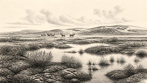
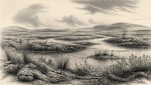
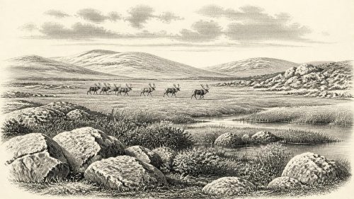
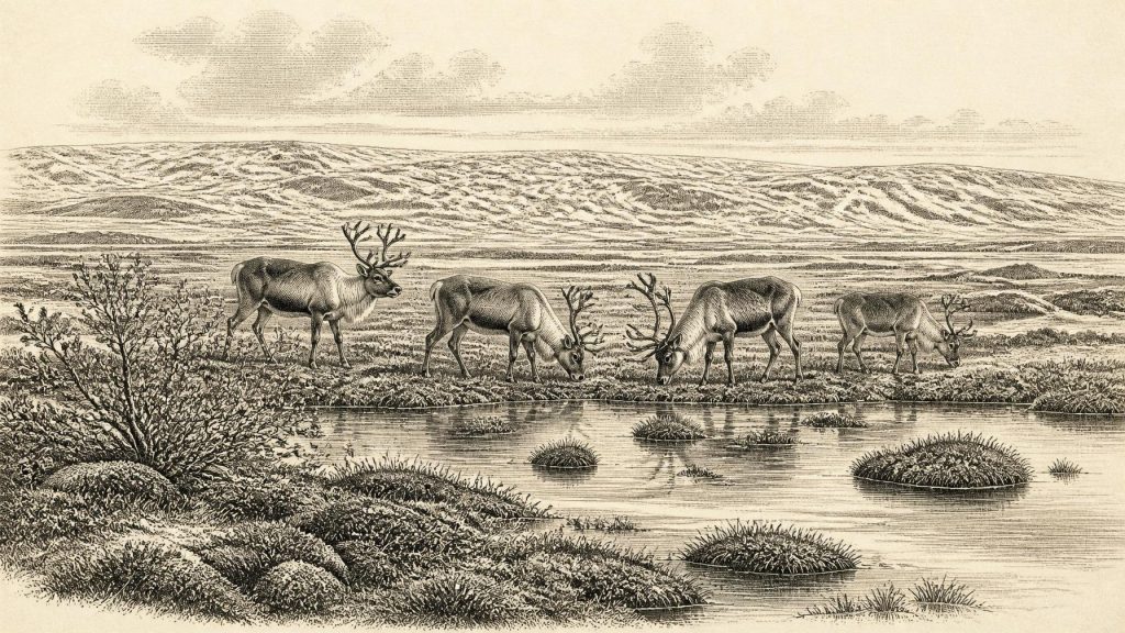
The plants and small animals preserved at Derryvree provide the closest evidence for everyday conditions around this broad horizon. They indicate open tundra vegetation and a periglacial climate: a landscape shaped by severe winters, seasonal freezing and thawing, sparse cover and short growing seasons. It was not the wooded, damp-green Ireland familiar today. Mosses, sedges, dwarf willow, mountain avens, clubmosses and aquatic plants point to a mosaic of wet ground, shallow freshwater and low-growing vegetation. The useful comparison is with a cold, mossy fen or muskeg-like wetland, rather than a modern blanket bog or forest lake.
Such evidence is environmental rather than picturesque. It can support the inference that sheltered hollows, sedge margins and pools were locally productive places within a generally exposed region. Water plants and insects, followed by birds and grazing animals, would have found resources there. Yet no fossil assemblage can furnish a complete food web, a precise summer temperature or a continuous view of the year. The short-lived organic layer records a particular locality under particular conditions; it should not be made to stand for an entire island.
Greenagho, near Belcoo in the same county, provides a related warning against imagining a uniformly frozen Ireland. Organic material from lake deposits beneath till there has also been interpreted as evidence of an earlier ice-free interstadial episode. Together, the Fermanagh sites show alternation: ice margins moved, climates shifted and small habitats opened before being overridden or transformed. This regional complexity is one of the central facts of Irish history at this time.
Animals in a Changing Landscape
In County Cork, Castlepook Cave near Doneraile preserves Ireland’s best-known assemblage of older cold-stage mammals. Its long and complicated cave deposits have yielded remains attributed to reindeer, woolly mammoth, giant deer, brown bear, wolf, foxes, mountain hare, lemmings and spotted hyaena. The cave was not a snapshot of a single year: carnivores could drag prey inside, water could move bones, and nineteenth- and early twentieth-century excavations did not always preserve the contextual detail expected today. Still, the assemblage establishes that an unexpectedly varied large-mammal fauna reached Ireland during portions of MIS 3.
Recent redating has made the site more important and more difficult. Improved pretreatment of bone collagen showed that several earlier radiocarbon determinations from Castlepook were too young, in some cases by many thousands of radiocarbon years. The revised work indicates substantially older MIS 3 occurrences for some animals and suggests that giant deer and spotted hyaena may have disappeared locally before the Last Glacial Maximum. It also means that confident reconstructions must date individual specimens and deposits where possible, rather than treating every bone from the cave as contemporary.
These animals make it reasonable to envisage open-country grazing, browsing and predation somewhere in Ireland during favourable phases. They do not show a permanent, stable ‘mammoth-steppe’ covering the whole island in 30,273 BCE. Nor can particular species be assigned to Derryvree itself merely because their bones occur elsewhere. The Irish record is sparse, geographically uneven and often dependent on cave collections recovered long ago. Its value lies in demonstrating movement, survival and changing ecological opportunity, not in providing an unbroken census of Ice Age wildlife.
The Human Question
There is no securely excavated camp, hearth, stone-tool assemblage, human bone or dwelling in Ireland that can be assigned to this calendar label. A reindeer femur from Castlepook has been reported by zooarchaeologist Ruth Carden and County Cork heritage publications as bearing a deep incision interpreted as a stone-tool cut made while fresh bone was processed. The specimen has been presented as possible evidence of human handling of reindeer around 33,000 radiocarbon years ago. If sustained by further contextual and microscopic work, it would greatly extend the known story of people in Ireland.
But the responsible wording is possible, not proof of an established population. A mark on one bone cannot reveal who made it, whether the animal was hunted or scavenged, how long people stayed, whether they returned, or whether they made a home on the island. Nor does a radiocarbon date for an animal’s death date the instant at which a surface mark was made. The cave’s disturbed and multi-period history strengthens the need for caution. Secure direct evidence of Upper Palaeolithic human presence in Ireland is presently much later, from the terminal Pleistocene at Alice and Gwendoline Cave in County Clare.
No Polities, No Trade Network
Consequently, political affairs, diplomacy, organised warfare, religion, learning and trade cannot be described for Ireland in 30,273 BCE. There is no evidence for rulers, territories, tribal names, monuments, ritual places, exchange routes or a settled society. Silence on these subjects is not an omission to be repaired with imaginative narrative; it is an important historical result. If people did enter Ireland during an MIS 3 interval, the evidence presently supports no more than the possibility of brief, highly mobile visits by small Upper Palaeolithic groups.
Low global sea levels altered the geography of north-west Europe, exposing areas now beneath the sea. That fact alone does not map a simple or permanent pedestrian route into Ireland at this particular time. Ice cover, coastlines, sea crossings, seasonal conditions and the shape of any exposed land all changed. Later palaeogeographical modelling confirms that Ireland and Britain were separated by about 16,000 calibrated years ago, while showing why broad claims about a single, enduring Irish land bridge are unsafe. For the much earlier horizon considered here, the route by which animals—and perhaps occasional people—reached Ireland remains unresolved.
A Landscape, Not a Chronicle
Ireland around 30,273 BCE is therefore best understood as a changing Ice Age landscape rather than a stage for a named historical episode. In Fermanagh, a freshwater wetland formed between glacial advances amid open tundra vegetation. Elsewhere, especially in the Cork cave record, large mammals and carnivores testify to intermittent ecological connections with wider north-west Europe. The island’s later glacial history would destroy or conceal much of the evidence that might have clarified the picture.
The surviving traces nevertheless matter. Derryvree’s silts show that cold-stage Ireland contained living freshwater environments, not only ice. Castlepook’s bones show that formidable animals ranged across parts of the island in the broader MIS 3 world. And the contested reindeer femur reminds historians that absence of a conventional settlement record is not proof that no person ever arrived. It is, however, a firm reason to distinguish evidence from interpretation, calibrated range from exact year, and a tantalising encounter from a demonstrated human history.
Primary Sources
- A Middle Midlandian Freshwater Series at Derryvree, Maguiresbridge, County Fermanagh, Northern Ireland
- Middle Midlandian Interstadial Deposits at Greenagho, Near Belcoo, County Fermanagh, Northern Ireland
- Exploring Controls of the Early and Stepped Deglaciation on the Western Margin of the British Irish Ice Sheet
- Deglaciation Chronology of the Donegal Ice Centre, North-West Ireland
- Pattern and Timing of Retreat of the Last British-Irish Ice Sheet
- Response of the Irish Ice Sheet to Abrupt Climate Change During the Last Deglaciation
- Trimlines, Blockfields and the Vertical Extent of the Last Ice Sheet in Southern Ireland
- Dimensions and Chronology of the Last Ice Sheet in Western Ireland
- Bayesian Modelling the Retreat of the Irish Sea Ice Stream
- The IntCal20 Northern Hemisphere Radiocarbon Age Calibration Curve (0–55 cal kBP)
- IntCal: Radiocarbon Dating Research
- A Reconsideration of the Radiocarbon Dating of the Marine Isotope Stage 3 Fauna from Southern Ireland
- The Irish Quaternary Fauna Project
- The Exploration of Castlepook Cave, County Cork
- Occurrence of Mammalia Relicts at Site Castlepook Cave
- Pleistocene Vertebrates in the British Isles
- Archaeological Heritage of County Cork
- Heritage Artefacts of County Cork
- New Insights on the Fauna of Ireland’s Younger Dryas and Early Holocene from Alice & Gwendoline Cave
- The Colonization of Ireland: A Human Ecology Perspective
- The Island of Ireland: Drowning the Myth of an Irish Land-Bridge?
- Phylogeographic, Ancient DNA, Fossil and Morphometric Analyses Reveal Ancient and Modern Introductions of a Large Mammal: The Complex Case of Red Deer (Cervus elaphus) in Ireland
- Irish Pleistocene Biostratigraphy