
Muskeg and Mammoth30420 BCE
Around 30,420 BCE, Ireland lay within the climatically unstable Late Pleistocene. Derryvree, County Fermanagh, preserves freshwater sediments between glacial tills, indicating treeless wetland vegetation, shallow pools and open periglacial ground during an ice-free interval. Crag Cave records milder interstadial episodes in south-west Ireland. Castlepook Cave, County Cork, contains mammoth, reindeer, giant deer, predators and other fauna accumulated over millennia, demonstrating ecological connections with north-west Europe. A possibly tool-cut reindeer bone may indicate early human carcass processing, but no secure settlement exists. Ireland had no documented societies, trade or political structures; its evidence chiefly records shifting ice, habitats and animal populations.
Dateline
The label 30,420 BCE is a modern chronological convenience, not a date that prehistoric Ireland’s inhabitants could have recognised. No written calendar, named ruler, settlement record or event can be attached responsibly to this individual year. In conventional “before present” reckoning, it falls roughly 32,370 years before AD 1950, within the Late Pleistocene and Marine Isotope Stage 3 (MIS 3), a long interval of abrupt climatic fluctuation. The soundest account is therefore built from dated ranges, sediments, animal bones and cautious inference—not from a year-specific narrative.
The most relevant Irish evidence does, however, place this nominal year within a remarkable environmental window. A freshwater deposit at Derryvree near Maguiresbridge, County Fermanagh, has a conventional radiocarbon determination of 30,500 +1,170/−1,030 radiocarbon years BP. Calibration is essential because radiocarbon years are not calendar years; modern calibration places the evidence broadly at about 36,900–31,700 calibrated years BP, approximately 34,950–29,750 BCE. Thus 30,420 BCE lies within the range represented by the deposit, though not at a demonstrable point within it.
Freshwater Beneath the Drumlin
Derryvree was exposed by roadworks in 1969, which cut through a drumlin: a streamlined hill made largely of sediment deposited by glacier ice. The section revealed a thick lower till, then fine sands and organic silts formed in freshwater conditions, capped by another thick till. This sequence is unusually valuable. It proves that ice had occupied the locality, that an interval followed in which water, sediment and biological remains accumulated, and that ice later returned or advanced sufficiently to seal the deposits below glacial debris.
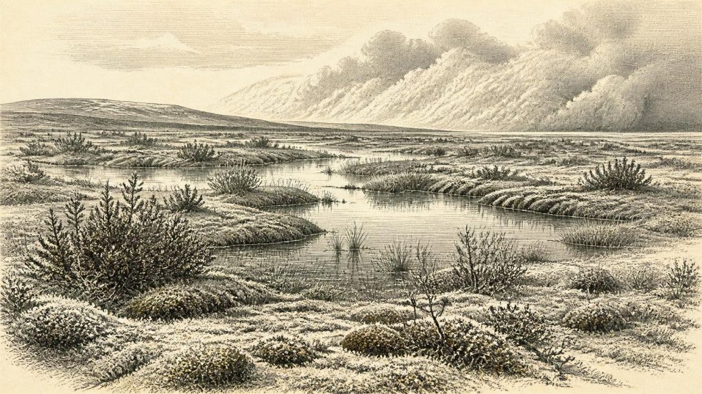
The organic layers contained plant and animal remains with what their original investigators described as a full-glacial character. Grasses and sedges dominate the botanical signal, accompanied by juniper, herbs, mosses and aquatic or wet-ground plants. The evidence supports a largely treeless, periglacial wetland landscape—often described as muskeg—with shallow pools, saturated ground and exposed open country around it. It does not support an image of familiar modern Irish pasture, dense forest or a uniformly snow-covered wasteland. Nor does one Fermanagh exposure provide a complete weather map for the whole island. It is a local archive, but an exceptionally informative one because later ice has destroyed or buried so many comparable deposits.
In practical terms, life in this landscape, whether plant or animal, was governed by short growing seasons, repeated freezing and thawing, wind exposure and poorly developed soils. Pool margins could nevertheless be productive in summer. Mosses, sedges and low herbs held ground together; willow or juniper may have found sheltered niches. Insects and plant macrofossils make clear that this was a functioning wetland ecosystem rather than inert ground between two glacial advances. The later ice preserved its traces even as it erased the landscape in which they grew.
An Unsettled Ice-Age Climate
At this date Ireland was approaching, but had not yet reached, the maximum expansion of the last British–Irish Ice Sheet. The global Last Glacial Maximum is generally placed around 26,500–19,000 years ago, considerably later than 30,420 BCE. Ice growth was neither simple nor simultaneous across Ireland: margins and thickness changed between regions, while cold episodes alternated with milder interstadials. The Derryvree record shows that north-central Ireland had ice-free ground during part of this earlier interval; it does not mean that every Irish region was open at the same time.
Crag Cave in County Kerry supplies complementary, rather than identical, evidence. Uranium-thorium dating of its speleothems shows that calcite formed episodically during Greenland interstadials in the last glacial period. As such growth requires circulating liquid water and conditions above persistent freezing in this shallow cave system, it demonstrates major climatic oscillation in south-west Ireland. It cannot tell us the temperature on a particular day in 30,420 BCE, but it warns against treating the Ice Age as one unbroken freeze.
Sea level was far lower than it is today because immense quantities of water were stored in continental ice sheets. Coastlines and sea crossings therefore differed greatly from those of modern Ireland. Yet low sea level should not be casually converted into a claim of a permanent, easy land bridge. The geography of the Irish Sea basin, the timing of ice margins and the viability of routes varied. The safest conclusion is that animal populations could intermittently connect Ireland with wider north-west European ecosystems; the details and duration of any route remain matters for reconstruction rather than certainty.
Castlepook’s Animal Archive
The strongest faunal counterpart to Derryvree lies far to the south at Castlepook Cave, also called Mammoth Cave, near Doneraile in north County Cork. It is Ireland’s richest known pre-Last Glacial Maximum vertebrate site. Its deposits and old museum collections include woolly mammoth, reindeer, giant deer, brown bear, spotted hyaena, wolf, fox, hare and lemmings. Direct dates on individual bones span a long period—roughly 45,700 to 19,950 radiocarbon years BP—so the assemblage must never be treated as a single community alive together in one year or valley.
Nevertheless, the fauna confirms the ecological possibilities of Late Pleistocene Ireland. Reindeer and lemmings fit open, cold-country habitats; mammoth and giant deer indicate that large herbivores periodically found enough forage; hyaenas, wolves and bears belonged to a food web in which caves could serve as dens, traps, shelters and repositories for scattered bones. Castlepook’s animal remains arrived through several processes, including carnivore activity, natural deaths, water movement and nineteenth- and early twentieth-century excavation. A cave bone is therefore evidence first of an animal and its depositional history, not automatically of a nearby hunting camp.
The Human Question
This distinction matters especially for the much-discussed reindeer femur from Castlepook. Re-examination has identified a deep incision interpreted by zooarchaeologist Ruth Carden as a cut made on fresh bone with a sharp stone tool during carcass processing. Public heritage material places the specimen at approximately 31,000 BC, and the find has prompted renewed investigation of Ireland’s Palaeolithic possibilities. If the mark is confirmed as anthropogenic, it would be evidence that a person handled a reindeer in Ireland tens of millennia before the island’s securely documented Mesolithic settlement.
But the claim must remain carefully bounded. The dated bone was not recovered from a newly excavated, intact occupation floor alongside hearths, recognisable stone tools, dwellings, human burials or a refitting butchered assemblage. Dating establishes the age of the animal’s death, while identifying a mark as a stone-tool cut requires a separate taphonomic judgement. Natural damage, carnivore action and the disturbed history of cave deposits make such tests demanding. Recent work at Castlepook has confirmed that Pleistocene deposits survive in parts of the system, but has not yet produced a secure Palaeolithic settlement horizon.
Accordingly, no responsible account can name a people, language, leader or culture in Ireland in 30,420 BCE. A possible episode of butchery would suggest practical knowledge of sharp lithic cutting edges and the value of a large carcass. It would not demonstrate continuous residence, population size, a repeated seasonal camp or a distinct Irish society. The best-established human settlement evidence belongs vastly later, after the final retreat of the ice and the start of the Mesolithic. The gap is itself historically important: survival of a single provocative bone does not fill it.
No Polities, No Trade, No Ritual Record
There is no evidence for political affairs, diplomacy, organised warfare, institutions, formal religion, art, literacy or trade networks in Ireland at this time. Those absences are not merely gaps in a written record; they reflect the lack of securely identified human sites from this phase. Nor should the movements of reindeer or mammoth be called trade. They reveal ecological dispersal, not exchange between communities.
If people did enter the island during a milder interval, their economy would have depended on immediate access to wild resources: meat, marrow, hide, bone, fuel and sheltered ground. That is an inference from the possible Castlepook butchery evidence and from wider Upper Palaeolithic lifeways, not a documented description of an Irish household. A cave might have offered temporary protection, but its carnivore occupants also made it dangerous. There is no basis for reconstructing permanent villages, fields, boats, ritual places or regional territories.
A Fragile Window
For 30,420 BCE, Ireland’s history is most clearly environmental. Derryvree records freshwater and tundra vegetation between episodes of glaciation. Castlepook records a changing succession of Ice-Age animals and, possibly, the earliest human handling of prey on the island. Crag Cave records climatic ameliorations amid a generally severe glacial world. Together they show an island of local wetlands, open cold-country vegetation, mobile fauna and unstable ice margins—not an empty void, but not yet a documented human homeland either.
That conclusion is necessarily modest, but it is substantial. The deposits reveal that Ireland’s deep past was shaped by repeated openings and closures: water appearing between till sheets, animals reaching favourable habitats, ice advancing again, and sediments preserving fragments of worlds otherwise lost. The numbered year can never be recovered with calendar precision. The broader interval, however, can be responsibly understood as one of ecological possibility at the threshold of the Last Glacial Maximum.
Primary Sources
- Middle Midlandian Freshwater Series at Derryvree, Maguiresbridge, County Fermanagh, Northern Ireland
- A Reconsideration of the Radiocarbon Dating of the Marine Isotope Stage 3 Fauna from Southern Ireland
- The Irish Quaternary Fauna Project
- Figure 6.— The Subdivision of the Quaternary Period in Ireland
- Landscapes and Environments of the Last Glacial-Interglacial Transition: A Time of Amazingly Rapid Change in Ireland
- Middle Midlandian Interstadial Deposits at Greenagho, Near Belcoo, County Fermanagh, Northern Ireland
- Episodic Speleothem Deposition Tracks the Terrestrial Impact of Millennial-Scale Last Glacial Climate Variability in SW Ireland
- Trimlines, Blockfields and the Vertical Extent of the Last Ice Sheet in Southern Ireland
- Growth and Retreat of the Last British–Irish Ice Sheet, 31,000 to 15,000 Years Ago: The BRITICE-CHRONO Reconstruction
- The IntCal20 Northern Hemisphere Radiocarbon Age Calibration Curve (0–55 kcal BP)
- IntCal: International Radiocarbon Calibration
- Cork County Geological Site Report: Castlepook Cave
- Heritage Artefacts of County Cork
- 2022:564 – Castlepook Cave, Castlepook South, Cork
- Archaeology Research Excavation Grant 2022: Castlepook Caves Project
- Ireland’s Palaeolithic Archaeology – Fleeting Footprints in a Frozen Land
- The Mesolithic in Ireland: When Was It?
- New Insights on the Fauna of Ireland’s Younger Dryas and Early Holocene from Alice & Gwendoline Cave
- Castlepook Caves
- The Nature and Timing of MIS 3 Interstadials; New Constraints from U-Series Dated Speleothems from Crag Cave, SW Ireland
