Birm-166’s Lost Waters31766 BCE
Labelled 31,766 BCE, this period cannot be tied to a precise Irish event, but falls within a broad Late Pleistocene calibrated range. Derryvree, County Fermanagh, preserves organic freshwater sediments between tills, indicating locally ice-free, treeless wet tundra with mosses, grasses, sedges, insects and severe seasonal conditions. Comparable northern deposits confirm environmental variation amid advancing glaciation. Castlepook Cave, County Cork, contains Marine Isotope Stage 3 fauna including mammoth, reindeer, hyaena and lemmings, demonstrating cold open habitats. A possibly stone-tool-marked reindeer femur suggests transient human activity, not settlement. Subsequent ice expansion reshaped habitats and erased or buried most evidence of earlier life.
Dateline
31,766 BCE is not a date that can be matched to an Irish event, ruler, battle or settlement in the way a later historical year can. It is a modern calendar label for a point roughly 33,715 years before AD 1950, within the later part of the Late Pleistocene and broadly within Marine Isotope Stage 3. No written record exists; nor does archaeology offer calendar-year precision at this depth of time. The responsible account is therefore one of calibrated ranges, deposits and cautious inference. Around this notional date, Ireland was a climatically unstable, sparsely documented land on the north-western fringe of Europe, where open cold-country environments and large mammals are better attested than human communities.
A Date Within a Range
The most useful evidence for this broad interval comes from Derryvree, near Maguiresbridge in County Fermanagh. There, organic freshwater silts and fine sands were found between two sheets of glacial till in a road cutting through a drumlin. The lower and upper tills show that ice occupied the locality at different times; the sediments between them preserve an ice-free interval. A radiocarbon determination on their organic content, Birm-166, was published as 30.5 ± 1.1–1.2 thousand radiocarbon years BP. Earlier published calibration placed that measurement within a broad range of approximately 36.9–31.7 thousand calibrated years BP. The modern label 31,766 BCE falls near the younger end of that wide range, not at a moment that can be isolated within it.
This distinction matters. Radiocarbon years are not calendar years, because atmospheric carbon-14 levels changed through time. Calibration curves translate measurements into probability ranges, and the farther back one goes, the less appropriate it becomes to speak as though a sample identifies one exact year. The Derryvree material can illuminate a phase of cold, ice-free or locally ice-free conditions; it cannot tell us what happened in a particular winter or summer of 31,766 BCE. Nor can one Fermanagh exposure stand for every Irish coast, mountain and river valley.
The Freshwater World at Derryvree
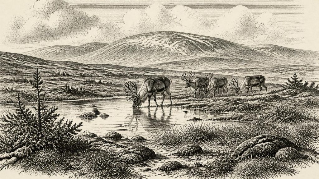
Even so, the Derryvree sediments are unusually eloquent. Their pollen, plant remains, mosses and beetles indicate a treeless muskeg or wet tundra landscape: waterlogged ground, shallow pools and plant-rich silts rather than forest. Grasses and sedges were important components, accompanied by herbs and low shrubs, including juniper in the wider cold-phase record. Such evidence suggests a landscape with a short productive season and severe winters, but not an empty white wilderness. Wet hollows could sustain mosses, aquatic plants and insects, while surrounding open ground provided forage for grazing animals.
Comparable sub-till organic deposits at Hollymount and Greenagho in Fermanagh, and at Aghnadarragh in County Antrim, reinforce the point that parts of northern Ireland preserved cold-stage environments between episodes of glaciation. At Aghnadarragh, insect and pollen evidence has been used to reconstruct open, sparsely vegetated ground and markedly seasonal conditions. These deposits are not all precisely contemporary with Derryvree; their value lies in showing the environmental range of the broader Midlandian, or Devensian, cold stage in Ireland.
For people today, drumlins are familiar rolling elements of the Irish landscape. At Derryvree, however, the drumlin is also a chronological archive. Ice later overrode, buried and preserved the freshwater deposits. That process destroyed much of the ground surface that might once have held campsites, hearths or footprints, while protecting a small sample of plants and insects beneath till. The imbalance helps explain why Irish evidence from this period is so fragmentary: geology has left historians with environmental traces rather than settlements.
Ice Was Advancing, Not Everywhere Present
The wider picture is one of change rather than a single, uniform ice cover. Reconstructions of the British–Irish Ice Sheet place its principal growth after roughly 35–32 thousand years ago, with its later maximum much later, during approximately 27–21 thousand years ago. Thus 31,766 BCE belongs to a long transition towards more extensive glaciation, not automatically to the island-wide ice maximum often imagined as “the Ice Age”. Evidence from Derryvree and other pre-Late Glacial deposits indicates that some ground in Ireland had remained free of the ice that subsequently reshaped it.
Local conditions could nevertheless have been harsh. Permafrost, seasonal freezing and thawing, strong winds and unreliable vegetation would have shaped both watercourses and animal movement. Coastlines were also unlike those of modern Ireland because global sea level was lower, although lower sea level does not entitle us to assume a simple walkable land bridge between Ireland and Britain. The existence, timing and usefulness of any such connection have long been debated. For this date, no archaeological evidence identifies the route by which animals—or any people—might have reached Ireland.
Castlepook’s Animal Evidence
Southern Ireland supplies another important, though differently preserved, record. Castlepook Cave near Doneraile, County Cork, formerly known as Mammoth Cave, produced a substantial collection of Pleistocene animal remains during antiquarian excavations. Later study and re-dating have associated the cave’s older fauna with Marine Isotope Stage 3. The collection includes woolly mammoth, reindeer, spotted hyaena, brown bear, wolf, foxes, stoat, mountain or Arctic hare, and lemmings; giant deer also belongs to the wider Irish Pleistocene story. These are not a complete census of one moment or one hillside. Caves collect bones over time, and predators, water and later disturbance can mix material. Yet together they demonstrate that cold-adapted and large grazing animals reached Ireland during this broad era.
Spotted hyaena is especially revealing. It was not a harmless spectator but a powerful carnivore capable of transporting and chewing bones, and Castlepook probably functioned in part as a carnivore den. Mammoth and reindeer imply open feeding grounds somewhere within the animals’ accessible range, while lemmings and cold-adapted hares support the environmental evidence for tundra-like conditions. But the cave must not be converted into a neat scene in which every recorded species stood together at once. It is a time-averaged faunal archive, and its earliest excavations did not meet modern standards of stratigraphic recovery.
The Human Question
A reindeer femur from the Castlepook collection gives this period its most provocative historical possibility. County Cork heritage publications identify it as dating to about 31,000 BC and describe a deep mark on it as a cut or chop made by a sharp stone tool during butchery, an interpretation associated with zooarchaeologist Ruth Carden. If that reading is upheld, it is evidence that Upper Palaeolithic people processed a reindeer in Ireland or handled part of its carcass there. It would push evidence of human activity on the island dramatically earlier than the long-established post-glacial archaeological record.
It is not, however, proof of a settled population in 31,766 BCE. The femur came from an old collection rather than a recently excavated, intact occupation surface. Its radiocarbon result dates the animal’s death, not independently the making of the mark, the place of killing or the length of any human visit. No securely associated hearth, stone-tool assemblage, dwelling, burial, artwork or repeated occupation layer of comparable antiquity has been found at Castlepook. The classification of bone damage as a stone-tool mark is itself a specialist taphonomic judgement, which must be distinguished from damage caused by carnivores, breakage, abrasion or excavation. The bone therefore supports a serious hypothesis of human activity, not a confident narrative of Ireland’s first permanent inhabitants.
Society Without a Social Record
There is no evidence from this date for political communities, named peoples, leaders, diplomacy, territorial boundaries, organised warfare or institutions in Ireland. Likewise, there is no securely demonstrated religion, burial rite, monument, art tradition, language or formal learning to describe. To supply any of these would be invention. The absence is not evidence that people everywhere lacked social lives; it means that Ireland has yielded no material basis for reconstructing them at this chronological resolution.
If the Castlepook modification was made by people, the most that can reasonably be inferred is a brief encounter by highly mobile foragers familiar with cutting technology and animal carcass processing. Reindeer could have provided meat, marrow, hide, sinew and bone, but none of those uses is independently demonstrated in Ireland by a securely excavated assemblage of this age. Hunting strategy, group size, season of arrival and the identity of any visitors remain unknown. They could have been passing through a much larger north-west European landscape rather than founding a lasting community.
Economy, Movement and Regional Change
Accordingly, there is no evidence for an Irish economy in the later historical sense: no farming, herding, fields, metalworking, exchange network, market, boat-building industry or long-distance trade can be documented for this point in time. The only defensible economic setting is ecological. Animals moved through open country in response to forage, shelter and season; predators followed prey; and any humans, if present, would have depended upon knowledge of that demanding landscape. The later expansion of the British–Irish Ice Sheet then altered habitats, displaced or eliminated animal populations locally, and eroded or sealed earlier surfaces.
The most important development around 31,766 BCE was therefore environmental instability on a frontier of advancing ice. Derryvree records freshwater life on cold open ground in Fermanagh. Castlepook records a southern Irish fauna that included mammoth, reindeer and hyaena, and perhaps a single humanly modified reindeer bone. These fragments do not yield a conventional year-by-year history. They offer something more fragile but equally significant: evidence that, long before farming, monuments or the Irish historical tradition, the land was repeatedly made and remade by water, wildlife, cold and ice.
Primary Sources
- A reconsideration of the radiocarbon dating of the Marine Isotope Stage 3 fauna from southern Ireland
- The Irish Quaternary Fauna Project
- Trimlines, blockfields and the vertical extent of the last ice sheet in southern Ireland
- Extent and timing of the Last Glacial Maximum (LGM) in Britain and Ireland: a review
- Growth and retreat of the last British–Irish Ice Sheet, 31,000 to 15,000 years ago: the BRITICE-CHRONO reconstruction
- Exploring the spatiotemporal dynamics of the last British–Irish Ice Sheet
- Freshwater organic deposits and stratified sediments between Early and Late Midlandian (Devensian) till sheets, at Aghnadarragh, County Antrim, Northern Ireland
- Aghnadarragh
- Figure 6: The subdivision of the Quaternary Period in Ireland
- Cenozoic: Tertiary and Quaternary
- The IntCal20 Northern Hemisphere Radiocarbon Age Calibration Curve (0–55 cal kBP)
- Marine20—The Marine Radiocarbon Age Calibration Curve (0–55,000 cal BP)
- The problem of a late Quaternary landbridge between Britain and Ireland
- Archaeological Heritage of County Cork
- Heritage Artefacts of County Cork
- Karst of Ireland
- Geological Heritage Audit Report: County Cork
- New insights on the fauna of Ireland's Younger Dryas and Early Holocene from Alice & Gwendoline Cave
- Pleistocene vertebrates in the British Isles
- Proceedings: Postglacial Colonisation of Ireland
