Doneraile’s Cave Interval31724 BCE
Around 31,724 BCE, a modern projection rather than a contemporary date, Ireland lay in unstable late Marine Isotope Stage 3, before the Last Glacial Maximum. Expanding ice sheets, lower seas and shifting landscapes shaped a cold, variably open environment. Castlepook, or Doneraile, Cave in County Cork preserves Ireland’s richest pre-maximum vertebrate record, including mammoth, reindeer, giant deer, bear, hyaena, lemming, Arctic fox and wolf. Revised radiocarbon dates place fauna in MIS 3. A cut-marked reindeer bone may indicate Upper Palaeolithic human activity, but no secure settlement evidence exists. The cave documents changing ecosystems, while glacial erosion and preservation constrain interpretation.
Dateline
The label 31,724 BCE is a modern calendar projection, not a date that people in Ice-Age Ireland could have recognised or recorded. It corresponds only approximately to 33,674 years before AD 1950, the conventional ‘before present’ reference point used in radiocarbon science. At this depth in time, a single calendar year cannot responsibly be assigned to an Irish event. The useful historical frame is therefore a broader one: the later part of Marine Isotope Stage 3 (MIS 3), before the full Last Glacial Maximum, when climate and ice cover changed repeatedly over centuries and millennia.
For Ireland, the evidence is unusually fragmentary. There are no written sources, named peoples, settlements, graves, tools securely linked to this date, or political institutions to describe. What survives instead is a difficult archive of cave bone, sediment, pollen, geological landforms and scientific dates. Around this point in time, Ireland was not the familiar green, wooded island of later prehistory. It was part of a cold and unstable north-west European world in which ice sheets were growing, sea levels were lower, and animal populations could move through landscapes whose coasts and connections have since vanished.
Before the Ice Maximum
This was not yet the Last Glacial Maximum itself. The global maximum of the last glacial cycle is commonly placed at about 26,500–19,000 calendar years before present, while reconstructions of the British–Irish Ice Sheet indicate substantial growth after roughly 35,000–32,000 years ago and maximum ice extents later, broadly between 27,000 and 21,000 years ago. Those ranges are models assembled from many sites, not a timetable applying identically to every valley, coast and upland.
At about 33,700 calendar years before present, Ireland stood near the beginning of that major expansion. Ice may already have occupied important upland and northern or western source areas, but its extent was neither uniform nor permanently fixed. Successive advances, stagnations and retreats could alter the local landscape markedly. The island’s later glacial deposits were themselves capable of eroding, burying or displacing earlier evidence, which is one reason why so little is known about conditions at any one moment.
The Irish term for this last major glacial episode is the Midlandian; in wider British scholarship it is often called the Late Devensian. Such labels are useful shorthand, but they should not suggest an unchanging frozen state. MIS 3 contained rapid climatic swings, including relatively milder interstadials and harsher stadials. Ireland’s available environmental sequences are too patchy to reconstruct the weather of a particular year, yet they demonstrate that open ground, wetlands and cold-adapted vegetation existed during intervals between or ahead of ice advances.
Castlepook’s Fossil Record
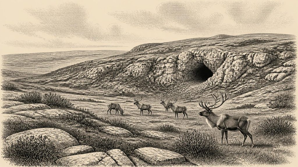
The most informative Irish locality for this horizon is Castlepook Cave, also known as Mammoth Cave or Doneraile Cave, in the limestone country near Doneraile in north County Cork. Its narrow galleries and chambers trapped or received animal remains over a very long span. Excavations between 1904 and 1918 recovered more than 2,000 bones. Geological Survey Ireland describes the cave as Ireland’s richest vertebrate-fauna site for the period leading towards the Last Glacial Maximum.
The assemblage is striking: woolly mammoth, reindeer, giant deer, brown bear and spotted hyaena occur among the earlier Ice-Age fauna, with later cold-stage remains including lemmings, Arctic fox and wolf. No single list of species should be mistaken for a census of animals alive together on one day. The cave accumulated bones across many episodes, and some were moved by water, scavengers or excavation. Nevertheless, the combined record establishes an important point: at intervals during MIS 3, southern Ireland could sustain large herbivores, predators and scavengers in a varied cold-climate ecosystem.
Reindeer and lemmings are particularly suggestive of open, treeless or sparsely shrubby country. Mammoths indicate extensive grazing habitat somewhere within reach, while hyaenas, wolves and bears point to a food web more complex than the later Irish fauna. Such animals would have used broad ranges rather than respecting modern county boundaries. Castlepook was not necessarily a place where all were resident. A cave can be a den, a refuge, a place where carnivores drag carcass parts, or simply a geological trap. Its fossils reveal regional possibility and recurring animal movement, not a settled ‘Cork community’.
Dates, Bones and Doubt
The cave’s importance has increased because improved radiocarbon techniques have revised parts of its chronology. The Irish Quaternary Fauna Project first brought accelerator mass spectrometry dating to many old cave collections in the 1990s. Later work by Ruth Carden, Thomas Higham and Peter Woodman re-dated selected specimens with improved pretreatment methods. Several Castlepook results proved substantially older than earlier measurements, strengthening the case that significant elements of the fauna belong in MIS 3. The researchers also warned that old cave deposits and old museum collections demand caution rather than simple confidence.
That caution matters especially for claims about people. A reindeer femur from Castlepook has been reported as carrying a deep incision interpreted as a stone-tool cut mark made during carcass processing. If that interpretation is correct, it would offer remarkable evidence that a small Upper Palaeolithic party reached Ireland in the broad period around 33,000 years ago. It would not demonstrate permanent settlement, a named culture, a village, a hunting territory or continuous descent from those visitors.
The claim remains limited because there is no securely associated hearth, stone-tool assemblage, dwelling, human bone or undisturbed butchery floor from the cave. The National Museum of Ireland continues to state that no clear evidence has emerged for human presence in Ireland during the Palaeolithic. The responsible conclusion is therefore neither dismissal nor certainty: the marked reindeer bone may preserve a very early trace of human activity, but the evidence is too slight to reconstruct a population or its way of life in detail.
Movement Without States
There were no Irish kingdoms, borders, diplomacy or warfare in the documentary sense. Nothing permits claims about chiefs, alliances, language, ritual authority or social rank. Nor is there evidence for farming, domesticated animals, pottery, metalworking or organised trade within Ireland at this date. If people did visit, the most defensible inference is of highly mobile hunter-gatherers using perishable equipment and sharp stone edges, travelling through a landscape in which animal herds represented food, clothing materials and perhaps opportunities for brief seasonal camps.
That inference draws on comparison with Upper Palaeolithic societies elsewhere in Europe, not on an excavated Irish camp. Contemporary populations on the continent made sophisticated stone technologies, worked bone and antler, used pigments, and in some regions created portable and cave art. None of those cultural achievements can presently be assigned to Ireland around 31,724 BCE. Castlepook is evidence for a potential encounter with people, not proof that Ireland shared every practice known farther south or east.
Likewise, lower global sea levels did not automatically provide an easy dry route to Ireland. The shape of the Irish Sea basin depended on changing sea level, local crustal movement and the advance of ice. Later studies debate the timing and nature of possible connections between Ireland and Britain. At this earlier date, animal movement and any possible human movement may have involved exposed shelf landscapes, ice-bound terrain, shallow-water crossings or shifting coastal corridors. It is safer to say that Ireland was less isolated geographically than it would become after deglaciation, while refusing to draw a simple, continuous land bridge across the map.
A Changing Regional Landscape
The most important development around this date was environmental rather than political: the progressive transformation of north-west Europe as the British–Irish Ice Sheet expanded. Ice reshaped drainage, scoured bedrock, transported sediment and eventually covered or overwhelmed habitats that had supported parts of the MIS 3 fauna. Open grassland and herb-rich tundra could be productive for grazing animals during favourable phases, but their persistence was precarious. Cooling, ice growth and altered routes of movement would have fragmented populations and changed the range of predators as well as prey.
This helps explain both the richness and the silence of the record. Castlepook preserves bones because its limestone cave provided a rare repository; most camps or activity areas on exposed ground would be exceptionally vulnerable to later glacial erosion and post-glacial change. Absence of known settlements is therefore not proof that no person ever entered Ireland. Equally, preservation bias cannot be used to turn one disputed incision into a substantial prehistoric population. Archaeology must hold both possibilities at once.
For religion, learning and culture, the honest answer is that the Irish evidence says nothing specific. Caves were natural features, not demonstrated sanctuaries. Animal bones are not offerings merely because they were found underground. There are no images, inscriptions, musical instruments or burials from which to infer belief. The material record illuminates ecology much more securely than imagination.
Thus 31,724 BCE is best understood not as a year of an Irish event but as a point within a narrowing window. Southern Ireland still lay within the reach of a cold-adapted animal world, and perhaps of occasional human visitors. Yet the approaching glacial maximum would radically alter that world. The cave beneath the Doneraile limestone preserves its most tangible legacy: not a lost nation or a first Irish settlement, but a fragile archive of animals, climate change and a tantalising, unresolved possibility of human contact.
Primary Sources
- A Reconsideration of the Radiocarbon Dating of the Marine Isotope Stage 3 Fauna from Southern Ireland
- The Irish Quaternary Fauna Project
- Castlepook Cave
- Prehistoric Details
- Extent and Timing of the Last Glacial Maximum (LGM) in Britain and Ireland: A Review
- Growth and Retreat of the Last British–Irish Ice Sheet, 31,000 to 15,000 Years Ago: The BRITICE-CHRONO Reconstruction
- Dimensions and Chronology of the Last Ice Sheet in Western Ireland
- Maximum Extent and Dynamic Behaviour of the Last British–Irish Ice Sheet West of Ireland
- Timing and Pace of Ice-Sheet Withdrawal Across the Marine–Terrestrial Transition West of Ireland During the Last Glaciation
- Advance and Retreat of the Marine-Terminating Irish Sea Ice Stream into the Celtic Sea During the Last Glacial: Timing and Maximum Extent
- Stratigraphic and Palaeo-Geomorphological Evidence for the Glacial-Deglacial History of the Last British-Irish Ice Sheet in the North-Western Irish Sea
- Radiocarbon Constraints on the Age of the Maximum Advance of the British-Irish Ice Sheet in the Celtic Sea
- The Problem of a Late Quaternary Landbridge Between Britain and Ireland
- Deglaciation, Earth Crustal Behaviour and Sea-Level Changes in the Determination of Insularity: A Perspective from Ireland
- Ireland: Submerged Prehistoric Sites and Landscapes
- The IntCal20 Northern Hemisphere Radiocarbon Age Calibration Curve (0–55 cal kBP)
- The IntCal20 Approach to Radiocarbon Calibration Curve Construction: A New Methodology Using Bayesian Splines and Errors-in-Variables
- New Data for the Last Glacial Maximum in Great Britain and Ireland
- Early Deglaciation of the British-Irish Ice Sheet on the Atlantic Shelf Northwest of Ireland Driven by Glacioisostatic Depression and High Relative Sea Level
- Oscillating Retreat of the Last British-Irish Ice Sheet on the Continental Shelf Offshore Galway Bay, Western Ireland
- Irish Caves Database: Mammoth Cave
- Heritage Artefacts of County Cork
