Maguirebridge’s Frostbound Fen31709 BCE
Labelled 31,709 BCE only conventionally, this period in Ireland belongs to unstable Late Pleistocene Marine Isotope Stage 3, not a precisely datable event. Derryvree, near Maguiresbridge, preserves freshwater sediments indicating treeless, frost-prone tundra, wetland plants and enduring seasonal ecosystems. Castlepook Cave’s bones, accumulated over millennia, document mammoth, giant deer, reindeer, hyaena and other cold-adapted fauna. A possibly stone-tool-cut reindeer femur suggests an early human visit or butchery, but proves neither settlement nor continuous population. Subsequent ice-sheet expansion reshaped and obscured evidence. Ireland was environmentally dynamic, ecologically active and sparsely documented, with claims about society, identity or politics unsupported by evidence.
Dateline
“31,709 BCE” is a modern chronological label, not a date that can be isolated in Ireland’s archaeological record. Counted back from 1950, it sits roughly 33,658 calendar years before present, but that arithmetic conversion must not be mistaken for an anniversary. At this depth of time, radiocarbon measurements require calibration, their probability ranges may extend across many centuries or millennia, and the Irish evidence normally records broad environmental intervals rather than a named year, season or event. The most responsible setting is the Late Pleistocene, within Marine Isotope Stage 3, during the long and unstable run-up to the Last Glacial Maximum.
For Ireland at this point, the principal historical evidence is geological, botanical and zoological. It comes from freshwater silts, pollen, mosses, beetle remains, bones and cave sediments—not documents, settlements, graves or monuments. These sources can show that parts of the island supported life in severe conditions. They cannot identify a people’s name, language, political order or beliefs. They do, however, reveal a changing landscape in which animals, cold-adapted plants, water and ice determined what was possible.
An Interval, Not a Snapshot
Ireland was not yet at the full extent of the last British–Irish Ice Sheet. The later maximum, broadly around 27,000–23,000 calibrated years before present in reconstructions of Ireland and its continental shelf, would bury or transform much of the country. Around the notional year used here, ice, climate and sea level were already changing on a continental scale, but the pattern was regionally uneven. Some ground was ice-free; other areas may have been affected by advancing ice or severe periglacial conditions, in which repeated freezing and thawing shaped exposed soils and sediments.
That qualification matters. It would be misleading to picture a uniform white island, and equally misleading to describe a benign grassland. The surviving records show a mosaic: open ground, sparse tundra vegetation, wet hollows, shallow freshwater and areas susceptible to frost, wind and seasonal inundation. The coasts and crossings familiar today did not exist in their modern form. Lower global sea level changed the outlines of the Irish Sea basin, yet the exact availability of dry routes between Ireland, Britain and continental Europe remains a question of changing topography, ice margins and water barriers rather than a simple, permanent “land bridge”.
Derryvree’s Buried Wetland
The clearest Irish environmental window close to this remote horizon lies at Derryvree near Maguiresbridge, County Fermanagh. Roadworks in 1969 cut through a drumlin and revealed freshwater silts and fine sands between glacial tills. The organic deposit produced a radiocarbon determination of 30,500 BP, with a large quoted uncertainty of +1,170/−1,030 years. It is therefore evidence for a broad Middle Midlandian interval, not for one particular year. Under current calibration practice, such an old determination belongs in a wide calibrated range measured in millennia; it should not be translated into a falsely exact calendar date.
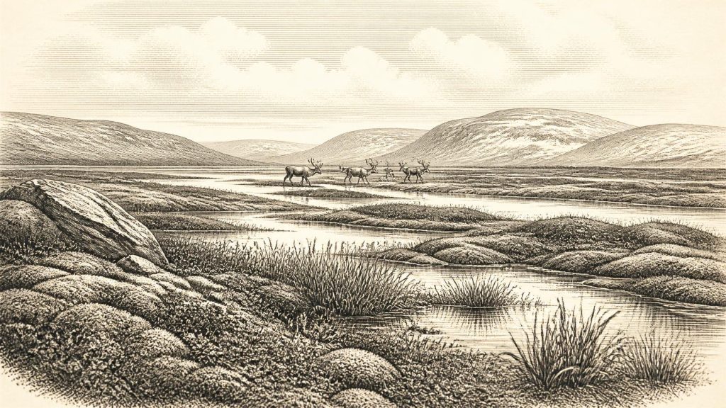
Within those silts were plant macrofossils, pollen and small animal remains. The assemblage indicates open tundra and a periglacial climate. Mosses, sedges and other hardy plants grew where water and seasonally thawed ground allowed them to do so. Finds including bogbean (Menyanthes trifoliata) and mountain avens (Dryas octopetala) are especially evocative: neither makes the place hospitable by modern standards, but both demonstrate that this was a living landscape rather than sterile ice. Sparse herb pollen is consistent with exposed, largely treeless terrain. A few grains of tree pollen do not demonstrate local woodland; they may have travelled long distances or been reworked from older deposits.
The best interpretation is of a cold wetland or muskeg-like patchwork, with mossy ground, sedge-rich margins and pools surrounded by thin vegetation. It offers no evidence of a human camp at Maguiresbridge. Its importance lies elsewhere: it proves that freshwater ecosystems persisted in at least part of Ireland during a cold stage and helps explain how herbivores and their predators could occupy the island intermittently.
Castlepook’s Animal Archive
In north County Cork, Castlepook Cave near Doneraile—also called Mammoth Cave—provides the richest Irish cave archive for vertebrate life leading up to the Last Glacial Maximum. Excavations undertaken chiefly in the early twentieth century recovered more than 2,000 bones. Later radiocarbon work showed that the assemblage spans a very long period: individual specimens range from about 45,700 to 19,950 radiocarbon years BP. The collection is consequently not a census of animals living together in 31,709 BCE, but evidence that the cave accumulated remains across many millennia.
Its fauna includes woolly mammoth, giant deer, reindeer, brown bear and spotted hyaena, with Arctic fox, wolf, mountain hare and lemmings also represented. Such animals point to an open, cold-stage environment capable of supporting grazing and browsing herbivores as well as large carnivores and scavengers. A hyaena den or scavenging site can concentrate bones from many places and moments; water, sediment movement and excavation can later alter their positions. Castlepook is therefore a record of ecological possibilities and animal movement, not a ready-made scene of a single herd or hunt.
The 2020 redating programme is an important caution as well as a breakthrough. Using improved pretreatment methods, Ruth F. Carden, Thomas Higham and Peter Woodman found that some Castlepook dates were substantially older than earlier results. Their work places elements of the southern Irish fauna firmly within Marine Isotope Stage 3 and suggests that giant deer and spotted hyaena may have disappeared locally before the Last Glacial Maximum. In historical terms, the result expands the time-depth of Ireland’s known Ice Age fauna while reminding us that old cave collections require continual reassessment.
The Reindeer Femur Question
One Castlepook reindeer femur has made this era especially important for Irish archaeology. County Cork heritage material identifies the specimen as dating broadly to about 31,000 BCE and presents a deep incision that zooarchaeologist Ruth Carden has interpreted as having been made by a sharp stone tool during carcass processing. If that interpretation is sustained, it would be evidence that Upper Palaeolithic people handled reindeer in Ireland tens of millennia before the island’s securely established Mesolithic settlement.
The distinction between evidence and interpretation must remain clear. The bone itself, its species identification and its age are material evidence. The proposition that the mark was made by a human tool is a specialist taphonomic interpretation that needs to exclude carnivore damage, sediment abrasion, weathering, excavation damage and later handling. Moreover, the dated bone records the animal’s death, not automatically the precise timing of the incision, the location of its killing, or the length of any human visit.
Nor does one potentially cut-marked bone establish a settlement. Castlepook has not yielded a securely associated stone-tool assemblage, hearth, dwelling floor, burial, art panel or repeated domestic debris from this period. Modern excavation in 2022 located surviving deposits but reported no cultural artefacts; it also confirmed how comprehensively earlier investigators had disturbed or removed much of the cave fill. The cautious conclusion for around 31,709 BCE is therefore that a human visit and reindeer butchery are plausible and potentially transformative, but not yet a demonstrated, continuous Irish population.
What Cannot Be Written
There is no evidence for political affairs in the later sense: no chiefs, kingdoms, assemblies, territories, diplomacy, laws or named communities. There is likewise no Irish evidence at this date for organised warfare, agriculture, livestock, trade routes, permanent villages, monuments, formal religion, writing or learning institutions. It would be irresponsible to fill those silences by borrowing stories from much later prehistoric Ireland or by assuming that every practice known from Upper Palaeolithic Europe occurred at Castlepook.
If people did enter Ireland in this broad period, they were almost certainly mobile hunter-gatherers operating in a landscape of demanding seasonal resources. That is an inference from the possible butchery trace, the reindeer bone and the wider north-west European context, not a direct description of Irish daily life. It permits no reliable statement about the visitors’ group size, kinship, clothing, shelters, routes, language or identity. They should not be called “Irish” in an ethnic or national sense. The archaeological question is more modest and more compelling: whether small human parties sometimes reached and used parts of the island before advancing ice erased, buried or scattered much of their evidence.
Landscape Before Oblivion
The broader history is one of environmental change. During the succeeding millennia, the British–Irish Ice Sheet expanded to its last maximum, remodelling valleys, plains and seabeds and destroying or concealing many older surfaces. That geological violence helps explain why Ireland’s Palaeolithic record is so sparse. The absence of camps is meaningful, but it is not absolute proof that no one ever arrived: cold-stage erosion, later glacial deposition, sea-level change and nineteenth- and early twentieth-century collecting all limit what survives and what can be reconstructed.
Thus the most faithful account of Ireland around 31,709 BCE centres not on an invented episode but on a testable frontier of knowledge. Fermanagh’s buried wetland indicates treeless, frost-prone tundra with freshwater life. Castlepook records a remarkable community of mammals, including reindeer, mammoth and hyaena, over a prolonged Ice Age span. A marked reindeer bone raises the possibility of an exceptionally early human encounter. Together, these traces reveal an Ireland that was cold, open, ecologically active and changing rapidly—an island landscape on the threshold of far more extensive glaciation.
Primary Sources
- The IntCal20 Northern Hemisphere Radiocarbon Age Calibration Curve (0–55 cal kBP)
- A Middle Midlandian Freshwater Series at Derryvree, Maguiresbridge, County Fermanagh, Northern Ireland
- Palaeoecology: Quaternary of Northern Ireland Guide
- Figure 6—The Subdivision of the Quaternary Period in Ireland
- BSBI: Menyanthes trifoliata
- BSBI: Dryas octopetala
- The Irish Quaternary Fauna Project
- A Reconsideration of the Radiocarbon Dating of the Marine Isotope Stage 3 Fauna from Southern Ireland
- Cork County Geological Site Report: Castlepook Cave
- 2022:564—Castlepook Cave, Castlepook South, Cork
- Heritage Artefacts of County Cork
- Growth and Retreat of the Last British–Irish Ice Sheet, 31,000 to 15,000 Years Ago: the BRITICE-CHRONO Reconstruction
- Pattern and Timing of Retreat of the Last British–Irish Ice Sheet
- Maximum Extent and Dynamic Behaviour of the Last British–Irish Ice Sheet West of Ireland
- Extent and Deglacial Chronology of the Last British–Irish Ice Sheet: Implications of Exposure Dating Using Cosmogenic Isotopes
- Trimlines, Blockfields and the Vertical Extent of the Last Ice Sheet in Southern Ireland
- New Data for the Last Glacial Maximum in Great Britain and Ireland
- Ireland: Submerged Prehistoric Sites and Landscapes
- The Problem of a Late Quaternary Landbridge Between Britain and Ireland
- Sea-Level Change in the Irish Sea Since the Last Glacial Maximum: Constraints from Isostatic Modelling
- New Insights on the Fauna of Ireland's Younger Dryas and Early Holocene from Alice & Gwendoline Cave
- Ireland’s Palaeolithic Archaeology – Fleeting Footprints in a Frozen Land
