
Calcite, Tundra, and Castlepook31606 BCE
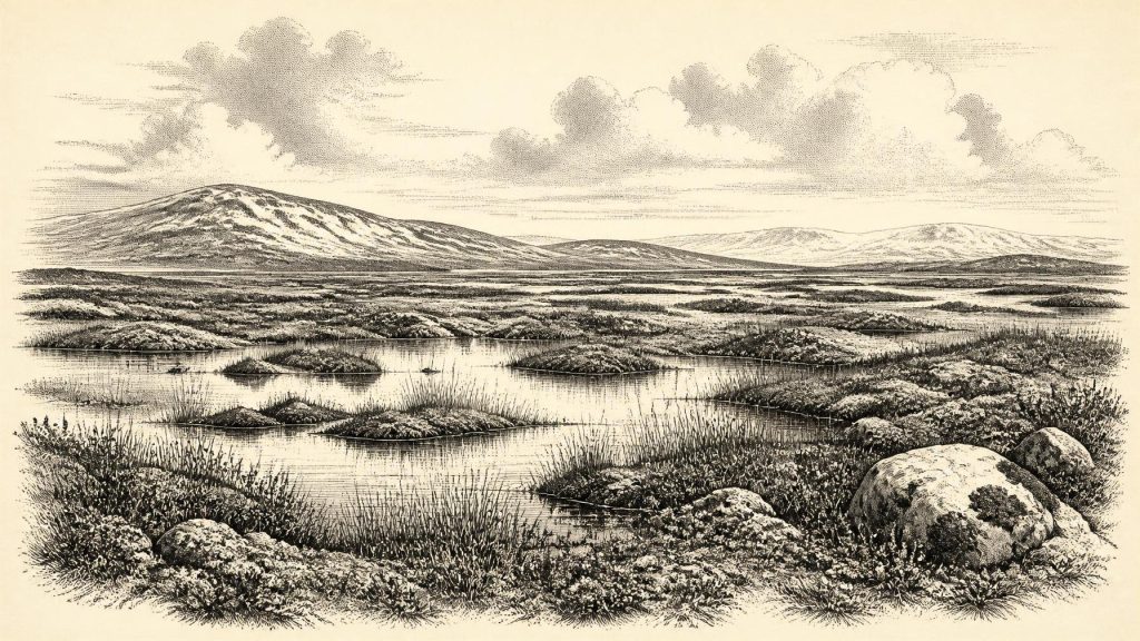
Around 31,606 BCE, Ireland lay within the climatically unstable MIS 3, before the later Last Glacial Maximum. Changing ice margins, lowered seas and uncertain land routes created a variable north-west European landscape. Derryvree sediments in Fermanagh indicate cold, treeless tundra-like wetlands with freshwater pools and seasonal freezing. Castlepook Cave preserves mixed remains of mammoth, deer, reindeer and predators, demonstrating diverse cold-stage fauna, though not a single contemporaneous community. Crag Cave calcite records milder interstadial episodes. A possibly cut-marked Castlepook reindeer bone may indicate brief human activity, but no secure settlement evidence exists. Later glaciation severely damaged Ireland’s overall archaeological record.
Dateline
The label 31,606 BCE is a modern way of locating a very remote point in time, not a year that can be recovered from Irish evidence. There were no calendars, writing, named communities or datable events on the island. In conventional archaeological terms, it lies about 33,550 calendar years before AD 1950, within the later part of Marine Isotope Stage 3 (MIS 3), a climatically unstable interval of the last Ice Age. The responsible history of Ireland at this point is therefore a history of ranges, deposits and probabilities. Radiocarbon results must be calibrated; even then they commonly span centuries or millennia. Cave bones may date an animal’s death but not necessarily the moment when a bone entered a cave or was modified.
An Island Before Maximum Ice
Ireland was not yet in the full grip of the later Last Glacial Maximum. Reconstructions of the British–Irish Ice Sheet show that its growth, maximum extent and retreat varied greatly between regions; the greatest late-glacial expansion belongs broadly to the period after this horizon. Around 33,550 cal BP, ice margins, snow cover, sea level and drainage were changing on timescales far beyond any single human lifetime. Some parts of Ireland could be ice-free while uplands and northern or western sectors were influenced by expanding ice. It is misleading to picture either a uniformly frozen island or a modern green landscape placed in colder weather.
Lower sea level exposed large areas now beneath the Atlantic and Irish Sea. That altered coastlines and may have made animal movement easier in some directions, but exposed shelf is not proof of a simple, continuous, dry route between Ireland, Britain and continental Europe. Ice, estuaries, rivers, tidal channels and shifting shorelines complicated travel. The physical setting was a changing north-western edge of Europe, rather than an isolated island in the later historic sense. It offered routes and barriers whose exact arrangement cannot be mapped precisely for 31,606 BCE.
Derryvree’s Cold Wetland
The strongest Irish environmental record relevant to this horizon comes from Derryvree near Maguiresbridge in County Fermanagh. Roadworks in 1969 cut through a drumlin and revealed freshwater silts and fine sands, including organic sediments, sealed between two bodies of glacial till. That sequence is important because a later ice advance buried and protected a small portion of a much older landscape. A radiocarbon determination of 30,500 radiocarbon years BP, with a substantial uncertainty, has been calibrated broadly to about 36,900–31,700 cal BP. The range includes the approximate chronological horizon represented by 31,606 BCE, but does not turn the sediments into an annual record.
Plant macrofossils, pollen, mosses and insect remains indicate a cold, open and largely treeless environment. Sedges, grasses, herbs, mosses and low shrubs grew around shallow freshwater, saturated ground and seasonally frozen soils. Bogbean and water-milfoil are among the plants identified from the deposit, reminding us that a glacial landscape could contain productive pools and wet hollows rather than unbroken snow. Pollen preservation was poor, and isolated grains of pine or hazel cannot securely demonstrate nearby woodland: such pollen may have travelled long distances or been redeposited. The firmer conclusion is that Derryvree was tundra or muskeg-like country, with vegetation concentrated wherever moisture, shelter and a short summer growing season allowed it.
Evidence From Caves
In north County Cork, Castlepook Cave near Doneraile—also called Mammoth Cave—provides the most evocative faunal evidence for Ireland before the later ice maximum. Its collections include remains attributed to mammoth, giant deer, reindeer, wolf, brown bear, Arctic fox, lemming and spotted hyaena. Such a list should not be treated as a single living community photographed at one moment. Caves accumulated bones through carnivore activity, accidental deaths, water movement and nineteenth- and early twentieth-century excavation. Subsequent scientific dating has shown that some early determinations were too young and that specimens from different episodes were mixed within the cave system.
Nevertheless, the broader result is secure: a varied cold-stage mammal fauna reached Ireland during MIS 3, at least between roughly 45,000 and 20,000 years ago, with some animals present before the Last Glacial Maximum. The animals imply open habitats capable of supporting grazers and browsers, scavengers and predators. Reindeer were suited to sparse northern vegetation; giant deer and red deer signal different ecological opportunities; hyaenas, wolves and foxes point to a food web in which carcasses were contested and bones were moved. Mammoth remains add scale to the picture, but do not prove that mammoths, reindeer and every carnivore named in the collections occupied Castlepook simultaneously.
Crag Cave in County Kerry supplies independent environmental evidence. Uranium-series dating of its broken stalagmites shows episodic calcite growth during parts of MIS 3, associated with Greenland interstadials—relatively milder phases within the wider cold stage. Calcite requires water moving through the cave and conditions sufficiently favourable for deposition. It does not prove a mild climate across every part of Ireland, nor establish woodland or human settlement. It does, however, reinforce the central point from Derryvree and the cave fauna: Ice Age Ireland experienced marked climatic fluctuations, including windows when land, fresh water and animal populations could persist beyond an ice margin.
The Castlepook Reindeer Question
A reindeer femur from Castlepook has been reported by County Cork heritage material and the researcher Ruth Carden as carrying a deep mark consistent with cutting by a sharp stone edge. Public accounts place the animal at about 31,000 BCE, close enough to make it highly relevant to the present notional year. If the incision is confirmed as a butchery mark, it would be Ireland’s earliest presently claimed trace of human action: evidence that one or more people handled a reindeer during an earlier Ice Age interval.
The claim deserves attention precisely because it remains limited. The specimen derives from an old cave collection, not a modern excavation of an intact occupation floor. No securely associated stone-tool assemblage, hearth, dwelling, burial, repeated processing area or human remains of comparable age has yet been recovered in Ireland. A date on the bone records the death of the reindeer, not automatically where it was killed, when the mark was made or how long any visitors remained. The most cautious interpretation is therefore of a possible brief human encounter, not a proven permanent population or a continuous Palaeolithic settlement.
Society Without a Settlement Record
If people did visit Ireland around this period, they would almost certainly have belonged to small, mobile Upper Palaeolithic foraging groups, comparable in broad subsistence terms to communities known elsewhere in north-west Europe. That is an inference from regional archaeology and ecology, not direct Irish evidence. Such people could have followed animal movements, made and maintained stone tools, shared food and knowledge, and chosen sheltered places during short stays. Ireland has not yet yielded the material traces required to reconstruct their houses, clothing, kinship, language, artistic traditions or seasonal round. Nor is there evidence for farming, herding, pottery, metalworking, monuments or a settled village economy.
For the same reason, political affairs, diplomacy and organised conflict cannot responsibly be narrated for 31,606 BCE. There is no evidence for rulers, territorial states, formal alliances or warfare. Religion is equally beyond recovery: no burial, shrine, figurative art or ritual deposit of this age has been securely identified in Ireland. A marked bone, if humanly modified, shows practical activity and perhaps hunting or carcass processing; it cannot reveal belief. Trade also remains unproven. People may have carried stone, hides, meat or social knowledge across changing landscapes, but Ireland offers no securely dated exchange network from this interval.
A Fragile Historical Horizon
What can be said with confidence is both modest and important. Around the broad horizon denoted by 31,606 BCE, Ireland contained cold but biologically active landscapes: open tundra-like ground, freshwater wetlands, limestone caves and animal populations capable of sustaining predators and perhaps occasional human visitors. Derryvree records the wetland world beneath later ice; Crag Cave records climatic windows through its calcite; Castlepook preserves a difficult but remarkable bone archive. The subsequent advance of ice destroyed, buried or rearranged much of what once existed. Ireland’s evidence is sparse not because nothing happened, but because the Ice Age itself was an exceptionally efficient editor of the archaeological record.
Primary Sources
- The Irish Quaternary Fauna Project
- A reconsideration of the radiocarbon dating of the Marine Isotope Stage 3 fauna from southern Ireland
- First evidence of a Late Upper Palaeolithic human presence in Ireland
- New insights on the fauna of Ireland's Younger Dryas and Early Holocene from Alice & Gwendoline Cave
- Growth and retreat of the last British–Irish Ice Sheet, 31 000 to 15 000 years ago: the BRITICE-CHRONO reconstruction
- Pattern and timing of retreat of the last British-Irish Ice Sheet
- Maximum extent and dynamic behaviour of the last British–Irish Ice Sheet west of Ireland
- Episodic speleothem deposition tracks the terrestrial impact of millennial-scale last glacial climate variability in SW Ireland
- Spatio-temporal dynamics of speleothem growth and glaciation in the British Isles
- The IntCal20 Northern Hemisphere radiocarbon age calibration curve (0–55 cal kBP)
- Palaeoecology
- The subdivision of the Quaternary Period in Ireland
- Ancient DNA reveals the origins of red deer (Cervus elaphus) in Ireland
- Archaeological Heritage of County Cork
- Castlepook Cave, Castlepook South, County Cork: Excavation Report 2022
- Ireland through geological time
- ESCR Site Summary: Deposits of the Last Glaciation
- Menyanthes trifoliata: Fossil Record in Fermanagh
- Myriophyllum alterniflorum: Fossil Record in Fermanagh
- The IntCal20 Northern Hemisphere radiocarbon age calibration curve (0–55 kcal BP)
