
Derryvree’s Insect Ledger31498 BCE
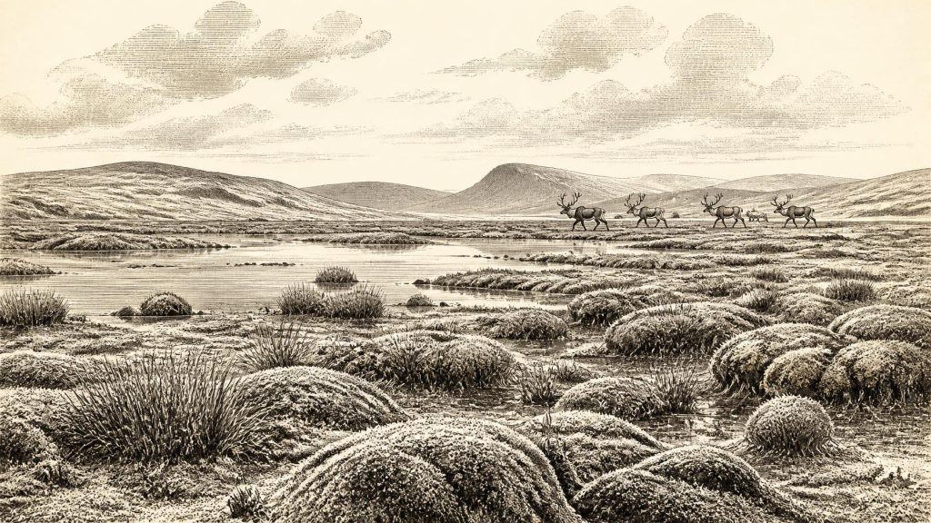
Around 31,498 BCE, Ireland cannot be described through precise dates or written history, but environmental evidence reveals a variable late-Pleistocene landscape. Organic silts at Derryvree, County Fermanagh, indicate an ice-free freshwater wetland with treeless tundra vegetation, mosses, sedges and northern insects during part of MIS 3. Other deposits suggest regional, rather than continuous, ice cover. Castlepook Cave, County Cork, preserves fauna including mammoth, reindeer, giant deer, hyaena, Arctic fox and lemmings, demonstrating open, cold habitats. A possibly cut-marked reindeer bone may indicate Upper Palaeolithic human activity, but cannot prove settlement. Later ice expansion destroyed or buried much evidence from landscapes.
Dateline
Modern calendar-year precision is not available for Ireland in 31,498 BCE. No calendar, written record, named individual or datable event survives from this depth of time, and archaeological science cannot turn such a label into a particular season or year. The number is best treated as a modern point of reference, roughly 33,450 years before AD 1950, within the Late Pleistocene and Marine Isotope Stage 3 (MIS 3). The most responsible account therefore concerns a broad interval around the date: a cold, unstable Irish landscape, intermittently capable of supporting plants and animals, and perhaps visited by people, but not yet known to have held a permanent human population.
For this period, Ireland’s history is recovered from buried muds, pollen, seeds, mosses, insect fragments, cave bones, cave sediments and the physical traces of ice. These records are uneven and often difficult to date. They establish some things firmly, suggest others cautiously, and leave many familiar historical questions unanswered. There is no evidence from around 31,498 BCE for rulers, political communities, warfare, diplomacy, organised religion, trade networks or settlements in Ireland. That is not because such matters can be assumed absent; it is because the surviving evidence is not capable of demonstrating them.
A Date Within a Range
The closest major Irish environmental record is at Derryvree, near Maguiresbridge in County Fermanagh. There, organic-rich freshwater silts lay between two deposits of till: unsorted debris laid down by ice. The lower till records an earlier glacial episode; the upper till belongs to a later advance. Between them is evidence that, for a time, the locality was not beneath an ice sheet. A radiocarbon determination known as BIRM-166, obtained from the organic sediment, was reported as 30,500 ± 1,200 radiocarbon years before present. Calibration gives a broad calendar-age span of approximately 36,900–31,700 calibrated years BP.
That range encompasses the modern label 31,498 BCE only in the broadest sense. It does not prove that a particular pond, plant or insect existed there in that numbered year, and it certainly does not date the whole island. The sample may include redeposited material and the interval represented by a sediment bed can be much longer than a single human lifetime. Nevertheless, Derryvree is important evidence that north-central Ireland contained an ice-free, biologically active freshwater environment during part of later MIS 3, before a subsequent ice advance sealed the deposit beneath till.
Cold Ground, Living Water
The Derryvree assemblage indicates a treeless muskeg or wet tundra landscape: waterlogged ground with freshwater mosses and sedges, rather than the dense oak and hazel woodland familiar from much later prehistory. Plant remains include species associated with cold, open conditions, and insect evidence has a northern character. This was not an empty polar desert. It was a patchwork of shallow water, wet mossy ground, sedge-rich margins and exposed mineral soils, shaped by frost, seasonal thaw and poor drainage.
The term “cold phase” is useful, but it should not create an image of unchanging winter. MIS 3 was climatically volatile across the North Atlantic world. Abrupt shifts in temperature and precipitation affected ice margins, vegetation and animal habitats over timescales far shorter than conventional archaeological periods. At Derryvree, the evidence speaks most clearly of local environmental conditions. It does not permit a detailed island-wide weather forecast, nor does it prove that every part of Ireland was simultaneously open land. Some uplands or western areas may have held ice while lowland Fermanagh preserved wet ground and freshwater life.
Other Irish deposits reinforce that sense of regional complexity. Organic material beneath later glacial deposits at Greenagho, also in Fermanagh, has produced an age consistent with ice-free conditions in the broader late-MIS-3 interval. Marine shells reworked into deposits around Glenulra in the west have likewise been used to infer open water near Donegal Bay before the great expansion of the last Irish ice sheet. These are not neat snapshots. Reworking means that a shell or fragment can be older than the sediment in which it was finally buried. Yet together with Derryvree they challenge any simple picture of Ireland as continuously ice-covered throughout the whole last glacial cycle.
The Faunal Evidence of North Cork
Far to the south, Castlepook Cave near Doneraile, County Cork—long also called Mammoth Cave—offers a different kind of archive. Excavations undertaken in the early twentieth century recovered a large and mixed collection of animal bones. The National Museum of Ireland preserves material from the cave, including spotted hyaena remains. Research and redating have shown that parts of the fauna belong to MIS 3, broadly before the Last Glacial Maximum. Castlepook is consequently vital evidence that cold-adapted and open-country mammals reached Ireland during this wider period.
The recorded fauna is striking: woolly mammoth, reindeer, giant deer, brown bear, wolf, Arctic fox, mountain hare, lemmings and spotted hyaena. Not every species need have occupied the cave’s immediate surroundings at the same moment. Caves are selective archives. Carnivores can drag in prey; scavengers, water, frost and roof collapse can move bones; excavators can disturb earlier deposits. A cave assemblage therefore records animal presence and the processes that accumulated remains, rather than a census of a single living landscape. The hyaena bones especially remind us that caves could be dens and bone-accumulation sites, not human shelters by default.
Even with those qualifications, the animals make ecological sense beside the Derryvree evidence. Reindeer and mammoth require food across extensive open terrain, while lemmings and Arctic fox indicate severe cold-country habitats. Giant deer, deer and brown bear point to variation within that open landscape: river corridors, scrub, sheltered slopes and more productive patches as well as bleak ground. Ireland around this broad interval was probably not a uniform “mammoth steppe”. It was a shifting mosaic, in which local soils, drainage, exposure and ice proximity determined which resources were available.
The Castlepook Reindeer Question
One Castlepook bone gives this remote date unusual human importance. A fragment of reindeer femur from the old cave collection has been publicised as approximately 33,000 years old and bears a deep linear modification interpreted by zooarchaeologist Ruth Carden as a mark made with a sharp stone implement during carcass processing. If that interpretation is confirmed, it would be evidence that people handled a reindeer in Ireland in the Upper Palaeolithic, vastly earlier than the well-established Mesolithic settlement record after the final retreat of the ice.
The conditional matters. The bone comes from a historic collection, not a recently excavated occupation surface with modern stratigraphic recording. No stone tool is securely associated with it. Nor has a hearth, dwelling floor, burial, art panel or coherent butchered animal assemblage of the same age been published from Castlepook. A radiocarbon date on an animal bone dates the animal’s death, not automatically the precise moment at which a surface mark was made. Natural breakage, carnivore action and recovery damage must also be excluded when modified bone is assessed. The marked femur is therefore a serious and potentially transformative clue, but not proof of a resident community.
Nor can the available evidence identify the people who may have made the mark. It would be unsafe to assign them an ethnicity, language, named archaeological culture or route of arrival. Upper Palaeolithic populations lived across parts of north-west Europe during MIS 3, but Ireland’s location at the Atlantic edge, its changing coastlines and its relation to Britain and the exposed continental shelf make access questions difficult. Lower global sea level altered shorelines, yet a lower sea does not by itself establish an easy land route at a particular date. Any human presence may have been brief, seasonal or repeated; the evidence cannot presently decide between these possibilities.
What Everyday Life Cannot Yet Reveal
If people did visit, a reindeer carcass would have offered valuable food and raw material: meat, fat, hide, sinew, marrow, bone and antler. This is an inference from the properties of the animal and known Upper Palaeolithic practices elsewhere, not a demonstrated Irish economy. There is no secure Irish evidence around this date for campsites, toolmaking places, clothing, boats, exchange, family groups or the management of hunting territories. Likewise, there is no material basis for reconstructing ceremonies, beliefs, art, teaching or social rank. Silence in the record should not be converted into a romantic story of either primitive isolation or an established Ice Age society.
What can be said is that survival, for animals and any passing humans, depended on movement through a demanding but not lifeless environment. Wetland plants supported invertebrates; open ground supported grazing animals; carcasses drew predators and scavengers; caves offered traps, dens and occasional preservation conditions. Seasonal changes in snow, frost, forage and water would have mattered greatly. The next major development was not political but environmental. After this broad MIS-3 interval, the British–Irish Ice Sheet built towards its Last Glacial Maximum, conventionally placed around 26,000–19,000 calibrated years BP. Much of the evidence that might once have existed on exposed ground was eroded, transported or buried by ice.
A Fragmentary Beginning
Thus 31,498 BCE should not be presented as Ireland’s first recorded year or as the date of a known arrival. It represents a window onto a much longer environmental episode. Derryvree’s organic silts show that freshwater wetlands and cold-tolerant life endured in at least one part of Ireland; Castlepook’s bones show that an impressive Ice Age fauna reached the island; and the incised reindeer femur raises, without finally settling, the possibility of Upper Palaeolithic human activity. Their combined importance lies in restraint. They replace a blank, ice-bound Ireland with a more dynamic landscape while preserving the distinction between hard evidence and the histories still waiting to be found.
Primary Sources
- Trimlines, blockfields and the vertical extent of the last ice sheet in southern Ireland
- Exploring the controls on the deglaciation of the last British–Irish Ice Sheet
- Figure 6.— The subdivision of the Quaternary Period in Ireland
- Early Midlandian–Middle Midlandian, Pleistocene, Northern Ireland
- The Geology of Ireland: Cenozoic—Tertiary and Quaternary
- A reconsideration of the radiocarbon dating of the Marine Isotope Stage 3 fauna from southern Ireland
- Phylogeographic, ancient DNA, fossil and morphometric analyses reveal ancient and modern introductions of a large mammal: the complex case of red deer in Ireland
- The Irish Quaternary Fauna Project
- New insights on the fauna of Ireland’s Younger Dryas and Early Holocene from Alice & Gwendoline Cave
- First evidence of a Late Upper Palaeolithic human presence in Ireland
- Archaeology Research Excavation Grant 2022: Final Report
- 32564: Castlepook Cave, Ballyhooly, Cork
- Spotted Hyena Skull
- Exhibition Galleries: National Museum of Ireland—Natural History
- The colonization of Ireland: A human ecology perspective
- Ireland: Submerged Prehistoric Sites and Landscapes
- Early deglaciation of the British-Irish Ice Sheet on the Atlantic shelf northwest of Ireland driven by glacioisostatic depression and high relative sea level
- BRITICE Glacial Map, version 2: a map and GIS database of glacial landforms of the last British–Irish Ice Sheet
- Landscapes and environments of the last glacial-interglacial transition: a time of amazingly rapid change in Ireland
- Aghnadarragh
- ESCR Site Summary: Aghnadarragh
- Could brown bears (Ursus arctos) have survived in Ireland during the Last Glacial Maximum?
