Grooved Bone31461 BCE
Around 31,461 BCE, Ireland lay within the climatically unstable Middle Midlandian of Marine Isotope Stage 3, not a uniformly frozen landscape. Derryvree, County Fermanagh, preserves evidence of ice-free, treeless wetland, while Crag Cave indicates episodic milder conditions. Castlepook Cave, County Cork, contains MIS 3 remains of reindeer, mammoth and other cold-adapted fauna, although accumulated over long periods. A grooved reindeer femur may bear a stone-tool butchery mark, potentially indicating fleeting Upper Palaeolithic human activity. However, no associated settlement, tools or social evidence survives. Subsequent ice-sheet growth transformed Ireland, destroying or burying much early evidence from this exceptionally ancient Irish period.
Dateline
31,461 BCE is a useful modern label, not a date that anyone in prehistoric Ireland could have recognised. No Irish community kept a calendar that can be aligned to this individual year, and neither radiocarbon dating nor glacial stratigraphy can isolate an event within it. The responsible approach is therefore to place the year within a broad scientific timespan. In relation to the radiocarbon convention of “before present” (AD 1950), it lies roughly 33,410 years ago, in Marine Isotope Stage 3 (MIS 3), a highly variable interval of the last Ice Age. The closest Irish evidence is dated in ranges of centuries or millennia, not to 31,461 BCE itself.
A Cold Interval, Not a Frozen Island
Ireland at this point was not the familiar green, wooded island of later prehistory. It belonged to the Middle Midlandian, or middle part of the last glacial period. Yet it should not simply be imagined as a country buried uniformly beneath ice. Ice expanded and contracted over long timescales, while climate swung abruptly between colder stadials and relatively milder interstadials. Conditions differed sharply by region, elevation and season. The later Last Glacial Maximum, when an extensive Irish Ice Sheet covered much of the island and adjacent continental shelf, still lay ahead. Around this notional year, parts of Ireland could support ice-free ground, freshwater and animal life, even as glaciers and ice sheets shaped other districts and threatened to advance again.
The strongest environmental window comes from Derryvree, near Maguiresbridge in County Fermanagh. A road cutting through a drumlin revealed organic freshwater silts and fine sands sealed between two thick tills: deposits laid down by separate episodes of glaciation. The organic layer produced a conventional radiocarbon result of 30,500 years BP, with a substantial uncertainty. Later calibration places the deposit broadly between about 36,900 and 31,700 calibrated years BP. That wide range includes the modernly expressed year 31,461 BCE, but does not prove that the deposit formed precisely then. It does, however, provide unusually direct evidence that this part of Fermanagh experienced an ice-free interval before the later advance that laid down the upper till.
Derryvree’s Open Wetland
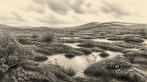
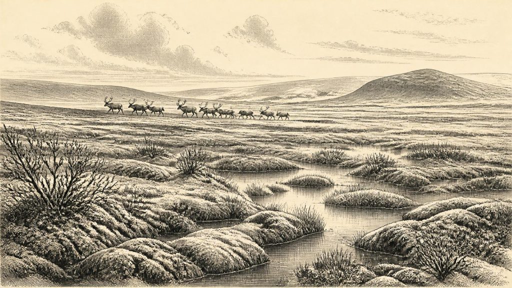
The Derryvree sediments preserve more than a date. Pollen, plant macrofossils, insects and other small remains indicate a treeless, periglacial landscape. It was not a forested bog. Researchers reconstructed a cold muskeg-like wetland: mosses and sedges around shallow pools, with aquatic plants in open water and sparse tundra vegetation beyond. Dwarf shrubs and hardy arctic-alpine plants could survive in such ground, but woodland could not. The evidence speaks most securely for the immediate locality, not for every Irish valley. Still, it is an invaluable corrective to the idea that Ireland was either entirely glaciated or entirely empty of life.
At Derryvree, freshwater itself is important evidence. Persistent pools, organic sediment and wetland plants imply intervals when liquid water accumulated rather than ground remaining permanently locked under glacier ice. This did not mean an easy climate. The insect and plant evidence points to severe winters, short growing seasons and open, exposed terrain. Frost action, seasonal thaw and waterlogging would have made movement difficult in places. A visitor looking across this landscape might have seen low vegetation, bare mineral ground, marshy hollows and distant uplands, rather than fields, woods or coasts recognisable today.
Crag Cave in County Kerry offers a separate indication of climatic instability. Uranium-thorium dating of broken and reworked cave calcites shows that speleothems formed episodically during MIS 3. Calcite can grow only when water is moving through the cave and conditions are sufficiently mild for liquid water. The cave record therefore supports the broader conclusion that Ireland experienced repeated ameliorations amid the cold stage. It cannot tell us the weather in 31,461 BCE, nor should a cave in Kerry be treated as a thermometer for Fermanagh. Together with Derryvree, however, it shows that the Irish climate was dynamic rather than uniformly glacial.
Animals in the Limestone Country
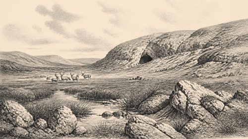
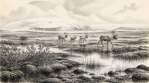
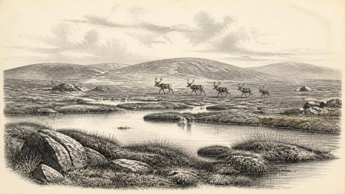
In north County Cork, Castlepook Cave near Doneraile—also known historically as Mammoth Cave—contains Ireland’s most striking assemblage of pre-Last Glacial Maximum animal remains. The cave deposits and old museum collections have yielded bones attributable to reindeer, woolly mammoth, giant deer, brown bear, wolf, Arctic fox, mountain hare, lemmings and spotted hyaena. This is a cold-stage fauna suited to open country and, in several cases, to landscapes far harsher than modern Ireland. Reindeer and mammoth evoke grazing herds; wolves and hyaenas evoke predators, scavengers and competition over carcasses. Yet this is not a single snapshot of one season or year. Cave bones may have accumulated over thousands of years, and carnivores, water and later disturbance could move material between deposits.
Recent redating has made this caution more important, not less. Improved collagen pretreatment showed that several earlier radiocarbon dates from Castlepook had made parts of the fauna appear thousands of years younger than they were. The revised work confirms that important animal remains belong to MIS 3, and suggests that giant deer and spotted hyaena may have disappeared locally before the Last Glacial Maximum. It does not establish that every listed species shared the same Cork hillside in 31,461 BCE. The safest conclusion is that Ireland, during this broad period, intermittently supported a richer mammalian community than later glacial conditions allowed.
The Mark on a Femur
One Castlepook object makes this date especially significant for Irish human history: a reindeer femur carrying a deep groove interpreted by zooarchaeologist Ruth Carden as a cut or chop mark made with a sharp stone tool during butchery. County Cork heritage material presents the specimen as dating to about 31,000 BCE. If that interpretation is upheld, it is potentially evidence that one or more people gained access to a reindeer carcass in Ireland during the Upper Palaeolithic, far earlier than the better-established terminal Pleistocene evidence from Alice and Gwendoline Cave in County Clare.
The distinction between evidence and interpretation is vital. The femur is a real, dated animal bone; the identification of its groove as a human tool mark is a specialist judgement based on the form and position of the damage. The cave collection was excavated principally in the early twentieth century, before modern excavation standards, and the bone was not recovered from a sealed living floor alongside a hearth, stone tools, food debris and a dwelling. Carnivores may have carried remains into the cave. A date for an animal’s death is also not automatically a date for human handling. The find may indicate butchery, but it cannot demonstrate a permanent settlement, a named group, or a precise hunt in this calendar year.
If people did reach Ireland in this period, their presence was probably slight and mobile rather than the foundation of a continuous population. Across north-west Europe, Upper Palaeolithic hunter-gatherers depended on intimate practical knowledge of seasonal animal movements, stone working, clothing, fire and shelter. Those comparisons help explain how a reindeer carcass might have been exploited, but they are not evidence that a particular toolkit, camp layout or social custom existed in Ireland. No securely associated Palaeolithic lithic assemblage, house, burial, artwork or repeated occupation horizon of this age has yet been published for the island.
No Kingdoms, No Borders
Political affairs, diplomacy and organised conflict cannot responsibly be reconstructed for Ireland in 31,461 BCE. There are no chiefs, polities, boundaries, treaties or battle sites in the evidence. Even a human visit inferred from the Castlepook femur would imply only a small number of people dealing with a carcass in a demanding landscape. It says nothing reliable about language, kinship, leadership or relations with groups beyond Ireland. Similarly, there is no direct evidence for ritual, formal religion, art or trade on the island at this date. Absence of evidence does not mean that people, if present, had no beliefs or culture; it means that Ireland has not preserved material evidence capable of describing them.
Movement into Ireland is itself unresolved. Lower global sea levels altered the outline of the Irish Sea basin, but ice extent, local relative sea level and the complex submerged topography make any simple claim of a broad, dependable land bridge unsafe. Animals plainly reached Ireland during parts of the Pleistocene, and a human incursion, if the Castlepook interpretation is confirmed, would have required passage through the wider north-west European landscape. Whether this involved dry corridors, short sea crossings, shifting coastal plains or combinations of these remains a question for geological and archaeological research rather than a fact available for this one year.
A Landscape Before the Great Advance
The greatest historical development around 31,461 BCE was environmental, not political: a precarious interval of habitable open ground between glacial episodes. Derryvree records wetland and tundra in Fermanagh; Crag Cave records episodes of liquid water in the south-west; Castlepook preserves a time-averaged record of large mammals and a possible humanly modified reindeer bone in Cork. These places do not combine into a detailed map of one year, but they reveal an Ireland of ecological opportunity bounded by cold, ice and rapid climatic change.
That opportunity did not last unchanged. During the following millennia, the growth of the British–Irish Ice Sheet transformed the island and scoured or buried much of its older archaeological landscape. This destructive history helps explain why evidence for early people is so sparse. The deep groove on the Castlepook femur is therefore important precisely because it is modest: not proof of a prehistoric nation, but a possible trace of skilled human action at the far western edge of Upper Palaeolithic Europe. Around 31,461 BCE, Ireland’s story is not one of recorded events. It is a story of cold wetlands, moving animals, unstable climates and a single contested mark that may yet change the beginning of human history on the island.
Source References
Hover over a number to see the source. Select it to open the source.

- [1] A Middle Midlandian Freshwater Series at Derryvree, Maguiresbridge, County Fermanagh, Northern Ireland
- [2] Episodic Speleothem Deposition Tracks the Terrestrial Impact of Millennial-Scale Last Glacial Climate Variability in SW Ireland
- [3] A Reconsideration of the Radiocarbon Dating of the Marine Isotope Stage 3 Fauna from Southern Ireland
- [4] The Irish Quaternary Fauna Project
- [5] Growth and Retreat of the Last British–Irish Ice Sheet, 31,000 to 15,000 Years Ago: The BRITICE-CHRONO Reconstruction
- [6] Dimensions and Chronology of the Last Ice Sheet in Western Ireland
- [7] Last Glacial Maximum Cirque Glaciation in Ireland and Implications for Reconstructions of the Irish Ice Sheet
- [8] The Deglaciation of the Western Sector of the Irish Ice Sheet from the Inner Continental Shelf to Its Terrestrial Margin
- [9] The Problem of a Late Quaternary Landbridge Between Britain and Ireland
- [10] Deglaciation, Earth Crustal Behaviour and Sea-Level Changes in the Determination of Insularity: A Perspective from Ireland
- [11] On the Cave of Castlepook, Near Doneraile, Co. Cork
- [12] New Insights on the Fauna of Ireland's Younger Dryas and Early Holocene from Alice & Gwendoline Cave
- [13] First Evidence of a Late Upper Palaeolithic Human Presence in Ireland
- [14] Revisiting Alice and Gwendoline Cave, Co. Clare: New Light on the 1902 Excavations
- [15] 2019:148 - Alice & Gwendoline Cave, Clare
- [16] 2022:564 - Castlepook Cave, Castlepook South, Cork
- [17] Heritage Artefacts of County Cork
- [18] Figure 6—The Subdivision of the Quaternary Period in Ireland
- [19] Aghnadarragh
- [20] Reconstruction and 36Cl Based Geochronology of the Deglaciation of Central Ireland
- [21] Ireland’s Earliest Settlers: Evidence for an Irish Palaeolithic
Primary Sources
- A Middle Midlandian Freshwater Series at Derryvree, Maguiresbridge, County Fermanagh, Northern Ireland
- Episodic Speleothem Deposition Tracks the Terrestrial Impact of Millennial-Scale Last Glacial Climate Variability in SW Ireland
- A Reconsideration of the Radiocarbon Dating of the Marine Isotope Stage 3 Fauna from Southern Ireland
- The Irish Quaternary Fauna Project
- Growth and Retreat of the Last British–Irish Ice Sheet, 31,000 to 15,000 Years Ago: The BRITICE-CHRONO Reconstruction
- Dimensions and Chronology of the Last Ice Sheet in Western Ireland
- Last Glacial Maximum Cirque Glaciation in Ireland and Implications for Reconstructions of the Irish Ice Sheet
- The Deglaciation of the Western Sector of the Irish Ice Sheet from the Inner Continental Shelf to Its Terrestrial Margin
- The Problem of a Late Quaternary Landbridge Between Britain and Ireland
- Deglaciation, Earth Crustal Behaviour and Sea-Level Changes in the Determination of Insularity: A Perspective from Ireland
- On the Cave of Castlepook, Near Doneraile, Co. Cork
- New Insights on the Fauna of Ireland's Younger Dryas and Early Holocene from Alice & Gwendoline Cave
- First Evidence of a Late Upper Palaeolithic Human Presence in Ireland
- Revisiting Alice and Gwendoline Cave, Co. Clare: New Light on the 1902 Excavations
- 2019:148 – Alice & Gwendoline Cave, Clare
- 2022:564 – Castlepook Cave, Castlepook South, Cork
- Heritage Artefacts of County Cork
- Figure 6—The Subdivision of the Quaternary Period in Ireland
- Aghnadarragh
- Reconstruction and 36Cl Based Geochronology of the Deglaciation of Central Ireland
- Ireland’s Earliest Settlers: Evidence for an Irish Palaeolithic