Maguirebridge’s Open Waters31361 BCE
Around 31,361 BCE, Ireland lay within the unstable cold conditions of Marine Isotope Stage 3, not a precisely datable historical moment. At Derryvree, County Fermanagh, freshwater sediments between glacial tills record an ice-free periglacial wetland, with sedges, mosses, aquatic plants and open treeless vegetation, though conditions varied regionally. Castlepook Cave, County Cork, preserves a long-accumulated fauna including mammoth, giant deer, reindeer, bear and hyena, indicating productive cold-country habitats. A modified reindeer femur may show Ireland’s earliest human animal processing, but cannot establish settlement. Changing ice, sea levels and uncertain routes constrain conclusions to provisional environmental history rather than political narratives.

Dateline
The modern label 31,361 BCE gives a misleading impression of precision. No person in Ireland recorded a year, season or event at this depth of time, and archaeology cannot recover one. Expressed in the conventional archaeological scale of years before AD 1950, the label falls about 33,311 calendar years BP, within the Late Pleistocene and Marine Isotope Stage 3 (MIS 3). It is best treated as a point inside broad, calibrated chronological ranges, not as an anniversary. The evidence relevant to Ireland consists chiefly of buried sediments, animal bones, cave deposits and ice-sheet reconstructions. Together they illuminate a cold, unstable island-edge landscape; they do not supply a year-by-year national history.
A Landscape Between Ice Advances
Ireland was in the last glacial cycle, but it was not simply a land buried uniformly beneath ice. The long-term record shows repeated advances and retreats, severe cold phases and more open intervals. Around the middle of MIS 3, local conditions varied sharply by region and changed over millennia. Modern reconstructions of the British–Irish Ice Sheet indicate major growth around the wider archipelago near the beginning of the 31,000-years-BP interval, with extensive ice later reaching its maximum size much later, around 26,000 calendar years BP. That later maximum must not be projected wholesale back onto 31,361 BCE.
The key Irish caution comes from Derryvree, near Maguiresbridge in County Fermanagh. Road works in 1969 cut through a drumlin and revealed organic freshwater deposits and fine sands trapped between an older lower till and a younger upper till. The sediments show that this particular district had experienced an ice-free episode before subsequent glacier ice crossed it. A radiocarbon determination, BIRM-166, gave 30,500 radiocarbon years BP, with a substantial uncertainty of +1,170/−1,030 years. Calibration places its possible calendar age across a broad span, commonly summarised as roughly 36,900–31,700 calendar years BP. The modern year-label therefore lies near the younger end of a range relevant to the deposit, but cannot be pinned to a particular layer, summer or human lifetime.
This is important evidence, but its geographical reach must be kept modest. Derryvree proves an open freshwater environment in south Fermanagh during part of the Middle Midlandian, the regional term used for this portion of the Irish glacial sequence. It does not prove that every coast, upland and valley in Ireland was simultaneously ice-free, nor that the whole island had one uniform climate. Ice margins, snowfields, permafrost, meltwater and vegetation responded differently to terrain and proximity to the sea. Ireland at this time was a changing mosaic rather than a single frozen scene.
The Derryvree Wetland
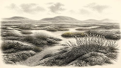
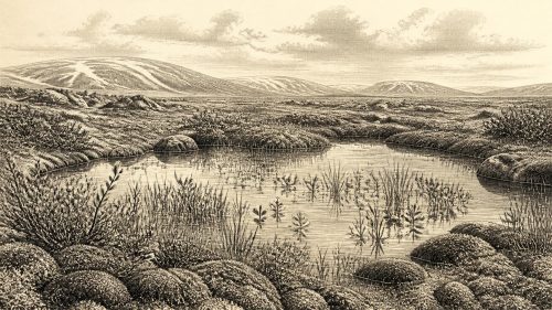
The Derryvree deposit is unusually valuable because it preserves the small organisms and plants that normally vanish from the archaeological record. Its pollen, plant macrofossils and insects indicate cold conditions and generally open, treeless vegetation. Sedges and freshwater mosses grew in saturated ground; aquatic plants show that pools or slow water persisted. Among the reported finds are water-milfoil and bogbean, alongside a distinctive assemblage of mosses. Herbs associated with tundra conditions occur in the pollen record. Juniper may have been part of the wider vegetation, though the sparse and poorly preserved pollen requires care in judging its abundance.
The likeliest picture is of a periglacial wetland set within exposed grass-, herb- and sedge-rich ground: a landscape with shallow water, seasonally waterlogged hollows, frost-affected soils and little if any closed woodland. It was not a featureless white waste. Summer growing seasons, however brief, supported plants, insects and grazing animals; in winter, cold, wind and frozen ground imposed stringent limits. The very survival of organic mud between tills is a fortunate accident of geological preservation. Later ice helped seal a small environmental archive even as it erased or buried much of the older surface landscape.
Such evidence also explains why claims of precise temperature, annual snowfall or a continuous plant cover should be avoided. Pollen can travel long distances, individual layers may represent accumulated decades or centuries, and modern ecological labels such as “tundra” summarise a community rather than reproduce every patch of ground. Yet the combined botanical and insect evidence securely supports an open, cold, freshwater-influenced environment in this part of Ireland. It is one of the best responsible ways to approach the Irish setting around the date in question.
Castlepook’s Animal Archive
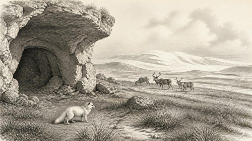
County Cork supplies a complementary record from Castlepook Cave, near Doneraile in the Awbeg valley. This limestone cave system is Ireland’s richest known pre-Last Glacial Maximum vertebrate assemblage. Excavations conducted mainly between 1904 and 1918 recovered large numbers of bones. Subsequent radiocarbon programmes and reassessment have shown that its remains accumulated over a long period rather than in one brief episode. The site contains evidence for woolly mammoth, giant deer, reindeer, brown bear and spotted hyena, with Arctic fox, wolf, stoat, lemmings and mountain hare also represented in its broader Ice Age fauna.
These animals should not be imagined as a single herd or a single moment’s menagerie. The cave received remains through several processes: carnivore activity, animals dying or becoming trapped, water movement, sediment disturbance and early excavation. Spotted hyenas almost certainly mattered greatly in bringing bones into the system. Re-dating has also demonstrated that several older determinations from Irish cave collections were too young, partly because modern techniques more effectively remove contamination from bone samples. Castlepook is therefore exceptionally informative, but it demands close attention to specimen, context and method.
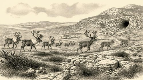
At a broad level, its fauna fits an open, cold and resource-rich environment, capable of supporting large herbivores and their predators. Reindeer are especially relevant to the date-label. A reindeer femur from Castlepook has been dated to about 33,000 years ago and bears a deep linear modification that has been interpreted as a stone-tool cut or chop made during fresh-bone butchery. If that interpretation is confirmed, it would be Ireland’s earliest known indication of human handling of an animal, far earlier than the securely documented terminal Pleistocene human evidence in County Clare.
A Human Presence, Not a Settlement
The qualification is essential. A radiocarbon result dates the death of the reindeer, not automatically the making of the mark; identifying a cut mark requires taphonomic judgement about damage caused by tools, teeth, trampling, sediment or excavation. Nor has a contemporaneous hearth, stone-tool assemblage, dwelling, burial or undisturbed occupation floor been recovered at Castlepook. The cautious conclusion is not that Ireland possessed a settled human population in 31,361 BCE. It is that a small Upper Palaeolithic party may have reached or used the island during an interval in which reindeer and other cold-adapted mammals were present.
If people did process the carcass, the act could have been economically significant without implying a village. Reindeer supplied meat, marrow, fat, hide, sinew, antler and bone: portable resources valuable to mobile foragers. But the single modified femur cannot tell us whether the animal was hunted, scavenged, killed elsewhere, carried to the cave, or encountered by one person or many. It does not identify language, kinship, territory or an enduring migration route. The evidence permits a carefully bounded possibility of short visits, not a detailed story of Irish colonisation.
Consequently, political affairs, diplomacy, organised warfare, named communities and formal religion are beyond recovery for this date. There are no Irish monuments, inscriptions, graves, artworks or settlements that demonstrate them. It would be equally wrong to fill the silence with imagined tribal chiefs, alliances or ritual caves. Upper Palaeolithic groups elsewhere in north-west Europe had social relationships, technical knowledge and cultural traditions, but analogies from Britain or continental Europe are context for interpretation, not direct proof for Ireland.
Island Edges and Uncertain Routes
Sea level and coastlines were different during the glacial period, while ice and changing relative sea level repeatedly reshaped the Irish Sea world. That made connections between Ireland, Britain and the continental shelf different from those of today, but the precise configuration and accessibility of routes at any one moment remain debated. Animal occurrence proves that species could reach Ireland at various times; it does not, by itself, demonstrate a permanent dry land bridge or a human road. Ice, sea crossings, short-lived coastal corridors and shifting habitats may all have affected movement.
The most defensible history of Ireland around 31,361 BCE is therefore environmental and provisional. In Fermanagh, an ice-free freshwater wetland preserves signs of cold, open vegetation within a broad calibrated age range. In north Cork, Castlepook preserves animals of mammoth-steppe and tundra-like country, and a reindeer bone that raises a serious but still constrained question about human activity. Across the island, the growing British–Irish Ice Sheet was part of the background of risk and transformation. Rather than a date of kingdoms or founders, this is a moment when Ireland’s deep past survives in moss-rich mud, cave bone and the difficult discipline of uncertainty.
Primary Sources
- A Middle Midlandian Fresh-Water Series at Derryvree, Maguiresbridge, County Fermanagh, Northern Ireland
- Early Midlandian–Middle Midlandian, Pleistocene, Northern Ireland
- Palaeoecology: Quaternary Research Association Field Guide
- A Reconsideration of the Radiocarbon Dating of the Marine Isotope Stage 3 Fauna from Southern Ireland
- The Irish Quaternary Fauna Project
- Castlepook Cave: County Geological Site Report
- Heritage Artefacts of County Cork
- The Exploration of Castlepook Cave, Co. Cork. With 3 Plates.
- New Insights on the Fauna of Ireland's Younger Dryas and Early Holocene from Alice & Gwendoline Cave
- Growth and Retreat of the Last British–Irish Ice Sheet, 31,000 to 15,000 Years Ago: the BRITICE-CHRONO Reconstruction
- BRITICE-CHRONO Maps and GIS Data of the Last British-Irish Ice Sheet 31 to 15 ka
- Timing, Pace and Controls on Ice Sheet Retreat: an Introduction to the BRITICE-CHRONO Transect Reconstructions of the British-Irish Ice Sheet
- The Timing and Magnitude of the British–Irish Ice Sheet Between Marine Isotope Stages 5d and 2
- Extent and Timing of the Last Glacial Maximum in Britain and Ireland: a Review
- Dynamic Cycles, Ice Streams and Their Impact on the Extent, Chronology and Deglaciation of the British–Irish Ice Sheet
- Maximum Extent and Dynamic Behaviour of the Last British–Irish Ice Sheet West of Ireland
- Stratigraphic and Palaeo-Geomorphological Evidence for the Glacial-Deglacial History of the Last British-Irish Ice Sheet in the North-Western Irish Sea
- Timing and Pace of Ice-Sheet Withdrawal Across the Marine-Terrestrial Transition West of Ireland During the Last Glaciation
- The IntCal20 Northern Hemisphere Radiocarbon Age Calibration Curve (0–55 cal kBP)
- IntCal Publications
- The IntCal20 Approach to Radiocarbon Calibration Curve Construction: a New Methodology Using Bayesian Splines and Errors-in-Variables
- Advances in Irish Quaternary Studies