Maguirebridge’s Till-Bound Wetland31362 BCE
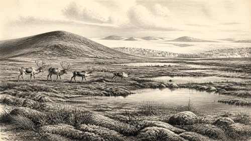
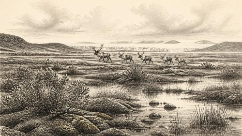
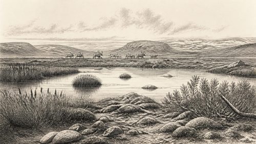
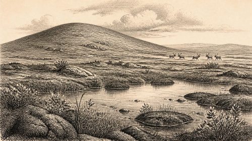
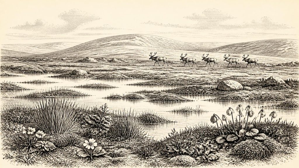
31,362 BCE is a modern label, not a recoverable Irish calendar year. Evidence instead depicts unstable MIS 3 conditions. At Derryvree near Maguiresbridge, freshwater sediments between glacial tills preserve tundra-steppe plants, mosses and aquatic species, showing an ice-free periglacial wetland between advances. Kerry speleothems indicate intermittent milder conditions with liquid water. Castlepook Cave fauna, although chronologically mixed, includes reindeer, mammoth, giant deer, predators and Arctic species, demonstrating connections with north-west Europe during lower sea levels. A cut-marked reindeer bone may indicate human butchery, but no settlement, tools or social organisation is securely known. Later glaciation buried and disrupted much evidence.
Dateline
A Year That Cannot Be Isolated
The label 31,362 BCE is a modern chronological convenience, not a year that can be recovered from Ireland’s archaeological record. No one on the island used a calendar of numbered years, and no surviving layer, bone or tool can be assigned to this single point with that degree of precision. In radiocarbon terminology it falls roughly 33,312 calendar years before AD 1950, within the later part of the Late Pleistocene, or Marine Isotope Stage 3 (MIS 3). This was a long and climatically unsettled phase of the last Ice Age, before the Last Glacial Maximum, when ice later expanded much more widely across Ireland and the surrounding seas.
The appropriate history is therefore not an annual chronicle of rulers, battles or settlements. It is a reconstruction of a changing physical world from sparse evidence: cave bones, freshwater silts, fossil plants and insects, ice-borne sediments, cave calcite and modern re-dating. These sources illuminate conditions over centuries or millennia. They can show that an environment existed, that particular animals occupied it, and sometimes that water flowed or vegetation grew. They cannot reliably tell us what happened in one particular year, nor support a detailed story of a resident human community.
The closest important Irish environmental record is Derryvree townland, near Maguiresbridge in County Fermanagh. Excavated during roadworks in 1969, it preserves an organic and sandy freshwater deposit lying between two tills: the unsorted debris laid down by glacier ice. The sequence demonstrates a crucial fact about the wider landscape. Ice had covered the area before the wetland formed; later ice overrode and sealed it. Between those glacial episodes, however, the ground supported standing or slow-moving freshwater and a distinctive cold-climate biota.
Freshwater Between the Ice Sheets
The Derryvree deposit produced the conventional radiocarbon determination BIRM-166, 30,500 radiocarbon years BP, with a large quoted uncertainty of +1,170/−1,030 years. A radiocarbon age is not itself a calendar age: atmospheric carbon-14 has varied through time, and measurements must be calibrated against an internationally maintained curve. At such antiquity, both the laboratory uncertainty and the form of the calibration curve generate broad probability ranges. The Derryvree material should consequently be treated as evidence for a wider Middle Midlandian or MIS 3 interval, not as proof that its plants grew exactly in 31,362 BCE.
What grew around that Fermanagh waterbody is more informative than a falsely precise date. Pollen was poorly preserved, but plant macrofossils and mosses indicated open, treeless tundra or tundra-steppe, with wet ground and shallow freshwater. Finds reported from the deposit include bogbean (Menyanthes trifoliata), alternate water-milfoil (Myriophyllum alterniflorum), mountain-avens (Dryas octopetala) and cold-tolerant mosses. Bogbean and water-milfoil point to aquatic or waterside habitats; mountain-avens is characteristic of exposed, calcareous, often Arctic-alpine ground. Together they do not depict a uniform wilderness. Rather, they suggest a mosaic of pools, saturated sedge- and moss-rich ground, exposed mineral soils and low vegetation shaped by frost, wind and short growing seasons.
That interpretation matters because the word ‘Ice Age’ can imply uninterrupted ice. Derryvree shows instead that cold-stage Ireland contained local environmental opportunities between glacial advances. The setting was periglacial: deeply cold, subject to freezing and thawing, but not necessarily buried beneath permanent ice at the moment the freshwater sediments accumulated. The later till above the organic layer is equally important. It warns that this was not a stable landscape destined to endure. Subsequent ice movement altered the terrain, covered the deposits and removed or disturbed much other evidence that might once have existed.
South-west Ireland supplies a complementary line of evidence. Uranium-thorium dates from broken and reworked speleothems in Crag Cave, County Kerry, show episodes of calcite growth during MIS 3. Because shallow-cave speleothem formation requires infiltrating liquid water and generally temperatures above freezing, these deposits support the view that the Irish climate oscillated sharply rather than remaining uniformly polar. They do not establish the exact weather at Maguiresbridge, and a cave record cannot simply be transferred to every region. Yet, alongside Derryvree, they make a persuasive case for repeated environmental amelioration amid a generally cold and unstable period.
Animals in a Connected Landscape
At Castlepook Cave near Doneraile, County Cork, fossil bones document a much broader Late Pleistocene animal community. Modern re-dating has demonstrated that material from the cave spans a long period, and that early excavations mixed or removed much of the original stratigraphy. Nevertheless, securely dated specimens show that Ireland was visited or occupied at intervals by mammals including reindeer, giant deer, brown bear, wolf, Arctic fox, lemmings, mountain hare, woolly mammoth and spotted hyaena. Not every species was necessarily present at the same time, and the cave assemblage must not be treated as a single living herd photographed in one season.
For the broad period surrounding the requested date, reindeer are especially evocative. Their presence is compatible with an open, cold landscape in which grazing animals moved through rather than a forested island. Mammoths, giant deer and large predators likewise imply ecological links beyond Ireland. During low sea levels, the geography of the north-west European shelf differed profoundly from today. Ireland was not yet separated from Britain by the later post-glacial sea barrier; connections across exposed or narrowed shelf landscapes could enable animal dispersal. The exact routes, durations and seasonal patterns remain uncertain, but the faunal evidence shows that Ireland was part of a wider north-west European ecological zone rather than an isolated refuge.
Castlepook also teaches caution. Cave deposits form through many processes: carnivores carrying prey, animals dying in shelter, water moving bones, sediment collapse and human excavation. The presence of a bone in a cave does not prove a nearby camp, a hunting kill or a resident population. Several Castlepook specimens have been revised substantially in age after improved pretreatment and radiocarbon methods were used. That revision is a reminder that scientific history is cumulative: old collections can yield major new results, but their formation history and surviving documentation set firm limits on interpretation.
The Human Question
A reindeer femur from Castlepook has been reported as carrying a deep incision interpreted as a fresh-bone cut made with a stone tool. If that identification is accepted, it provides possible evidence that people handled and butchered reindeer in Ireland around 33,000 years ago. It is an important proposition, because it would extend the island’s known human story far beyond the later, much better evidenced Mesolithic settlement. But it must be expressed precisely. The bone is evidence for a possible episode of carcass processing, not evidence for a named people, permanent occupation, a village, language, religion or political order.
There is no securely associated Irish stone-tool assemblage of this age, no hearth, dwelling floor, burial, art panel or settlement sequence from which to reconstruct daily life. Nor can the inferred visitors responsibly be labelled ‘Irish’, Gaelic or Celtic: all such identities belong to vastly later historical and linguistic contexts. A small group could have crossed or followed animal movements, taken meat or marrow from a carcass, and left again. Equally, the evidence currently cannot establish whether visits were repeated, seasonal or exceptional. The contrast with contemporary regions of Britain and continental Europe is instructive: people there made sophisticated stone tools, used fire, wore tailored clothing and practised varied social traditions, but such general European knowledge cannot fill the Irish evidential gap.
Consequently, political affairs, diplomacy and organised conflict are unknown for Ireland at this date. There are no chiefs, states, territorial boundaries or negotiated alliances visible in the record. Likewise, nothing directly supports claims about ritual, belief, art, formal learning, exchange networks or family organisation. The most that can be said is conditional: if people reached the island, their survival would have depended upon skilled mobility, knowledge of weather and animal behaviour, control of warmth and food, and social co-operation. Those are reasonable inferences from the severe environment and the wider Upper Palaeolithic world, not observations from an Irish camp.
Work, Movement and Survival
The economy of this landscape was ecological rather than agricultural. There were no farms, fields, domestic livestock, pottery, metalworking or trade routes demonstrated in Ireland at this time. The productive resources visible in the evidence were wild: grazing animals, predators and scavengers, fresh water, plants adapted to short summers, stone, wood where available, hides, bone and fuel. Reindeer and other large herbivores would have represented substantial potential food and raw material for any human visitors, but direct proof of hunting remains absent. Carnivores, including hyaenas, were active competitors and agents in the formation of cave assemblages, not merely dramatic background animals.
Settlement was therefore probably absent or at most fleeting on the evidence presently available. A wetland near Maguiresbridge was not a town, and Castlepook Cave was not demonstrated to be a human home. Yet the island was not empty of life. Around the notional date, Ireland contained cold-adapted communities whose movements responded to climate oscillations, vegetation and access across the wider shelf. The later expansion of the Last Glacial Maximum would erase, bury and rearrange parts of that world. Derryvree’s organic silts survive precisely because they were sealed between tills; Castlepook’s bones survive because caves can protect fragments of deep time.
For 31,362 BCE, then, Ireland’s history is best understood as the history of evidence under pressure: a tundra wetland in Fermanagh, cave faunas in Cork, intermittent liquid water in Kerry, and a possible humanly modified reindeer bone whose implications remain larger than its physical size. Together they reveal an island in a cold but changing Ice Age landscape. They do not yield a calendar-year event. Their value lies in showing what responsible prehistory can recover—and in marking, equally clearly, what it cannot yet know.
Primary Sources
- A Middle Midlandian Freshwater Series at Derryvree, Maguiresbridge, County Fermanagh, Northern Ireland
- The Irish Quaternary Fauna Project
- A Reconsideration of the Radiocarbon Dating of the Marine Isotope Stage 3 Fauna from Southern Ireland
- Episodic Speleothem Deposition Tracks the Terrestrial Impact of Millennial-Scale Last Glacial Climate Variability in SW Ireland
- Late Pleistocene Chronostratigraphy and Ice Sheet Limits, Southern Ireland
- Timing and Pace of Ice-Sheet Withdrawal Across the Marine–Terrestrial Transition West of Ireland During the Last Glaciation
- The Timing and Magnitude of the British–Irish Ice Sheet Between Marine Isotope Stages 5d and 2
- Spatio-Temporal Dynamics of Speleothem Growth and Glaciation in the British Isles
- The IntCal20 Northern Hemisphere Radiocarbon Age Calibration Curve (0–55 cal kBP)
- OxCal
- Palaeoecology
- The Subdivision of the Quaternary Period in Ireland
- Castlepook Cave
- Archaeological Heritage of County Cork
- BSBI: Menyanthes trifoliata
- BSBI: Dryas octopetala
- BSBI: Myriophyllum alterniflorum
- New Insights on the Fauna of Ireland's Younger Dryas and Early Holocene from Alice & Gwendoline Cave
- Castlepook Cave, Co. Cork
- A Critical Review and Re-Investigation of the Pleistocene Deposits Between Cranfield Point and Kilkeel, Northern Ireland