BIRM-166’s Dwarf Willow31276 BCE
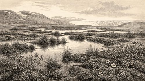
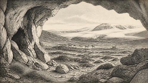
About 31,276 BCE, Ireland lay within the unstable later Marine Isotope Stage 3, not a datable historical year. Derryvree, County Fermanagh, preserves freshwater sediments between glacial tills, indicating an ice-free tundra wetland with sedges, grasses, dwarf willow, mountain avens, bogbean, water-milfoil and cold-adapted insects. Other northern deposits suggest recurrent open conditions. Castlepook Cave fauna indicates large mammals, including mammoth, reindeer and giant deer, but complex deposits limit precise dating. Ice was expanding before the Last Glacial Maximum. A possibly cut-marked reindeer bone suggests fleeting human presence, not settlement. Evidence supports a changing, resource-bearing landscape, while excluding claims of organised society.
Dateline
The label 31,276 BCE gives a useful point of reference, but it cannot describe a known Irish event in a single calendar year. No written record, settlement sequence or precisely dated human action exists for that year. In archaeological terms it falls about 33,226 calendar years before AD 1950, within the later part of Marine Isotope Stage 3, a long and unstable phase of the last ice age. The responsible history is therefore regional and approximate: a reconstruction from sediments, fossils, cave deposits and ice-sheet evidence, expressed in calibrated ranges rather than annual certainty.
The closest major Irish environmental archive is the Derryvree freshwater series, exposed during roadworks in 1969 near Maguiresbridge, County Fermanagh. There, organic silts and fine sands lay between two tills: the unsorted debris deposited by successive glaciers. This order matters. It proves that, at least locally, an ice-free freshwater environment existed after one phase of glaciation and before another. A conventional radiocarbon measurement, BIRM-166, produced an age of 30,500 years BP with a large error margin. Modern calibration has been discussed as a broad span of roughly 36,900–31,700 calibrated years BP, or approximately 34,950–29,750 BCE. The notional year lies within that range, but cannot be pinned to a particular season, layer or moment in the life of the wetland.
A Wetland Between Ice Advances
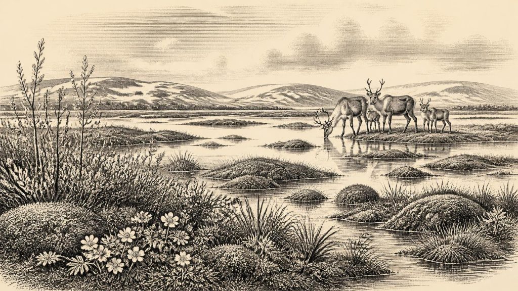
Derryvree offers an unusually vivid, if local, view of Ireland at this time. Its plant remains, pollen and insects indicate a cold, open, treeless landscape with standing or slow-moving fresh water, mossy margins and patches of wet ground: what researchers described as a muskeg or tundra wetland. Sedges and grasses were important parts of the vegetation. Fossils include species associated with Arctic or alpine conditions, among them dwarf willow, mountain avens and bogbean, while water-milfoil points to freshwater pools. Insects of cold northern aspect reinforce the botanical evidence. This was not an empty, uniform plain of snow; it was a seasonally changing mosaic of shallow water, saturated ground, low plants and exposed mineral soil.
That reconstruction needs careful limits. The Derryvree deposits record their immediate catchment, not the whole island. Pollen can travel, sediments can be redeposited, and a drumlin cutting is a rare survivor of a landscape repeatedly reshaped by ice. Nevertheless, its position between tills establishes an important negative point against an older simplified picture: Ireland was not continuously buried beneath a single unbroken ice cover throughout the last glacial period. At the same time, Derryvree does not demonstrate that every region was ice-free, nor that a stable climate endured for centuries without interruption.
Other northern sites help to frame this uncertainty. Organic deposits at Hollymount, also near Maguiresbridge, and at Greenagho near Belcoo show that cold, open, non-forested conditions occurred in Fermanagh during portions of the Midlandian, the Irish name for this part of the last glacial cycle. Their dates and correlations are not equally secure. Greenagho’s radiocarbon result, for example, has been treated cautiously as a minimum age. Such evidence is more useful for identifying recurring environmental states than for drawing a single island-wide map for 31,276 BCE.
Before the Greatest Expansion
The date belongs before the global Last Glacial Maximum, generally placed around 26,500–19,000 years ago, and before the maximum extent of the last British–Irish Ice Sheet. That does not mean conditions were mild. Ice sheets expand, thin and reorganise asynchronously; local glaciers, sea ice, permafrost and severe winters could shape life far beyond an ice margin. Recent reconstructions of the British–Irish Ice Sheet begin at about 31,000 years BP and show substantial growth and changing flow patterns in the millennia that followed. Around the nominal date, Ireland was entering a world in which cold conditions and advancing ice would increasingly determine the survival of landscapes and their inhabitants.
The physical geography was also unlike that of the modern republic and Northern Ireland. Global sea level was much lower because immense volumes of water were held in ice sheets, but coastlines around Ireland cannot be reconstructed from sea level alone. Isostatic movements of the land, glacier margins and later marine erosion complicate the picture; much of the relevant coastal plain is now underwater or has been reworked. It is therefore unsafe to claim a simple, permanent land bridge from Ireland to Britain or continental Europe. Movement of animals and any people must be considered possible only through changing, poorly resolved routes, rather than assumed from a map of lowered seas.
Animals in the Open Country
Southern Ireland provides a complementary but differently problematic record. Castlepook Cave, near Doneraile in north County Cork, has long been known as Mammoth Cave because of its rich Pleistocene fauna. Its deposits and old excavations produced remains attributed to woolly mammoth, reindeer, giant deer, wolf, fox or Arctic fox, brown bear, spotted hyaena, mountain hare and lemmings. Together these species support the broad inference of open, cold habitats capable of sustaining grazing animals and their predators. Mammoth, reindeer and giant deer should not, however, be imagined as a single herd encountered on one day. Cave assemblages can accumulate through carnivore activity, natural deaths, water transport and human collecting over long periods.
Dating has made that warning especially important. Earlier radiocarbon programmes placed elements of the Castlepook fauna in the middle of the last glaciation, broadly comparable in age to the Derryvree evidence. Later work on improved pretreatment of bone samples demonstrated that some older Irish cave determinations could be misleading. Castlepook is thus a crucial archive, but not a securely stratified census of the island at 31,276 BCE. What it can support is a cautious image of animal communities reaching Ireland during Marine Isotope Stage 3, when the island’s ecology included species now absent from it.
For animals, the practical economy was seasonal movement through an exposed landscape. Reindeer could exploit lichens, grasses and sedges; hares and lemmings occupied low vegetation and sheltered ground; large herbivores would have concentrated opportunities for wolves and hyaenas. This is ecological interpretation, not direct observation. There are no Irish kill sites, camps, storage pits or trackways dating securely to this point that reveal how prey and predators used a particular valley. Yet the mixture of wetland flora at Derryvree and large-mammal fossils at Castlepook makes clear that the island had resources as well as hazards.
The Human Question
Whether people were present in Ireland around this period remains the most arresting and the most constrained question. A reindeer femur from Castlepook has been publicised as bearing a deep mark consistent with cutting on fresh bone by a stone tool, and has been associated with an age of about 33,000 years. If the mark is confirmed as anthropogenic and contemporary with the animal’s death, it would indicate a brief Upper Palaeolithic human encounter with a reindeer carcass, perhaps by a very small travelling group. It would not by itself prove a permanent population, a village, or a continuing Irish hunting tradition.
The distinction is essential. Castlepook has not supplied a securely associated hearth, stone-tool assemblage, house floor, human bone, burial or dense cluster of deliberately butchered remains from this early period. Antiquarian excavation and the complex history of cave deposits make association difficult. Elsewhere in north-west Europe, Upper Palaeolithic communities made sophisticated stone and organic tools, developed artistic traditions and hunted large game. Those continental and British comparisons show what was possible, but they are not evidence that such practices were established in Ireland. Ireland’s own record remains too thin to assign a language, ethnicity, social structure or named culture to the inhabitants of this notional year.
What Cannot Be Recovered
Accordingly, there were no demonstrable Irish political affairs, diplomacy or organised warfare to record in 31,276 BCE. No chiefdom, territory, treaty, fortification or conflict has been identified. Nor is there evidence for local religion, formal burial, art, schooling, farming, herding, metalworking, pottery, long-distance trade or seafaring at this date. These are not merely missing details awaiting a name: the surviving evidence is of a kind that cannot sustain such claims. A possible act of butchery, if upheld, concerns subsistence at a single point, not a documented society.
The most meaningful development is environmental. In the Fermanagh evidence, freshwater life and tundra plants occupied ground later sealed beneath glacial sediment. In the Cork caves, mammals preserve evidence of an Irish fauna that later climatic deterioration would transform. The interval was one of repeated thresholds: between ice advances, between wetland and frozen ground, and perhaps between animal-only landscapes and occasional human visits. Its history survives not in chronicles but in a dwarf willow fragment, a bogbean seed, insect remains, cave bone and the sedimentary boundary left by ice.
For that reason, 31,276 BCE should be approached as an archaeological horizon rather than a date of certainty. The calibrated ranges permit Derryvree and aspects of the Castlepook fauna to illuminate the broad period, while demanding restraint about exact simultaneity. Ireland at this point was cold, open and environmentally dynamic; parts of it were capable of supporting freshwater ecosystems and large mammals; and human presence is a serious but still limited possibility rather than a settled fact. That modest conclusion is also a substantial one: it replaces a blank, frozen island with a difficult, changing Pleistocene landscape whose few surviving records deserve to be read closely.
Primary Sources
- Early Midlandian–Middle Midlandian, Pleistocene, Northern Ireland
- Palaeoecology
- Figure 6.— The Subdivision of the Quaternary Period in Ireland
- A Middle Midlandian Freshwater Series at Derryvree, Maguiresbridge, County Fermanagh, Northern Ireland
- The Irish Quaternary Fauna Project
- A Reconsideration of the Radiocarbon Dating of the Marine Isotope Stage 3 Fauna from Southern Ireland
- Growth and Retreat of the Last British–Irish Ice Sheet, 31,000 to 15,000 Years Ago: the BRITICE-CHRONO Reconstruction
- Growth and Retreat of the Last British–Irish Ice Sheet, 31,000 to 15,000 Years Ago: the BRITICE-CHRONO Reconstruction
- Dimensions and Chronology of the Last Ice Sheet in Western Ireland
- Deglaciation Chronology of the Donegal Ice Centre, North-West Ireland
- Trimlines, Blockfields and the Vertical Extent of the Last Ice Sheet in Southern Ireland
- BRITICE Glacial Map, Version 2: a Map and GIS Database of Glacial Landforms of the Last British–Irish Ice Sheet
- New Data for the Last Glacial Maximum in Great Britain and Ireland
- Stratigraphic and Palaeo-Geomorphological Evidence for the Glacial-Deglacial History of the Last British-Irish Ice Sheet in the North-Western Irish Sea
- Radiocarbon Constraints on the Age of the Maximum Advance of the British-Irish Ice Sheet in the Celtic Sea
- New Insights on the Fauna of Ireland's Younger Dryas and Early Holocene from Alice & Gwendoline Cave
- First Evidence of a Late Upper Palaeolithic Human Presence in Ireland
- Heritage Artefacts of County Cork
- Menyanthes trifoliata
- Salix herbacea
- Dryas octopetala
- Myriophyllum alterniflorum