Derryvree’s Cold Fen30994 BCE
Thirty thousand nine hundred and ninety-four BCE is best treated as a broad MIS 3 horizon, not a recorded Irish year. At Derryvree, Fermanagh, freshwater silts between glacial tills, dated roughly 31,700–36,900 years ago, preserve evidence of cold, open, wetland terrain. Other deposits and Kerry speleothems show repeated climatic shifts. Southern caves contain varied cold-stage fauna, including mammoth, reindeer, giant deer, predators and lemmings, though old collections require caution. A possibly cut-marked Castlepook reindeer bone may indicate human activity, but no settlement is known. Advancing ice, altered coasts and erosion made Ireland environmentally unstable and obscured earlier landscapes from view.
Dateline
The label 30,994 BCE is a modern chronological convenience, not a year that anyone in Ireland could have named or recorded. There were no written calendars, states, rulers or dated events on the island from which a single twelve-month history can be recovered. Expressed in the archaeological convention of years before AD 1950, it lies roughly 32,943 years before present. That conversion is useful for orientation only: evidence from this depth of time is dated in calibrated ranges, often spanning centuries or millennia. The most responsible subject is therefore Ireland during the later part of the Last Ice Age, in Marine Isotope Stage 3 (MIS 3), rather than an invented event in one exact year.
For this broad horizon, the most informative Irish evidence is neither a settlement nor a grave. It is a combination of organic mud trapped beneath later glacial deposits in County Fermanagh, bones from limestone caves in the south, cave mineral deposits, and the larger reconstruction of the British–Irish Ice Sheet. Together they show an island region of sharp climatic instability: locally ice-free ground, freshwater hollows and open cold-country vegetation existed during parts of MIS 3, while expanding ice was already altering the prospects for animals and any people who might have reached Ireland.
A Date Range, Not a Dateline
The closest dated environmental archive is at Derryvree near Maguiresbridge, County Fermanagh. Road works in 1969 cut through a drumlin and revealed organic-rich silts and fine sands between two tills: layers of sediment laid down directly by ice. The buried freshwater deposit returned a radiocarbon result of 30,500 BP, with a substantial uncertainty. Later assessment places its calibrated age broadly between about 31,700 and 36,900 calendar years before present. The modern year-label in this article falls within that wide interval, but the deposit does not identify conditions on a particular day, season or year.
This distinction matters. A radiocarbon date is an estimate based on the remaining radioactive carbon in once-living material; calibration translates that measurement through an independently constructed record of changing atmospheric carbon. At around 33,000 calendar years ago, the resulting ranges are necessarily broad. Nor is one Fermanagh basin a miniature map of the whole island. It records a local environment at a particular stage in a complicated sequence of deposition, erosion, freezing and renewed glaciation. It can illuminate the kind of country that existed in part of Ireland, not provide a uniform national weather report.
The Derryvree Landscape
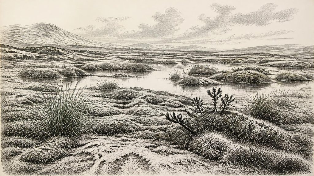
The Derryvree silts preserve freshwater mosses, sedges and other plant remains, alongside pollen and insects associated with cold northern conditions. Their combined message is of open, largely treeless ground rather than woodland. Small pools, wet sedge beds and mossy ground lay within a frost-affected landscape. Earlier writers used the term muskeg for this mosaic of wetland, shallow water and saturated vegetation. That is an interpretative comparison, not proof that every feature looked like a modern northern peatland.
Open country need not have been lifeless. Low vegetation could sustain grazing and browsing animals, while wetlands would have offered sheltered, seasonally productive patches. Yet the conditions were severe by later Irish standards. Trees were scarce or absent locally, winters were harsh, and exposed ground was vulnerable to frost action, wind and seasonal thaw. The plants and invertebrates recorded at Derryvree are especially valuable because later ice sealed the deposit under till. Without that accident of preservation, this brief glimpse of Irish MIS 3 ecology would have disappeared.
Elsewhere in Fermanagh, deposits at Hollymount and Greenagho also demonstrate that intervals of non-glacial conditions occurred between ice advances. Cave calcite at Crag Cave in County Kerry adds a different kind of evidence. Speleothems grow only when water can circulate through the rock and cave temperatures permit deposition, so their episodic growth records milder pulses amid the wider glacial climate. Such evidence does not mean that Ireland was continuously temperate. Rather, it confirms that the Late Pleistocene Atlantic margin changed abruptly and repeatedly, with consequences for vegetation, animals and ice.
Animals in Southern Caves
County Cork and Waterford caves provide the principal evidence for animals living in, moving through, or being transported into southern Ireland before the Last Glacial Maximum. Castlepook Cave, near Doneraile in north Cork, is the best known. Its historic collections include remains attributed to woolly mammoth, reindeer, giant deer, brown bear, wolf, hare, Arctic fox, lemmings and spotted hyaena. These species should not be imagined as a single herd or a single scene. Cave deposits may contain material accumulated over many thousands of years, and some bones were redeposited by water, carnivores or later disturbance.
Nevertheless, the cave fauna establishes an important point: parts of Ireland could support a varied cold-stage mammal community during MIS 3. Reindeer and mammoth indicate extensive open habitats; lemmings and Arctic fox point to cold conditions; hyaenas and wolves remind us that large herbivores were part of a predator–scavenger food web. Giant deer, despite the popular name “Irish elk”, was a widespread Eurasian animal, not an animal unique to Ireland. Its presence in Irish cave collections belongs to a long and changing Pleistocene history rather than to any national origin story.
The collections also require caution because many were excavated in the late nineteenth and early twentieth centuries, before modern standards of stratigraphic recording and sample treatment. The Irish Quaternary Fauna Project demonstrated both the value and the difficulty of this material: accelerator radiocarbon dating established that a range of mammals reached Ireland between at least about 45,000 and 20,000 radiocarbon years ago, but it also showed that bone position in an old cave excavation could not automatically be treated as a secure age. More recent ultrafiltration dating has revised some earlier results. The lesson is methodological as well as historical: each bone, date and claimed association must be tested anew.
The Castlepook Human Question
A reindeer femur from Castlepook is directly relevant to this period because it has been publicly presented as about 33,000 years old and as bearing a deep mark interpreted by zooarchaeologist Ruth Carden as a stone-tool cut or chop made while a carcass was processed. If both the dating and the interpretation are confirmed through full specialist publication and contextual study, it would be evidence that one or more Upper Palaeolithic people handled a reindeer in Ireland at roughly this time.
That is an important possibility, but it is not the same as proof of a settled population. No securely associated Irish hearth, dwelling, stone-tool assemblage, human burial, art panel or living surface has been established for around 30,994 BCE. A mark on one animal bone could represent a brief visit, a hunting episode, or carcass processing elsewhere before scavengers carried remains into the cave. It cannot identify a named people, a language, a route of arrival, continuity of occupation, or descent from later inhabitants. Natural damage, carnivore activity and old excavation handling must also be distinguished carefully from human modification.
The strongest published evidence for human activity in Ireland remains much later: a cut-marked brown-bear kneecap from Alice and Gwendoline Cave, County Clare, independently dated to 12,810–12,590 and 12,810–12,685 calibrated years before present. The difference between this securely published terminal-Pleistocene evidence and the earlier Castlepook claim should be kept clear. Castlepook expands the research question; it does not yet provide a conventional archaeological settlement record.
Society Beyond Recovery
Because human presence is unproven at settlement scale, political affairs, diplomacy, organised conflict, religion, artistic traditions, teaching and trade cannot responsibly be described for Ireland in this year. There is no evidence for chiefs, territories, ritual sites, exchange networks or permanent communities. Even if the Castlepook mark proves anthropogenic, it would indicate an encounter with an animal carcass, not a polity or a society in the later historical sense.
What can be said is more modest. Any people present would have depended on detailed practical knowledge: reading animal movement, finding shelter, maintaining warmth, navigating a cold and rapidly changing coastal world, and obtaining food where vegetation and large mammals permitted. These are reasonable inferences from Upper Palaeolithic lifeways elsewhere in north-west Europe, but they are comparative context, not directly excavated Irish biography. No Irish tool kit of this age allows the attribution of a particular cultural tradition.
Ice, Coasts and Lost Ground
The broader regional change was the growth of the British–Irish Ice Sheet. Its eventual maximum lay ahead, but ice was already advancing and reorganising landscapes during the period around this date. Modern reconstruction shows that different sectors reached their maxima at different times, rather than behaving as one simple frozen blanket. Later ice eroded, buried and redeposited earlier surfaces, helping to explain why an open-air camp from MIS 3 would be exceptionally difficult to find.
Sea level was lower than today because immense volumes of water were held in ice sheets. Coastlines and shallow seas therefore differed greatly from the familiar outline of Ireland, but the exact accessibility of routes into Ireland at any one time remains uncertain. It is unsafe to assert a simple land bridge or a particular migration corridor from the available Irish evidence. The cave fauna shows that animals reached suitable habitats; it does not by itself reveal how, how often, or whether people travelled with them.
Thus the history of Ireland around 30,994 BCE is not one of kingdoms or monuments but of precarious environments and fragmentary traces. Derryvree preserves cold freshwater life between ice advances. Castlepook preserves evidence for a varied Ice Age fauna and a consequential, unresolved possibility of human activity. The approaching ice sheet would later erase much of this world. What survives is enough to show that Ireland was neither timelessly empty nor reliably hospitable: it was a shifting northern landscape whose history must be told in ranges, deposits and probabilities.
Primary Sources
- A Middle Midlandian Fresh-Water Series at Derryvree, Maguiresbridge, County Fermanagh, Northern Ireland
- Palaeoecology: The Middle Midlandian Palaeoenvironment of South Fermanagh
- Figure 6.— The Subdivision of the Quaternary Period in Ireland
- The Irish Quaternary Fauna Project
- A Reconsideration of the Radiocarbon Dating of the Marine Isotope Stage 3 Fauna from Southern Ireland
- Episodic Speleothem Deposition Tracks the Terrestrial Impact of Millennial-Scale Last Glacial Climate Variability in SW Ireland
- Growth and Retreat of the Last British–Irish Ice Sheet, 31,000 to 15,000 Years Ago: the BRITICE-CHRONO Reconstruction
- Late Pleistocene Chronostratigraphy and Ice Sheet Limits, Southern Ireland
- Exploring Controls on the Last British–Irish Ice Sheet's Deglaciation
- Trimlines, Blockfields and the Vertical Extent of the Last Ice Sheet in Southern Ireland
- New Data for the Last Glacial Maximum in Great Britain and Ireland
- New Insights on the Fauna of Ireland's Younger Dryas and Early Holocene from Alice & Gwendoline Cave
- New Insights on the Fauna of Ireland's Younger Dryas and Early Holocene from Alice & Gwendoline Cave
- First Evidence of a Late Upper Palaeolithic Human Presence in Ireland
- First Evidence of a Late Upper Palaeolithic Human Presence in Ireland
- The Mesolithic in Ireland: When Was It?
- Heritage Artefacts of County Cork
- 2022:564 – Castlepook Cave, Castlepook South, Cork
- Reindeer Bone Found in Cork Cave Shows Human Activity in Ireland 33,000 Years Ago
- The Archaeological Survey of Ireland Collection
- BRITICE-CHRONO: Introduction
- Investigating Seasonal Mobility in Irish Giant Deer Megaloceros giganteus Through Strontium Isotope Analysis
