Fermanagh’s Buried Freshwater30906 BCE
Although 30,906 BCE is a modern label rather than a recordable Irish date, evidence illuminates its wider Late Pleistocene setting. At Derryvree, County Fermanagh, freshwater silts between glacial tills indicate a cold, treeless tundra wetland formed during an interval between ice advances. Comparable deposits confirm episodic, regionally variable glaciation before the Last Glacial Maximum. Southern cave faunas, including reindeer, mammoth and hyaena, show changing connections to open northern environments, though assemblages are chronologically complex. No secure human settlement exists; a possibly butchered reindeer bone remains inconclusive. Lower seas changed movement; later ice buried landscapes, making environmental evidence the surviving history.
Dateline
30,906 BCE is a modern chronological label, not a date that anyone in Ireland could have known or recorded. There was no writing, named polity, calendar or recoverable annual sequence from which to identify an event in that particular year. Expressed against the radiocarbon convention of “before present”, where present is AD 1950, it lies roughly 32,850 years ago. That conversion should not imply false precision. At this depth of time, deposits are dated in ranges, often with substantial uncertainty, and the evidence speaks most securely about long environmental intervals rather than a single winter, journey or generation.
Ireland then belonged to the Late Pleistocene, conventionally placed within Marine Isotope Stage 3 and the regional Midlandian cold stage. It was part of a north-west European world marked by abrupt climatic swings, changing ice margins and lower seas. The island was not yet simply the uniformly ice-covered landscape often imagined for the later Last Glacial Maximum. Nor can its condition at one named year be mapped with confidence. The appropriate history is therefore a history of sediments, plants, animals, ice and uncertainty.
Dating a Calendarless Landscape
The most illuminating evidence comes from Derryvree, near Maguiresbridge in County Fermanagh. Road works in 1969 cut through a drumlin and exposed an extraordinary sequence: organic freshwater silts and fine sands lay trapped between two thick layers of till, the unsorted sediment deposited by glacier ice. The stratigraphic order is robust. Ice had formed the lower till; subsequently, at least at this locality, a freshwater environment accumulated mineral and organic sediment; later ice crossed the district and sealed the deposit below an upper till.
Organic material from the Derryvree series returned a conventional radiocarbon result of 30,500 years BP, with an uncertainty of +1,170/−1,030 years. Such a result is not itself a calendar date. Radiocarbon ages must be calibrated because atmospheric carbon-14 levels changed through time, and calibration at more than thirty millennia ago necessarily yields broad ranges. The Derryvree evidence is thus relevant to the climatic world around this article’s notional year, but it cannot be made to prove that a particular pond, plant or insect existed in 30,906 BCE. The distinction between an age estimate and an annual historical date is essential.
The Derryvree Wetland
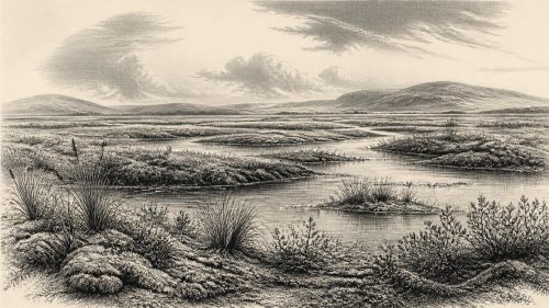
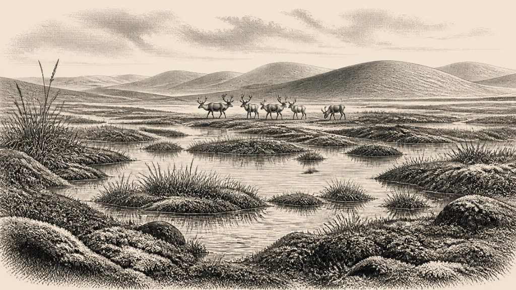
What the buried freshwater layers do preserve is unusually direct local evidence for a cold, treeless landscape in northern Ireland. Their pollen, plant macrofossils, mosses and insect remains point to open tundra or tundra-steppe conditions and a periglacial climate: ground subject to severe cold and freeze-thaw processes, although not necessarily covered by glacier ice at Derryvree while the organic layers formed. Sedges, mossy wet ground and shallow water mattered more here than woodland. Even the limited pollen evidence suggests that any dry-land vegetation was sparse.
This was not a timeless, featureless white wilderness. Fresh water, silts and organic remains imply pools, saturated ground and seasonally changing margins in a sheltered lowland setting. Cold-adapted plants could occupy damp hollows, while exposed ground beyond them supported a thin, open cover rather than closed forest. But the evidence does not justify a painted panorama in which every species was contemporaneous or every part of Ireland looked alike. Derryvree was a local archive, preserved by exceptional burial beneath the drumlin; it provides a window, not a census of the whole island.
Ice Before the Maximum
The enclosing tills make one larger fact unmistakable: glaciation in Ireland was episodic and regionally varied. The wetland formed between glacial episodes, and renewed ice later erased or buried much of the terrain that had existed around it. Other inter-till deposits in Fermanagh, including sites near Hollymount and Greenagho, reinforce the conclusion that cold, non-glacial conditions occurred in parts of the north between advances. These deposits are not identical in date or environmental detail, but together they caution against treating the Irish Ice Age as one unchanging freeze.
Recent reconstructions of the last British–Irish Ice Sheet model substantial ice-sheet growth from about 31,000 years ago, with the greatest expansion later, broadly during the interval from c. 26,000 to 20,000 years ago. At the chronological scale relevant here, Ireland was entering a phase of major climatic and glacial reorganisation, not yet living through a single island-wide maximum frozen state. Precise ice limits at roughly 32,850 years ago remain modelled estimates constrained by uneven evidence. It is safer to say that ice, periglacial ground and ice-free refuges could coexist across a changing region than to draw a firm shoreline or glacier front for one calendar year.
Animals in an Open Country
Southern Irish caves provide a complementary, though more difficult, record. Castlepook Cave near Doneraile in County Cork has yielded remains attributed to animals including reindeer, woolly mammoth, giant deer, brown bear, wolf, Arctic fox, mountain hare, lemmings and spotted hyaena. Re-dating has demonstrated that some older cave chronologies were too young, while confirming the importance of Castlepook and related sites for Ireland’s Marine Isotope Stage 3 fauna. Reindeer and lemmings particularly fit a cold, open environment; mammoth and hyaena indicate ecological connections far removed from modern Ireland.
Yet a cave bone assemblage is not a photograph of a living herd. Carnivores may carry prey into caves, scavenging may redistribute bones, and early excavations did not always preserve the contextual information expected today. Different bones can also represent occupations separated by thousands of years. The responsible conclusion is that Late Pleistocene Ireland supported, at various times, a richer and colder-adapted mammalian fauna than today. It is not that mammoths, hyaenas, reindeer and people can all be placed together beside one Cork cave entrance in 30,906 BCE.
The Human Question
Human history at this date is especially uncertain. No securely excavated settlement, hearth, lithic assemblage, dwelling, grave, artwork or ritual monument is known in Ireland from around 30,906 BCE. Consequently, there is no evidence for an Irish people, language, chiefdom, conflict, diplomacy, trade network or religious practice that can responsibly be described for this year. There is equally no basis for reconstructing clothing, cooking, family organisation or seasonal movement on the island itself.
A reindeer femur from Castlepook Cave has been reported as carrying a mark interpreted as a possible stone-tool butchery trace and as dating to roughly 33,000 years ago. If that interpretation is eventually confirmed through further analysis and secure contextual work, it would indicate a very early, probably fleeting, human visit to Ireland during the Ice Age. It would not demonstrate permanent settlement. The claim remains much narrower than later popular retellings: one modified bone, from a cave with complex deposits, cannot establish a population, a hunting camp or a continuous occupation. The first well-published evidence of human activity presently accepted with much firmer contextual support comes far later, from a butchered brown-bear patella at Alice and Gwendoline Cave in County Clare, dated to the terminal Pleistocene.
Society, Economy and Belief: Evidential Limits
For a conventional year-by-year history, politics, war, diplomacy, religion, culture and learning are often central. Here, silence is the finding. No Irish evidence supports named leaders or communities; no weaponry can be linked to conflict; no imported objects demonstrate exchange; and no ceremonial structure, image or burial illuminates belief. The absence does not prove that no human being ever set foot on the land during this long climatic phase. It means that the archaeological record presently cannot convert that possibility into social history.
Likewise, an economy cannot be inferred merely because animals and edible plants existed. Reindeer, hare or mammoth remains show animal presence, while wetland plants reveal habitats; they do not prove hunting, trapping, hide-working or trade by people in Ireland. Should people have visited, the open landscapes and animal resources may have been attractive, but that is interpretation rather than evidence. The line must remain visible.
Island, Region and Legacy
Lower global sea levels changed the outlines of the seas around Ireland, exposing areas of continental shelf now submerged. This did not automatically create a simple, continuously usable land bridge, nor does the presence of mammals reveal exactly how they reached the island. Ice, changing coastlines, channels and cold seas all affected movement. Ireland’s relationship with Britain and the wider European landmass therefore changed through time, but the routes available at this precise point remain unresolved.
The enduring importance of 30,906 BCE lies not in an invented event but in the evidence’s scale. Derryvree’s buried freshwater bed, Fermanagh’s other inter-till deposits and the cave faunas of Cork show an Ireland repeatedly reshaped by climatic instability. Wet ground could sustain tundra vegetation between glacial advances; animals adapted to open northern environments crossed or recolonised changing landscapes; and later ice could entomb the traces. Around this point in deep time, environment is not merely the setting for history. It is the surviving history.
Primary Sources
- A Middle Midlandian Freshwater Series at Derryvree, Maguiresbridge, County Fermanagh, Northern Ireland
- Early Midlandian–Middle Midlandian, Pleistocene, Northern Ireland
- Palaeoecology
- A Reconsideration of the Radiocarbon Dating of the Marine Isotope Stage 3 Fauna from Southern Ireland
- The Irish Quaternary Fauna Project
- Freshwater Organic Deposits and Stratified Sediments Between Early and Late Midlandian (Devensian) Till Sheets, at Aghnadarragh, County Antrim, Northern Ireland
- Middle Midlandian Interstadial Deposits at Greenagho, Near Belcoo, County Fermanagh, Northern Ireland
- An Inter-Till Freshwater Deposit at Hollymount, Maguiresbridge, Co. Fermanagh
- Mammoth and Musk Ox ESR-Dated to the Early Midlandian at Aghnadarragh, County Antrim, Northern Ireland, and the Age of the Fermanagh Stadial
- Growth and Retreat of the Last British–Irish Ice Sheet, 31,000 to 15,000 Years Ago: the BRITICE-CHRONO Reconstruction
- BRITICE-CHRONO Maps and GIS Data of the Last British-Irish Ice Sheet 31 to 15 ka
- The Timing and Magnitude of the British–Irish Ice Sheet Between Marine Isotope Stages 5d and 2
- Trimlines, Blockfields and the Vertical Extent of the Last Ice Sheet in Southern Ireland
- Stratigraphic and Palaeo-Geomorphological Evidence for the Glacial-Deglacial History of the Last British-Irish Ice Sheet in the North-Western Irish Sea
- First Evidence of a Late Upper Palaeolithic Human Presence in Ireland
- New Insights on the Fauna of Ireland's Younger Dryas and Early Holocene from Alice & Gwendoline Cave
- The IntCal20 Northern Hemisphere Radiocarbon Age Calibration Curve (0–55 cal kBP)
- A Stratigraphic Framework for Abrupt Climatic Changes During the Last Glacial Period Based on Three Synchronized Greenland Ice-Core Records
- Ireland: Submerged Prehistoric Sites and Landscapes
- The Quaternary of Western Ireland: INQUA Field Guide Pre:GL-2
- Field Guides
- The Geological Heritage of County Leitrim